 MERTON HISTORICAL SOCIETY
 Author Archive: Peter Hopkins
Memories of a Morden Lad 1932-1957
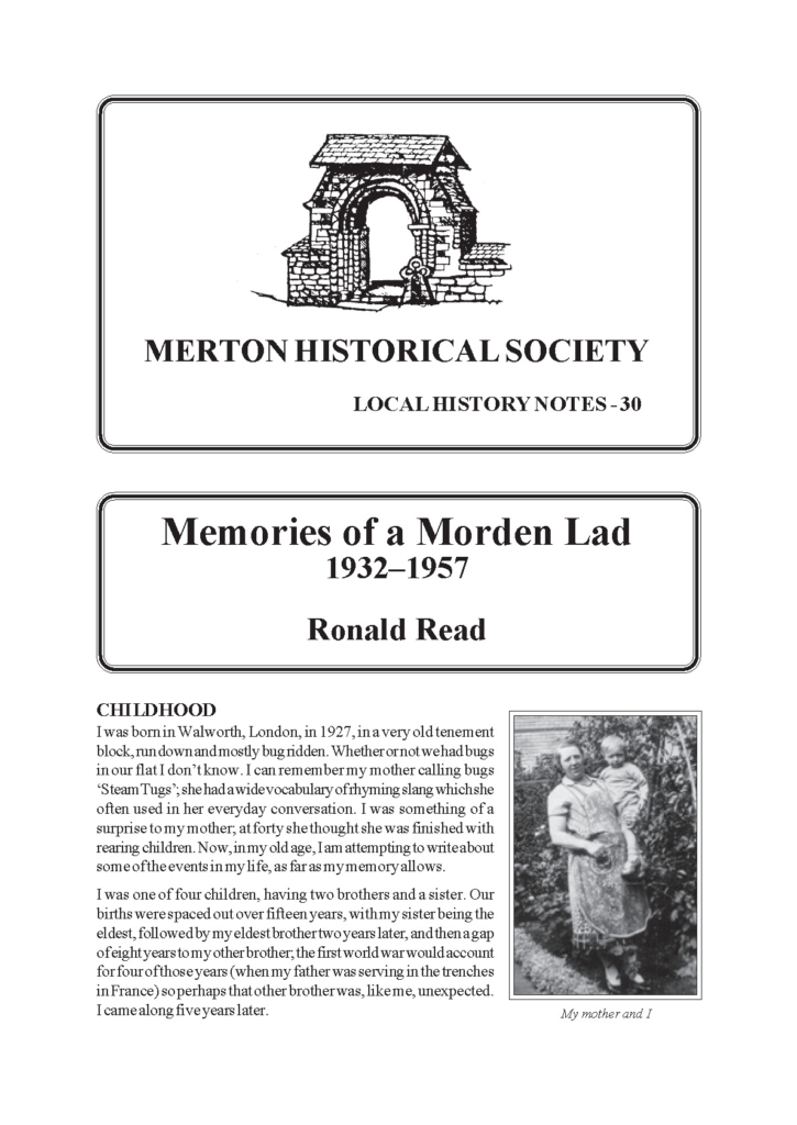
Local History Notes 30: by Ronald Read
Ronald Read recounts his childhood and wartime memories of growing up on the Morden part of the St Helier estate in the 1930s and 1940s. He then takes us to post-war Europe following his call-up to the army in 1945. His return to civilian life in Morden in 1948 was interrupted by 18 months spent in sanatoria in Waddon, Southbourne and Cheam, after he was diagnosed with TB in 1952. Mr Read expresses himself bluntly, and some readers might be offended by his language, but his account is a valuable, and fascinating, record of his life and experiences at home in Morden and further away. At 72 pages, this is our most substantial Note yet.
Memories of Lower Morden
Lilian Grumbridge was born in one of the ‘New Cottages’ in Lower Morden Lane in 1915, and lived there until her marriage, when she moved to her present home in nearby Hillcross Avenue. Her memories of life in this tiny rural area, with its three farms, contrasts with life in the area today.
Memories of Morden between the Wars
Betty Whittick relives her childhood in Garth Road. Those who heard Betty at our September 2012 ‘Chat Show’, or have listened to snippets on our website, have already had a foretaste of these fascinating reminiscences.
Memories of Service with the LDV/Home Guard, Mitcham 1940-42
We have all laughed at ‘Dad’s Army’, but behind the mishaps and jokes was a very serious purpose. These notes by J B Pritchard give a clear, factual account of the formation, arming and training of the Mitcham Home Guard, formed to protect Mitcham against the threatened German invasion or any other hazard. A timely reminder of desperate measures needed in desperate times.
Memories of the New Merton Board Mills 1964-1976
by Robert Parkin
Merton digital classics
In the opening decades of the 20th century a number of publications appeared dealing with the history of Merton. These are now out of copyright so, as none of them seem to be currently available online, we have scanned our own copies.
Merton Memories
The Borough is fortunate to have an impressive archive of historic photographs, including the splendid Tom Francis Collection recording places, events and characters of Victorian and Edwardian Mitcham. The Merton Memories Project, produced by Merton Library and Heritage Service, offers unprecedented access to a unique collection of photographs charting the history of Merton over the past 150 years. Visit https://photoarchive.merton.gov.uk/
Merton Priory monograph from MoLAS
Congratulations to Dave Saxby, Pat Miller and their colleagues for an excellent and very readable volume – well worth the long wait. The 296-page The Augustinian Priory of St Mary Merton: Excavations 1976-1990 is available from the Museum of London at £27.95 (ISBN 798-1-901992-70-0)
Miss Tate and her Almshouses
Faith, feminism and philanthropy in late Georgian and early Victorian England
Mitcham digital classics
In the 1920s two collections of Mitcham reminiscences were published under the title Old Mitcham I (1923) and II (1926). One of the articles included in these collections had been published separately in 1909 and another reprinted separately in 1932. They are all now out of copyright so, as none of them seem to be currently available online, we are very grateful to Merton Heritage Service for permission to scan photocopies of their copies found among the late Eric Montague’s papers.
Mitcham Gardens and Gardeners of the 18th Century
In Mitcham Gardens the author explores the surprisingly rich history of 18th-century horticulture in Mitcham, manifested by plantations, shrubberies, walled gardens, glasshouses and gravel walks, as local gentlemen vied with each other in this fashionable craze.
Mitcham Herbal Industries
THE MITCHAM HERBAL INDUSTRIES
Mitcham in 1838: A Survey by Messrs Crawter & Smith
Among the archives at Surrey History Centre, Woking, is a small folio volume entitled Collected Reference to the Parish of Mitcham in the COUNTY OF SURREY SURVEYED by Messrs Crawter & Smith 1838. Its 170 folios list every property in Mitcham – cottages, houses, shops, farms, gardens, fields, meadows, woods and wastelands – together with acreage and use – arable, meadow, pasture, wood or ‘sundries’. Each property is numbered, from 1 to 1438, and the names of the occupiers are listed, though often several buildings in the same ownership are grouped together. Thus the book gives a very detailed picture of Mitcham in 1838.
Mitcham in 1846: The Tithe Apportionment Map
The tithe apportionment records of 1846 supply a very detailed picture of Mitcham, including every property and providing field names for almost every field. The map identifies each field and building with a number, and the accompanying schedule also gives the name of the owner and the occupier of each field, its area (in acres, roods and square perches), and, in most cases, the use to which it was put. It also gives the same information for the larger houses, but most dwellings are listed together near the end of the schedule under the general headings of Sundry Owners and Sundry Occupiers.
Mitcham in the Mid-17th Century:
A Surrey Village under Stress
Using primary sources where possible, the author examines the impact of the Civil War on the semi-rural parish which was Mitcham at the time. Topics discussed include recruitment, taxation, parish administration, social structure and even the property market.
Moated Sites in Merton, Mitcham and Morden
In this study, produced to accompany a display and short talk contributed to a seminar on ‘Moated Sites & Churches in the Landscape’ organised by Surrey Archaeological Society’s Medieval Studies Forum in March 2015, Peter Hopkins examines the evidence for nine local sites where the present or former existence of a medieval moat has been suggested.
Morden digital classics
A volume on The Registers of Morden, Surrey, 1634-1812 by F Clayton , published in 1901, is available from Internet Archive. It includes transcripts of inscriptions inside the church and in the churchyard, together with a brief historical introduction (though his attribution of the gift of the manor of Morden to Westminster Abbey by Prince Ethelstan is mistaken – the gift was to St Peter’s Winchester and the estate was Steeple Morden in Cambridgeshire).
Morden Fee in Ewell
Ewell was a royal manor until granted to Merton Priory in 1121, but there were several small estates, some of them independent manors and some held from the other manors. Westminster Abbey claimed 2 hides of land in Ewell by right of a charter of archbishop Dunstan and king Edgar in 959AD, which exists only in a 12th-century fabrication This holding was not specified among the Abbey’s estates in 1086, but its estate in Morden, described in 969AD as 10 hides, was assessed at 12 hides in Domesday Book, suggesting that the Ewell lands were already part of the Morden estate. By the late 13th century, when the extant manorial court rolls and manorial account rolls begin, the tenants of these Ewell properties formed a separate tithing within Morden manor, with its own head tithingman [capitalis decennarius] and ale-taster [cervisie tastator] and, according to a survey of Ewell undertaken in 1408 by Merton Priory, Westminster Abbey’s holding there was called Morden fee.