 MERTON HISTORICAL SOCIETY
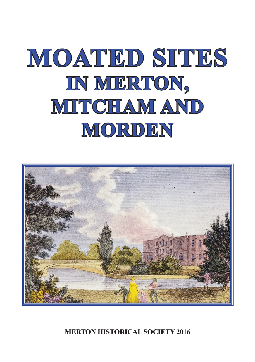
 Moated Sites in Merton, Mitcham and Morden
 by Peter Hopkins
In this study, produced to accompany a display and short talk contributed to a seminar on ‘Moated Sites & Churches in the Landscape’ organised by Surrey Archaeological Society’s Medieval Studies Forum in March 2015, Peter examines the evidence for nine local sites where the present or former existence of a medieval moat has been suggested.
- Merton Place
- West Barnes
- South-west of St Mary’s Church, Merton
- Morden Hall
- Ravensbury
- The Canons
- Mitcham Hall
- Mitcham Grove
- Colliers Wood House
CONTENTS
3
INTRODUCTION
Moated sites, where a house and its associated buildings were protected
by a wide ditch filled with water, seem to have been popular from around
1200 to around 1325. scholars are not agreed as to whether they were
primarily defensive, or chosen as an effective means of drainage, or
merely served as status symbols. No doubt they could serve a number of
purposes. They were not impregnable against concerted attack, but would
have deterred the depredations of raiders and thieves in the unsettled
times of the 13th and early 14th centuries.
Moats are normally associated with high-status buildings, such as manor
houses or monastic granges, but can also be found around humbler
establishments, especially those remote from areas of settlement.
Few remain in use, though some can be traced in the landscape, while
others are only known from map and other documentary evidence.
In 1969 the late Dennis Turner published a ‘Provisional list of moated
sites in N.E. surrey’,1 which included three sites in Merton, two in
Mitcham and one in Morden:
Merton WEST
BARNES (TQ 226685). 19th-century map evidence
suggests that this farm was once moated. It was originally a grange
of Merton Priory. Site now covered by school buildings.
MERTON PLACE (TQ 261700). Illustrations and descriptions
of this one-time home of Lord Nelson show that it was partially
moated. Whether the moat was the remains of a genuine medieval
site or whether it was part of a gardening extravaganza is not clear.
S.W. of sT MaRY’s CHURCH (TQ 250694). 19th-century map
evidence suggests that there was possibly once a moated site here.
Mitcham RaVeNsBURY (TQ 265681). water channels enclosing a
rectangular area may merely be connected with water mills. A
large pond, possibly a medieval fish-pond, immediately to the east,
has now been filled in and built over.
THE CANONS (TQ 279683). The pond to the east of the house
could be the remains of a moat. The site is that of a medieval manor.
Morden MORDEN HALL
(TQ 260687). A
complex
enclosure probably
considerably altered when the present house was built in 1770.
4
Two sites within Wimbledon were also included, but they lie outside the
scope of Merton Historical Society and within the remit of the Wimbledon
Society, and so will not be considered further in this study:
Wimbledon OLD RECTORY (TQ 244715). The writer recalls reading a
statement to the effect that the Old Rectory was once moated but
cannot now trace the reference. Corroborative evidence is needed.
BURLINGTON ROAD (TQ 240717). Moat-like ditches marked
on the Tithe Award Map are probably merely outflows connected
with the nearby lakes.
Dennis Turner followed this in 1977 with ‘Moated Sites in Surrey: a
provisional List’,2 which split the sites between ‘Certain and probable
Sites’ and ‘Doubtful Sites’. The first category included:
Merton MeRTON pLaCe (TQ 260700)
WEST BARNES (TQ 226685) – Map evidence only
Morden MORDeN haLL (TQ 259686)
while the doubtful sites included:
Merton NEAR RECTORY (TQ 250694)
Mitcham THE CANNONs [sic] (TQ 279683)
MITCHAM HALL (TQ 274683)
RAVENSBURY (TQ 266681)
In some cases there is a slight disparity between the grid reference on
each list, as the feature is larger than a single cell. The spelling of Canons
in the second list is almost certainly a typographical error introduced at
the editorial stage. Dennis was a long-time resident of Merton and active
within Merton Historical Society for many years, and knew the area well.
Since this list was published, Eric Montague has put forward another
possible site, at Colliers Wood House, and I would like to consider yet
another, Mitcham Grove.
This study examines the evidence currently available for each of the
sites within the present London Borough of Merton, except for the two
Wimbledon sites.
5
Detail from a modern street map, showing the sites discussed in this book.
Reproduced by permission of Merton Design Unit, London Borough of
Merton
West
Barnes
Lower
Morden
6
Colliers
Wood
House
Merton
Place
Merton
Church
Morden
Hall
Mitcham
Hall
Ravensbury
The
Canons
Mitcham
Grove
7
MERTON PLACE
The earliest account of the origins of the house is in an indenture of lease
and release dated 22 June 1792, in which Sir Richard Hotham bargained
and sold to Charles Greaves, William Hodgson, James Newton and John
Leach
all that capital messuage heretofore built and erected by Henry Pratt Esq.
situate in the parishes of Merton and Wimbledon, or one of them, which
with the lands hereinafter mentioned were formerly called
Moat House
Farm, but several alterations
and additions having been lately made to
the said capital messuage by the said Sir Richard Hotham and the same
having been greatly enlarged and improved the said capital messuage for
some time past hath been and now is known by the name of and called
Merton place … 3
Only the house site – some 1½ acres – was within Merton parish, the
remaining lands being within Wimbledon parish, north of the road.
Pratt had bought the land in June 1748,4 and insured the property with
the Sun Insurance Company in August 1753.5 The site (circled) had been
shown on John Rocque’s Map of Ten Miles around London of 1741–5,
and the curving leat from the western course of the Wandle, feeding a
pond and the moat that gave the site its name, is clearly shown.
8
Pratt’s son sold the property to Hotham in 1764,6 and it seems certain that
the black rectangle (circled) depicted on Rocque’s Map of Surrey from
1768 represents the moat surrounding the house.
Sir William and Lady Hamilton recommended this site to Nelson for his
new home, and he completed the purchase in October 1801,7 despite his
surveyor’s adverse comments:
There are so many insurmountable objections as a Residence, that I am
astonished anyone can think of it as nearly compleat for any family … 8
One of his comments related to the moat that had given its name to the
original house, which was
circumscribed by a dirty black looking canal, or rather a broad ditch,
which keeps the whole place damp.
However, Emma Hamilton treated the ‘ditch’
as a feature rather than
a liability, calling it ‘The Nile’, after Nelson’s victory in Aboukir Bay,
and it takes pride of place
in contemporary engravings, such as those
reproduced on the front cover and overleaf.9
9
The ‘Canal’
is shown on this extract from the plan accompanying the
sales particulars of 1823, when the site of the house was auctioned.10
The plan gives the measurements of each of the 31 lots described in the
sales particulars as ‘adequate for detached villas’, no.28 having the note
10
‘Upon this Lot the Mansion recently stood’. Only two arms of the moat
had survived, and these were soon to disappear.
But what was the origin of this moat, which clearly predated Pratt’s
house? Contemporary maps show that the house was very close to the
precinct wall of Merton priory, called ‘Merton Abby’
or ‘Martin Abby’
on Rocque’s maps. A
document of 1538 records that
in April 1533 the
prior and convent had leased to John Hyller for 21 years
a certain parcel of the demesne of Merton pertaining to the Grange there
situate outside the gates of the said late priory [detailed schedule of
fields] with all buildings and curtilages pertaining to the same Grange,
with a certain house with garden which the farmer inhabits. Except that
the prior and convent reserves to itself and its successors the dovehouse,
ponds, fisheries, woods and underwood, trees and all firewood, and all
other commodities, liberties and franchises to them pertaining, with free
ingress and egress through the whole of the said premises, and of holding
their Court and View of frank-pledge within the Grange whenever and
as often as they please …And the same John is to repair and maintain all
ditches and fences of the said Grange with its appurtenances.11
Thus the Grange was immediately outside the gate, and granges were
often moated.12 But Merton Place could not have been located within the
moated site of the former Grange outside the gates of Merton priory, as
Nelson had bought Merton place in October 1801, and it was not until
November 1802 that he purchased the adjoining 114-acre Merton Grange
estate.13 In his will Nelson bequeathed to Emma Hamilton
my capital messuage at Merton, in the county of Surry, and the outhouses,
offices, gardens and pleasure grounds belonging thereto, and
such parts of my grounds, farms, lands, tenements and hereditaments,
in the several parishes of Merton, Wimbledon, and Mitcham, or any of
them, as, together with, and including the site of the said messuage, outhouses,
offices, gardens, pleasure grounds, shrubbery, canal, and mote,
shall not exceed seventy-acres, as shall be selected by the said Emma,
lady Hamilton, within six months after my decease.14
In addition to the 20 acres of the house and pleasure grounds, Emma
selected the lawns and shrubberies within Wimbledon, and the following
properties within Merton (measured in acres, roods and perches)
11
Farmery
1.0.14
Roadway 0.1.34
Barn field
6.0.30
Middle field
6.3.25
Sheephouse field
6.2.33
and these are depicted on the plan
accompanying the deed recording her
selection,13 as shown in this sketch by
the late John wallace.
They can be identified as the 18 acres of plots 221–222 of the Merton tithe
apportionment of 1844, named as ‘Morden Six Acres’and ‘Sheep House
and Middle Field’.15 (The superimposed outline marks the probable extent
of the priory’s Grange estate to the west and the precinct to the east.)
‘One close called shepshowse Close and Mychelle Close’ is listed in the
lease of the Grange to Hyller immediately before the farmer’s house,16
which probably indicates that the Farmery purchased by Nelson with the
Merton Place
Merton
priory
precinct Merton
Grange
12
rest of the Merton Grange estate stood on the site of the 16th-century
house. An extra-illustrated edition of Manning & Bray’s History and
Antiquities of Surrey in the British Library contains a drawing labelled
‘A
sketch of Merton Abbey Farm before it was pulled down for Lord
Nelson’s mansion. It was the birthplace of my father, Mr John Berryman,
Free School master, Chertsey. Oct 1798 in going the annual rounds of
visiting my relatives.’17 Here is a copy sketched by John Wallace.
We have seen that Nelson did not pull down the house at Merton Place,
though he greatly extended it. But a former tenant of Merton Grange
before Nelson’s purchase, occupying the ‘house with barns, stables etc
in Merton’, was Thomas Berriman,18 whose son John was baptised 28
October 1736.19 There seems no doubt that Nelson’s Farmery had replaced
an earlier building on the site of the house belonging to Merton Grange,
to the south of the site of Merton Place, and that this was the building
depicted on Rocque’s maps within the curve of the leat feeding the pond
and the Merton Place moat. Had the leat served as a moat surrounding
the domestic buildings of the priory’s Grange, with the moat at Merton
Place forming a secondary enclosure for ancillary buildings – a common
feature within monastic moated granges?20
Hyller continued to occupy the Grange after the Dissolution in 1538,
and in July 1553 the estate was granted by Letters Patent to John, earl of
Warwick and Sir Henry Sidney,21 and in May 1564 to sir henry sidney
alone, by which time Hyller had been replaced by William Tirrell. 22
Sidney sold 150 acres to Richard Garth, who had purchased the adjoining
manor of Morden.23 Some time between 1629 and 1651 the rest of the
estate came into the hands of Rowland Wilson, who had purchased the
former priory precinct in 1625.24
13
The precinct had been leased separately from the Grange, and the lessee
for nearly 50 years was the queen’s ‘cofferer’or household treasurer, Sir
Gregory Lovell. Following Lovell’s death in 1597 an efficient county
surveyor discovered that he had occupied some insignificant properties
adjoining the precinct, for which no rent had been charged. His widow,
Dorothy, was granted two 30-year leases for these extra properties,
paying an additional 20 shillings in annual rent. One of these properties
was described as
all that parcel of land containing by estimation one rood of land enclosed
with mote and hedges and one old dovehouse built and erected from of
old upon the same parcel of land, lying and being in the parish of Merton
aforesaid and abutting against the north upon the royal way leading from
Merton aforesaid towards Tooting 25
Thus we have an ancient moated site on a small plot immediately to the
south of the High Street on the periphery of the priory precinct. This was
presumably the dovehouse reserved by the priory when the Grange had
been leased to hyller in 1533.
Surprisingly, the surviving copy of the 1597 lease has a note to the
appropriate government officials explaining the origin of the dovehouse:
Yt seemeth by Auncient Surveye that the said parcel of grounde was
inclosed owt of the waist on purpose to build the said dovehouse
thereuppon for the provision of the said late Monastery and a mote cast
aboute the said dovehouse within the said inclosed grounde for the saffe
keeping of the doves.
The moated dovehouse remained part of the precinct estate until 1612,
by which time
the precinct had been purchased from the Crown. In 1601
Nicholas and Elizabeth Zouche had received licence to alienate to Charles
earl of Nottingham and his wife Katherine
the site of the former priory of Merton alias Marten alias Marton, and 1
messuage, 4 barns, 4 dovecotes, 4 gardens, 4 orchards, 100 acres land,
180 meadow, 80 pasture, 6 wood and 6 heath and furze, and 10s rents in
Merton, Mitcham, Streatham and Long Ditton in county of Surrey.26
The Nottinghams sold to John Spylman in 1605,27 who, with his wife,
Elizabeth, and Anthony and Susan Ingram, sold to Thomas Cornwall in
1606.28 Cornwall proceeded to break up the estate,29 and the precinct was
14
sold in 1610 to Thomas Marbury.30 But in 1613, when Marbury sold to
trustees of Sir Francis Clarke, the grant excluded ‘a certain messuage and
tenement formerly called le Duble Dovehouse belonging to the said late
priory’.31 This property had been sold the previous year to John Listnye,
when it was described as
all that messuage or tenement formerly a dovehouse enclosed with a ditch
[inclusis cum fodeum] situate outside the walls of the late house of the
dissolved priory of Merton alias Marton in the county of Surrey; and one
piece of land containing one acre; and also the aforesaid ditch [fodeum] or
la moat and scouring and soil of the same; and all shops [shopas], cellars,
solars, barns, stables built thereon with orchards, gardens, easements and
appurtenances pertaining to the messuage.32
It would seem that additional land, probably further encroachment upon
roadside waste, had been added, bringing the property up to the 1½ acres
recorded at the time of Nelson’s purchase of Merton Place.
A
similar description appeared in 1621 when Henry Carpenter received
pardon for purchasing from Listnye in October 1612
all that messuage or tenement formerly with the Great Dovehouse
enclosed with ditches and walls being outside the walls of the late house
of the dissolved priory of Merton alias Marten in the county of Surrey;
and one parcel of land containing by estimation one acre; and land and
soil of the same Dovehouse or house messuage aforesaid.33
Asimilar pardon was granted to Rowland Wilson in 1632 for acquiring
from Henry Carpenter’s brother Gregory and Gregory’s youngest son
William Carpenter
all that messuage or tenement called by the name of the Double Dove
House and all messuages, lands, tenements, meadows, orchards, buildings,
stables, gardens, orchards, land, … pertaining, and all hereditaments
belonging to the same messuage or tenement situate, lying and being in
Merton in the county of Surrey in the tenure of the said Gregory and his
heirs.34
In 1635 a very belated pardon was granted to William Carpenter
for receiving the property from his father in November 1624.35 The
Carpenters also owned west Barnes in Merton, to which we shall turn in
the next section.
15
Wilson now owned the Precinct, the Grange and the Double Dovehouse,
and all
passed to his grandchildren, the eldest of whom was Ellis Crisp.
Ellis had sold the site of Moat House Farm (the later Merton Place) in
1699 to William Hammond, whose grandson in turn sold it to Pratt in
1746. There seems little doubt that Moat House Farm was built on the
site of the former moated dovehouse.
It may be pertinent that when the house was offered for sale in 1801 it
contained ‘a very extensive Servants Hall with a Strong Stone Closet and
capital Iron Door’,36 and this is shown on Thomas Chawner’s Plan of
the Entrance Story of Lord Nelson’s House in Merton of January 1805,
reproduced below.37
Could this stone closet have utilised part of the original dovehouse?
16
WEST BARNES
Merton priory had another large estate occupying the western section
of the parish of Merton, and the name ‘Westbarnys’appears in manorial
court rolls from 1505.38 Alease of 1536 is copied into Ministers Accounts
for 1538 following the dissolution of the priory.39 The property covered
a total of 579 acres,40 as outlined on this copy of the 1844 tithe map for
Merton. (Only two sections of the estate were liable
for tithes, so the
remainder was left blank on the map with no plot numbers assigned.)
The estate was granted to Sir John Gresham in 1545,41 and between
1567 and 1598 most was sold to his tenant, John Carpenter,42 though one
section, the later Blagdon Farm, was sold to Thomas Randall in February
1573/4.43 The estate passed from John Carpenter’s son Gregory, whom
17
we have met above regarding the Double Dovehouse, to his son Robert,
who divided the estate among his sons, the western section, including
the old farmhouse (below),44 going to his eldest, another John, while the
eastern section was settled on his four younger sons. A
further division
had occurred by 1737 to create the farm known as Blue House Farm.
18
In 1811 John Middleton, owner of the eastern section of West Barnes,
wrote to Surrey historian William Bray about some possibly Roman bricks
‘dug out of the ruins of an ancient arch that had crossed a small rivulet or
common sewer at West Barns in Merton, in the land of C. F. Bond Esq.
about a hundred yards on the East side of a very old farm house, moated
round, which formerly belonged to the Abbat and Monks of Merton’.45
Middleton’s nephew, Edward Rayne, whose name was appropriated for
the station and development at Raynes Park, referred to the western farm
as ‘Moat Farm’in family correspondence in 1837,46 and the Merton tithe
apportionment of 1844 gives the name ‘Moat Meadow’to plot 25, south
of the farmhouse in plot 27. This meadow lay on the southern bank of the
Pyl Brook which flows to its confluence with the Beverley Brook at the
western edge of the estate.
Remnants of the moat survived into the 20th
century, and are shown on Ordnance Survey maps of 1913, reproduced
below, and 1935. The site is now covered by the 1985-built gymnasium
of Raynes Park High School.47
There seems little doubt that this was a medieval moated site, though
whether the estate should be classed as a medieval grange, rather than
a Tudor farm, is open to debate. Manorial court rolls reveal that all but
three acres of the tenant lands in the former open fields had come into the
hands of the priory by the end of the 15th century, enabling the creation
of the large farms.
19
SOUTH-WEST OF ST MARY’S CHURCH, MERTON
Arectangular pond with rounded ends, in a field to the south-west of the
ancient parish church of Merton, was shown on Ordnance Survey maps
until 1913, though the extract below is from the map of 1894–6. It is within
the grounds of the Vicarage (not Rectory as in Dennis Turner’s second
list), but the garden boundary has clearly been extended to include the
pond, indicating that it already existed when the garden was established.
Merton priory had appropriated the rectorial tithes of the parish early in
its history, perhaps even from its foundation in 1114, and certainly before
1340 when a document in the priory cartulary records Merton among
16 churches and chapels ‘that the Prior and Convent possessed and held
to their own proper use … (with their tithes and appurtenances), and to
which sufficient portions for Vicars were assigned’.48
In October 1537, shortly before the Dissolution, the prior and convent
leased to William Saunder and Thomas Saunder, for 40 years at an annual
rent of £2,
20
the Rectory of Merton, with a tenement and parcel of land on the west
side of the parish church, with a barn and close called the parsonage barn,
and all tithes, oblations, mortuaries, profits, commodities, and advantages
to the Rectory relating or pertaining …the Lessees to provide a fit priest to
celebrate in the said parish church, and also wine, bread, wax candles, and
all necessaries which by ancient law pertained to the said church, and all
other burthens, ordinary and extraordinary, chargeable upon the Rector.49
This parsonage barn and close would be the plots on which the later
vicarage was built c.1818, together with the lands on which the present
parish hall now stands, and the adjoining Glebe Meadow. In 1844 the
tithe apportionment identifies these as ‘glebe’, plot 69 being the ‘house
and garden’
(i.e. the Vicarage) of a little over half an acre, and plot 70
‘Church Meadow’ at almost 3 acres (see tithe map extract below).
Plot 71 was a ‘cottage and garden’belonging to James Sutton and occupied
by George Groves, a copyhold property to which Sutton’s father-in-law,
William Head, had been admitted in 1806.50 It was probably the ‘cottage
with yard called Telford in Church Streate’
mentioned in the manorial
court rolls between 1521 and 1627.51
The Locke family purchased the rectorial rights in 1552/3 and continued
as lay rectors until 1644. They also owned the freehold property opposite
the church, known in the 18th century as Merton Place and later as Church
House. The rectorial rights were held by the owners of this property into
21
the 19th century, and the barn that stood in the grounds of Church House
was known as the tithe barn. However, the 1537 lease shows that the
parsonage barn was then within the close opposite the Church house
site, so the possibility exists that the pond was part of a moat that had
protected the earlier tithe barn. The close would be that shown in the
foreground of J Stratford’s 1806 engraving of the south and west sides of
st Mary’s church, reproduced below.
It was probably this close that was granted by the priory to William de
Cuteron in January 1310/11, described as
that land in the ville of Merton which is called parroccheshawe, and is
of the church land; to have and hold to himself and heirs, free from all
secular exaction; he returningthence annually to the almoner 4s. sterling,
and to find in autumn three men at a bederipe and one man for reaping,
the almoner finding drink. William and his heirs to hold the land so long
as they perform their part.52
It is likely that this area had been the original location of Merton priory
which, when founded in 1114, occupied wooden buildings in the vicinity
of the church that sheriff Gilbert had recently built and decorated at his
own expense. However, the prior preferred the site by the Wandle, being
attracted by its abundant water supply among its other benefits, and the
community moved there in 1117.53
22
MORDEN HALL
The Morden Hall site is set among a complex system of channels and
leats of the River Wandle, reflecting centuries of human adaptation of the
river’s course, as depicted on this extract from the 1st edition Ordnance
Survey 25-inch map of 1864.
23
There is convincing documentary evidence, in the form of insurance
policies, to show a building under construction in 1750 for the fifth
Richard Garth, whose family had owned the manor of Morden since
1554. This was no doubt the present Morden hall, now in the ownership
of the National Trust, and depicted in this engraving published in Edward
Walford’s Greater London (1883).
In 1754 Richard married Mary Leheup, to whom were born three daughters
who were to become coheiresses to the Morden estate. Following their
marriages in 1774, 1775 and 1778, and the death of his wife in 1780,
Richard Garth V
moved to a house in west London, and the house was
thereafter leased to tenants.54
But there had been an earlier ‘mansion house’on the site. Alist of leases
dating from 1745, when Richard had come of age, begins with ‘a capital
messuage or mansion house with barns, stables, buildings, outhouses,
dove houses and dove coat, yards, courtyards, gardens, orchards and
premises’all leased, together with 34 acres of meadow and pasture land,
to Peter and Stephen Mauvillain, proprietors of the calico printing works
at nearby Ravensbury, and owners of a house adjoining the Morden Hall
estate within the curtilage of the present Morden Lodge.55 The lease had
originated in 1716, and included
24
use, liberty, priviledge and benefitt of cutting and digging trenches,
ditches and drains as they can and lawfully may grant in any part of these
above mentioned premises (except the yard, etc.) in order to bring such
part of the River Wandle as they the said Peter and Stephen Mauvillain
shall think necessary or convenient, in, by or through the said premises
for the carrying on of the trade, profession, occupation or business of
staining, dyeing, washing and printing of calicoes or such other stuffes,
goods, wares, commodities, matters and things as now are or hereafter
may or shall be used; And priviledge, use, right and interest in Fishery or
priviledge of Fishing in the River Wandle …56
Although many of the channels within the estate might have originated in
such industrial uses, the house itself occupies a 5-acre site surrounded by
water channels that have every indication of being a moat, though later
adapted as a garden feature as portrayed in this illustration of c.1790.57
This site had been occupied as the estate centre for centuries, and is
identifiable as the ‘capital messuage with a certain place within the court
of which the easement of the cattle sheds are worth per annum 3s’, in
an extent or valuation of Westminster abbey’s estate
in Morden, made
in 1312.58 A’Croft next to the Court’contained 1 acre of meadow worth
2s, as well as 2¾ acres of pasture, this distinction indicating riverside
meadowland. This was likely to be the ‘Croft’shown on a plan of 1859
25
(below) as occupying the area enclosed by a loop of the Wandle, and cut
by the leat operating the 18th-century snuff mills which adjoin Morden
Cottage.59 The medieval mill was not valued in the 1312 extent as it was
in the process of being rebuilt,60 and was therefore not contributing to the
manorial economy at that moment.
Copyright Surrey History Centre
mills
26
An agreement of November 1225 between the abbot and convent of
Westminster, the prior and convent of nearby Merton, and Sir William
de Mara who held the neighbouring manor later known as Ravensbury,
probably indicates the date that the moat was created.61 It records that
the said abbot and convent of Westminster have granted to E the prior and
convent of Merton and the lord W
de Mara and his heirs in perpetuity,
a common way for all riders and pedestrians and for carts direct from
the northern and western corner of their court of Morden to the southern
corner of their tenement in the same vill next to the house of William son
of Sweyn on the west side, extending just as straight and best as possible,
behind their court of Morden, going across their meadow that is there to
the least harm, not only to the said abbot and convent of Westminster,
but also to the prior and convent of Merton and W
de Mara and his
heirs, having in its breadth twelve feet, if the said abbot and convent,
on both sides, wish it to be ditched, or if indeed they do not wish it to be
ditched, by breadth of ten feet. Thus for this covenant and concession,
the said prior and convent of Merton and W
de Mara have resigned and
quitclaimed to the abbot and convent of Westminster the road that they
required from them going across their court of Morden and the pathway
going across their meadow. Yet the said prior and convent of Merton and
Wde Mara, by reason of the same way and path that is required of them,
henceforth are able to require from them another way.
The new road would be the present Morden Hall Road, and William son of
Sweyn’s house in the vicinity of the present Morden Lodge. The re-routing
of a road that had previously crossed the abbot’s court at Morden would be
a necessary preliminary to the creation of a moat. And 1225 was also a key
date in Westminster abbey’s history, for it was the year in which the abbot
allocated several manors, including Morden, to the support of the convent,
reserving others to fund his own expenses.62 Acustumal of around this date
reveals that the abbey was now managing all its estates directly through
its own local managers, rather than leasing them to tenants, as had been its
custom since the 11th century.63 Morden itself was already leased ‘at farm’
in 1086, as Domesday Book records its value as ‘now £10 and yet it renders
£15’.64 Now that the manorial centre was no longer occupied by a resident
lessee, but managed by a local reeve who lived on his own customary
tenement, it would seem that additional protection for the estate’s crops and
livestock, such as would be provided by a moat, was considered necessary.
27
RAVENSBURY
Although there was some inconsistency over the grid reference for this
site, the description applies to plot 285 on this extract from the 1864/7
Ordnance Survey 25-inch maps, the channels enclosing about one acre.
The late 17th- or early 18th-century Ravensbury Manor House, depicted in
an 1825 watercolour by Yates (on facing page),65 had occupied the riverside
site to the east of this feature (marked by the smaller circle). This was
probably on the site, or within the curtilage, of the ‘capital messuage of the
manor’first noted in extant records in an inquisition post mortem of 1313.66
Is plot 285 another exampleof a moated enclosure for ancillary buildings
adjoining the site of the house, as suggested above for Merton Place?
28
Another possibility is that this water feature was associated with the
snuff mills adjoining the road, which first appear in extant records in a
rental c.1680, when they were described as ‘the new erected mill below
Ravensbury’.67 Previously ‘Ravisbury mill’had referred to the ‘millhouse
and three water corn mills therein’
above Mitcham bridge on the site of
the Grove mill (see page 35),68 but these had been lost to Reigate manor
around 1590 after decades of legal wrangling.69
If not medieval, then a connection with the print works seems more likely,
as its buildings lay in and around the ‘moated’site. The parallel channels
to the north were for calico bleaching, and Peter Mauvillain who, as we
saw in the previous section, leased the nearby Morden Hall site, was
operating a calico printing works at Ravensbury by 1719.70
In his first list, Dennis Turner mentioned a possible medieval fish-pond
immediately to the east of plot 285. An even larger rectangular pond to
the west of the present road in an island site between Morden Lodge and
the snuff mills – plot 33 on the Ordnance Survey map – was known as
Little Steelhaws from the 16th to 19th centuries, perhaps from stell or
stiell, Old English for a fish-pond (though occasionally it was rendered
Stenehawes or Stevenhawes after a nearby property).71 It was within
Ravensbury manor until 1588, when it was purchased by Richard Garth I,
lord of the manor of Morden.
29
THE CANONS
This 17th-century house takes its name from the Augustinian canons of
Southwark priory, who held an estate in Mitcham from the 12th century
until the Dissolution. Close to an early 16th-century dovehouse in the
grounds is a pond – plot 182 on this extract from the 1895 Ordnance
Survey map. This pond formerly comprised two adjacent ponds, probably
stews for breeding and holding freshwater fish so prized by monastic
communities. There is no other documentary or map evidence to support
the suggestion that this had once formed part of a moat. The water
channel shown on the map running eastwards into the pond presumably
flows from an artesian well that first appeared in 1822, as commemorated
by the obelisk at the corner of Cricket Green and Madeira Road, and so
must be a latefeature, probably dug as a convenient way of getting rid of
the excess spring water.72
30
Photographs, by E N Montague, of The Canons (above ) in 1966,
the obelisk (below left) in 1975, and the dovehouse (below right) c.1970
31
MITCHAM HALL
Among the earliest known benefactors of Southwark priory were members
of the de Wicford family, whose many grants of land in Mitcham are
recorded in the fragmentary remains of the priory’s cartulary.73
There were two estates in Wicford or ‘Whitford’recorded in Domesday
Book, one held by William fitzAnsculf, the other by Odo, bishop of
Bayeux, half-brother of William the Conqueror.74
Wicford takes its name from the ford across the Wandle, long superseded
by Mitcham bridge, and the original ‘wic’
could well have been
associated with the ancient ‘oval enclosure’
within the Morden section
of Ravensbury manor (tithe
plots 291, 310–322). FitzAnsculf’s Wicford
estate seems to have comprised that section of the later Ravensbury
manor that lay within Morden, his estate in Mitcham closely matching
the Mitcham section of Ravensbury.75 After the death of the Conqueror,
bishop Odo supported the king’s eldest son Robert of Normandy against
his younger brother William Rufus and, on the defeat of Robert, Odo’s
estates were confiscated. There is some evidence that
his Wicford estate
also came into the hands of fitzAnsculf, though it remained separate
from the Ravensbury holdings, being held as a knight’s fee of the fee of
Barnack of the fitzAnsculf honor of Dudley.
The earliest mention of this knight’s fee in the Mitcham area is from
1210–12 when, according to The Red Book of the Exchequer, Alexander
de Wicford held half a knight’s fee in Surrey of the honor of Dudley.76 In
1242/43 an Alexander de Wycford is recorded as holding a full knight’s
fee in Mitcham of the honor of Dudley and the barony of Roger de Sumeri
(a descendant of fitzAnsculf) during the reign of Henry III (not Henry I as
stated by Lysons).77 By 1428 the subsidy rolls recorded that John Burgh
owed 6s 8d for ‘one fee in Mitcham and Wandsworth, which William
de Mareys had formerly held of the fee of Barnack’,78 so the former de
Wicford estate had passed into the possession of William Mareys.
This
was
presumably
the
William Mareys who in 1361 granted, for a
£5 annuity, an extensive though undefined estate in ‘Wykeford in the
parish of Mitcham’
to the vicars of Mitcham and Morden, possibly in
trust for Merton priory.79 It is described as
32
all my capital messuage with the buildings built upon it, gardens,
crofts, meadows, pastures, woods, trees, fences, hedges, ditches just
as it encloses [sicut includit], with two watermills and a certain piece
of marshland [more] adjoining just as the water encloses it [sicut aqua
includit] towards the field called Beneytesfeld and with all other their
appurtenances which I have in Wykeford in the parish of Mitcham.
Later records indicate that Bennetsfield is the 23 acres in Morden within
the loop of the Wandle south and east of Mitcham Bridge, now occupied
by the National Trust’s Watermeads and The Hub sports ground (see map
on page 35).80
In January 1348/9 Mareys incurred a debt of £100 to Henry le Strete, a
London vintner who had
purchased
the neighbouring ‘Rasebury’estate
in
January
1346/7
and a further 60 acres from Mareys in the following
October.81 In February 1348/9 Mareys granted strete a 25-year lease
of his lands and tenements in Mitcham, Wicford, Wandsworth and
Carshalton, enabling Strete to take the profits of the estate to recoup
his losses – an arrangement on which he apparently reneged in 1361
when he granted an estate in trust to the vicars in return for an annuity.82
Mareys had still not repaid his debt by September 1362, which seems to
have brought Strete to ruin – a debt of £186 incurred by Strete in 1357,
and still outstanding 15 years later after Strete’s death, was bought up
by the prior of Merton in 1373, the prior thereby acquiring a further
interest in Mareys’s estate, while the
manor
of
Ravensbury
was
sold.83
The priory was said to be holding ‘the manor of Wykford’in 1380,84 and
at the Dissolution held lands in the vicinity of MitchamBridge as part of
its Maresland or Mareshlandes estate ‘in Mitcham and Carshalton’.85 The
lands can be traced through later documents, where they are described
as ‘Mareslondes’, ‘Marrish lands’, ‘Marris Fee’ or ‘Marsh Fee’ lands.86
This disintegration of Mareys’s estate is reflected in a 1402 assessment,
made to levy an aid towards the marriage of Henry IV’s daughter,
which reveals that at that time William Mareys’s knight’s fee obligation
had been divided among the prior of Merton, John Werbeltone, John
Dymmok and John Grevyle who, through his wife, had inherited the
manor of Ravensbury in 1391, no doubt including the 60 acres that Strete
had purchased from Mareys in 1347.87
33
Was it Mareys’s capital messuage that was enclosed by fences, hedges
and ditches, or is this describing all his various landholdings? Could it
be the former moated home of the de Wicford family? Eric
Montague
has suggested that this house may have stood on the site of the later
Mitcham Hall, where ‘there survived until the 1920s an L-shaped lake
with the appearance of having formed part of a rectangular moat’.88 It is
likely to have been the ‘great messuage’which James Wilford, a former
alderman of the City of London and Master of the Worshipful Company
of Merchant Taylors, bequeathed to his eldest son Robert in 1525. This
bequest excluded two tenements on which his younger sons had already
built houses, which can be identified with some confidence on the 1895
Ordnance Survey map as the site of the later so-called Manor House to
the north of Mitcham Hall and a plot to the south on which had stood ‘a
little property’ which played host to Elizabeth I on three occasions.89
Robert Wilford certainly held the former priory estate called ‘Mareslondes
otherwise called Mareshfee with appurtenances in Mycham and
Carsalton’, but he obtained these, and other priory estates, by grant of
the king in 1544, not by inheritance from his father.90 It is possible that
the de Wicford family home had been repurchased when the rest of their
knight’s fee holding was sold, as Mareys’s father sold a house and 17
acres in Mitcham to Arnold de Wykeford at the end of the 13th century.91
Amore likely location for William Mareys’s capital messuage was on the
Mitcham Grove site, discussed in the next section.
34
MITCHAM GROVE
In 1584, during a dispute over the mills above Mitchambridge, reference
was made to a ‘messuage, two mills and 30 acres of land in Mitcham
called the marrys’, and the name Marris Fee or Marsh Fee is given to
several other closes in Mitcham and Carshalton to the east of Mitcham
bridge, indicating that they are likely to have formed part of Merton
priory’s Maresland or Mareshlandes estate in those two parishes.92 These
are identified by three dotted outlines added to this extract from the Plan
of Estates situate in the Parishes of Mitcham, Carshalton, Morden &
Sutton in the County of Surrey which accompanied the particulars of sale
of the estate of Henry Hoare in 1828.93
‘the
marrys’
‘Marsh fee lands’
BennetsfieldMitcham
Grove
Mitcham
Hall
‘Marris
fee’
‘Marris
fee’
‘Marris fee’
35
It is possible that other fields in this area had also been part of the priory’s
estate, though field name evidence has not survived.
Henry Hoare had held an extensive estate based on his home at Mitcham
Grove, situated on an island between channels of the Wandle. Excavations
conducted in 1974–5 revealed foundations and pottery from a 12th- or
13th-century building, its Tudor successor and hoare’s house built in the
18th century.94
The Tudor estate had been created from a variety of sources, including
copyholds of Ravensbury and Vauxhall manors, the freehold mills and
lands of Reigate manor, and freehold houses and lands purchased from
several owners, not just the heirs of Robert Wilford. Thus we cannot be
certain that the later Mitcham Grove had been within Merton priory’s
estate though, as Bennetsfield is just across the road from Mitcham
Grove, and, as the site is enclosed by water, it is a firm contender for
being the site of William Mareys’s capital messuage mentioned in 1361.
However, the 1867 Ordnance Survey map (below) shows the irregular
course of the streams that encompass the 5½-acre site of the former
house demolished in 1845 – plot 288. As it shows none of the features
we would expect of a medieval moat, if this is the site of Mareys’s capital
messuage, it is unlikely that any ditches that might have enclosed it in
1361 had formed a moat.
36
COLLIERS WOOD HOUSE
In this extract from the Ordnance Survey map of 1888, a long straight
pond is shown at the rear of ‘Manor House’, formerly Colliers Wood
House, its surrounding estate having been redeveloped for housing.
The Ordnance Survey map of 1867 seems to depict it as shrubbery.
37
Similarly an estate map of 1824 does not indicate that this is a water
feature, though it parallels the River Graveney, shown fronting the main
road along the western boundary.95
Copyright Surrey History Centre
38
The river is presumably the ‘shewer againste his close called Colliers
Close lienge by the highe waye which leadithe from Marten abbaye
to tootinge warde’ that the then copyholder was instructed to cleanse
in 1576, his neighbour being responsible for the next length as far as
‘the brickbridge’,96 perhaps that named as ‘Terriers Wood Bridge’over
the Graveney on John Rocque’s Map of Ten Miles around London of
1741–5. This shows the property of ‘Peter de St Loy’– in fact Peter St
Eloy, who was admitted to the copyhold in July 1739 – with ornamental
canals meeting in a small round pond or ‘basin’.97 Could the 1888 pond,
if such it is, be a remnant of this water feature?
Eric Montague suggested that these ‘straight lengths of water [were]
possibly vestiges of a moated enclosure created in the Middle Ages, an
hypothesis to which added credence is given by the house being situated
on a spur of slightly elevated ground, defined by the 50-foot contour’.98
He also notes that the old Mitcham–Tooting parish boundary, west of the
present Colliers Wood High Street, ‘followed a serpentine course across
fields and through hedges’, concluding that ‘it perpetuated an ancient
channel of the Graveney’.99 He suggests that the river might have been
diverted ‘during the Middle Ages, perhaps with the intention of creating
a partially moated enclosure for the homestead of Jenkingranger which
then occupied
the site of Colliers Wood House’. This name appears in
the earliest extant court rolls of the manor of Ravensbury from 1487.100
39
CONCLUSIONS
This study has examined documentary evidence alongside that revealed
on old maps, and together
they seem to confirm the three sites within
Dennis Turner’s category of ‘Certain and Probable Sites’, to which can
be added Merton Grange and Mitcham Hall.
The evidence suggests that Merton Place, formerly known as Moat
House Farm, was on the site of the moated dovehouse belonging to
Merton priory, and might even have incorporated part of its structure.
Two arms survived into the 1820s. It was likely to have been a secondary
moat, the primary moat having enclosed the adjoining Merton Grange.
At the priory’s other farm, West Barnes, two arms of the moat survived
into the 1930s, the house being called Moat Farm into the 19th century.
Similarly at Mitcham Hall two arms of the moat which had surrounded
James Wilford’s ‘great messuage’, probably on the site of the de Wicford
family’s medieval home, survived into the 1920s.
The only local moated site to survive today is at Morden Hall, probably
dating from around 1225 when occupied as the manorial centre for
Westminster abbey’s estate in Morden. However, over the centuries
additional channels have been dug, many of industrial origin to support
the local calico bleaching and printing industries, though all have since
been improved for aesthetic purposes.
Of Dennis Turner’s ‘Doubtful’
moated sites, that at Ravensbury could
possibly be associated with the medieval manorial centre nearby, though
there is no documentary evidence for it. An industrial origin seems more
likely, again probably associated with calico bleaching and printing.
Although the other sites have early water features, there is no evidence
that any of them related to a moat. The pond near St Mary’s Church may
well have originated in the earliest period of Merton priory’s occupation
of this site, and it certainly predated the vicarage garden that finally
engulfed it, but its precise purpose and form remain unknown.
The fishponds at The Canons are also medieval in origin, but again there
is no evidencefor a moat, the water channel feeding into the ponds postdating
the 1822 appearance of the artesian well.
40
Colliers Wood House certainly had extensive water features by the early
18th century and had been fronted by the re-routed River Graveney by
the late
16th century, but there is no evidence that these were part of a
moat surrounding the medieval house.
although Mitcham Grove probably occupied the site of William
Mareys’s ‘capital messuage’
and has been surrounded by water since
at least the 14th century, these watercourses are unlikely to have ever
formed a formal moat.
All the sites considered above were of high status, most of them belonging
to important medieval monastic establishments and manorial centres.
Even Colliers
Wood, though a copyhold property, became the centre for
a substantial estate.
However, it must be remembered that ditches frequently enclosed even
the humblest cottage, as this extract from the Morden manorial court roll
for May 1389 reveals:
At this court comes Ralph atte Rithe and surrenders into the lord’s hand,
for himself and his heirs forever, one cottage with curtilage adjoining,
parcel of his tenement which he holds of the lord by roll of court, namely
on the east of his tenement aforesaid as enclosed with hedge and ditch
[prout sep’ & foss includit]. and later the lord in open court grants the
said cottage with appurtenances to William Pynnore and Lucy his wife,
daughter of the aforesaid Ralph, to hold to themselves and theirs at the
will of the lord in bondage by roll of court, by service, saving [the lord’s]
rights etc. And they give the lord for fine for entry as appears. And they
do fealty.101
Ralph held a customary half-virgate tenement (about ten acres) fronting
the green in Lower Morden Lane. This cottage was clearly built within
the curtilage of his messuage plot, yet was enclosed by hedge and ditch
to separate it from its parent holding.
It is likely that all the messuage plots here were similarly enclosed. It is
certain that ditches ran along the roadside, as tenants were continually
being ordered to scour them, under penalty of an amercement. Morden
lies on the heavy London Clay, and ditches were essential for drainage.
None of the other sites in this study were on the clay.
41
REFERENCES
1 Surrey Archaeological Collections 66 (1969) pp.113–4
2 Surrey Archaeological Collections 71 (1977) pp.89–94
3 Lambeth Archives Minet Deed 3764 (transcribed by John Wallace)
4
Surrey History Centre (SHC) 7883/5: abstract of title
London Metropolitan Archives (LMA), Guildhall Library Q2.8674/81 (I3), p.207:
sun Insurance policy 74383 (transcribed by John wallace)
6
SHC 7883/5: abstract of title
7
SHC 7883/5: abstract of title
8
Quoted in Jack Russell Nelson and the Hamiltons (1969) pp.227–8
9
Engraving, in the author’s possession, of ‘Lord Nelson’s Villa at Merton, Engraved
by Amb. Warren from a Drawing by Gyford For Dr. Hughson’s Description of
London, Published by J. Stratford, 112, Holborn Hill March 1, 1806.’
Merton Heritage & Local Studies Centre MerMor_Houses_Buildings_Merton_
Place_16-6
11
The National Archives (TNA) SC 6/HenVIII/3463 m.5v
12 Janette henderson In Search of Merton Priory’s Granges (Merton historical
society 2014) p.11
13
SHC 7883/3: abstract of title; Peter Hopkins A History of Lord Nelson’s Merton
Place (Merton historical society 1998)
14
Quotation from Fairburn’s edition of The Life of Admiral Lord Nelson (Twenty-
fifth edition) p.55. The original will was then in Somerset House, and a duplicate
in the National Maritime Museum, Greenwich.
Peter Hopkins Local History Notes 12: The Parish of Merton in 1844: The Tithe
Apportionment Map (Merton historical society 1998)
16
TNA SC 6/HenVIII/3463 m.5v
17 British Library (BL) Crach 1. Tab.1.b.1
18
Judith Goodman Coal and Calico: Letters and Papers of the Bennett and Leach
Families of Merton and Wandsworth (Merton historical society 2008) p.183
19
Merton Parish Register, unpublished transcript by Stephen Turner of Merton
historical society
Janette henderson In Search of Merton Priory’s Granges (Merton historical
society 2014) p.11
21
Patent Rolls 7 Ed. VI, pt. xi, m. 25: Calendar of Patent Rolls Edward VI 1547–
1553 5 (1926) pp.242–3
22
Patent Rolls 6 Eliz. pt. vi, m.18: TNA C 66/1001
23
SHC K85/3/28 p.32v
24
TNAA 4/15 f.151v
TNa 367/1030
26
TNAA 4/7 f.313v
27
TNAA 4/8 f.271
28
TNAA 4/9 f.69
29
TNAA 4/9 ff.176v, 178, 197
TNAA 4/11 f.312
31
TNAA 4/11 f.311v
42
32
TNAA 4/11 f.181v
33
TNAA 4/14 f.113
34
TNAA 4/17 f.41
35
TNAA 4/18 ff.169–169v
36 shC g85/2/1/1/42 (transcribed by John wallace)
37
Merton Heritage & Local Studies Centre MerMor_Houses_Buildings_Merton_
Place_16-3
38
LMA, Guildhall Library ms 34,100/205 roll 1 m.21
39
TNA SC 6/HenVIII/3463 m.6
40
Peter Hopkins Discovering the Past 2: West Barnes & Cannon Hill (2000)
41
TNA C 66/768 mm.11–12 (transcribed by John Wallace)
42
TNA C 66/1041 mm.28–9 (transcribed by John Wallace); SHC K212/71/2–5
(transcribed by John Wallace); TNAA 4/6 f.138v
43
TNAA 4/1 f.133
44
‘West Barnes Farm, Now demolished: From a water-colour drawing in the
possession of Mrs Lavender.’ reproduced in W H Chamberlain Reminiscences of
Old Merton (1925) p.54
45
O Manning & W Bray The History and Antiquities of the County of Surrey III
(1814) p.cli
46 e M Jowett Raynes Park: A Social History (Merton historical society 1987) p.65
47 Janette henderson In Search of Merton Priory’s Granges (Merton historical
society 2014) p.15
48
BL Cotton MS Cleopatra C. vii ff. cciiij–ccv.v (no.548): A Heales The Records of
Merton Priory (1898) pp.243–4
49
TNA SC 6/HenVIII/3463 m.6: translation A Heales The Records of Merton Priory
(1898) p.344
50
John Innes Foundation Historical Collections TD 1513/4: Merton manorial court
rolls: entry for 4.3.1806 (transcribed by John Wallace)
51
LMA Guildhall Library ms 34,100/205 roll 2 mm.9, 14, roll 4 mm.1, 2, 3v, 5, 11v
52
BL Cotton MS Cleopatra C. vii f.clix.v (no.373): A Heales The Records of Merton
Priory (1898) p.204
53
College of Arms Arundel MS 28 ff.1–3: M L Colker ‘Latin Texts concerning
Gilbert, founder of Merton Priory’ in Studia Monastica 12 (1970) pp.248–249.
A translation of this important document has been commissioned by Merton
historical society.
54 w J Rudd Morden Hall (Merton historical society 1998) p.4
55
SHC K85/2/51–52
56 shC 683/1
57
Judith Goodman Merton & Morden: A Pictorial History (Phillimore 1995)
illustration 8, reproduced in the present publication courtesy of Sotheby’s
58
Cambridge University Library Kk 5.29 39v–43v: images and translation available at
http://www.mertonhistoricalsociety.org.uk/index.php?cat=projects&sec=!extent1312
59
SHC K85/2/353
60
Westminster Abbey Muniments (WAM) 27304; WAM 9289 m.1; Society of
Antiquaries London MS 555 m.1
43
61
WAM ‘Westminster Domesday’ 169b–170a; BL Cotton MS Cleopatra C. vii f.cxj.v
(no.194)
62
Barbara Harvey Westminster Abbey and its Estates in the Middle Ages (1977) p.78
63
WAM 9287; BLAdd Ch 8139
64
Domesday Book f.32r, 6: Ann Williams and G H Martin Domesday Book: A
Complete Translation (penguin 2002) p.77
65
‘Mitcham – Ravensbury Manor House – Mrs Barnard’: a rear view in a
watercolour by Yates dated 1825, in an extra-illustrated copy of E W Brayley
History of Surrey (Vol. III), by courtesy of Merton Library & Heritage Service
Mit_Buildings_32-1
66
TNAC 134/32 (18) m.3: Calendar of Inquisitions Post Mortem 5 (1908) 445 p.250
67
SHC 212/9/2 m.3; E N Montague Mitcham Histories 10: Ravensbury (Merton
historical society 2008) p.83
68
SHC 320/1/13 p.8; 303/21/4/1–4
69
TNA C 2/Eliz/H17/3; see also SHC 643/2/3; SHC 371/2/5/1&2 = SHC 3537/1/21
(p.50 entry 63) =3537/1/22 (p.31 entry 63); 371/2/5/4 = 3537/1/23 (p.23); TNA CP
25/2/228/37&38ELIZIMICH; SHC 3537/1/23 (p.23) = 371/2/5/4; TNA STAC 3/6
(25), 3/8 (2), 4/2 (65), 4/4 (12); BLAdd Ch 23560; BLAdd Roll 23557
70 e N Montague Mitcham Histories 10: Ravensbury (Merton historical society
2008) p.63
71
BLAdd Ch 23643 8r, 9r; Add Ch 23644 3r, 1v; Add Ch 23646 1r; SHC K85/2/12;
K85/2/18; K85/3/28 pp.18–20; 320/1/13 p.65; TNA
C 66/1309 m.14; TNA
A
4/4 f.231v; Peter Hopkins Local History Notes 13: Morden in 1838: The Tithe
Apportionment Map (Merton Historical Society 1998) plot 353; AH Smith English
Place-Name Elements II (1956) p.150
72 e N Montague Mitcham Histories 11: The Cranmers, The Canons and Park Place
(Merton historical society 2011) pp.73–105
73
BLAdd MS 6040 f.1 nos. 1 & 2, f.2 no. 20: translation by Dr R A M Scott from a
transcript by Dr J Blair; E N Montague Mitcham Histories 11: The Cranmers, The
Canons and Park Place (Merton historical society 2011) pp.11–13
74
Domesday Book ff.31v, 5 & 35v, 21: AWilliams & G H Martin (ed) Domesday
Book: A Complete Translation (penguin 2001) pp.75, 84
75
Peter Hopkins Medieval Morden: Landscape and Landholding (in preparation)
76
TNA E 164/2 f.146v (249v): H Hall (ed) The Red Book of the Exchequer (1896)
p.560
77 Liber Feodorum: The Book of Fees commonly called Testa de Nevill II: AD
1242–1292 (1923) p.687; O Manning & W Bray The History and Antiquities of
the County of Surrey II (1809) p.499; D Lysons The Environs of London I: Surrey
(1792) p.351 citing BL Harl MS 313 f.15, but the entries on this folio are from the
reign of Henry III according to A Catalogue of the Harleian Manuscripts in the
British Museum I (1808) p.194. The de Sumery connection was through the first
marriage of Gervase Paynell’s daughter, long after the time of Henry I.
78
TNA E 179/184/75 rot.3 mm.2–3: Subsidy Rolls 1428: Surrey: Wallington
hundred, transcribed in Inquisitions and Assessments relating to Feudal Aids
1284–1431 V (1908) p.124
44
79
TNA C 54/199 m.3d: Close Roll 35 Edward III (1361–1362): Calendar of Close
Rolls Edward III 11 1360–1364 (1909) p.302
80 BL add Ch 23637 8r, 10r
81
TNA C 241/143 (64); TNA CP 25/1/229/49 no.9: Feet of Fines Surrey 21 Edw III;
TNA CP 25/1/229/49 no.12: Feet of Fines Surrey 21 Edw III
82 TNa e 40/5695
83
TNA C 241/143 (64); C 131/190/33 m.1, 1v; C 131/20 (23) m.1, 1v, 2; C 131/20
(14) m.1; C 131/20 (15) m.2 (the extent for C 131/20 (14) was attached to C
131/20 (15) and vice versa); TNA C 54/211 m.34d: Calendar of Close Rolls XIII
(1911) p.544: Close Rolls 47 Ed III m.34d; TNA CP 25/1/230/60 no.4: Feet of
Fines surrey 1 Ric II
84 TNa C 143/395/28
85 Valor Ecclesiasticus (1814) ii 48; TNA SC 6/HENVIII/3463 m.11
86
SHC 77/4/1; 212/113/18a; 230/1; 230/2; 599/219 a–b; 599/221; 599/390 a–d;
599/391 a–d
87 Inquisitions and Assessments relating to Feudal Aids 1284–1431 VI (1920) p.389
88 e N Montague Mitcham Histories 4: Lower Mitcham (Merton historical society
2003) pp.5, 9
89 e N Montague Mitcham Histories 4: Lower Mitcham (Merton historical society
2003) pp.15–18
90
SHC 599/219 a–b: 3 copies of a translation of a grant in fee-farm of the manors
of Biggin and Tamworth and other lands in Mitcham, late Merton Priory,
19.5.1544=Pat Roll 36 Hen VIII pt.27 m.22 (29)
91 TNa e 40/9189, dated by Dr John Blair in a letter to e N Montague
92
TNA C 2/Eliz/H17/3; SHC 77/4/1; 212/113/18a; 230/1–2; 470/1 p.5
93
London Borough of Sutton Archives 2361/2/2; Croydon Library HW904
94
D G Bird ‘Excavations at Mitcham Grove, 1974–5’ in E N Montague Mitcham
Histories 10: Ravensbury (Merton historical society 2008) pp.175–8
95 shC 320/2/1 p.3
96
G L Gomme Court Minutes of the Surrey and Kent Sewer Commission 1569–1570
I (London County Council 1909) 973–4, p.252
97 e N Montague Mitcham Histories 9: Colliers Wood or ‘Merton Singlegate’
(Merton historical society 2007) pp.52–4
98 e N Montague Mitcham Histories 9: Colliers Wood or ‘Merton Singlegate’
(Merton historical society 2007) p.46
99 e N Montague Mitcham Histories 9: Colliers Wood or ‘Merton Singlegate’
(Merton historical society 2007) p.22
100
SHC 320/1/13 pp.52–55; BLAdd Ch 23548 2r
101 BL add Roll 56039 3r
45
46