 MERTON HISTORICAL SOCIETY
 West Barnes & Cannon Hill
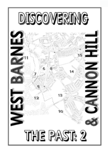 Discovering the Past 2: by Peter Hopkins

Like its predecessor, on Lower Morden, this large-format booklet devotes each of its 15 double-spread pages to a separate theme. After useful discussions of four key periods in the early history of the district, and an explanation of Merton Priory’s estates at the Dissolution, there are lucid histories of each farm or other piece of land that together made up the western part of Merton parish and the immediately surrounding area. For each there is at least one map, the outline of each land-holding being superimposed on a modern map. The narrative is clear, and throughout there are nicely varied illustrations.
Review in MHS Bulletin 136 (Dec 2000)
West Barnes covered the areas now known as Raynes Park and Motspur Park.
This booklet is based on an exhibition held at New Malden Evangelical Free Church, Seaforth Avenue in August
2000. All profits from its sale go towards church funds.
Although the title only refers to West Barnes and Cannon Hill, the medieval estates extended beyond the
areas of present day Merton which go by these names. They even included lands beyond the Beverley Brook in Malden
and Kingston parishes. This booklet likewise crosses the modern Borough boundaries, to give an overview of this region
as a whole.
After a brief look at the early history of the area, the focus is on the great estates at the end of the medieval
period, especially those belonging to Merton Priory. An attempt is made to map the individual fields listed in Ministers’
Accounts of 1538, and then the subsequent history of each estate, and its sub-divisions, is followed into modern times.
CONTENTS:
Page 1 Early History
Page 2 Domesday Book 1086
Page 3 The Middle Ages
Page 4 The 16th Century
Page 5 The Estates of Merton Priory in 1538
Page 6 West Barnes Farm
Page 7 Blagdon Farm
Page 8 West Barnes Park
Page 9 Blue House Farm
Page 10 The Commons
Page 11 Hoppingwood Farm
Page 12 Motspur Farm
Page 13 Hobalds Farm
Page 14 Cannon Hill
Page 15 Bakers Farm
Acknowledgements: Grateful thanks are due to: Merton
Design Unit (London Borough of Merton) for permission to use their current street map.
Merton Library and Heritage Services for the use of Miss Jowett’s photographs in their collections (marked MLSC).
Stephen Day for permission to reproduce the postcard view of Hoppingwood Farm from his book Malden ~ Old & New.
Malcolm Claridge and John Goddard for modern day photographs (marked with initials).
Judith Goodman of Merton Historical Society for advice, information and many corrections, as well as for access to the research
notes of the late John Wallace, whose knowledge of the history of this area is unlikely to be equalled.
John Pile of Merton Historical Society for tracings of the Tudor ‘plotts’.
Surrey Archaeological Society for permission to reproduce the map of Malden in 1627 from their Collections Vol.41.
The extracts from old maps are from the collections published by Harry Margary: 250 Years of Map-making in the County of
Surrey (1974) and Rocque’s Exact Survey (1971).
Other illustrations come from 19th- and early 20th-century publications.
Although most of this booklet is based on study of surviving documents, many discovered and transcribed by John Wallace, the
information on the earliest and the most recent periods is taken from published books. I have found the following most useful, and
extend my thanks to their authors:
John Wallace A Walk Around West Barnes (1987)
E M Jowett Raynes Park: A Social History (1987)
Judith Goodman Merton and Morden: A Pictorial History (1995)
Kenneth Ross A History of Malden (1947)
Stephen Day Malden ~ Old & New: A Pictorial History (1990)
S Lown & P Panizzo ‘A Fair and High Locality’: The Chronicle of Coombe Ridge House and ‘The Manor of Coombe’ (1996)
June Sampson All Change: Kingston, Surbiton & New Malden in the 19th Century (1985)
Margaret Bellars Kingston Then and Now (1979)
Apologies are offered for the inevitable errors and false assumptions, which will hopefully be corrected in due course!
Published by New Malden Evangelical Free Church, Seaforth Avenue
Copies are available from Peter Hopkins, 57 Templecombe Way, Morden, Surrey SM4 4JF at £2.50 including postage.
Discount is available for bulk orders.
. Peter Hopkins 2000
Merton
The Roman road known later as Stane Street ran across the eastern part of Merton, crossing the Wandle near the present Savacentre. Romanditches in the area may
indicate a settlement by the road, perhaps a staging post. Some think there may have been Roman settlement in the Blagdon area.
Merton is a Saxon name, probably meaning “farmstead by the pool”. It is bounded on the west by the Beverley Brook, on the east by the Wandle, on the north by the road
to Kingston, and on the south by a remarkably straight border with Morden. These bounds are set out in aCharter of AD967, whereby King Edgar granted the estate at
Mertonto Ealdorman Ælfheah and his wife Ælfswith.
By 1066 the estate was in the hands of Earl Harold, who became king on the death of Edward the Confessor, until his defeat at Hastings.
Morden
The line of Stane Street runs through Morden, forming its border with Sutton in the south-east. Remains of the road have been found at Morden Park and beneath Crown
House (now the Civic Centre). Evidence of Romano-British settlement has been found near St Helier Station.
The name is Saxon, meaning “hill in a swampy place”, and its location between the Wandle and the Pyl and East Pyl brooks bears this out.
Land south of the Crown was still called Marsh Close in the early 1800s.
Westminster Abbey owned the estate from long before the Norman Conquest. Although no original Saxon charters survive, tradition had it that 10 hides at Morden had been
given to Westminster before the Abbey was refounded by St Dunstan during the reign of Edgar, and that the grant was confirmed by Edgar in AD969.
A hide was a notional unit of tax assessment, also known as a carucate or a sulung.
EARLY HISTORY WIMBLEDON MERTON Hopping
KINGSTON
MORDEN
MALDEN
CHEAM
Coombe and Hopping were both in the ancient parish of Kingston
In 1816 Bakers was sold to John Hilbert, who had bought the lordship of the manor of Merton together with Manor Farm in 1801. Bakers was enlarged by 21½ acres allotted
to Hilbert from the enclosure of the Common.
In 1818 Hilbert’s nephew, William Tate, inherited the property, followed in 1834 by John Hilbert Tate, the son of another of Hilbert’s nephews.
As former demesne land of Merton Priory, Bakers was tithe free and was omitted from the Tithe Survey of 1844. John Overton had been the Tates’ tenant here since the
1820s.
In the late 1870s William Rayne, son of Edward Rayne late of West Barnes Park (see p.8), was tenant, the owners being the Whatley family.
Rayne also farmed the nearby Cannon Hill Farm, which had recently been added to the Cannon Hill estate.
He was succeeded by J J Keevil, who was still tenant when Bakers End Farm, as it was now known, was offered for sale in 1883. By 1901 it was Broadwater Farm, a dairy
farm run by the Berkshire family.
Postcard View of Broadwater Farm MLSC
Bushey Mead, built between 1890 and 1913, was among the first in the area to be developed. The roads became known as the Apostles,
being twelve in number. Approach Road, providing the link between Kingston Road and Grand Drive without crossing the railway line, was also developed in 1913, on the
former Sandpittes or Poors Wood.
Bakers End Farm was demolished in 1920 and a council estate laid out on its fields, centred on Whatley Avenue and the north-western arm of Martin Way. In 1926 a further
100 council homes were built in Cannon Hill Lane and the extension of Whatley Avenue.
Joseph Hood, MP for the constituency of Wimbledon, Merton and Morden, gave and equipped the Joseph Hood Recreation Ground. He died suddenly in 1931, while serving as
mayor of Wimbledon.
The David Lloyd leisure centre was created on the eastern edge of Prince George’s Playing Fields in 1988. The Playing Fields themselves are now the training ground for
Wimbledon Football Club.
Detail from 25 inch to the mile Ordnance Survey map 1897
15
In 1607 Thomas Cornwall, who had bought the site of the former
priory and the demesne lands, sold Bakers and the adjoining lands to
Gabriel Carr.
It had apparently already been farmed as a unit, as it was described as
“late in the occupation of Thomas Hickson”.
The property seems to have been the subject of a marriage settlement
for Cecilie, wife of John Carr, and was held on her behalf by John
Daunser from 1616 to 1620. The property passed from John and
Cecilie to Anthony Daunser in 1623, but he sold it to Thomas Hill that
same year.
Hill disposed of it in 1637 to John Garth, a younger son of George
Garth, lord of the manor of Morden (see p.13). It was to be held by
Elizabeth Duran for her lifetime, and pass to John Garth after her
death. John sold it in 1651 to Richard Aldworth.
In 1763 Bakers Farm was bought by John Wallinger, who bequeathed
it to his nephew, John Arnold, in 1766. Arnold took the name of
Wallinger, and in 1792 left the farm to his son, John Wallinger Arnold
Wallinger.
Richard Berryman was tenant in the 1780s and 1790s, followed by
William Head, who owned the property called Our Lady House in Merton.
A 31-year lease granted in 1791 was still in force in 1815, when the
farm was offered for sale. The tenant was then Benjamin Umphelby.
Some of the fields still retained names familiar from the 16th century:-
Rushey Mead meadow 6 acres
Rushey Mead wheat 5 acres
The Hither Sandpit Mead meadow 10 acres
The Middle Sandpit Mead meadow 7 acres
The Further Sandpit Mead meadow 7½ acres
Lords Hill Mead meadow 10½ acres
Malden
Malden is bounded on the west by the Hogsmill, on the east by the
Beverley Brook, on the south by Sparrowfield and on the north by Norbiton
Common.
It has been inhabited for at least 2500 years, early Iron-Age settlements
having been discovered near the parish church. Romano-British remains
have also been found in the area, dating from the 2nd to 4th centuries
AD.
The name Malden is Saxon, derived from Mael-dune. Mael is an image or
picture, while dune means hill. Christes mael was the cross or crucifix, so
Malden was “the hill with the cross on it”. The church still includes some
evidence of its Saxon foundation. It stands 93 feet (30m) above sea-level.
(Domesday Book also refers to the hamlet of Malden Rushett, between
Chessington and Leatherhead, which belonged to Chertsey Abbey in 1086).
Coombe and Hoppingwood
The discovery of Neolithic axes, arrowheads and pottery on Coombe Hill
shows that it was frequented by nomadic hunters over 5000 years ago.
One hand axe may even date from the Paleolithic era.
However, the first evidence for permanent settlement in the area is from
the Middle to Late Bronze Age, some 3000 years ago. Evidence of a
village community has been found on the site of Coombe Wood Golf
Course. The villagers grew crops, kept sheep and cattle and wove cloth.
There is also a suggestion of Romano-British settlement in the area,
perhaps until the 4th century AD. The surviving evidence includes coins,
urns, pottery and other artifacts.
The name Coombe is Saxon, meaning a valley on the side of a hill.
Hoppingwood Farm perpetuates the placename Hopping, mentioned in
the Merton charter of 967. It probably referred to a place where wild
hops grew. Fields on both banks of the brook retained the name.
BAKERS FARM
The meeting of the Hundreds
The name Motspur Park may also be of significance. In 1627 it was
Although the eastern boundary of Malden parish normally follows the
called Mott’s Furse Farm, and may have been named after Henry Mott.
Beverley Brook, a 30-acre field east of the brook was also in Malden. On
He is mentioned in a rental of Malden manor from 1457 as the former
its northern edge, another 30-acre field in Merton extends south from
owner of a free tenement then in the possession of John Vincent.
the Merton-Morden boundary. The land to the east of these two fields is
However, many Mot placenames come from the Anglo-Saxon word gemot,
in Morden, while the land to the south is in Cheam.
referring to a meeting place. Another related word is moot.
This area is not just a meeting of parish boundaries. Malden is in Kingston
Interestingly, another property in Malden was called Moot’s Farm in
Hundred, Merton in Brixton Hundred and Morden and Cheam in
1768, when it was a copyhold property belonging to Joseph Bell. It
Wallington Hundred. The hundreds were the judicial and administrative
became the property known in the 19th century as Fullbrooks.
divisions within the shires.
Is it possible that Benanbarrow was the site of an early Saxon meeting
The bounds of the Saxon estate at Merton listed in 967 mention
place?
Benanbarrow as a landmark in the south-western corner of Merton. This
This area was certainly of special significance in Saxon times, with three
suggests that an important burial mound stood here at the time.
hundreds and four parishes extending their boundaries to converge here.
1 acre = 0.405 hectares = 4050 square metres
1
Following his defeat of Harold at Hastings in 1066, William of Normandy was crowned King of England. Most of the lands of the English nobility were granted to his
followers. Twenty years later, William compiled a survey of these lands. The Anglo-Saxon Chronicle records that in 1085
in midwinter the king was in Gloucester. … the king had great deliberations and very deep speech with his counsellors about this land, how it was occupied and by what
men. He then sent his men over all England into each shire, and had it made out how many hides of land were in the shire … also he let it be written down …
what and how much each man who was holding land in England, in land, in livestock, and how much money it was worth.
The information was collected at Winchester, and copied into volumes now in the Public Record Office. They have been transcribed, translated,
edited and published by a team of scholars working under the direction of John Morris, and the following extracts are from this edition.
Merton
In Brixton Hundred:
The King holds MERTON. Earl Harold held it. Then and now it answered for 20 hides. Land for 21 ploughs. In lordship 2 ploughs. 56 villagers
and 13 smallholders with 18 ploughs. A church. 2 mills at 60s; meadow,
10 acres; woodland, 80 pigs. Value before 1066 £25; later £16; now
£35; however, its holder pays £43.
(The entry also mentions 16 dwellings in Southwark belonging to this manor, and two other remote properties – 2 hides in another Hundred within Surrey and 2 sulungs in
Kent).
The observation that the holder of the manor paid more than its value suggests that it was leased to a tenant at this time.
A sulung was the Kentish equivalent of a hide. 60s = 60 shillings = £3.
DOMESDAY BOOK 1086
WIMBLEDON MERTON KINGSTON
MORDEN MALDEN
CHEAM
Coombe and Hopping were both in the ancient parish of Kingston
John Watney is listed as the owner/occupier in Merton Land Tax records of 1805, but by 1810 Cannon Hill was owned by Thomas Sherwood.
In 1814 he took a 20-year lease on Lower Morden Farm, but “cleared all off and ran away by Michaelmas Day, 1828”!
His son, Moses, sold Cannon Hill in 1830 to Frederick White, but in 1832 it was purchased by Richard Thornton, who added 34 acres from West Barnes Park. In 1865
Thornton left over £3,000,000, an exceptionally large fortune, of which £7000 was for the founding of Merton village school. The estate was retained by his heirs for
shooting,
but the empty house became dilapidated and was pulled down.
Cannon Hill farmhouse, on the site now occupied by St John Fisher church, stood on land enclosed from Merton Common in 1816, part of the Bonds’ Merton Hall Farm. James
Page bought the whole property around 1840, but no buildings are shown here on the 1844 Tithe map.
The farmhouse appears on the 1860s Ordnance Survey map, and in the 1871 Census. William Rayne farmed here and at Bakers in the 1870s.
Cannon Hill House – from W H Chamberlain Reminiscences of Old Merton, 1925
George Blay acquired the Cannon Hill estate in 1925, at the same time as the former Raynes Park Golf Course (see p.8). He offered the site of the former parkland
belonging to Cannon Hill House to Merton and Morden Urban District Council and, after initial doubts, they agreed to purchase 53½ acres for £17,610. It was to be called
Cannon Hill Common,
though it had never been part of the common land of the manor.
Blay began his building at the Raynes Park end of the estate with Firstway,
and reached Cherrywood Lane and The Green in 1929, though he sold land here to Messrs Bessant and Brown for development. In 1930 he filled in the empty spaces with
various closes and built Eastway. New Ideal Homesteads completed Blay’s estate around 1939.
The Messines Field had been provided by a family who had lost one of its members at Messines Ridge near Ypres in the 1914-18 war, and it was later acquired by Prince
George’s Playing Fields. Raynes Park Playing Field, formerly the Technical Schools Sports Ground, was established on part of the field obtained by Thornton from West
Barnes Park in 1841.
Detail from John Rocque’s Map of Surrey,c.1770
14
In 1600 the site of the former priory together with all the demesne
lands including Canondownehill, were sold by Elizabeth I to Nicholas
Zouche, and they passed through several hands until in 1607 Thomas
Cornwall started to sell off the separate properties.
By 1610 all that was left was the site of the priory, the 60-acre wood
called Canondownehill and a 7-acre parcel of land lying by the said
wood, which Cornwall then sold to Thomas Marbury. He in turn sold
them in 1613 to trustees for Sir Francis Clark, and Sir Francis sold
them in 1624 to Rowland Wilson, a citizen and vintner of London.
Rowland Wilson bought other properties in and around Merton,
including Blagdon Farm. As well as bequeathing donations for the
poor out of the Blagdon rents, he also arranged for almshouses to be
built in the Kingston Road, by the junction with the present Brisbane
Avenue.
In 1732 Richard Dallett of Merton left his sons leases of three farms in
Merton. He had probably lived at the later Merton Hall Farm, but also
leased a farm called Cannon Hill, which may have been the Cannon
Hill estate, or possibly Merton Hall Farm land south of the Common.
The first evidence for a house at Cannon Hill dates from 1763, when
William Taylor appears in a list of Surrey freeholders. It is likely that
the house was built for him. Taylor also held on lease a farm in Lower
Morden and the woodland that became Cherry Wood.
At the end of the 18th century Edwards, in his Companion from London
to Brighthelmston, described Cannon Hill as “a white house situated on
an eminence commanding a pleasant and extensive prospect to the
east, over a small park or lawn. On the west are suitable gardens,
shrubberies, etc. and the soil is stiff black clay”.
Taylor leased Cannon Hill to William Mollison, who bought the estate
in 1792. Mollison continued to lease the farm in Lower Morden, as
well as some lands from John Middleton of West Barnes Park.
CANNON HILL
1860s
1841
Morden
In Wallington Hundred:
The Abbey of Westminster holds MORDEN itself. Before 1066 it answered
for 12 hides, now for 3 hides. Land for … [ploughs]. In lordship 3
ploughs; 8 villagers and 5 cottagers with 4 ploughs. 1 slave. 1 mill at
40s. Value before 1066 £6; now £10; however, it pays £15.
In medieval times Westminster Abbey held property in Ewell as part of
its manor of Morden. The 12th-century versions of the Saxon charters
refer to King Edgar confirming grants of 2 hides in Ewell and 10 hides in
Morden in the mid-10th century, and this probably accounts for the 12
hides allocated to Morden in the Domesday entry.
The fact that it paid more than its value suggests that it was leased out.
Coombe
In Kingston Hundred:
Ansgot the Interpreter holds COOMBE from the King. Cola held it
before 1066. Then it answered for 3 hides, now for 1½ hides. Land for
3 ploughs. In lordship 1; 6 villagers and 1 smallholder with 1 plough.
Meadow, 4 acres; for grazing, 4 pigs. Value 60s.
Humphrey the Chamberlain holds COOMBE from the Queen’s holding.
Alfred held it from King [Edward]; he could go where he would. Then it
answered for 3 hides, now for nothing. Land for 2 ploughs. In lordship
1; 3 villagers and 4 smallholders with 1 plough. Meadow, 8 acres. Value
before 1066 £4; later 20s; now 100s. After 1066 the woman who held
this land put herself in the Queen’s hands with it.
(Humphrey also had a villager of Kingston to collect the Queen’s wool.)
Malden
In Kingston Hundred:
Robert of Watteville holds MALDEN from Richard of Tonbridge. Harding
held it from King Edward. Then it answered for 8 hides, now for 4. Land
for 5 ploughs. In lordship 1 plough; 14 villagers and 2 smallholders with
4 ploughs. A chapel; 3 slaves. A mill at 12s; meadow, 4 acres; from
grazing, 1 pig in 7 pigs. Of these hides a man-at-arms holds 1 hide and
1virgate; he has 1 plough, and 1 villager and 1 smallholder. Meadow 1
acre. Total value before 1066 £7; later 100s; now £6 12s.
In MALDEN 1 hide which Robert of Watteville holds, remains in dispute.
The men of the Hundred state that Edward of Salisbury and Robert
d’Oilly adjudged it to Richard of Tonbridge. It remains exempt, in the
King’s hand.
Domesday often includes a sum for pigs. This is a payment for the right of pasturage
2
Merton Priory
In 1114 the manor of Merton was in the hands of Gilbert the Sheriff of Surrey, Huntingdonshire and Cambridgeshire. Having rebuilt the parish church he decided to set
up a priory for Augustinian canons nearby,
and invited the sub-prior of Huntingdon Priory to serve as prior. The allocated site did not prove to be suitable, and a new site was chosen by the River Wandle.
The canons entered into possession of their new priory in 1117, and in 1121 Gilbert persuaded Henry I to grant his new foundation a charter of liberties. Gilbert gave
the priory the whole manor of Merton as well as other properties, and over the coming years the priory amassed estates all over the south of England, and a few
further north.
At first the estate at Merton was worked on a communal basis, the priory’s lands being intermingled with the peasant land, but by the end of the 15th century most of
the land had come into the hands of the prior, and large farms were created and leased to tenants.
Hobalds
Merton Priory had held an estate in Lower Morden, or Westmorden as it was then known, from the early 13th century.
William de Wattune was listed among the freehold tenants of Westminster Abbey around 1220, holding 1 virgate. In Morden, a virgate was customarily 20 acres.
His son, another William, but with the surname spelt de Wautone or Walton, gave the property to the priory. In 1231 it was described as a carucate, some four times
larger than a virgate.
By the end of the Middle Ages the estate was known as Hobalds and consisted of 80 acres in Morden as well as 30 acres adjoining in Merton and another 30 acres
adjoining in Malden.
THE MIDDLE AGES WIMBLEDON MERTON KINGSTON
MORDEN Hobalds MALDEN
Sparrowfield CHEAM
Coombe and Hopping were both in the ancient parish of Kingston
At the beginning of the 19th century Hobalds was augmented by the addition of lands which had formerly been part of the farm leased to William Mollison of Cannon Hill.
In 1817 more lands were added,
formerly farmed by Richard Dallett.
By 1818, when Hobalds was to be leased to William Watts it totalled 229 acres. However, the lease was never delivered, as Watts “ran away”!
Instead the farm was leased to William Aspin, who still held the farm when the Tithe Surveys were undertaken. It consisted of almost 167 acres in Morden, over 30 acres
in Merton and over 16 acres in Malden.
Several other tenants held the farm until, in 1890, 125 acres were sold to Battersea Corporation for a new cemetery, the remainder being leased with Lower Morden Farm
to J J Bishop, founder of the removals firm.
Morden Cemetery and North East Surrey Crematorium JG 1999
Following the death of Sir Joseph Hood, MP for Wimbledon, Merton and Morden, in 1931, the Merton section of the former Hobalds land was acquired by a memorial
committee, at a cost of some £18,000, raised mostly by public subscription. In 1935 the Sir Joseph Hood Memorial Playing Fields were conveyed to the Urban District of
Merton and Morden.
The Sir Joseph Hood Memorial Wood has only been open to the public since 1990, and was declared a Local Nature Reserve in 1994. The wood was apparently planted by
Richard Garth in the 1860s.
The fields behind Green Lane Primary School, providing grazing for the stables opposite, still retain their rural aspect. The school was in Kingston Borough until
boundary changes in 1995 transferred it to Sutton.
Ancient boundary ditches and hedges still separate these fields from the cemetery within Morden parish.
The Four Acres estate was built in 1980 on land not required by the cemetery. The Catholic Schools and the sports grounds occupy the former Hobalds and Twyry Meads.
Hobalds in the 16th century – extract from a Tudor ‘plott’
13
By 1611 Hobalds had come into the possession of the Garth family,
who had bought the manor of Morden in 1554. The Garths remained
lords of the manor of Morden until the late 19th century, and also
bought the West Barnes Park estate in the 1860s (see p.8).
In 1611 Robert Garth let the property to William Coxitter, following
the death of the previous tenant, Martin Cottye. It consisted of over
140 acres, of which 30 acres were in Malden and 30 acres in Merton.
Garth also leased Coxitter a further 30 acres of the former priory
demesne meadows, Twyry Mead and Hobalds Mead, which he had
bought from Thomas Cornwall in 1607.
The map of Malden in 1627 shows “Hobbals Land” to have been the
odd rectangle of Malden land on the east bank of the Beverley Brook.
It was generally known as Hyde Hill.
In 1745 Hobalds was on lease to Thomas Budd, who had taken over
the lease from his widowed mother. The farm was now 178 acres in
total.
In the 1770s the tenant was Edward Martin, paying £52 13s. a
year, but the meadowland was leased separately. John Warrington,
who had bought the former Garth manor house in 1774, and held
other properties in Morden, paid £42 a year for Lower Morden
Meadows.
By 1782 both sections of the old farm were in Garth’s hands, and he
leased them to William Weller at £112 10s. a year. By this time 18
acres of Hyde Hill in Malden had been transferred to the farm which
came to be known as Lower Morden Farm.
Weller was succeeded as tenant by William Plank, and then by John
Dutton.
The Manor of Coombe Nevill
In the 12th century Ansgot’s former estate at Coombe was held by the
Belet family, members of which family also held Shene (Richmond) and
part of Bagshot. After the death of Michael Belet in 1215, King John
granted the Coombe estate to Hugh de Nevil, and from this time the
manor was called Coombe Nevill.
When William de Nevill died at the beginning of the 14th century, his
lands were divided between his two daughters. Nicholaa married John
de Hadresham, and on the death of a later John de Hadresham in
1417, the manor passed to trustees who transferred it to Merton Priory
in 1423 for the purpose of endowing a chantry. The priory already
owned nearby Hartington Coombe.
Humphrey the Chamberlain’s estate was later held by the Postel family,
and then by the Baldwin family. In 1292-3 Peter Baldwin still held his
lands by the old tenure of collecting the Queen’s wool.
Sparrowfield Common
The land to the south of Green Lane as far as the A24 formed a vast
extent of common pasture known as Sparfield or Sparrowfield. It was
shared between Morden, Malden, Cheam, Cuddington and Ewell, and
was often the subject of bitter dispute between the neighbouring
communities.
In the 13th century tenants of Malden manor had to remind the
Archbishop of Canterbury and the Prior of Christ Church Canterbury,
lords of the two manors of Cheam, that the tenants of Malden had
rights of pasture there.
In the 14th century men from Cheam assaulted the Abbot of
Westminster’s servant, and drove away cattle belonging to his manor
of Morden.
In the 15th century the men of Malden tore down a boundary cross set
up by the Archbishop’s men, and were accused of sacrilege and heresy!
HOBALDS FARM
‘The House of Scholars’ in Malden
Walter de Merton, rector of Cuddington, bought the manor of Malden in
1240. A skilled lawyer, he entered the royal Chancery, becoming Keeper
of the Great Seal in 1258, and Chancellor of England from 1260-62.
Walter had responsibility for eight nephews, whom he wanted to study
at Oxford. He was interested in educational reform, and decided to set
up a college for them and other young clerks.
In 1262 he assigned the income from his manors to support the scheme,
initially under the supervision of Merton Priory, but in 1264 the property
was vested in the community itself.
Malden became the administrative centre, where Walter set up the ‘House
of the Scholars of Merton’ under a Warden, to run the estates for the
maintenance of the scholars at Oxford, and other male relatives.
By 1274, when Walter became Bishop of Rochester, Merton College
Oxford was sufficiently established for the administration to move from
Malden to Oxford, though the income still came from the manors.
Ploughman and plough from a manuscript of Piers Plowman
3
West Barnes
Merton Priory had a grange with a great barn attached, outside the walls of the precinct, in the east of the manor, but it also had barns at the western end of the
manor.
The name Westbarns appears in priory records from 1505, and a copy of a lease of the farm survives from 1536. It covered a total of 579 acres, of which 20 acres were
coppiced woods.
In 1545 the West Barns estate was granted by the Crown to Sir John Gresham. The Greshams leased it to a tenant farmer, John Carpenter,
and over the following years he bought most of the farm from them,
parcel by parcel, completing his purchases in 1598.
However, not all the property farmed by Carpenter came into his possession. 113 acres called Blaldenys or Blackdenys were sold separately, to Thomas Randall, in 1573/4
and formed the later Blagdon Farm.
Demesne lands of Merton Priory
Until 1538, Merton Priory retained direct control of 350 acres in Merton,
Mitcham and Morden. These demesne lands were mostly meadow and pasture land, such as Twyry and Hobalds Meads by the Pyl Brook,
Combestrowde Mead and Katerslease near Coombe Bridge, and a 7acre
close of pasture above Canondownehyll. Another 60-acre close at Canondownehyll was described as wood ground. A further 146 acres,
centred on Bakers tenement, were situated together between Cannon Hill Lane and West Barnes.
At the Dissolution, the demesne lands were leased to Sir Thomas Hennage, together with the site of the former priory itself. Hennage,
who had leased Merton Priory’s manor of Molesey since 1519, died in 1553. In 1558, Mary I granted these lands to the newly refounded Priory of Shene, but on her death
they reverted to the Crown. Elizabeth I leased them to the treasurer of her household, Gregory Lovell.
THE 16th CENTURY Demesne Coombe
lands
West Barnes
Appuldore
Morden
Hobalds Malden
Sparrowfield
A note on the Malden Tithe Survey of 1794 shows that Machell was succeeded as tenant by Duff. Maps of the late 18th and early 19th centuries call the farm Notcurse or
Nutcars Farm, but the Greenwoods’ map of 1822-23 shows it as Motspur Farm.
By 1865 Motspur Farm had been acquired by Charles Blake. He laid out the road called Motspur Park and started to build large houses along it, in continuation of his
re-routed West Barnes Lane, where he had already built Ivy House and Dudley Lodge.
Meanwhile Judas Field had been sold to the owner of Blue House Farm.
A note on the 1794 Tithe Survey gives Rucker and Captain Clarke in place of James Carpenter. It became the site of The Grange, owned later by William Gush, an artist
whose daughter married Charles Blake after the death of his first wife.
The White House, BBC Club, Motspur Park MC 2000
Blake rebuilt the old Motspur Farm farmhouse and erected four others in his new road, and more in Malden Road. Two of these houses survive along Motspur Park.
The old farmhouse in the BBC Sports Ground is now called The White House. The Rookery, where Blake spent his final years, is now part of Fulham Football Club training
ground, formerly the University of London Athletic Ground.
The sports grounds now occupy about a half of the former farmlands of Motspur Farm.
Most of the later housing in the area was by Sydney Parkes’s Modern Homes and Estates Ltd, who also developed the former Blue House Farm lands (see p.9).
Malden in 1627, from a map in Merton College, Oxford
12
Between 1623 and 1627 Merton College Oxford attempted to regain
the manor of Malden, claiming undue pressure from the Queen (see
p.4). Eventually a compromise was reached, whereby the Goodes
retained the lease of the manor for 80 years, after which it would
revert to the college.
Maps of the manor survive from both these years and show that the
Goodes held two properties there. The demesne lands or home farm of
the manor covered 204 acres, mostly around the manor house by the
church, but also in the north-west of the manor, adjoining ‘Kingston
Common’.
They also held the 141-acre Furse Farm or Mott’s Furse Farm in the
north-eastern part of the manor. The northern section of the road now
called Malden Road was then called Fursen Lane.
Charles Goode sold the lease in 1672 to Sir Thomas Morley.
Morley’s widow surrendered the lease in 1707 as agreed, and the
College then leased it to Richard Willis, Dean of Lincoln, and later
Bishop of Winchester. In 1741 John Willis granted a 20-year lease of
Mottes Furze Farm in Malden to Robert Carpenter of Merton.
Robert was probably a great-grandson of the Robert Carpenter who
had divided the old West Barnes estate among his sons in the 1660s.
When he died in 1776 he left the lease of Motts Furze Farm, together
with freehold properties in Malden and Cheam, to his wife Anne, for
life, and then to his great-nephew Robert. He left the lease of Little
West Barnes to his nephew, James Carpenter, father of young Robert.
The 1794 Tithe Survey of Malden lists James Carpenter as owner-
occupier of the 4-acre Judas Field, the last of the Carpenter possessions.
The Survey also shows Willis’s tenant at Motts Furze Farm as Machell.
Joseph Machell later took over James Carpenter’s tenancy of Blue
House Farm.
Hobalds
When Merton Priory was dissolved in 1538 its estate in Lower Morden
was described as:
Mansion
called Hobbaldis with lands in Morden, Maldon and Merton
and lands called Appuldore in Maldon and Kyngestone.
It was on lease to Thomas Fremondis or Fromond, for £10 a year. The
Fromond family held the manor of East Cheam.
Hobalds remained Crown property until Mary I granted it with other
lands to the refounded Priory of Shene at Richmond. She died soon after
making the grant, and the lands returned to the Crown.
In 1562 Elizabeth I sold the estate to Lawrence Stryfe and Thomas Reve.
The southern Appledore lands remained part of Hobalds for some years,
but ultimately came into the possession of Richard Broughton. He also
bought the adjoining Blagdon Farm in 1626, and it remained part of
that farm until modern times.
The Manor of Coombe Nevill
In a valuation of Merton Priory’s lands taken in 1535, its manor of “Combe
Nevell”, excluding the woodland which was valued separately, was leased
to John Dymoke at a rent of £2 a year. The Dymoke family had held a
neighbouring estate since the 14th century.
At the Dissolution in 1538 the manor of Combnevell, with lands in
Appuldore “between the king’s way to Combe and Malden on the west
and land of West Barnes on the east”, was leased to Henry Courtenay,
Marquis of Exeter, at £16 a year. He was executed in December 1538.
The manor was granted to Edward Duke of Somerset in 1547 and on his
execution was given to William Cecil, later Lord Burghley, in 1552.
In 1579 it was granted to Thomas Vincent who, in 1595, granted a lease
of 61 acres of coppice and woodgrounds in Kingston called Great, Middle
and North Hoppings, and Hoppings next West Barnes, presumably part
of Appuldore, and later Hoppingwood Farm.
MOTSPUR FARM
Sparrowfield Common
A dispute during the reign of Edward VI led to the drawing up of the
earliest known large scale maps of the area.
The king’s tenants of Morden claimed that they had always enjoyed the
right to pasture their animals in Sparrowfield, and to take furze and
wood for fuel and fencing.
However, certain tenants of Cheam had driven away their animals,
claiming that Morden tenants had no rights in the common. The case
went to the King’s court, where a plan or ‘plott’ of the land in question
was tendered in evidence. The accuracy of this was questioned, so
Commissioners were appointed to investigate the matter at first hand
and to produce a more accurate version. Both the ‘plotts’ are now
preserved in the Public Record Office.
(see extracts on p.10)
The Manor of Malden
Merton College Oxford were leasing the manor of Malden to tenants by
the middle of the 15th century. Henry VIII acquired a 260-acre estate
in Malden in 1541, and seized another 120 acres of Merton College
land. These formed part of his Great Park of Nonsuch.
In 1560 Elizabeth I ‘persuaded’ the college authorities to grant her a
5000-year lease of the manor of Malden, which she then assigned to
the Earl of Arundel, keeper of Nonsuch Palace, in an attempt to obtain
Nonsuch from him.
Arundel assigned the lease to his son-in-law and heir, John Lord Lumley,
in whose name the manorial court was held in 1579.
By 1585 Lumley had conveyed the manor to Joan Goode, widow of the
physician to Mary Queen of Scots, and the manor remained in the
possession of the Goode family until 1672.
4
THE ESTATES OF MERTON PRIORY IN 1538
When Merton Priory was dissolved by Henry VIII in 1538, all its former estates came into royal ownership. The estates were in the hands of lessees or farmers,
who paid a fixed annual sum or ‘farm’ for the privilege of receiving the income from the estate. Each year these farmers rendered account to the king’s ministers,
and these accounts are in the Public Record Office at Kew. The first year’s accounts describe the estates in some detail.
The entries have been given a code letter to enable the provisional identification of each property on the map, based on Ordnance Survey maps of 1871-74.
Account of Sir Thomas Hennage, Farmer of Demesne lands in
Merton.
Farm of the site of the priory and demesne lands £2613s. 4d:-
C3 meadows at Bakers 40 acres
D2 meadows Rushymede / Bushymede 12 acres
Southmede [by the Wandle] 16 acres
E Twyrymede 20 acres
F Sandpyt meade 26 acres
G Combestrowd meade 30 acres
H field at Bakers 30 acres
I field called Hylfeld 8 acres land
J field called Okefeld 30 acres
K close above Cannondownehyll 7 acres
L meadow called hobbalds meade (24 acres)
fflemynge mede [in Mitcham] 7 acres
M at Cannondownhyll 60 acres
N a piece of land called Carters leys 40 acres
Account of Henry Marquis of Exeter, farmer of the Manor of
Combnevell in Kyngeston:-
A Farm of the manor of Combnevell
B plus a parcel of land and a parcel of meadow lying at Appuldore between
the king’s way to Combe and Maldon on the west and lands of West
Barnes on the east £16 0s. 0d
THE ESTATES OF MERTON PRIORY IN 1538
When Merton Priory was dissolved by Henry VIII in 1538, all its former estates came into royal ownership. The estates were in the hands of lessees or farmers,
who paid a fixed annual sum or ‘farm’ for the privilege of receiving the income from the estate. Each year these farmers rendered account to the king’s ministers,
and these accounts are in the Public Record Office at Kew. The first year’s accounts describe the estates in some detail.
The entries have been given a code letter to enable the provisional identification of each property on the map, based on Ordnance Survey maps of 1871-74.
Account of Sir Thomas Hennage, Farmer of Demesne lands in
Merton.
Farm of the site of the priory and demesne lands £2613s. 4d:-
C3 meadows at Bakers 40 acres
D2 meadows Rushymede / Bushymede 12 acres
Southmede [by the Wandle] 16 acres
E Twyrymede 20 acres
F Sandpyt meade 26 acres
G Combestrowd meade 30 acres
H field at Bakers 30 acres
I field called Hylfeld 8 acres land
J field called Okefeld 30 acres
K close above Cannondownehyll 7 acres
Lmeadow called hobbalds meade (24 acres)
fflemynge mede [in Mitcham] 7 acres
M at Cannondownhyll 60 acres
N a piece of land called Carters leys 40 acres
Account of Henry Marquis of Exeter, farmer of the Manor of
Combnevell in Kyngeston:-
AFarm of the manor of Combnevell
Bplus a parcel of land and a parcel of meadow lying at Appuldore between
the king’s way to Combe and Maldon on the west and lands of West
Barnes on the east £16 0s. 0d
The third Earl Spencer sold the Coombe estate in 1837 to the first Duke
of Cambridge, a son of George III. It covered 1300 acres, and included
Coombe House, which had replaced the Tudor manor house, three farms
and the ground leases on two other mansions, now part of Kingston
University.
One of the farms was the 255-acre Hoppingwood Farm, which included
the 67-acre Merton Abbey Meads, as Comberstrowde Mead and Carters
Lease were now known.
The 1840 Tithe Survey of Kingston shows Richard Chaundry as the tenant
at Hoppingwood Farm. Merton Abbey Meads, being former demesne land,
was tithe-free and so was omitted from the Merton Tithe Survey undertaken
in 1844.
By the 1860s the second Duke of Cambridge had started selling parcels
of land on Coombe Hill for substantial houses, such as those built for
John Galsworthy, the father of the author of The Forsyte Saga.
Postcard view of Hoppingwood Farm, postally used 1905 SD
The London and Southampton Railway, opened in 1838, had cut
Hoppingwood Farm in two. The station, known at first as ‘Coombe-with-
Malden’, was opened in 1846, and led to the creation of New Malden.
The first roads to be created were the six Groves, laid out in the 1850s.
However, Hoppingwood survived as a farm until 1911, when it became
the first of the Coombe farms to be sold for development. Its last tenants,
since the late 19th century, had been the Horlick family. Much of the land
remains open ground, occupied by Malden Golf Course, Beverley Park
and the Malden Wanderers Cricket Club, along the western bank of the
Beverley Brook, and various sports grounds on the former Merton Abbey
Meads.
The area around the farmhouse became Cambridge, Hoppingwood,
Orchard, Rosebery and Alric Avenues, while the southern fields are now
covered by Dukes and Kings Avenues, Malden Hill and Gardens, Hillbrow
and The Mount. Merton Abbey Meads include Westcombe Avenue, Coombe
Gardens, and Camberley, Somerset and Taunton Avenues, built in 1925.
Detail from John Rocque’s Map of Ten Miles around London,1741-45.
Unfortunately, Hoppingwood was on the join of two sheets which don’t quite match!
11
In 1608 Sir Francis Vincent sold the manor of Coombe Nevill to William
Cockayne, Lord Mayor of London. His son Charles, created Viscount
Cullen in 1642, was a staunch Royalist, and raised a troop of horse for
the king’s service. He is said to have lost £50,000 by his loyalty, and in
1651 was forced to sell the manor.
The buyer was Edward Lord Montagu, who bought it in trust for his
daughter Elizabeth, wife of Sir Daniel Harvey.
In 1654 Daniel Harvey bought some freehold property in Merton from
a Robert Wood. This was almost certainly Comberstrowde Mead and
Carters Lease, which were owned by Robert Harrison and Roger Wood
in 1620.
The demesne lands and the priory site (see p. 4) had been sold by
Elizabeth I in 1600 to Nicholas Zouche, and they passed through several
hands until Thomas Cornwall started selling off the separate properties.
Robert Harrison bought the 30-acre Comberstrowde Mead and the 40
HOPPINGWOOD FARM
In 1608 Sir Francis Vincent sold the manor of Coombe Nevill to William
Cockayne, Lord Mayor of London. His son Charles, created Viscount
Cullen in 1642, was a staunch Royalist, and raised a troop of horse for
the king’s service. He is said to have lost £50,000 by his loyalty, and in
1651 was forced to sell the manor.
The buyer was Edward Lord Montagu, who bought it in trust for his
daughter Elizabeth, wife of Sir Daniel Harvey.
In 1654 Daniel Harvey bought some freehold property in Merton from
a Robert Wood. This was almost certainly Comberstrowde Mead and
Carters Lease, which were owned by Robert Harrison and Roger Wood
in 1620.
The demesne lands and the priory site (see p. 4) had been sold by
Elizabeth I in 1600 to Nicholas Zouche, and they passed through several
hands until Thomas Cornwall started selling off the separate properties.
Robert Harrison bought the 30-acre Comberstrowde Mead and the 40acre
Carters Lease from Cornwall in 1607.
In John Rocque’s Exact Survey of the Cities of London, Westminster
and the Country near Ten Miles Round, published in 1745, he marked
“Comb Barn” south of “Comb Lane” between “West Barns Lane” and
“Comb Bridge”. This was the location of Comberstrowde Mead and
Carters Lease, and confirms that this was the property bought by Daniel
Harvey in 1654 .
Rocque’s map also shows the farm at Hoppingwood. It is not named on
this map, but on his c.1770 Map of Surrey it is called Hopping Farm
(see p.14).
Edward Harvey sold the manor around 1753 to the trustees of the
young John Spencer, who had inherited his father’s estates in 1746 at
the age of 12. He was created Viscount Spencer in 1761 and Earl
Spencer in 1765. His father, a grandson of Sarah Churchill, Duchess of
Marlborough, had inherited her manor of Wimbledon in 1744.
Earl Spencer’s tenant of Merton Abbey Meads towards the end of the
century was Thomas Watney, followed by Matthew Watney.
Account of Thomas Fremondis, Farmer of Hobbaldis:-
O Mansion called Hobbaldis with lands in Morden, Maldon and Merton
P together with a certain parcel of land in Maldon and Kyngestone parishes
called Appuldore £10 0s. 0d.
Farm called Westbarnes:
£18 10s. from the farm of :
Q
a certain mansion called Westbarnes with all buildings, barns, stables,
curtilages and gardens pertaining
R
7 small closes lying near the mansion 31 acres
Certain other parcels of land, meadow and wood:
S
A close called Bromsell 33 acres
T
Hoppyng Mede, a close of meadow and wood 45 acres
U
Hoppyng, a close 55½ acres
V
Pitles, a close 25 acres
W
Eastfeld, a close 106 acres
X
Canondownhyll, a close (48 acres)
Y
A field called Twyryfeld 33 acres
Z
and 3 closes called Westfeld and Blaldenys 188 acres
with all tithes within the demesne of this farm except the tithe of wood
growing within the farm
as demised by indenture to Thomas and Geoffrey Bedle 31 August 1536.
5
When John Carpenter died in 1611, his will divided his properties between his wife and two sons.
The younger son, Henry, received the Eastfields, and probably built a house there, but he died three years later, and the whole estate reverted to his elder brother,
Gregory.
Gregory settled all of the West Barnes estate, except for 12 acres called Cannonhill Crofts, on his eldest son, John. In 1631 he left these 12 acres plus other property
to his youngest son, William. Other properties went to his middle son, Robert, who also received John’s share on his death in 1658.
Robert divided the property into two, the eastern portion being settled on his four younger sons. In 1662, he left the main farm to his eldest son, another John, to be
divided equally among John’s six children after John’s death.
In 1718 John Carpenter of Kingston, mercer, owned five-sixths of West Barnes. He was probably the son of James Carpenter of Kingston,
who died in that year. It was then on lease to Charles Newington,
who had taken over the lease on the death of his father George, but when it was sold in 1737 it was on lease to another James Carpenter.
The remaining one-sixth of the farm seems to have been owned by the elder James’s brother, Joseph, who sold his interest in the farm in 1737 to Joseph Chitty, who had
bought the rest of the farm.
In 1758 Thomas Chitty also bought the farm later called Merton Hall Farm, the property later known as Church House, some copyhold closes and the rectorial right to
tithes.
In 1762 the property passed to Eleanor Bond, daughter of Thomas Chitty, and it remained in the Bond family until the beginning of the 19th century. Between 1780 and
1800 the tenant was Mary Batts,
who was herself a substantial property owner.
The early 19th century saw a movement towards enclosing waste lands.
When such a proposal was put forward in 1806 for enclosing Merton and Morden Commons, the parishioners of Morden opposed it on the grounds “that the majority of the
cottagers have large families and will be wholly deprived of firing which at present they enjoy from the Common.
That it is not in their power to purchase coals and other fuel and will drive them to the greatest distress”.
Norbiton Common was enclosed under an Act of Parliament obtained in 1808, Cheam Common in 1810, and Merton Common in 1816. Each of the tenants of the manor, both
freeholders and copyholders, was granted an allotment of land from within the former common. Lanes and footpaths were created to provide access to each of these
enclosures.
Morden Common was not developed until the end of the century, the southern section becoming a brickworks, now the industrial estate, the northern section a market
garden.
WEST BARNES FARM
NORTH
WEST
Detail from the first Tudor ‘plott’ of Sparrowfield Common
In the 1920s, Morden Common, the easternmost section of the former Sparrowfield, was described as having “even now a rather wild appearance”. In 1926 a large area was
bought for the Cemetery, and the Council later bought more land for the Refuse Disposal Depot. Garth Road and its closes were soon lined with houses and maisonettes.
Across the parish boundary, Worcester Park Sewage Disposal Works were constructed in 1927-28. They have recently closed, following connection with Thames Water’s
Hogsmill site at Berrylands. Longfellow,
Lincoln and Washington Roads in Worcester Park were built by the British Land Company Ltd in 1865-66, on two of the allotments from the enclosure of Cheam Common.
In 1923 Martin Way was laid out on the line of the old Green Lane across Merton Common, and the housing on each side was built by the late 1930s. John Innes’s former
brickworks became Mostyn Gardens.
Norbiton Common was built over between the 1860s and early 1930s.
WEST
NORTH
Detail from the Commissioners’ ‘plott’
10
Sparrowfield Common was only one of many commons in the area
but, being so large and being shared by so many villages and manors,
it was the subject of more and bigger disputes, and therefore more
records survive concerning it.
To the north of the manor of Malden, and west of Blagdon and
Hoppingwood Farms, lay Norbiton Common. It separated these
settlements from the town of Kingston, though the main roads to
Kingston crossed the Common.
By the 19th century, Merton Common was some 400 metres wide and
1200 metres long, running each side of the present Martin Way from
just west of Cannon Hill Lane towards London Road, narrowing to a
funnel by the Crown Inn, now the Civic Centre site. Another funnel, by
the railway bridge in Cannon Hill Lane, led into Merton village. The
land north of the Morden boundary seems to have been enclosed from
the common in 1505, when the Prior of Merton gave land here to his
tenants in exchange for Combestrowd Meade, south of Coombe Lane.
The importance of the Commons in the village economy can be seen
from these regulations from the Merton manorial court rolls of 1708:First
it is ordered that all persons who have the right to put cattle into
Merton Common do cause the same cattle to be pitch marked with the
lord of the manor’s mark, paying 2d. for each mark, and that in case
any cattle shall be found in ye said common not marked that the
Common keeper drive the same to pound and that before the same is
delivered out the owner to pay the usual charge.
Also it is ordered that if any person or persons having no right so to do
cut or carry away any wood, bushes or furzes or other like wood either
from ye common of Merton or a place called Sandepitts which lyeth on
ye road side leading from Merton to Kingston shall forfeit and pay to
ye lord of ye manor aforesaid for every bundle of such wood, furzes
and bushes 5 shillings.
Approach Road now covers the Sandpits, later known as Poors Wood.
THE COMMONS
Sandpits /
Poors Wood
Merton
Common Norbiton
Common
Morden
Common Cheam
Common
(Sparrowfield)
The Bonds’ tenant in the early 19th century was James Steel, who
remained in occupation after they sold the farm in 1816 to trustees
for William Holmes. Steel was followed by Richard Hallam in the late
1820s, but Henry Hills was Holmes’s tenant in 1844 when the Tithe
Apportionment Survey was undertaken.
All holders of land were required to pay a tenth of the produce of the
land to the rector of the parish church, to pay for the upkeep of the
church and the maintenance of services. Merton Priory had taken over
the tithes of Merton. After the Dissolution, the right to the tithes was
sold to a local landowner, Thomas Locke, and in time came into the
possession of the Bond family. However, West Barnes had been granted
the right to its own tithes, so Hills paid his tithes to Holmes.
George Dickson was tenant from the 1850s to 1880s, and was
succeeded by William Harriott. Harriott bought the farm in 1894,
building a new farmhouse on land now occupied by Malden Court.
West Barnes Farm – from W H Chamberlain Reminiscences of Old Merton, 1925
West Barnes Farm was divided first by the London and Southampton
Railway, opened in 1838, and then by the Kingston Bypass (A3) and the
Merton Spur, opened in 1927. Raynes Park Station was built on the very
corner of the Pitles, adjoining Poors Wood, in 1871.
The site of the old moated farm house, demolished around 1900, is now
part of Raynes Park High School, and Bushey First and Middle Schools
each occupy part of the former farmlands. In addition to the school
fields, the meadowlands alongside the Beverley Brook are sports grounds,
as is the land north of the railway line.
In 1909, 19 acres were sold to Carters Tested Seeds, replaced in 1967
by the Carters estate. Bradbury Wilkinson bought the closes south of the
Pyl Brook in 1921, occupied since 1987 by Tesco.
Dickson’s Cottages were built in West Barnes Lane around 1864/66 for
farm labourers, but very little of the old farm is occupied by housing –
some blocks of flats along the northern arm of West Barnes Lane, and
houses along the A3, and in Aboyne Drive and Firstway.
Detail from John Senex’s Map of Surrey,1729
6
Blagdon was the first part of the old West Barnes estate to be separated.
In 1573/4 John Gresham sold to Thomas Randall 113 acres land
called Blaldenys or Blackdenys, together with 48 acres called
Canondowne Hilles.
In 1586 Randall sold the property to Thomas Chapman, who in turn
sold it to John Evelyn in 1595. The following year Evelyn sold the
Canondowne Hill land to John Carpenter, who had bought the rest of
West Barnes.
The Evelyn family sold “Blackdenis” in 1626 to Richard Broughton,
who also owned adjoining lands in Malden and Kingston. In 1634 he
left his “farme of Blagdens, Appledore and Hoppinge” to Robert Cesar,
who sold it to Rowland Wilson in 1649. Wilson, who owned several
estates in Merton, left “Blackdens” to his grandchildren, subject to the
payment of 52 shillings a year to the poor of Merton.
It is not known how long Rowland Wilson’s heirs, the Crisp family, kept
Blagdon. They sold the former priory precincts in 1668, and the land
on which Nelson’s Merton Place was built was sold by them in 1699.
In the 1690s the tenant at Blackdens or Blackdownes was a William
Collins, but in 1732 Richard Dallett of Merton left the lease of
Blackdowne to his son Matthew, who was already in occupation.
Dallett had also leased two other farms in Merton, one called Cannon
Hill, the other probably the Bond family’s farm later known as Merton
Hall Farm. He also owned two small freehold cottages in Lower Morden.
The family later bought several copyhold properties in Merton.
By 1764 Blagdon was the property of John Lawson of Chancery Lane
and Southside Wimbledon, and in that year he left it to his son Francis.
In the 1780s and early 1790s his tenant farmer was John Golden,
who was followed by John Watney until 1814.
Daniel Rucker inherited the property in the opening years of the 19th
century and, according to Merton Land Tax returns, James Carpenter
continued as his tenant until 1814.
The Land Tax returns show that Carpenter was succeeded as tenant by
Edmund Reed.
Then from 1823 to 1829 the tenant was Joseph Machell. Machell was
already tenant of the adjoining Motts Furse Farm by 1794.
Captain Clarke bought the farm from the Ruckers, but around 1850 it
had been sold again.
The new owner was Charles Blake, a solicitor with a penchant for land
development. ‘Squire Blake’, as he liked to be known, diverted the old
route of West Barnes Lane, which had run along his boundary with
Blagdon between the present Phyllis and Adela Avenues, and started to
develop his land for housing.
BLAGDON FARM
Blue House Cottages, Motspur Park MC 2000
Along the new line of West Barnes Lane Charles Blake built Dudley Lodge
(demolished in 1924) and Ivy House (demolished in 1970 to make way
for Dodge City DIY centre). He also built West Barnes Terrace, by the
railway crossing opposite West Barnes Farm, around 1884, and Blue
House Cottages by the bridge over the Beverley Brook, presumably for
his farm workers. Two survive, the other two being demolished in 1963,
having been condemned as unfit for occupation.
The farm was used for breeding polo ponies, before being acquired by
Sydney Parkes in 1925 for Modern Homes and Estates. Parkes paid for
Motspur Park Station and developed the estate around it between 1925
and 1927, though it was completed by Wates after 1936. Phyllis Avenue
and Arthur Road were named after Parkes’s children.
The old oak trees lining Arthur Road are a remnant of the old boundary
hedges between the enclosed fields. The southern boundary of the estate
is occupied by sports grounds.
Detail from J Lindley & W Crosley’s Map of Surrey,1793
9
It is not clear at what stage the property that became Blue House
Farm was separated from the main West Barnes estate. It consisted
of the south-western section of the original estate, including the former
Westfields.
The Westfields, together with a close called Draper’s Close, the Twyries,
Canondowne Hill, Canondowne Croft and the Broomfields, had been
left by the first John Carpenter (see p.6) to his eldest son, Gregory, in
1611, together with a house and lands at Cheam. However, Gregory
inherited the whole of the estate following the death of his brother
Henry in 1614.
What is certain is that once the eastern section had been settled on
Robert Carpenter’s youngest sons around 1660, this south-western
corner would have been cut off from the main farm.
The property had definitely become separated from the old West Barnes
Farm by 1737, when it was described as a messuage and barns with
100 acres of land.
It was probably then known as Little West Barns. In 1776, Robert
Carpenter left the lease of a farm called Little West Barns to his nephew
James Carpenter. He had also held the lease of Motts Furse Farm in
Malden, and various “freehold messuages, cottages, lands, hereditaments
and premises situated in the parishes of Cheam and Malden”.
However, John Rocque’s Map of Surrey, dating from c.1770 (see p.14)
shows the farm as Blue House, as does Lindley and Crossley’s Map of
Surrey in 1793, reproduced below.
Land Tax returns record James as the tenant until 1814. In the 1780s
and early 1790s it was owned by William Hayley, and after that it
was owned by John Anthony Rucker, proprietor of the textile printing
works at Phipps Bridge.
The tenants in 1815 were Messrs Berrenger, followed by Daniel Deacon
in the 1820s. Charles Lawson sold Blagdon in the 1840s to Philip
Matthews. When the Tithe Surveys were undertaken, Blagdon consisted
of 120 acres in Merton, 80 acres in Kingston and 16 acres in Malden.
The tenant was Edward Rayne, who also owned West Barnes Park.
Tithe Apportionment Surveys calculated a rent-charge to replace
traditional tithes. Because Blagdon had been part of the old West Barnes
estate, which had always had the right to its tithes, the rent-charge was
payable to the owner of Blagdon. The Merton Survey of 1844 listed
Matthews as owner, but Lawson as receiving the rent-charge, suggesting
that the sale had only just taken place.
Matthews was still owner in the 1870s, but had sold to Joseph St
John, a builder, by 1881. Tenants included James Allen in 1851, John
West in 1861, Henry Willis in 1871 and Henry Hatch in 1881. In
1891 Clement Keevil ran the Blagdon Stud Farm for shire horses.
BLUE HOUSE FARM
Blagdon House, Blagdon Lane, built 1826. MC 2000
Blagdon Farm house still stands among its outbuildings, serving the
adjoining Emanuel School Playing Field. Along Burlington Road the
Sacred Heart School in Merton Borough and Burlington School in
Kingston Borough are both on former Blagdon lands. Residential streets
lie to the south of Burlington Road and to the north by the Beverley
Brook. Beverley School occupies the field known in the 17th century as
Appledore.
Other land by the Bypass became a centre for light industry, famous
names including Shannon, Decca, Senior’s Pastes, British Salmson Aero
Engines and Champion. Now most of the sites are retail developments.
East of the Epsom Branch Railway, opened in 1859, Seaforth Avenue
was started in 1901. It originally stopped at the edge of the Blagdon
estate, and was not continued to West Barnes Lane until 1934. Estella
Avenue is named after the daughter of the developer, William Furmage
Palmer, who lived at Blagdon until around 1920.
Detail from John Seller’s Map of Surrey,c.1693
7
The property which became West Barnes Park was the eastern section
of the old West Barnes estate, which Robert Carpenter had settled on
his four youngest sons, Nicholas, William, Charles and Thomas.
They did not farm it themselves, as it was leased to Nathaniel Chalkhill.
Chalkhill was one of the original trustees of Merton’s Rutlish Charity.
The lands, totalling 211 acres, included 38 acres on Canon Downe
Hill, as well as the former Eastfield and lands called The Tweyryes,
near the Pyl and East Pyl brooks.
The original house had probably been built by Henry Carpenter, Robert’s
uncle, around 1612.
At least one of the Carpenters mortgaged his interest in the land, and
this may have been the reason for their individual interests in the
property being sold between 1683 and 1689 to Dr John Budgen of
Dorking.
In 1723 Dr John Budgen commissioned John Harding to produce a
plan of his West Barnes estate, and this plan is now on display in the
Wimbledon Society Museum in the Ridgway. The estate totalled 200
acres.
The Budgens were country gentlemen from West Newdigate but also
had an estate in the Dorking area. John Budgen died in 1732, leaving
the property to his nephew, Thomas Budgen. Thomas was a Member
of Parliament in the 1750s but was defeated in the election of 1761.
He died in 1772, leaving his estates to his son John Smith Budgen. In
the 1780s Budgen’s tenant farmer was John Cross.
In 1787 John Smith Budgen sold the farm to John Middleton for
£4270. Middleton leased part of the property to William Mollison of
Cannon Hill. Mollison also leased a farm in Lower Morden, and by
1805 both of Mollison’s leaseholds were in the possession of John
Dutton, who already farmed at Hobalds.
WEST BARNES PARK
until 1841
Dutton was followed at West Barnes by Joseph Booker around 1815,
and then by Messrs Curtis around 1820. In 1822 John Middleton
invited his nephew, Edward Rayne, to become tenant of his West Barnes
property. When Middleton died in 1833, he left the farm to six trustees
to sell, and Edward set about buying the property from them. By 1840
he had bought five of the six shares, and the following year obtained
the remainder by releasing 34 acres to one of the trustees, Richard
Thornton of Cannon Hill.
As Edward farmed the property himself, there was no need to calculate
a rent-charge in place of tithes, so West Barnes Park was not included
in the Tithe Survey. However, the sale map of 1833 survives.
Edward died in 1847, but his widow and sons continued at West
Barnes until 1868, though they sold the freehold in 1866. The new
owner, Richard Garth, lord of the manor of Morden, planned to develop
it for housing.
West Barnes Park House, c.1867 MLSC
Garth paid for a station to serve his planned development, and on
opening in 1871 it was called Raynes Park station, though the land on
which it stood was never part of the Rayne estate.
Grand Drive and Blenheim Road were laid out in the 1880s with freehold
building plots. About a dozen mansions were built at first, and more in
the 1890s, as well as the more modest constructions by James Randall
Randall Lodge, Bonaccord and Bijou Villas – all completed by 1899. –
The early 1900s saw more varied properties.
Most of the former fields were leased to the Raynes Park Golf Club
between 1893 and 1924, after which they were acquired by George
Blay, together with the Cannon Hill estate. Blay had built most of the
houses on the estate by 1930, though some work remained to be done
after the War by New Ideal Homesteads.
From the 1930s several sports grounds were created. The line of trees
running north-south through Prince George’s Playing Fields is a remnant
of the eastern boundary of West Barnes Park.
Harding’s Survey of West Barnes,1723 MLSC
8