 MERTON HISTORICAL SOCIETY
 Lower Morden and Morden Park
 Discovering the Past 1: by Peter Hopkins
In producing this booklet of 25 double-spread pages, Peter offers us a rich source of material, most of which appears in print for the first time and is the result of a great deal of original research into a wide range of documentary sources. A general survey of Morden parish from AD 1 to the year 2000 leads the reader into a detailed account of 20 locations into which Peter has divided Lower Morden. The whole is illustrated with 47 maps and 39 photographs old and new, all reproduced to a remarkably high standard for a desk-top publication.
The introductory section of the booklet explores the development of Morden from a small settlement on Roman Stane Street to the population explosion of the 1920s and ’30s. With the departure of the Roman legions in AD 410 Morden disappears from view for more than five centuries, emerging from the ‘Dark Ages’ in the 11th century as an estate owned and managed by Westminster Abbey. The manor remained with Westminster until the Dissolution, when it came into the hands of the Garth family. The Garths were the ‘squires’ of Morden until the latter part of the 19th century, overseeing and directing the changes from open-field agriculture to a landscape of enclosed and individually tenanted farms. Two quite remarkable maps show Morden in the 14th and 16th centuries.
This booklet will undoubtedly serve for many years to come as an important source for anyone with an interest in the area, from the experienced local historian to the general reader curious about the history of this locality.
Review by John Pile in MHS Bulletin 132 (Dec 1999)
This booklet is based on an exhibition held at St Martin’s Church, Camborne Road, Morden in September
1999, as part of a diocesan Open Day. All profits from its sale go towards church funds.
Although Lower Morden today is an unexceptional corner of suburban London, mostly dating from the
1930s, it has a history going back for centuries. All the classical elements of land use and exploitation are here
– the early open fields and their amalgamation, the meadows and the common heath – the latter less conducive
to agriculture and therefore used as rough grazing, but also for squatters’ plots and illicit enclosures. We also
have evidence of the agricultural revolution taking place, with the rationalisation of holdings as they passed into
the hands of major landowners during the Elizabethan period of high farming, and then the creation of parkland
in the 18th century. As a finale, we have the ultimate disappearance of the rural landscape as it was “developed”
for housing in the inter-war years. In studying the history of this small area of settlement we can chart how the
appearance of much of lowland England was modified over the last millennium, as the resources of the land
were exploited under increasing population pressure, and the landscape was changed for ever.
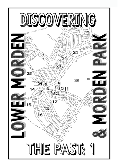
After a brief overview of Morden’s history over the past 2000 years, we look at 20 modern sites, as
marked on the front cover, to discover what was here in past centuries:-
Page 6 New Cottages, Lower Morden Lane once the site of John Manship’s farm
Page 7 Hatfeild School, Lower Morden Lane once the site of Lower Morden Farm
Page 8 St Martin’s Church, Camborne Road built on Great Mill Field
Page 9 Bow Lane an ancient thoroughfare to Merton
Page 10 Morden Park Library, Lower Morden Lane once the site of Graves Farm
Page 11 Wyevale Garden Centre, Lower Morden Lane once the site of Peacock Farm
Page 12 Cardinal Avenue & Cranmer Close once the site of medieval tenements
Page 13 Morden Park Baptist Church once the site of Wynterworthe Farm
Page 14 Morden Cemetery & NE Surrey Crematorium once the site of Hobalds Farm
Page 15 Merton & Sutton Cemetery, Garth Road once the site of Morden Common
Page 16 Garth Road Factories some on the site of squatters’ cottages
Page 17 Tudor & Morden Farm Schools, Aragon Road built on the former communal South Field
Page 18 Kingsbridge & Lynmouth Avenues built on an early enclosure
Page 19 Carlingford Road & Allgood Close built on the West Shott of South Field
Page 20 Churston, Thurleston, Templecombe, & Shaldon built on the fields of Bowhill
Page 21 Cherry Wood, Shaldon Drive the former Cumberstrode Ruffet
Page 22 Hillcross School, Monkleigh Road built on ancient farmland
Page 23 Morden Park an 18th-century gentleman’s estate
Page 24 Grand Drive Shops built on the Common Mead
Page 25 The Catholic Schools, Grand Drive built on Merton Priory’s meadowland
Acknowledgements: Grateful thanks are due to:-
Merton Design Unit (London Borough of Merton) for permission to use their current street map
Merton Library and Heritage Services for the use of maps and photographs from their collections (marked MLSC)
Lilian Grumbridge for the use of her childhood photographs (marked LG)
John Goddard, Tom Cantell, George Hopkins and William Rudd for modern day photographs (marked with initials)
John Pile of Merton Historical Society for tracings of the Tudor ‘Plotts’ and sections of the Tithe Map
Sheila Harris for Peter’s drawing of The Old School House. Other illustrations come from 19th- & early 20th-century publications
William Rudd, John Pile, Judith Goodman, Eric Montague and Lionel Green of Merton Historical Society for their advice, information,
inspiration and the breadth of their historical knowledge.
Apologies are offered for errors and assumptions which will hopefully be corrected in due course!
Published by St Martin’s Church, Camborne Road, Morden Surrey SM4 4JL
.. Peter Hopkins 1999, revised 2000
DISCOVERING THE PAST 1: LOWER MORDEN & MORDEN PARK
The Roman road between London and Chichester
passed through Morden. In later times it was known
The Roman road between London and Chichester
passed through Morden. In later times it was known
The line of Stane Street can be traced from the Lord
Nelson on the boundary with Cheam, to the Civic
Centre, on the boundary with Merton parish, passing
through Morden Park.
The Saxons settled in the area, though little has
been found from this period within Morden. A large
Saxon cemetery has been excavated across the Wandle,
within Mitcham.
The names of local settlements date from Saxon times.
Morden probably means “hill in a swampy place”.
The boundaries of the various settlements were also
set during the Saxon period. A charter of King Edgar
of AD967, granting the estate of Merton to Ealderman
Ælfheah and his wife Ælfswith, lists the boundaries
of the estate, including that between Merton and
Morden.
Fragments of Roman pottery dating to the late first
century AD have been discovered scattered across a
wide area east of St Helier Station in Green Lane. This
suggests that there was a Roman settlement in the
area.
Perhaps this was a work camp relating to the building
of the road, but occupation certainly continued into
the 2nd century.
It has been suggested that the mound in Morden Park
may possibly have been of Roman date.
Westminster Abbey owned Morden before the
Norman conquest. Although no original Saxon charters
survive, tradition had it that 10 hides at Morden had
been given to Westminster before the abbey was
refounded during the reign of Edgar, and that Edgar
had confirmed the grant in AD969. Westminster Abbey
retained the estate until the 16th century.
The dedication of Morden Parish Church to St Lawrence
may be evidence that it was a Saxon foundation. There
were two early saints called Lawrence, the martyr
Lawrence of Rome (d.258), and Lawrence of
Canterbury, successor to St Augustine who introduced
Christianity to the Saxon kingdom of Kent.
After the Dissolution of Merton Priory in 1538, the demesne
lands of the Priory passed to the Crown, and were leased with
the Priory precinct.
In November 1558 Queen Mary granted the former Priory precinct,
the 350 acres of demesne lands, and Hobalds, to the refounded
Priory of Shene, in Richmond. Mary died three days later, and
Shene Priory was dissolved, the properties reverting to the Crown
once more.
In 1600 the site of Merton Priory and its demesne land were
sold, though the Queen was still entitled to an annual payment
of £25. The property passed through several owners in a few
years.
MLSC
Merton Priory demesne lands
The south end of Grand Drive c1910
In 1607 the then owner, Thomas Cornwall, started to sell off
parts of the demesne, and the 20-acre Twyryemead and the 24acre
Hobalde Mead were sold to Robert Garth, lord of the manor
of Morden, together with the 16-acre Southmead, by the Wandle,
for the sum of £200, but also paying £2 a year to the King.
By 1611 Hobalds Mead, now 18 acres, and Twyry Mead, now
12 acres, were leased with Hobalds Farm, and they remained
part of that farm until the end of the 19th century.
The word Twyry originally meant land between rivers or streams,
in this case the Pyl and the East Pyl. By the early 19th century
people had problems with the name, and it gradually changed
from “Twirey” to “Twiney” in 1803, and even “Swing” in 1818.
There were also Twyry lands in the adjoining West Barnes estate.
25
JG
JG
Priory.
St Catherine’s is within the ancient parish of Merton, on a pieceof land called Twyry Mede, while St John Fisher is in Morden Parish, on a piece of land called Hobalds
Mede.
Hobalds Farm had been Merton Priory property since the early 13th century, and this piece of meadow had probably been claimed by the Priory out of the Common Mead.
When the Priory leased Hobalds to farmers, Hobalds Mede was retained by the Priory as demesne land. Twyry Mede was similarly retained when West Barnes was leased to
farmers.
Although in separate parishes, these two adjoining pieces of meadow have remained together until the present day.
Detail from 1838 & 1844 Tithe Maps, shaded to show location with modern street map superimposed
Roman and Saxon Morden
eet
BRIXTON HUNDRED
MITCHAM
MERTON
Saxon cemetery
Line of Stane Street St Lawrence
Morden
Church
•
Parkmound
Benanbarrow?
Roman settlement
MALDEN
KINGSTON
HUNDRED
CHEAM
CARSHALTON
SUTTON WALLINGTON HUNDRED
1
JG
The Pyl Brook behind Derwent Road
The later Peacock Farm had 6 acres called Bottom Common Mead,
while the later Lower Morden Farm had 6 acres enclosed out of
the Common Mead, adjoining the 5-acre Mead Close, the 2-acre
Hawks Mead, adjoining Short Hills, and the 4-acre Rale Mede.
Mention is also made of a half-acre pightle adjoining the Common
Mead, belonging to a smallholding in the tenure of John Cowing.
Surprisingly little land in this area was still meadowland by 1838.
The Tithe Apportionment map shows 6 acres around Shorthills,
in the area of Derwent Road, and 12 acres in Bow Lane Field and
Bow Lane Meadow, around the present Glenthorpe Road and
the parallel section of Camborne Road.
Presumably new improvements in agriculture meant that hay
meadows were no longer as important as they had once been.
The Domesday Survey of 1086 was In 1225 Westminster Abbey divided its estates, to
commissioned by William the Conqueror to find out provide support for either the Abbot or the monastery.
what and how much each landholder held in land Morden was allocated to the monastery kitchen.
and livestock, and what it was worth.
A document of this time mentions eighteen customary
The Abbey of Westminster holds Morden itself. tenants paying rent as well as providing labour service.
Before 1066 it answered for 12 hides, now for 3 hides. There were also three large freehold estates in Morden,
Land for …. In lordship 3 ploughs; which soon became independent properties. One,
8 villagers and 5 cottagers with 4 ploughs. 1 slave. owned by William de Wattune, and given by him to
Merton Priory, became Hobalds in Lower Morden. The
1 mill at 40 shillings.
Priory also owned the Spittle estate, between Central
Value before 1066 £6; now £10; however, it pays £15.
Road and Carshalton. A neighbouring estate was
Ravensbury manor, with lands in Mitcham and Morden.
In 1312 Westminster Abbey undertook a survey
Until 1358 Westminster Abbey ran the estate
of its estates including Morden. The large freeholds
directly through its own officials. After this date,
mentioned in 1225 were no longer part of the manor.
however, the demesne or home farm was leased to a
There were five smaller freehold properties in Morden, succession of tenants or farmers.
as well as thirteen customary tenants who held 240
The Rectory, or the rights to the great tithes, was also
acres of arable land. Twenty-five tenants rented
leased to laymen, including William Wynteworthe in
cottages, yards and small plots of land.
1391, who probably gave his name to a substantial
The demesne lands were all listed by name and freehold property in Lower Morden.
acreage, as well as land use. There was a ‘Capital
The final lease was granted in 1511 to William Porter.
Messuage’ or house, with gardens and yards, 306¾
It was for 60 years, and by the time it expired
acres of arable, 2½ acres meadow, and 35 acres of
Westminster Abbey had been deprived of its estates.
In 1583 the Common Mead covered 30 acres. This was mainly
between the Pyl Brook and Bow Lane (Camborne Road), but it
seems to have extended along the East Pyl into the Morden Park
estate. 16th-century leases of the farm that preceded Morden
Park mention 2 acres in the Common Mead, and in the 18th
century this estate included the 2½-acre Gallows Mead.
During the 17th century parcels of the Common Mead were
being enclosed. The Railed Close, or Rayle Mead was described
as a new enclosure in 1616, and another parcel was also newly
enclosed that year.
By 1745 the Common Mead seems to have been totally enclosed.
Graves Farm had a 3-acre close called Longmead, adjoining
Hobalds Mead, and a 6-acre close adjoining Longmead.
Detail from the 1838 Tithe Map shaded to show land use
24
Although building at the Raynes Park end of Grand Drive wasbegun in the 1880s development was slow and the Lower Mordenend was not developed until the late 1930s. The
block of shops and flats which includes the Post Office was not built until the late 1960s and the ‘new’ estate of Buttermere Close, Coniston Close and Derwent Road was
completed in 1980.
rate of development.
feeding the livestock during the winter months.
Each villager was allotted part of the Common Mead.
small holdings such as Plomer Shawe, which only had 3 acres of arable, had one acre of meadow in the Common Mead.
TC
Detail from the 1838 Tithe Map, shaded to show location with modern street map superimposed
The area was vulnerable to flooding, which accounts for the slow However, these water meadows along the Pyl and the East Pyl brooks had been very important in
the medieval economy, providing the hay that was so essential for Even very
Although building at the Raynes Park end of Grand Drive was begun in the 1880s development was slow and the Lower Morden end was not developed until the late 1930s. The
block of shops and flats which includes the Post Office was not built until the late 1960s and the ‘new’ estate of Buttermere Close, Coniston Close and Derwent Road was
completed in 1980.
rate of development.
feeding the livestock during the winter months.
Each villager was allotted part of the Common Mead.
small holdings such as Plomer Shawe, which only had 3 acres of arable, had one acre of meadow in the Common Mead.
TC
Detail from the 1838 Tithe Map, shaded to show location with modern street map superimposed
The area was vulnerable to flooding, which accounts for the slow However, these water meadows along the Pyl and the East Pyl brooks had been very important in the
medieval economy, providing the hay that was so essential for Even very
Bere
Swynesmede
worth
Waterden
Eylond
Marsche
North
Atte
Schote
hacche
Comstrod
Chirche Forlong
Bow
Hill
Common
Shotts
Mead
Newbury
part of
Snake
Croftes
Hobalds
Dedeman
Ravensbury
Hull
Manor
Forlonges Le
West
Gillene
Spittle
Held
West Morden
Shote Wulfardes Croftes
Sparrowfield
South
Gellenmede
Arable tenant land
Sutton
Common Field
Arable demesne land
Heath
Mixed tenant & demesne arable Meadow Independent Freeholds Common pasture Wood Settlement
2
surrendered to the Crown in January 1540.
The manor of Morden remained Crown property until
30 June 1553, when Edward VI sold it to Edward
Whitchurch, a London haberdasher, and Lionel
Ducket, a mercer, together with property in
Nottinghamshire and Staffordshire, for £699 18s 1d.
As the manor was still at lease, Whitchurch rebuilt a
copyhold property called Growtes, while Ducket
occupied a Ravensbury copyhold.
Details from a 16th century map of London
During the early 17th century both of
Merton Priory’s former Morden estates also came into
Garth ownership, though Spittle Farm was sold again
in 1639, on the death of Richard Garth II.
Richard Garth II had restored the Rectorial tithes to
William Booth, who was nominated as Rector in 1634.
The refurbishing of the church in its present form was
started at this time.
William Booth married Richard’s daughter, Ellen, in
September 1635. Ellen’s first husband, Thomas Hicks,
had died 15 months before. Thomas and Ellen had
leased the farm later known as Lower Morden Farm.
Henry VIII Edward VI
Mary I Elizabeth I
The Garth Coat of Arms
Edward VI died a week after the sale, to be
succeeded by Mary, an ardent Roman Catholic.
Whitchurch was a prominent Protestant, and had been
involved in the printing of Miles Coverdale’s ‘Great
Bible’. He was also the official printer of both Prayer
Books of Edward VI. On Mary’s accession he went
into hiding, selling the Morden estate to Richard Garth
on 7 March 1554.
Merton Priory was dissolved in 1538, but Mary gave
Hobalds and other lands to the newly formed Priory of
Shene. On Mary’s death in 1558, Elizabeth I closed
Shene Priory, the lands returning to the Crown.
By the mid-17th century the Garths had
bought virtually all the freeholds and copyholds in
Lower Morden, enabling them to complete the enclosure
of the open fields and to reorganise the farms there.
Twelve Morden inhabitants contributed almost £19
towards a “Free and Voluntary Present” to King Charles
II in 1661-2, following his return from exile.
The Hearth Tax returns for 1664 list 40 Morden
properties, of which 31 paid the tax. One property
had 19 hearths, three had 15, one had 11, one 10,
one 6, two 5, three 4, five 3, seven 2 and sixteen only
1. Eleven of the householders were widows.
Detail from 1860s Ordnance Survey map showing trees which
marked the boundaries of fields which preceded Morden Park
As well as the mansion, another important landmark is the Mound.
It has been suggested that this might have been a Roman burial
mound, though others argue it was merely a feature of the 18thcentury
landscaping, using excavated soil to create a base for a
summerhouse. Perhaps both suggestions are true.
Although the early 18th-century maps do not show this feature,
local field names may provide some clues to its prior existence.
From Tudor times onwards, one of the large fields here was called
Gallowsfield, and there are a number of instances in Surrey of
such a name being associated with burial mounds.
Again the 1312 list of demesne lands include Dedemanforlonges,
which may possibly refer to a burial mound, though it may just
refer to a memorable death in the area.
Further lands were added over the years, including 7½ acres
from Bryons Farm, later Peacock Farm, in 1769, and a further
35 acres in 1783. Also in 1783 he added Cumberstrode Ruffett,
the present Cherry Wood, and a 7½ acre field from Shords Farm,
later Morden House. By 1838 the estate totalled 210 acres.
The core of the estate had been demesne land by the mid-16th
century, though in 1312 it was partly demesne and partly
customary land, held by the villagers.
The earliest extant lease is from 1594, when 110½ acres were
leased to Thomas Leysden. This did not include the 24 acres of
wood ground known as Long Hill Ruffett, which belonged to the
estate later.
Morden Park Mound
from Merton Historical Society’s Morden Park Morden(1977)
23
WR
WR
When John Ewart, a wealthy merchant, was looking for land on which to build a mansion, he wanted a 99-year lease, and the only way that was possible was by a special
Act of Parliament.
Ewart took over a 133-acre farm previously leased to Edward Martin, and built his mansion on the hill known as Longhill. At the same time he agreed to take over another
24 acres to the north of Martin’s Farm, which was to become vacant in 1780.
Detail from 1838 Tithe Map, shaded to show extent of estate
with modern street map superimposed
Tudor Morden – a reconstruction
Barrow Waterden The
Field Growtes
Mershe
Great Hobalds
Parkland
Cumberstrode
ChurchField
Newbury
Bow
Common Hill
Mead
Shotts
New
Ducket’s
Close
part of
Snake
Hobalds
Farm
Ravensbury
Hill
Gallows
Manor
Field Spittle
Lower
Gilden
Farm
Morden Mordens
Hill
part of
Morden
Kynnersley
South
Common
Sutton Manor
Field
Common
Arable tenant land Mixed tenant & demesne arable Arable demesne land Meadow Independent Freeholds Common pasture Woodland or wood pasture Settlement
3
The late 18th and early 19th century was a
period of gentrification, with large estates formed
The late 18th and early 19th century was a
period of gentrification, with large estates formed
around 1750, and Morden Park from 1768-9.
The financier Abraham Goldsmid built a spectacular
home at Morden Lodge, in place of the former manor
house, Growtes, sold by the Garths in 1682.
In 1823 Spittle Farm was described as “a handsome
mansion with beautiful grounds and a farm, the
Fashions of 1806 – from prints of the period
property of George Matthew Hoare, Esq., banker.”
His father owned nearby Mitcham Grove.
Many maps of the area date from this period.
Early mapmakers who produced large-scale maps of
Surrey included John Seller (revised 1693) and John
Senex (1729). John Rocque’s detailed maps of 174145,
and 1765-75 were followed by Lindley & Crossley
(1793), Faden (1800), and Greenwood (1822-23).
The first edition Ordnance Survey maps for our area
dated from 1816, and large scale maps were produced
from the 1860s.
The Tithe Apportionment map and schedule provided
The village school was opened in 1731 at
the corner of Central Road. It started with 12 pupils,
but had more than 100 on roll by 1878, when it
became a National School. It had been enlarged in
1872 and an infants room was added in 1889. In
1910 the school moved to a new building across the
road, the old school becoming the Parish Hall.
A Sunday School was started in 1791, by Dr John
Witherington Peers, the Rector.
The parish workhouse was built in 1772 on a piece
of waste land in Central Road, but became redundant
after the opening of the Croydon Union Workhouse
under the Poor Law Amendment Act of 1834.
a detailed survey of Morden in 1838.
Stephenson’s locomotive “The Rocket”
A document of 1745 gives a detailed list of
properties leased by the Garths to various tenants in
Morden.
During the 1770s the farms in the Lower Morden area
were reorganised, and most of the land was divided
between four large farms. Instead of the scattered
small fields which had developed over the centuries,
the fields attached to the new farms were in more
compact blocks.
Many of the earlier farmsteads became cottages for
the farm workers.
A general view of the Selley estate
The remaining 35 acres transferred from Bryons Farm were-
Peartree Close, formerly Little Snake Hill 2¾ acres
Firze Field and Snake Hill, formerly Great Snake Hill 6 acres
Hither Field at the end of the lane, formerly Larklease
and Long Cumberstrood 5 acres
Gate Close 3 acres
Three Acres, lying on the south side of Northwood 3¾ acres
Lower Five Acres, formerly the Pightles 5¾ acres
Dencher Close, formerly Little Cumberstrode 3 acres
Lower Cumberstrode 6 acres
Snakehill was in the south-western corner of Morden Park, adjoining
Bowhill. Cumberstrode was in the area south of Cherry Wood,
formerly Cumberstrode Ruffett (see page 21).
Longhill was the name of the hill on which Morden Park mansion
was built. In 1567 it had extended over 40 acres, but by 1611
it had been divided. Longhill itself was a 16-acre close, and the
remaining 24 acres were coppice or wood ground called Long Hill
Ruffett.
By 1784 “Langhill Wood” had been reduced to 8½ acres, and
had either already been or was about to be ‘grubbed up’ to be
used for arable farming. Other parcels of wood ground survived
on the estate, and had probably been part of the original wood.
By 1838 only two areas of woodland survived on the estate, the
Great Wood, later Cherry Wood, which had been added to the
estate in 1784, and the 2-acre Little Wood, which might have
been a surviving fragment of Longhill Wood.
The corner of Ashridge Way showing old boundary trees
Photograph from Selley’s Guide
22
GH
GH
Detail from 1860s Ordnance Survey Map, shaded to show fields
with Selley’s 1930s street plan superimposed in white
Morden in 1838 – Land Use
4
During the 1870s and 1880s the Garths
During the 1870s and 1880s the Garths
His son, Gilliat Edward, who inherited in 1906, was
responsible for the preservation of our two beautiful
parks. In order to prevent Morden Park from being
lost under suburban building development, Hatfeild
sold the freehold to the Merton and Morden Urban
District Council in 1936 as a permanent open space.
When he died in 1941 he left his Morden Hall estate
to the National Trust.
The St Helier Estate was the largest
development in Morden. It occupies some 825 acres,
of which 322 acres are in Morden, acquired by the
London County Council between 1926 and 1929.
By 1939 over 9000 new dwellings had been built
on this land, more than 3,500 of them in Morden.
The creation of the separate parish of St Peter
St Helier brought changes to Morden’s boundary.
Some land surplus to LCC requirements, at the
junction of Central Road and Green Lane, was
acquired by the Trustees of the Haig Homes for
disabled ex-servicemen and the Officers’ Family
Association for an extensive housing estate.
Morden Underground Station (actually
in Merton parish!) was built in 1926 among farm
fields. Although Merton Park was developed by John
Innes from the 1870s, Morden remained a village.
There had been isolated pockets of development in
the 19th century, such as the corrugated iron clad
cottages built in Crown Lane by Thomas North,
opposite the 19 dwellings erected in the late 1890s
for John Innes’s brickfield workers on the Merton side
of the road. Another brickfield, on Morden Common,
was served by 12 cottages built by 1869 at the
southern end of what is now Garth Road.
During the 1930s Morden was transformed
from a village to a suburb.
In the Hillcross Avenue area Messrs W H Selley built
their so-called Merton Park Estate, while G T Crouch
Ltd laid out their Morden Park Tudor Estate around
Tudor Drive, and Wates built in the Garth Road area.
As well as the big estates, smaller companies built
single roads, such as Mr Warren’s houses in and
around Arundel Avenue.
Building was halted in 1939, but after the War,
council houses were built in Tudor Drive, and flats at
Edinburgh Court and Thornton Court in Grand Drive.
Detail from the plan enclosed with Selley’s Guide
When Westminster Abbey surveyed its estates in 1312, it listed
arable, meadow, pasture and woodland. However, no woodland
was recorded for its Morden estate.
However, the name Comstrod did appear, among the most valuable
arable land, but less valuable land seems to have adjoined it.
This suggests that Cherry Wood may have once been poor quality
arable land that was abandoned some time after 1312, perhaps
following the Black Death of 1349. It gradually reverted to scrub,
leading to the descriptions as Furze and Ruffett, and by the early
18th century it had become a substantial wood.
When Messrs Selley acquired land here for building in the 1930s,
they offered Cherry Wood to Merton and Morden Urban District
Council as a permanent open space.
Several Cumberstrode lands appear in lists of fields transferred
from Bryons Farm to Morden Park in 1783.
In 1616 Combestrood Ruffett had extended over 8¾ acres,
whereas only 3 acres passed to Thomas Conway in 1784.
However, in a document of 1745 a Jonas Lovejoy is shown as
holding lands including Coomberstroude Ruffett alias Wood Close,
containing 5 acres.
References from the 16th century onwards place Coomberstroude
Ruffett to the east of Bowhill, in the same area that we find
Cherry Wood today.
In the 16th and early 17th centuries there are also references to
Bowhill Furze, and it seems likely that the two names relate to
the same general area.
“Cherry Wood” – photograph from Selley’s Guide
21
JG
JG
A recent study by the London Ecology Unit reports that the larger oaks in Cherry Wood are around 200 years old, and the presence of ramsons and wood melick suggests an
ancient origin.
There are references to the North Wood as a landmark in leases of 1719-1783, relating to property belonging to Bryons Farm that became part of the Morden Park estate in
1783.
The North Wood itself was not part of Morden Park at this time,
but a year later Richard Garth leased to Thomas Conway of Morden Park, a parcel of wood ground called Cumberstrode Ruffit of 3 acres, previously held by William Taylor
of Cannon Hill.
Detail from the 1860s Ordnance Survey Map
Morden in the 20th century
Modern parish boundary Extract from a modern street map of the Borough of Merton, by Merton Design Unit, London Borough of Merton
………………….
…
………………….
..
..
..
….
..
..
..
……..
…
………
..
……
……..
…………
…….
………
…..
…
……
……………….
………….
…….
…
………
………………
Ancient parish boundary
5
JG
JG
The parish boundary with Merton makes several turns in the Bowhill area, and it was necessary to mark these corners in someway, so that the boundary would be preserved.
In earlier centuries marks were cut on trees, and children were bumped there when ‘beating the bounds’ so that they would remember these locations.
Such a “perambulation of the parish boundaries” took place in May 1882, and the records survive, including the map used by the group of parish officers, old men and
young boys. This map shows “the position upon which it was resolved to erect new boundary posts”.
More than 30 new posts were erected, one of which still stands behind Thurleston Avenue, just outside the allotment gates.
The eight “New Cottages” were built in 1907. Lilian Grumbridge has published her memories of her childhood here.
On this site in 1838 stood a pair of cottages within a farm yard,
and another pair adjoining a barn. They had been part of Hobalds Farm since 1803. A footpath divided the cottages from 2 gardens and a meadow, which had belonged with
them since 1763.
This was the year that John Manship was granted a lease of the farmstead and 92 acres in Lower Morden. The Manship family were major land owners in Mitcham. John
Manship’s daughter rand heir, Ann, married Simon Ewart, son of John Ewart who built Morden Park on land he leased from the Garths from 1768.
According to Land Tax records, Manship sub-let the farm to successive owners of the nearby Cannon Hill estate.
In 1540 William Playstowe, John Pleystowe, and Thomas Toller JG
GRAND DRIVE
HILLCROSS
AVENUE
LOWER MORDEN
LANE Detail from the 1838 Tithe Map, shaded to show location with outline of modern streets superimposed in white
each held small closes and acre strips in Bowhyll. Graves Farm included 2 closes there totalling 8 acres in leases of 1588-1745.
From 1579 to 1624 the later Lower Morden Farm included:-
Bowhill Close joining east on Combestrode, containing 4 acres.
8 acres in the Shott by Bowhill between the meadow and Bowhill7 acres in the Middle Shott in Bowhill between the furzes called Bowhill Furze and Snakehill
In 1745 this farm included:
15
acres in three closes in Lower Shott in Bowhill, between Bowlane on south-west and Upper Shott on Bowhill on north-east A 7-acre close in the Upper Shott in Bowhill A 4-
acre close in the Upper Shott between Bowhill and Coomberstroude Ruffett
..Site of new boundary posts erected in 1882
……………………….
20
JG
JG
the slopes of a hill, formerly known as Bowhill.
By 1838 the whole of Bowhill belonged to Lower Morden Farm,
but in the Middle Ages it had been part of the open field system,
divided into acre strips within various shotts or furlongs. The
names of these shotts were still used in 1745, although the holdings
were now in small closes, rather than the scattered strips.
This might suggest that Bow Hill was not fully enclosed until the
18th century, although enclosure had already started here in the
16th century.
In 1521 John Hyller held two separate 1-acre strips in Bowhyll.
One was identified as being between land of John Pleystowe on
the south and land of the vicar of Morden on the north.
Detail from the 1838 Tithe Map, shaded to show location
with modern street map superimposed
Detail from the 1933 Ordnance Survey Map, with annotations
According to newspaper reports in 1889, John Innes, the creator
of Merton Park, built cottages in Lower Morden. This entitled
him to be represented at the enquiry into the purchase by Battersea
Burial Board of land belonging to Hobalds Farm for use as a
cemetery.
They were probably the two cottages known as “Beverley
Cottages”, between the present Beverley public house and “New
Cottages”, though they were not shown on Ordnance Survey
maps of the 1890s.
The four “Farm Cottages”, also known as “Bishops Cottages”, do
appear on these maps. They were demolished in the post-war
period. J J Bishop, founder of the removal firm, was tenant of
the adjoining farms from the 1880s.
Before 1763 the farmstead had no lands adjoining, its 4 acres of
pasture having been annexed by its neighbour, the later Lower
Morden Farm, some 200 years before.
In 1745 it was described as “a messuage with outhouses, edifices,
barn, stables, buildings, yards, backsides, orchards and gardens,
in the occupation of Thomas Warden”.
Warden farmed a mere 24 acres in five closes scattered around
Lower Morden, the largest of which, New Close, totalled 9½
acres, and had been formed from five small enclosures from the
old South Field. All his lands were later added to Peacock Farm,
in the reorganisation of Garth farms in Lower Morden.
The ‘Four Acres’ of pasture belonging to this farmstead in 1838
had probably been Manship’s 3-acre ‘Stack Meadow’ and orchards.
Beverley Cottages, Lower Morden Lane
JG
6
JG
JG
In 1838 the farm included 130 acres in three blocks in Morden
and one in Malden, as shown on the adjoining map. It belonged
to Richard Garth, and was farmed by Thomas Marshall.
The farm had been formed in 1771, as part of the reorganisation
and consolidation of Garth properties in the area.
Before that time the lands attached to this farmstead had been
more scattered.
In 1745, the farmer was Jonas Lovejoy, who also farmed Franks
Farm on the opposite side of Lower Morden Lane.
Detail from the 1838 Tithe Map, shaded to show extent of farm
JG
Hobalds Mead Bridge? – Lower Morden Lane crosses Pyl Brook
However, the three Westhaws closes had not been part of the
medieval Wynterworthe Farm. It is likely that these 10½ acres
had been the 10½-acre Westshote, listed among the Westminster
Abbey demesne lands in 1312. Another 4 acres called Westbutte
probably abutted onto Westshotte.
Most of the demesne lands of Morden were in the north of the
manor – in the Morden Hall area, between London Road and
Central Road, in the present Morden Park, north of Morden Park,
and in the area east of Epsom Road and south of Green Lane.
The demesne lands totalled 344¼ acres – 306¾ acres of arable,
2½ acres of meadow and 35 acres of pasture.
with modern street map superimposed
During the 18th century there had been three closes here, as well
as odd parcels of arable and meadow land.
“The 3-acre Westhaws and 2 acres by Hobalds Mead Bridge”
were part of one of John Howard’s farms, together with a
farmstead and a 1-acre close adjoining, called Winters.
“Lower West Haws of 3 acres, Paper West Haws of 4½ acres and
2 acres lying east upon Cheam Common” were part of Mary
Martin’s farm, together with a farmstead and pightle, and a 2½
acre
close also called Winters.
The fact that both properties held closes called Winters and closes
called Westhaws suggests that these two farms had formerly
been one property. This was the former Wynterworthe Farm,
which had a 3½-acre close called Winters in 1617.
Westminster Abbey’s demesne lands in 1312 – a reconstruction
Probable demesne
Mixed demesne &
customary land
Possible demesne
Merton Priory lands
Ravensbury Manor
19
GRAND DRIVE
HILLCROSS AVENUE LOWER
MORDEN LANEC AMBORNE
ROAD
meadow in the Common Mead. It was farmed by William Parker.
A John Parker had held land in Morden as early as 1494, but we do not know whether it was this farmstead.
During the early 17th century, the farm was occupied by members
of the Garth family – first by the lord of the manor’s son, George,
and later by two sons-in-law, David Benet and Thomas Hicks. It was one of the biggest properties in Lower Morden at this time.
The medieval farmstead had probably been one of three tenements north of Lower Morden Lane and west of Bow Lane, each having a 1-acre yard, a 1-acre orchard and a 4-acre
close of pasture.
In the late 16th century this farmstead had 100 acres in small enclosures of arable in the South Field and in Bowhill, and of Detail from the 1838 Tithe Map, shaded to
show location with modern street map superimposed
The land crossed by Carlingford Road and Allgood Close is shown on the Tithe Apportionment map of 1838 as a block of three fields. They were bounded on the west by the
Pyl Brook, on the north by Lower Morden Lane, on the east by Hawkins Lane and on the south by the continuation of the back lane towards Merton Common.
Four Acres Common, an arable field, and the 6¾-acre Mint Field Meadow belonged to Peacock Farm.
Pyl Brook.
JG
MLSC
belonged to Lower Morden Farm, while the 7½-acre Lower This area also includes the northern end of Lynmouth Avenue and Kingsbridge Road, as well as the length of Lower
Morden Lane between the Beverley roundabout and the bridge over the
Detail from the 1838 Tithe Map, shaded to show location with outline of modern streets superimposed in white
Lower Morden Farm in 1952, with the school under construction
The corner where the Nursery now stands was a separate property until the 1860s. It was a freehold property, not leased from the Garths.
Hugh Dollett owned it in the mid-17th century, and it remained in his family for around 200 years. His great-granddaughter,
Elizabeth, married into the Watney family of Wimbledon. James
Watney sold it to the Garths in 1862.
In 1838 it was described as two cottages with gardens, totalling
half an acre, then owned by Elizabeth’s son-in-law, William Rawlins.
No doubt it had once included an orchard and a close of pasture,
but these had already been taken over by its bigger neighbour
before the end of the 16th century.
7
St Martin’s was opened in 1957, the youngest of the daughter churches of Morden parish, which became a Team Ministry in1988. It stands at the edge of a field that is
shown on the Tithe Apportionment Map of 1838 as Great Mill Field (plot 43).
Could there have been a watermill on the East Pyl Brook?
It does not seem very likely.
The name did not appear in early lists of field names. In the16th, 17th and 18th centuries this field was part of a “12-acre close lying behind the barn”.
It had probably originally been three closes of pasture, each of 4acres, belonging to the three medieval tenements here.
By the end of the 16th century the central tenement had taken over the closes belonging to its neighbours.
TC
GRAND DRIVE
HILLCROSS
AVENUE CAMBORNE
ROAD
LOWER
MORDEN LANE
..
TUDOR DRIVE
….
Hungerhill
Bowhill
Longhill
Cannonhill
Gildenhill
St Martin’s was opened in 1957, the youngest of the daughter churches of Morden parish, which became a Team Ministry in1988. It stands at the edge of a field that is
shown on the Tithe Apportionment Map of 1838 as Great Mill Field (plot 43).
Could there have been a watermill on the East Pyl Brook?
It does not seem very likely.
The name did not appear in early lists of field names. In the 16th, 17th and 18th centuries this field was part of a “12-acre close lying behind the barn”.
It had probably originally been three closes of pasture, each of 4acres, belonging to the three medieval tenements here.
By the end of the 16th century the central tenement had taken over the closes belonging to its neighbours.
TC
GRAND DRIVE
HILLCROSS
AVENUE CAMBORNE
ROAD
LOWER
MORDEN LANE
..
TUDOR DRIVE
….
Hungerhill
Bowhill
Longhill
Cannonhill
Gildenhill
Detail from the 1838 Tithe Map, shaded to show location with outline of modern streets superimposed in white
The lands belonging to this second farm were described as:-
Southwells, a close of 5½ acres, joining west upon the Common Long Close of 4 acres, joining west on Southwells
Hilly Field of 6½ acres
Wikefield of 7½ acres
A field called the Two Slips of 4 acres.
Southwells and Long Close were mentioned in 1579, when Southwells was of 7 acres and Long Close 2½ acres. Thus the two fields always totalled 9½ acres, though the
individual fields were rearranged.
This land might have been demesne land of the manor. In 1617 Wynterworthes included 1 acre “in a close called Southwelles of Mr Garth’s”.
Contour map of Morden
Detail from the second Tudor plott
Wikefield may possibly be the Wyggeshyll Close mentioned in1521, on the north of Hungerhill, the later Stonecot Hill.
The second Tudor “plott” or plan of Sparrowfield seems to show two enclosures in this area, one of which is marked as Fyrsy, the second as Close. This might mean that
the two enclosures were formerly one, known as Fyrsy Close.
However, there are several references to Hungerhill Vyrsyn or Furzes in the 16th century, and woodland called Hungerhill Ruffetin the 17th century. The name Hungerhill
suggests it was all of poor quality, and the poorest arable land was commonly abandoned after the Black Death, gradually reverting to scrub.
In the light of this, it is possible that the ‘plott’ may actually depict a single close, north of the ‘fyrsy’ on Hungerhill.
WEST
NORTH
18
JG
JG
These three fields are now crossed by Kingsbridge and Lynmouth Avenues. The modern roads still follow the curves of the ridges and furrows of the medieval furlongs.
This land had previously been farmed by Richard Dallett, who had inherited a copyhold property on Morden Common, and two leasehold farms in Lower Morden, from his
relative Rosa Howard.
Rosa’s husband, John Howard, was holding these two farms by 1745. One farm was part of the property formerly known as Wynterworthes, while the other farmstead and 4-
acre Barn Close probably adjoined it.
LG
In the late 18th century the farms in Lower Morden were Detail from the 1838 Tithe Map, shaded to show location with modern street map superimposed
reorganised into four large farms, with larger units of adjoining fields rather than the small scattered fields that had developed over the centuries.
The 12-acre close behind the barn was divided between two of these farms. John Manship was allocated one section, adjoining his farmstead.
The rest continued as the Home Meadow of the farm later known as Lower Morden Farm, though it was divided into two fields.
The farmer was called Richard Mills.
Great Mill Field seems to have been the larger of the two fields belonging to Mills! The other was Little Mill Field.
Surviving Mill Sites in and around the ancient parish of Morden
13½-year old Lilian Grove (now Grumbridge) in Lower Morden Farm rick yard, with Great & Little Mill Fields in the background
Morden had a watermill at the time of the Domesday Survey in 1086. It was probably on the Wandle.
The most likely location would be in the area now known as the Watermeads. There are mills on the Mitcham bank.
The old parish boundary was a very strange shape in this area,
and the most likely explanation is that this was the mill site.
However, early references suggest there may have been one or
two other mill sites in Morden by the 16th century.
One may have been on the site of one of the Morden Hall Snuff Mills. There was certainly a mill here by 1750, when the second snuff mill was built. There was also a
mill on the Merton side of Morden Hall in the 1620s. The Ravensbury Mills apparently date from the 1680s.
8
Morden Hall Snuff Mills Ravensbury Mills
Mitcham Mills
……
River Wandle
Watermeads
Pyl Brook
East Pyl Brook
JG
JG
As today, one end of Bow Lane was at Lower Morden, but its other end reached the village of Merton.
The slipway from Hillcross Avenue to Camborne Road follows the route of the old roadway, and the section of Camborne Road leading to the Cannon Hill Lane mini-
roundabout is roughly on the same route.
The road that we now know as Cannon Hill Lane, from the mini-
roundabout to Kingston Road, was also part of Bow Lane.
GRAND DRIVE
HILLCROSS
AVENUE CAMBORNE
ROAD
LOWER
MORDEN LANE
..
Detail from Tithe Map, showing Bow Lane, with outline of modern streets superimposed in white
The South Field c1765 – detail from John Rocque’s Map of Surrey
The next stage of development took place in the third quarter of the 18th century, when most of the smaller farms were absorbed by their larger neighbours.
This provided the opportunity to redistribute the various fields so that each farm had large blocks of adjacent fields rather than widely scattered small fields.
At first there were four large farms, but in the early 19th century
John Manship’s former farm was divided between the others.
The Tithe Apportionment map shows the three large farms, now known as Lower Morden Farm, Peacock Farm and Hobalds Farm.
Most of the South Field belonged to Peacock Farm, with only a block of four fields at the eastern corner belonging to Lower Morden Farm, which had more land on Bowhill.
The South Field was divided from the farmsteads of Lower Morden by a ‘back lane’, and various footpaths divided the furlongs.
By the beginning of the Tudor period some villagers had exchanged some of their scattered strips to form more compact enclosures,
but most of the holdings were in acre and half-acre strips.
More new enclosures were made throughout the 16th and early 17th centuries. By the middle of the 17th century all the former freehold and copyhold lands in Lower
Morden had come into Garth ownership, and there was nothing to stop the enclosure of the South Field from being completed. Often whole furlongs were enclosed as single
fields.
By 1745 enclosure was complete, and each farm had a number of small closes instead of the individual strips of earlier times.
South Field in 1838 – The Tithe Map shaded to show Occupiers
Hobalds Farm Lower Morden Farm Morden Park Peacock Farm
17
Detail from Tithe Map, shaded to show extent of South Field,
with modern street map superimposed
GH
Detail from Tithe Map, shaded to show extent of South Field,
with modern street map superimposed
GH
The lane was an ancient lane, and is mentioned as early as 1505,
but not by name. It is described as the way leading from Merton Common towards Hobalsmede. The first extant reference to the name Bow Lane dates from 1679, though
Bowhill, from which the name probably originates, is found in documents by 1521.
Between 1794 and 1814 a long-running dispute over Bow Lane was waged at the Merton manorial courts. The successive owners of Cannon Hill, General Taylor, William
Molleson, and Mr Sherwood, had gradually encroached upon Bow Lane, and closed it, including it as part of their estate.
9
Lanes and footpaths shown on the Tithe Map of 1838 with modern street map superimposed
Cannon Hill Lane c1920
Senior residents of Merton and Morden were called to give evidence that the road had always been open for carts travelling between Merton Common and Morden.
The 1838 Morden Tithe Map shows a number of tracks in the area, some of which still partially survive.
A ‘back lane’ ran between the South Field and the farmsteads south of Morden Green, and continued as far as Morden Common.
The present footpath and footbridge between Garth Close and Lynmouth Avenue marks where this lane crossed the Pyl Brook.
This back lane was crossed at right angles by another lane known as Hawkins Lane in 1838. A length of Seymour Avenue seems to follow the southern section of Hawkins
Lane.
The length of Grand Drive from Queen Mary Avenue to Cannon Hill Lane follows the route of the old path which crossed John Manship’s farmstead. It was probably part of
Twyry Lane, which ran along the Merton boundary to Bow Lane.
MLSC
HAWKINS LANE
The two schools, which opened in 1939, are situated on the
northern edge of what was formerly the South Field of Morden.
In the early medieval period, the arable lands of the manor were in large blocks, farmed communally by the villagers. The open fields were divided into shotts or
furlongs, and each villager had a number of one-acre strips scattered among the different furlongs.
A number of these furlong names are recorded in early documents,
including Longfurlong, Shortfurlong, Spotfurlong, Strutfurlong, and Hungerhill Shott.
Normally the lord of the manor would have had a number of strips interspersed among the strips belonging to the villagers,
but the survey of 1312 shows that most of these ‘demesne’ lands were in compact blocks in the northern part of the manor.
JG
JG
of World War II as a Merton & Morden Civil Defence Depot.
It is variously remembered to have been a Heavy Rescue Centre,
adjoining the Auxiliary Fire Station temporarily based at Peacock
Farm, and a Decontamination Unit. It is the only purpose-built
Civil Defence structure to survive in the area.
Air Raid Wardens’ posts were positioned at the corners of several
roads in our area, and these were manned by those too old or too
young to serve in the armed forces.
Their task was two-fold. They gave warning when an air raid
was expected, and when all was clear. A more arduous task was
coping with the casualties of the raids.
The library opened here in 1946.
AIR RAID
PRECAUTIONS
Wills Cigarette Cards 1938
Detail from John Rocque’s Map of Surrey c1765
Another cluster of copyhold cottages was nearer the northern
edge of Morden Common. Nicholas Dollatt left a copyhold
tenement and orchard on Morden Common to his daughter, Rosa,
in 1732.
Rosa was married to John Howard, who also leased part of the
old Wynterworthes farmstead, and another property in Lower
Morden from the Garths.
On Rosa’s death in 1776, the copyhold and the leased properties
passed to her relative Richard Dallett the younger of Merton. In
the Land Tax records, Dallett’s copyhold consisted of two separate
properties, one of which he sold in 1788, the other in 1790.
Both properties are on the 1838 Tithe Apportionment and the
1865 Ordnance Survey map, but did not survive to modern times.
In 1790 the Woods’ tenant was Edward Harper, who was
presented at the manorial court for making an encroachment on
Morden Common. As Harper appears as an owner in Land Tax
records in 1804 -5, it seems likely that he built the cottage next
to the Woods’ cottage, although he had no rights to the land.
In 1805 Rev G K Whatley and Ann Whatley were granted licence
to enclose land that they already occupied on Morden Common,
and they may well have been Harper’s heirs. Long-standing
enclosures were often authorised in this way.
They sold the copyhold to Jonathan Acres a few weeks later, and
he still owned two cottages on this site in 1838. His son sold it
to the Garths in 1861. These cottages must have been demolished
soon after, as they were not on the 1865 Ordnance Survey map.
Detail from the 1865 Ordnance Survey map
16
AVENUE CRANMER CL Detail from the 1838 Tithe Map, shaded to show location CARDINAL LOWER MORDEN
LANE
In 1838 this piece of land (plot 102) was an orchard, belonging to Lower Morden Farm. Two cottages and gardens, a barn,
wagon house and yard adjoining and belonging to it have now become part of Wyevale.
There was also a small piece of grassland called Gilbert’s Meadow to the north-east.
This had probably formerly been the farmstead of an 18¾-acrefarm known as Graves Farm, occupied by Binskin Baker in 1745.
Land Tax returns show that his family remained in Lower Morden until the 1830s. Although they had given up the farm by 1771,
they probably continued to live here.
A previous tenant had been Thomas Warden, who was granted a lease on the property in 1679.
Morden Park Library c1946
Detail from 1838 Tithe Map, showing location of the cottages with modern street map superimposed
Most of the factories occupy the site of the former brickworks.
However, until the 1970s a pair of cottages stood as 194 and196 Garth Road, now the car park of a factory. From the late19th century they were called Flitwick and
Clifton Cottages.
These cottages had been built on land enclosed from Morden Common, and Flitwick (from Old English for ‘strife’) may refer to the disputes between neighbouring villages
over pasture rights.
The first certain reference to this site comes from 1758, referring to outstanding rent of £5. As the annual rent was 5 shillings, it may be that the rent hadn’t been
paid for 20 years. The rent was owed by Mrs Wood of Epsom, for a copyhold property formerly held by her mother, Mrs Steward. Mrs Wood paid ten years’ rent in 1770 and in
1780. The Wood family still owned this copyhold property in 1838, when it consisted of two cottages.
JG
AVENUE CRANMER CL Detail from the 1838 Tithe Map, shaded to show location CARDINAL LOWER MORDEN
LANE
In 1838 this piece of land (plot 102) was an orchard, belonging to Lower Morden Farm. Two cottages and gardens, a barn,
wagon house and yard adjoining and belonging to it have now become part of Wyevale.
There was also a small piece of grassland called Gilbert’s Meadow to the north-east.
This had probably formerly been the farmstead of an 18¾-acrefarm known as Graves Farm, occupied by Binskin Baker in 1745.
Land Tax returns show that his family remained in Lower Morden until the 1830s. Although they had given up the farm by 1771,
they probably continued to live here.
A previous tenant had been Thomas Warden, who was granted a lease on the property in 1679.
Morden Park Library c1946
Detail from 1838 Tithe Map, showing location of the cottages with modern street map superimposed
Most of the factories occupy the site of the former brickworks.
However, until the 1970s a pair of cottages stood as 194 and196 Garth Road, now the car park of a factory. From the late19th century they were called Flitwick and
Clifton Cottages.
These cottages had been built on land enclosed from Morden Common, and Flitwick (from Old English for ‘strife’) may refer to the disputes between neighbouring villages
over pasture rights.
The first certain reference to this site comes from 1758, referring to outstanding rent of £5. As the annual rent was 5 shillings, it may be that the rent hadn’t been
paid for 20 years. The rent was owed by Mrs Wood of Epsom, for a copyhold property formerly held by her mother, Mrs Steward. Mrs Wood paid ten years’ rent in 1770 and in
1780. The Wood family still owned this copyhold property in 1838, when it consisted of two cottages.
JG a
close adjoining upon Bowhill in Morden containing 2 acres
another close called Bowhill Close containing 6 acres another close called Mother Holmes Close containing 1¾ acres a little close of meadow joining on Twyry Lane
containing 1 acre In 1588 these lands were part of a 12-acre farm leased to William Grene, and it seems likely that the Elizabethan farm was based on this same farmstead.
MLSC
10
JG
JG
Centre alone keeps the tradition alive.
A Council-run nursery had preceded Wyevale on the site of Peacock Farm. The Victorian farmhouse still survives. The name Peacock Farm appears on Ordnance Survey maps
from the 1860s.
It is possible to trace the succession of tenants of this farm as far back as 1714, when it was leased to Reginald Marriott. He also
held property in the Morden Hall area.
In 1719 he assigned his lease to William Wickham, and either William or his son of the same name was holding it in 1745. It covered 75½ acres.
William Wickham the younger died in 1771, but he had given up the farm a few years earlier.
Detail from 1838 Tithe Map, shaded to show extent of farm
with modern street map superimposed
WEST A dispute during the reign of Edward VI led to the drawing up of
the earliest known large scale maps of Morden and its surroundings.
The king’s tenants of Morden claimed that they had always enjoyed the right to pasture their animals in Sparrowfield, a large area of common in Cheam and Morden. They
also had the right to take
NORTH
furze and wood for fuel and fencing.
However, certain tenants of Cheam had driven away their animals,
claiming that Morden tenants had no rights in the common. The case went to the King’s court, where a plan or “plott” of the land in question was tendered in evidence.
The accuracy of this was questioned, so Commissioners were appointed to investigate the matter at first hand and to produce a more accurate version.
Both the “plotts” are now preserved in the Public Record Office.
Detail from the first Tudor plott
Not everyone in the village could claim common rights of pasture,
fuel, and so on. This was a privilege reserved for the lord of the manor and his copyhold and freehold tenants.
By the end of the 19th century the Garths had bought virtually all these properties from their manorial tenants, and only a few cottages remained in individual
ownership. None of these cottages had any lands belonging, and their owners were no longer entitled to claim common rights.
By 1874 the Garths were in a position to legalise the extinction of
all their copyholds, prior to selling the manor.
The northern section of the Common was occupied as a market garden at the beginning of the 20th century, while the southern section, now the industrial estate, was a
brick works.
Detail from the Commissioners’ revised plott
NORTH
WEST
15
Detail from the 1838 Tithe Map, shaded to show location with modern street map superimposed
The land to the west of the Pyl Brook and south of the lane now known as Green Lane formed Morden Common. Common pasture was a very important part of the village
economy.
Morden Common was part of a large area called Sparrowfield,
shared between Morden, Malden, Cheam, Cuddington and Ewell,
and was the subject of many disputes over the centuries.
In the 13th century the tenants of Malden manor had to remind tenants of Malden had rights of pasture there.
In the 15th century it was subject to violent disputes. The men of Malden tore down a boundary cross set up by the Archbishop’s men, and were accused of sacrilege and
heresy!
JG
the Archbishop of Canterbury and the Prior of Christ Church,
Canterbury, lords of the two manors of Cheam, that the free
The Victorian farmhouse at Peacock Farm is part of Wyevale
Although we can only trace tenants back to 1714, this farmstead was almost certainly of medieval origin. However, the site was probably not one of the earliest in
Lower Morden.
This group of farmsteads had been built around a triangular green which had formed at the junction of Lower Morden Lane and Bow Lane. Both Peacock Farm and its
neighbour, Graves Farm, seem to have been built on the green itself, and are therefore unlikely to have been part of the first phase of development.
It was not unusual for such encroachments to be made on open spaces, as the increase in population led to a greater demand for housing. Both these farmsteads were
considerably smaller than the other farmsteads here, though in course of time they became the centres of substantial farms.
11
In 1768 John Arbuthnot of Mitcham was granted a 21-yearlease of this farm, which had been extended considerably. It now included the farmstead formerly known as Franks
Farm, on the opposite side of Lower Morden Lane, as well as other lands which brought the farm to almost 125 acres.
In 1780 Edmund Bryon was granted a lease, and the farm was known as Bryons Farm until at least 1856. During his tenancy 50 acres of the farmland were transferred to
the newly formed Morden Park estate.
In 1804 Brions Farm was leased to James Whitbread Atkinson,
by which time another 56 acres had been added from John Manship’s former farm (see p.6). By 1838, when the tenant was William York, the farm extended over 156 acres.
Detail from the 1838 Tithe Map, with the farmstead shaded,
and the outline of modern streets superimposed in white
LOWER MORDEN
LANE
CARDINAL
AVENUE BOW LANE
Opposite Peacock Farm was a glebe meadow owned by the Rector.
On the west of this, and extending behind it, was a farmstead(plots 67-70) known as Franks Farm, probably after John Franke who died in 1665. In 1629, when the farm was
held by William Batts, it totalled almost 69 acres, and in 1745 it was 70½ acres.
In the late 18th century Franks Farm was divided between what became Lower Morden Farm and Peacock Farm, the farmhouse being later described as two cottages, belonging
to Peacock Farm.
The present green in Cardinal Avenue is on the site of these cottages.
CRANMER CLOSE
LANE
LOWER MORDEN CARDINAL
AVENUE
TUDOR DRIVE
BOW LANE glebe
7067
Detail from the 1838 Tithe Map, shaded to show farmsteads with outline of modern streets superimposed in white
Hobalds in the 16th century – extract from a Tudor ‘Plott’
The creation of a cemetery here echoed the situation of a millennium before.
In AD 967 King Edgar granted an estate at Merton to Ealdorman Ælfheah and his wife Ælfswith, and the grant lists the boundaries of the manor, starting from the Wandle,
the boundary with Mitcham, “and thence westwards to slade edichs southward, thence to Benanbarrow”, continuing along the Beverley Brook, the boundary with Kingston,
and then along the boundary with Wimbledon.
Thus the boundary between Merton and Morden was marked first by a shallow valley or ‘slade’ and then by a burial mound,
which was probably in the Hobalds area, between Lower Morden and Motspur Park.
Merton Priory had been given the property between 1225 and1237 by William de Wautone or Wattun (see page 2). According to a list belonging to Westminster Abbey, who
owned the manor of Morden at that time, William was one of three men who held freehold property there in 1225. William paid the Abbey 2 shillings(10p) a year for a
virgate of land, normally 20 acres.
Another document in the Abbey’s archives records an agreement by the Abbot of Westminster about William’s gift of all but 12acres of his land in ‘Westmordone’ to the
Prior of Merton.
In July 1237 the remaining 12 acres were given to Merton Priory by Nicholas de Pyrle and his wife Johanna, probably William’s daughter, or perhaps his widow.
The growth of Hobalds Farm
by 1600from 160718171803/1808
14
In 1890 Battersea Corporation bought 125 acres in Lower Morden
for a new cemetery. The land had been part of the farm called
Hobalds.
The name Hobalds can be traced back to Tudor times, when the
farm belonged to Merton Priory. It included lands in Merton and
Malden as well as Lower Morden.
possession of Robert Garth, lord of the manor of Morden.
were added over the years.
Cottage by the Green 1930s, occupied by Abraham Clarke in 1838
JG & North East Surrey Crematorium
Detail from the 1838 Tithe Map, shaded to show location
with modern street map superimposed
MLSC
Franks Farm had probably been the copyhold tenement which
John Hiller had obtained in 1529. It was certainly south of
Morden Green, and of a similar size. He held some 20 acres of
arable land, mostly in acre and half-acre strips “lying separately
in the town and fields of Mordon”.
It is likely that Hiller’s copyhold had originally included the adjoining
farmstead, occupied by Abraham Clarke in 1838 (plots 65-66).
The site is between Cranmer Close and Lower Morden Lane.
This property, with its 1-acre “pightle” or narrow strip of pasture
behind, is first mentioned in 1636, when James North was granted
the lease of a 12½-acre farm in Lower Morden. North had
previously been tenant of Plomer Shawe, a freehold cottage sold
to the Garths in 1634. Plomer Shawe had just 4 acres – 2 in the
Southfield, one in Coombestrowde, and one in the Common Mead.
After the Dissolution of Merton Priory in 1538, the farm became
the property of the Crown, who sold it in 1562 to private owners.
By the beginning of the 17th century it had come into the
The
Garths leased it to a succession of farmers, and additional lands
In the corner of Clarke’s holding stood three copyhold cottages
(plots 62-64) occupying a quarter of an acre. These first appear
in Land Tax records from 1804. One of these was a beerhouse,
known in 1838 as the Sheepshearers and later as the Jolly Farmers.
Perhaps sheep were shorn within the confines of the green.
It seems likely that they were late copyholds carved out of the
farmstead to create a beerhouse, similar to the copyholds carved
out of Ducket’s Farm to create the Plough in Morden Lane (now
Central Road) around 1797.
There was another farmstead to the west of Clarke’s smallholding.
By 1838 it was part of Peacock Farm. It was probably one of the
farmsteads of John Howard in 1745, and later Richard Dallett.
They had held the adjoining property, once part of Wynterworthes.
MLSC
12
JG
Detail from a 1930s photograph of The Kennels
LG
JG
Detail from a 1930s photograph of The Kennels
LG
Richard Garth II had bought Wynterworthes in 1629 from Bartholomew Fromond, who also had lands in Cheam and Mitcham.
At this time it included a further 34 acres of arable land, partly in acre strips scattered in the common fields, but partly in small enclosures. It also included 3½
acres in four separate parcels in the common meadow, as well as almost 4 acres of coppice.
Bartholomew’s father William Fromond had bought the property in 1602 from William Playstowe, who had inherited it from his father in 1596.
William Playstowe senior and his brother John had each inherited a share of the farm from their uncle, Richard Playstowe. William’s share totalled 44 acres, and his
brother John probably had a similar amount.
Two views of The Kennels c1937
Morden Park Baptist Church was opened in 1960, in the present church hall. The new building was dedicated in 1991. It stands on the site of a farm (plots 55-56) known
as The Kennels in 1937 when the farmhouse burned down, though actually a pig farm.
Photographs from this period show a weatherboarded building with a jettied upper storey. The construction of the house may suggest a surviving wing of a hall-house.
We can trace the occupants of this property back to 1745, when Mary Martin was leasing it from Richard Garth IV. A neighbouring property was leased to John Howard.
These two properties had formerly been the single farmstead known as Wynterworthes.
CRANMER CLOSE TUDOR DRIVE LOWER MORDEN LANE
..
The house, with its orchards, gardens and yards, had covered 2acres, and a 3½-acre close called Winters adjoined it.
The Kennels
Detail from the 1838 Tithe Map, shaded to show location with outline of modern streets superimposed in white
MLSC
Again it was a mixture of acre or ½-acre strips and small enclosures, spread over a large area of Morden, including lands in Rosehill and Central Road, as well as in
Lower Morden.
The Playstowe family had owned Wynterworthes since 1459. John Playstowe, Richard Best and John Bristowe had paid £20 for this freehold tenement and other lands in
Morden, when they bought it from William Lovelace in that year.
Wynterworthes was probably named after an early owner.
A William Wynteworthe appears in Westminster Abbey accounts for Morden in 1391 (see page 2).
MLSC
13