 MERTON HISTORICAL SOCIETY
 09 Colliers Wood or ‘Merton Singlegate’
 Mitcham Histories 9

by Eric Montague
An outlying settlement within the future parish of Mitcham, Colliers Wood can be identified with a Saxon estate, and a substantial house may be traced back to the mid-15th century. Straddling the old Roman road to London, the hamlet had developed close to the Wandle crossing, and for its livelihood the community was oriented more towards Merton priory and Tooting than to its ‘parent’ village. By the 17th century the river was attracting textile processors, and a century later mills on the former priory site were major employers. Further industrialisation followed the extension of the railways. Colliers Wood House was not demolished until 1904, but suburban villas and terrace houses already covered much of its grounds. The last of the water-powered industries survived into the mid-20th century, and the character of the area is now predominantly residential, with a strong retail component.
 CONTENTS:
- THE KING’S HIGHWAY
- PLACE-NAMES, BOUNDARIES AND FIELDS
- PICKLE COMMON, THE PICKLE DITCH AND THE WHITSTERS OF JACOBS GREEN
- COLLIERS WOOD HOUSE
- AN INDUSTRIOUS VILLAGE
- WANDLE BANK CORN MILL
- EARLY VICTORIAN COLLIERS WOOD
- THE VICTORIAN SUBURB EMERGES
- CHRIST CHURCH
- WILLIAM DE MORGAN AT COLLIERS WOOD
- INDUSTRIAL EXPANSION
- EDWARDIAN COLLIERS WOOD
- RECOLLECTIONS OF AN EDWARDIAN CHILDHOOD
- THE DECLINE OF THE RIVER WANDLE AND COLLIERS WOOD
- WANDLE PARK 1907-2000
- THE WANDLE HERITAGE
- FROM SEWAGE DISPOSAL WORKS TO NATURE PARK
- A MISCELLANY
MITCHAM HISTORIES: 9
COLLIERS WOOD
or
‘MERTON SINGLEGATE’
Detail from A Bryant’s Map of the County of Surrey, dated 1822-1823,
scale three inches to one mile
MITCHAM HISTORIES: 9
COLLIERS WOOD
or
‘MERTON
SINGLEGATE’
E N MONTAGUE
MERTON HISTORICAL SOCIETY
IN ASSOCIATION WITH
MERTON LIBRARY & HERITAGE SERVICE
COLLIERS WOOD
Published by
MERTON HISTORICAL SOCIETY
IN ASSOCIATION WITH
MERTON LIBRARY & HERITAGE SERVICE
2007
© E N Montague 2007
ISBN 978 1 903899 54 0
Printed by intypelibra
Cover Illustration: The Five Bells by Merton Bridge
Copy of an unsigned and undated watercolour
Reproduced courtesy of Merton Library Service
INTRODUCTION
The incentive to write this history came initially from a remark made by
the Revd David Jardine when, in 1968, I offered him a short article on
Colliers Wood House for inclusion in the Christ Church Magazine.
The article had concluded with a reference to the history of the
development of the Colliers Wood estate as “another story” in which
David immediately expressed both an interest and the hope that one
day a history of the parish might appear in print. Lacking any personal
connection with the district, I felt at first that such an undertaking should
be left to those who, perhaps having lived in Colliers Wood for the
greater part of their lives, could write with a hindsight and feeling denied
the stranger. However, anniversaries are occasions calling for
retrospection as well as celebration, and it was the approaching centenary
of the consecration of Christ Church in 1973 which provided the stimulus
for me to attempt a history of the community for whose spiritual needs
the church had been founded.
It is hard now to believe that as late as the last quarter of the 19th
century Colliers Wood remained a small riverside hamlet, with
weatherboard cottages, wayside inns and some water-powered industry.
Then, with the increasing demand for housing as London expanded,
fields rapidly began to give way to terraces of houses. From 1926 Colliers
Wood has been served by the Underground, evolving mainly as a
convenient, and affordable, ‘dormitary suburb’. No national figures seem
to have had their origins in Colliers Wood, and it is probable that many
of today’s residents think that it has little history of interest. However
there can be few who have not wondered now and again about the men
and women who once lived here but have left so little trace.
With the exception of the chapters contributed by the late James Barton
Bass and E M Broadbridge, the following history of two millennia of
transformation has, of necessity, been sketched in the very broadest
terms, the information being gleaned from the more readily available
sources, both published and unpublished. The account is certainly not
exhaustive, and in local directories and newspapers, parish and local
authority minutes, deposited plans and published maps, census returns
etc., there remains an unexploited mine of information from which a
devotee of local history might well extract material for a far more detailed
history of a particular road or estate, or of a specific factory or industry.
COLLIERS WOOD
Attempts to colour this outline with human detail have been hampered by
the general lack of material for the years prior to the reign of George III.
From the mid-Victorian period onwards the situation is quite different,
and it has been possible to draw on several excellent sources which are
available. The recording of the recollections of the older residents of Colliers
Wood could still produce a wealth of anecdotes and personal reminiscences
to fascinate readers in years to come, and is a task which should be
treated with some degree of urgency. The reminiscences of the late James
Bass will, I hope, prove an inspiration to others.
Until 1875 the district known as Colliers Wood lay within both the
ecclesiastical and civil parishes of Mitcham, and for local government
purposes it was to remain a part of Mitcham until 1965. It would seem,
however, that few of its inhabitants ever considered themselves as residents
of Mitcham. This attitude is quite understandable, at least until the end of
the 19th century, for the village of Mitcham lay a mile and a half away
across open fields and meadows, and had no visible connection with Colliers
Wood except two country lanes. Although, strictly speaking, a history of
Colliers Wood ought to be regarded as one with the history of Merton,
since socially as well as geographically it had for centuries been part of
the community that evolved during the Middle Ages in the vicinity of the
Priory, the following study is blatantly parochial. The separation of this
corner of Mitcham from the adjoining domain of Merton almost certainly
predates the first tentative creation of the ecclesiastical parishes in that
largely unrecorded period of English history before the Norman Conquest.
The official union of the two halves of the community had to await the
upheaval of the London Government Act of 1963, by which time Colliers
Wood and Merton were already part of the same urban sprawl.
In view of the foregoing, it is not without significance that I have dealt at
some length with boundaries. Relying substantially on official records for
much of the information on the period prior to the end of the 19th century,
it is easy for the researcher to acquire the totally false impression that in
Colliers Wood he is dealing with a separate village. This division has been
perpetuated in the pages that follow, primarily because several studies of
the history of Merton have now been published. Evelyn Jowett’s A History
of Merton and Morden, (compiled hastily in 1951 in connection with the
local Festival of Britain activities), Merton Priory by Penny Bruce and
Simon Mason (1993), Judith Goodman’s Pictorial History of Merton
and Morden (1995), and Lionel Green’s A Priory Revealed (2005) are
commended to everyone interested in the history of that part of the London
Borough of Merton lying to the west of the Wandle.
It is mainly by reason of these studies, and also Heales’s monumental
Records of Merton Priory (1898), that I have refrained from any but
passing references to that great Augustinian establishment which, for
over four centuries, exerted an inescapable influence on the lives of the
cottagers and smallholders on both banks of the Wandle. The important
calico bleaching and printing works which flourished at Merton ‘Abbey’
in the 18th and early 19th centuries, and the silk printing works that
followed, were also a vital element in the economic and social life of the
adjoining villages, either as direct employers of labour or, indirectly, through
the subsidiary activities they fostered. The industry has been the subject
of a separate study, published in 1992 as my Textile Bleaching and
Printing in Mitcham and Merton, but this has not precluded my mentioning
it again where this seems necessary. Finally, I am conscious of having
very largely omitted any mention of the great and famous people whose
comings and goings the local peasantry would have followed with awe,
respect, and sometimes with affection.
For many years, in common with many other rivers in industrial
surroundings, the Wandle, once famous for its trout, was so polluted as to
be almost unable to support plant or animal life. Its immediate surroundings,
even where accessible, were unattractive, as were the only visible stretches
of the Graveney and Pickle. However, in recent years organisations such
as the Environment Agency, Thames Water, and the National Trust, as
well as local community groups, have done much to transform the character
of the river, not least at Colliers Wood. Though much of its flow has to
come from the treatment works at Beddington, this effluent is now of a
much higher standard than in the past. Not only has the nature of local
industry changed, but controls on pollution and penalties for infringement
are much stricter. Also sophisticated flood prevention measures upstream
now minimise the dangers of destructive surges after heavy rainfall. There
have been coarse fish now in the Wandle for some time, and recently
brown trout and water voles have been successfully re-introduced. Today
access to the banks is better than for very many years, and a pleasant
stretch of the Wandle Trail borders Colliers Wood.
The history of Colliers Wood is subtantially that of the transformation of a
mid-19th century hamlet in semi-rural Surrey into an ill-defined area of
COLLIERS WOOD
metropolitan London, followed by the recent rejuvenation of the whole
area. Administratively on the outskirts of one civil parish (Mitcham),
socially orientated towards a second (Tooting), and eventually absorbed
by the London Borough of Merton, its geographical situation has militated
against its ever attaining a measure of autonomy. This is the sort of story
typical of many communities in Greater London. Happily, however, recent
years have seen a transformation of Colliers Wood once more into a
locality with much to recommend it. Two hotels do good business; there
are eating places and still some pubs. Established residents and newcomers
alike appreciate the Underground, the big supermarket, the retail parks,
the craft market at Merton Abbey Mills, the small shops, the peaceful
park and the paths by the River Wandle.
Incomplete as it undoubtedly is as a parish history, this study is offered to
the reader in all humility. It was written with no pretence at literary style
or artistic merit, and in the main its compilation in 1973 (and subsequent
up-dating) from a welter of sources has been an amusing form of
relaxation. As Professor V H Galbraith so aptly remarked, “Historical
study to many of us is an expanding revelation whose ever increasing
fascination only deepens the conviction that one is still a beginner”. I
accept full responsibility for the mistakes and misconceptions which I am
sure will have remained in the text, despite careful checking. I acknowledge
with thanks the assistance staffs of the various record offices and public
libraries have so willingly given me, and remember with particular gratitude
the encouragement I received, as a beginner in local history, from staff
and members of Surrey Archaeological Society, and from staff at Lambeth
Archives (Minet Library) and at the old Surrey Record Office at Kingston.
In particular, I wish to express my gratitude to many friends and fellow
members of Merton Historical Society whose helpful and forthright
comments on reading various drafts of this work have been of such
assistance in producing what, I hope, is a reasonably coherent narrative.
Judith Goodman contributed a chapter on William De Morgan. Dr Susan
Kelly kindly advised on the interpretation of Merton’s bounds in a 10thcentury
charter.
Finally I would like to thank Merton Library and Heritage Service for
offering to fund the publication of this book, and for once again allowing
me to use a number of illustrations from their extensive collections.
E N Montague
CONTENTS
1 The King’s Highway ……………………………………………………………………. 1
2 Place-names, Boundaries and Fields
Place-names ……………………………………………………………………………… 17
The Boundary with Tooting Graveney …………………………………………. 21Field-names ………………………………………………………………………………. 24
3 Pickle Common, the Pickle Ditch and the Whitsters of Jacobs Green
Pickle Common and the Pickle Ditch …………………………………………….. 29
The Merton Whitsters ……………………………………………………………….. 34
The Jacobs Family ………………………………………………………………… 35
Jonathan Meadows ………………………………………………………………. 36
4 Colliers Wood House
Introduction ……………………………………………………………………………… 43
Medieval Beginnings …………………………………………………………………. 44
The Tudor House Emerges …………………………………………………………. 46The Jacobean and Commonwealth Periods …………………………………… 49
The Colliers Wood Estate in the 18th Century ………………………………. 52The New House at Colliers Wood ……………………………………………….. 56
The Last Years of Colliers Wood House ……………………………………….. 60
5 An Industrious Village
The Early Mills at Merton Priory …………………………………………………. 67Textile Finishing and Other Industries at Merton ‘Abbey’ ……………… 69The Copper Mills ………………………………………………………………………. 71
Agriculture ……………………………………………………………………………….. 74The Surrey Iron Railway …………………………………………………………….. 76
6 Wandle Bank Corn Mill
The Medieval and Tudor Mills below Merton Bridge …………………….. 81The New Industrialists ……………………………………………………………….. 81
The 18th-Century Corn Mill………………………………………………………… 84The Last Days of the 18th-Century Mill ……………………………………….. 87James Perry ………………………………………………………………………………. 89James Perry’s Mill ……………………………………………………………………… 917 Early Victorian Colliers Wood …………………………………………………… 97
8 The Victorian Suburb Emerges ………………………………………………… 101
9 Christ Church (E S Broadbridge) ……………………………………………… 11710 William De Morgan at Colliers Wood (J A Goodman)…………………. 127
11 Industrial Expansion ……………………………………………………………….. 131
12 Edwardian Colliers Wood …………………………………………………………. 135
13 Recollections of an Edwardian Childhood (J B Bass) …………………… 139
14 The Decline of the River Wandle and Colliers Wood…………………… 151
15 Wandle Park 1907-2000 …………………………………………………………. 157
16 The Wandle Heritage ………………………………………………………………. 167
17 From Sewage Disposal Works to Nature Park…………………………… 169
COLLIERS WOOD
18 A Miscellany
The Royal Six Bells ………………………………………………………………….. 177Millers Mead …………………………………………………………………………… 180
The ‘Priory Road’ Site………………………………………………………………. 183Northwards from Colliers Wood Underground Station …………………. 185Byegrove ………………………………………………………………………………… 187
Developments of the 1960s ………………………………………………………. 192Christchurch Road …………………………………………………………………… 196
Notes and References………………………………………………………………. 201
Appendix: Analysis of Occupations in 1851 Census Returns ………… 214
Index……………………………………………………………………………………… 215
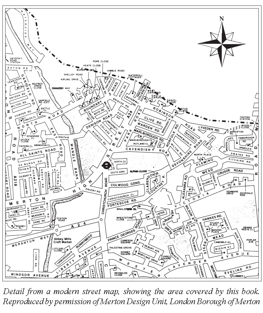
Detail from a modern street map, showing the area covered by this book.
Reproduced by permission of Merton Design Unit, London Borough of Merton
MAPS AND ILLUSTRATIONS
The Five Bells by Merton Bridge – undated and unsigned watercolour …. cover
Detail from A Bryant’s Map of the County of Surrey, dated 1822-1823 ……. ii
Detail from a modern street map, showing the area covered by this book…. x
Two views from Merton Bridge ……………………………………………………….. xiii
High Street Colliers Wood, looking north from Apex House/Lyon Tower … xiv
The MoLAS excavation in 1997 on the Priory Road site…………………………. 7
Singlegate tollgate across High Street Colliers Wood, mid-19th century … 12
The Singlegate turnpike gate shown on a plan of 1863 …………………………. 13
High Street Colliers Wood, seen in a postcard c.1920 …………………………… 15
The road north from Colliers Wood, c.1910 …………………………………………. 16
Waterfall House, Colliers Wood, c.1972 ……………………………………………… 21
Map showing boundary revisions of 1903/4……………………………………….. 25
Singlegate Schools in July 1969 ………………………………………………………… 28
Detail from an 1866 copy of an 1805 plan of the Merton Abbey Estate …… 30
Priory Road at its junction with Christchurch Road in 1972 ………………….. 32
Cars parked on Jacobs Green, May 1974 …………………………………………….. 33
The Poplars, Jacobs Green, c.1914 …………………………………………………….. 36
Weatherboarded cottages at Jacobs Green, c.1913 ………………………………. 38
Early 19th-century cottages facing Phipps Bridge Road……………………….. 40
Weatherboarded cottages at Jacobs Green, demolished c.1961 ……………… 42
Detail from John Rocque’s Map of Ten miles around London 1741-45 ……. 53
Rear elevation of Colliers Wood, from a watercolour by J Hassell, c.1823 …. 60
Detail from 25-inch to 1 mile Ordnance Survey map of 1867 ………………….. 62
Colliers Wood House c.1900 ……………………………………………………………… 64
Terrace housing in Warren Road, built c.1904 ……………………………………… 66
‘Stone Cottage’ and the gateway on the Surrey Iron Railway ……………….. 79
Watercress beds off Christchurch Road c.1912 ……………………………………. 80
Extract from the Merton Mill Sales Particulars of 1822 ………………………….. 93
James Perry’s Merton Flour Mill, photographed in 1970……………………….. 95
Merton Mill from the south, c.1970 ……………………………………………………. 96
Detail from plan accompanying Wandlebank sales particulars of 1883 …. 105
Willow Farm, Christchurch Road, photographed c.1910 ……………………… 108
‘Pools Corner’, junction of Church Road and Western Road, 1987 ………. 109
Junction of Christchurch, Western and Phipps Bridge Roads c.1880………… 111
High Street Colliers Wood seen in a postcard c.1920 ………………………….. 112
Victorian villas, Norfolk/Wilton Roads, photographed in 1972 …………….. 113
Detail from 25-inch to 1 mile Ordnance Survey map of 1894-6 ……………… 114
COLLIERS WOOD
One of the earlier houses on the Colliers Wood estate, c.1968 ……………. 115
Houses in Warren Road, built near the site of Colliers Wood House, c.1972 …. 116
Christ Church, Colliers Wood, in 1966 ………………………………………………. 119
William De Morgan ………………………………………………………………………… 127
Impressed ‘Merton Abbey’ marks on De Morgan pottery and tiles……… 128
Extract from 25-inch to 1 mile Ordnance Survey map of 1898 ……………….. 129
Byegrove Court and Newborough House from Wandle Park, March 2007 130
Rear of Kendall Court, Merton Mill, in September 1994 ………………………. 134
High Street Colliers Wood, c.1905 ……………………………………………………. 135
Christchurch Road, seen from Lyon Tower in 1975 …………………………….. 138
Members of the Colliers Wood Fire Brigade in 1908 …………………………… 143
High Street Colliers Wood, looking towards Merton, c.1920 ……………….. 154
Recent housing at Wandle Park, March 2007 …………………………………….. 156
Memorials in Wandle Park – Feeney, Ashby and Fenwick ………………….. 158
The wrought-iron gate and bridge leading to Wandlebank House, 1973 .. 163
The penstock serving the former mill pond inlet ………………………………… 164
Recent landscaping and wetland planting at Wandle Park, March 2007… 166
Sketch plan of Wandle Valley Joint Sewerage Board’s works in 1950 ……. 173
Wandle Meadow Nature Park , March 2007 ………………………………………. 175
The Royal Six Bells, High Street Colliers Wood, in 1960 ……………………… 179
Millers Mead c.1975……………………………………………………………………….. 181
Colliers Wood Underground station in May 1972 ……………………………… 185
The Royal Standard ……………………………………………………………………….. 186
‘Merton Road. The late residence of Mr Lindsey, Mitcham’, c.1820 …….. 189
The Red Lion, High Street Colliers Wood, in August 1969 ………………….. 191
Colliers Wood Community Centre, 1975; St Joseph’s RC Church, 1972 …. 193
Apex (or Lyon) Tower in August 1969 ……………………………………………… 195
The rebuilt No. 70 Christchurch Road in 1982 ……………………………………. 196
The Tandem Works, Christchurch Road, in May 1974 ………………………… 197
Extract from 25-inch to 1 mile Ordnance Survey map of 1894-6 …………….. 199
The girls’ entrance, Singlegate School, c.1970 …………………………………… 200
Imperial Measures are used in most sections of this book
1 acre = 4 roods = 160 square rods, poles or perches = 0.4047 hectares
1 yard = 3 feet = 0.9144 metres
1 mile = 1.61 kilometres
1 ton = 20 cwt = 80 quarters = 2240 lb (pounds) = 1.016 tonnes
£1 = 20s (shillings) = 240d (pence)
1 gallon = 4.5 litres
1 (British) horse power = 0.746 Kw
Two views from Merton Bridge
The view towards Colliers Wood – Watercolour by John Hassell, 1821,
reproduced by courtesy of Merton Library Service
The view towards Merton – Painting by Hubert Williams, c.1900
reproduced by courtesy of Merton Library Service
COLLIERS WOOD
High Street Colliers Wood, looking north from Apex House
later renamed Lyon Tower, photographed in 1968
Chapter 1
THE KING’S HIGHWAY
Below the surface of the busy A24 as it passes through Tooting, Colliers
Wood , Merton and Morden lie the remains of Stane Street, constructed
by Roman army engineers within a decade or so of the invasion of
Britain under the emperor Claudius in AD 43. Sixty-three miles long,
the road was a superb feat of early civil engineering, crossing the Downs
and cutting through the dense forests of the Surrey and Sussex Weald.
It was clearly seen to be of considerable political, if not strategic,
importance by the occupying power, and provided an overland route
between Londinium and Noviomagus Regnensium, the forerunner of
the modern Chichester which, in the first century AD, was developing
as the new capital of Tiberius Claudius Cogidubnus, the native client-
king of the Atrebates. This was the Cogidubnus whose great palace
was discovered at Fishbourne, south of Chichester, in 1960 and has
become, once again, one of the show places of southern Britain.
No actual trace of the road had been reported from the Colliers Wood
area until 1997, when a substantial section of Stane Street, plus one of
the two usual flanking ditches, was exposed by the Museum of London
Archaeology Service (MoLAS) in excavations opposite Wandle Park,
to the south of the present main road. This enabled the point at which
the Wandle was crossed to be identified, and also confirmed the long-
held belief that the Roman road followed a direct line between Tooting
and Morden, crossing the site of the future Merton priory. The following
year further excavations took place, this time including land cleared
for redevelopment between Priory Road and Colliers Wood
Underground station. Together, the two seasons’ works resulted in the
full six-metre width of the Roman road being exposed in two places, in
both instances some two metres below modern ground level. Two phases
of construction could be identified, one dating to the late 1st century
and the other to perhaps 100 years later. The road surface was of
carefully laid flint and gravel, but was not cambered. Contrary to
expectations, it did not slope westwards, towards the Pickle Ditch (which
is believed to follow an ancient channel of the Wandle), but to a point
further east where, presumably, the Roman ford had been.1
COLLIERS WOOD
Evidence of contemporary settlement in the vicinity of the road on the
opposite, south-western, side of the river had come from earlier
excavations conducted by MoLAS on the site of Merton priory, before
the construction of the present Sainsbury’s supermarket. These yielded
Roman bricks, fragments of hypocaust tiling and wall plaster – all
indicative of a substantial building or buildings – as well as occupational
debris including a coin, fragments from a glass vessel, an iron rake-tine
and a stone spindle whorl.2
Half a mile further on, during the course of gravel digging in 1922 close
to the assumed course of the road near Morden Halt station (now Morden
Road Tramlink stop), between 500 and 600 Roman coins, fragments of
pottery, and a 1st-century fibula or brooch were discovered. The coins
were reported scattered over a large area at a density of one per square
metre, and spanned virtually the whole of the Roman period, the latest
being dated to AD 375. Unfortunately the precise site of the discovery
was not recorded, but it is shown on a sketch map to have been in the
general area of the Lombard Road factory estate, close by what was
then the Wimbledon to Croydon railway line.3 Further south-west, in
Morden Park, portions of the road have been exposed on several
occasions, and from here the route taken is easy to follow, leading initially
to the small Roman town at Ewell, where there is generally assumed to
have been a mansio or hostelry for travellers between the two provincial
centres.
Stane Street has determined much of the modern road pattern, and the
old route is followed for many miles by the A29 through Ockley,
Billingshurst and Pulborough, as well as the A24 near to London. The
importance of the road as a link between London and the hinterland of
south-western Surrey clearly did not cease with the collapse of the
Roman Empire in western Europe. It is to be expected that, with the
gradual decline in civil administration in Britain during the late 4th and
early 5th centuries, sections of the road would have fallen into disrepair,
but from the distribution of villages with Saxon names like Clapham,
Tooting, Merton and Morden along its route and, indeed, from the name
of the road itself, it is a reasonable assumption that substantial lengths
remained in use into the post-Roman period. Early Saxon pottery and a
THE KING’S HIGHWAY
number of items manufactured from antler, including combs, were found
on the priory site by MoLAS in 1996, but the Colliers Wood area itself
is relatively poor in reported archaeological finds from the period, the
only discovery known being an Anglo-Saxon saucer brooch of the late
5th or early 6th century, allegedly excavated “on Stane Street, Merton”.4
The exact provenance is not known.
Primarily concerned with the history of Colliers Wood, this study has
been confined intentionally to that part of the former parish and later
Borough of Mitcham lying to the north-west of the village centres around
the Upper and Lower Greens. It is difficult, however, especially when
dealing with the early Middle Ages, to exclude altogether any reference
to the neighbouring parish of Merton and the great priory which, for 400
years, had a profound effect on life in the surrounding area. For the
same reason we will venture over the parish boundary into Wimbledon
to record what is known of the history of ‘Merton’ flour mills and the
adjacent Wandle Park, once the grounds of Wandlebank House.
Scandinavian raiding parties had undoubtedly already found their way
into north-east Surrey early in the 9th century, and when, in AD851, a
great Viking invasion force entered the Thames estuary, the old Roman
road provided an easy route deep into the county, parts of which they
ravaged. The farmsteads and settlements in their path would not have
escaped their attention, and tradition holds that it was in the village of
Ockley that the invaders were halted and defeated by the men of Wessex
under Aethelwulf and his son Aethelbald. For 20 years Surrey, and
particularly the vulnerable north-eastern part of the county, experienced
an uneasy peace whilst a group of Vikings established themselves
permanently on the Isle of Sheppey, and others turned their attention to
the subjugation of northern England. Then, in 871, the ‘Great Army’
of Northmen under Guthrum invaded Wessex, meeting furious opposition
from the Saxons under Aethelred and his brother Alfred. The struggle
reached a climax in the defeat of West Saxons at the battle of ‘Meretun’
or ‘Merantune’, at which we are told “there was great slaughter on
both sides” and Aethelred was mortally wounded.5 Alfred retreated
into Somerset, and for the next seven years Surrey remained under
Danish domination. There is little firm evidence of settlement, but it
COLLIERS WOOD
can be assumed some migration of people of Scandinavian origin from
London – already a town of importance attracting foreign traders –
occurred during the remainder of the 9th century. The basic Saxon
administrative structure of shire and hundred survived, although
temporarily disrupted, and once the boundary between Danelaw and
Wessex was established by the treaty of Wedmore (Chippenham) in
879, Surrey and the Wandle Valley returned to Saxon rule and to the
diocese of Winchester.
The location of the battle of Meretun is still a matter of debate, and the
balance of probability is that the encounter took place not at Merton in
Surrey (alternative spellings of which, confusingly, included Meretune
and Mereton(e)) but in the vicinity of Reading, where the Danes
established their base camp in January 871. It is nevertheless interesting
to read in Edwards’s Companion from London to Brighthelmston,
published in 1801 and researched some ten years previously, of the
earliest recorded find of archaeological significance at Merton. After
describing the visible remains of the priory, he noted that
In removing the ground to erect some buildings about twenty
years ago, were found several pieces of spears, swords, human
bones, and other exuviae of a battle”.6
Unfortunately, there is no record of the fate of the finds, or of the
exact position in which they were unearthed, although it would seem
likely, from Edwards’s mention of “recently erected buildings”, to
have been near the junction of today’s Mill Road with Merton High
Street, where there was considerable building activity connected with
industrial expansion in the latter half of the 18th century.7 A site on
the south-western bank of the Wandle, where the road crossed the
river, would have provided a strong position at which to attempt to
bar the way to a hostile force advancing into Surrey from the direction
of London. It would not seem too fanciful, therefore, to imagine that
here, where Colliers Wood merges into Merton, was the scene of
some unrecorded skirmish between Saxons and Danes in the 9th
century.
A second discovery of Saxon graves a mile to the west, close by Merton
parish church, was reportedly made in 1882 when a Mr Harding,
THE KING’S HIGHWAY
digging in the garden in the rear of cottages in Church Path, “unearthed
some ancient spearheads, Saxon coins, and what appeared to be human
remains. These he found at a depth of four feet”.8 Sadly, as in the case
of the material from the site Edwards described, the current location
of the finds from Church Path is also unknown.
Since the 10th century an estate at Merton had been held of the Crown
by members of the Saxon nobility. For administrative and judicial
purposes it was the custom of medieval kings to travel constantly with
their officials from one part of the kingdom to another and, whilst we
have nothing to suggest the existence of any residence in the vicinity
of Merton adequate for the monarch and his entourage before the
erection of Merton priory, we can safely assume that it was not
uncommon for royalty to pass through Colliers Wood on journeys
between London and the palace at Winchester.
Domesday Book contains no references identifiable specifically with
the Colliers Wood area, although the commissioners conducting the
survey in 1086 were required to make careful enquiry as to the
resources and value of all holdings. Colliers Wood is situated almost
exclusively on the flood plain of the Wandle, and the alluvial top soil
in this part of the parish of Mitcham is fertile and easily worked.
Furthermore, the watermeadows bordering the river and its tributary
the Graveney would have provided fodder and rich grazing, and it is
most unlikely that the district was uninhabited in the 11th century. As
we shall show later, there was a large house at Colliers Wood towards
the end of the Middle Ages, and it can be argued that the homestead
which preceded it had its origins in the demesne farm of the small
estate in Wallington hundred which in 1066 was held by Alfward as a
tenant of the abbot of Chertsey.9 By 1086 this holding, and the abbey’s
adjoining estate in Tooting, had passed into the hands of Hamo the
sheriff of Kent. Alfward’s land had included 11 acres of meadow,
which might well have been on the banks of the Wandle or the
Graveney, and there was sufficient arable to warrant a plough team
being kept on the home farm. The population comprised six cottagers
with their families, and also three slaves or bondsmen, forming a little
community of perhaps 30 people in all.
COLLIERS WOOD
Beyond the Wandle, Merton, never an isolated settlement by virtue of
the old Roman road, increased greatly in importance after the founding
of the priory early in the 12th century, and became the frequent resort
of many distinguished, and even royal guests. Queen Matilda, Henry
I’s consort, held the priory in particular regard, bringing the young
prince William here to see the church and cloistral buildings as they
began to rise above the willow-lined banks of the river. At Whitsun
1117, when the first wooden church was consecrated and the canons
took formal possession of their new priory, we are told that it was before
an assembled multitude.10 All this activity just over the parish border
can hardly have taken place without a dramatic impact on the lives of
the people living in what we know as Colliers Wood.
Replacement of the early timber buildings of Merton priory with
sophisticated structures in stone progressed throughout the 12th and
13th centuries, the prolonged activity generating a steady demand for
skilled and unskilled labour. One can visualise generations of local
men finding work on or about the building site, and over the succeeding
four centuries the influence of the prior and convent on the economy
of the surrounding countryside, where the monastery became a major
landowner, must have been immense.
Once they were sufficiently complete the priory buildings were used
not only for religious purposes but also for affairs of state, and it needs
little imagination to visualise small groups of peasants, standing with
their children at the roadside in Colliers Wood, staring in wonder as
the great and good of the land rode by. The rich clothing of the nobility
and the colourful trappings of their horses contrasted sharply with the
rude homespun garments of the rustics, and the splendour of such scenes,
often to be repeated, would have been long remembered by people
whose simple lives were otherwise governed by the harsh realities of
wresting a living from the soil.
The need for a bridge across the Wandle must have been recognised at
a very early period, and whereas during Roman times vehicular traffic
and animals presumably crossed the river by the ford, what appeared
in a recent excavation to have been raised gravel causeways on both
sides of the road prompted the idea that these might have been used by
THE KING’S HIGHWAY
pedestrians and led to footbridges. A ford seems to have been here as
late as the 10th century, for there is mention of a ‘Bradenforde’, or
broad ford, in a charter defining the bounds of the estate at Merton
granted by King Edgar of Wessex to his ealdorman Aelfheah in 967. 11
There is no contemporary reference to a bridge, however, and the date
of erection of the first structure capable of carrying anything more than
travellers on foot is lost in antiquity.
The depth of sediment found overlying the Roman road in the
excavations by MoLAS in 1997/8, and the absence of any datable items
from the late 4th century until the Middle Ages, provided a clear indication
that the immediate vicinity of the old river crossing was, in fact, frequently
flooded. The fineness of the silt, moreover, indicates that it was deposited
in still water, which suggests the existence of a mere, or area of semipermanent
standing water. This very conveniently provides an
explanation for the road to Merton village having been diverted several
degrees to the north, whilst a branch skirted the mere to the south and
led to Phipps Bridge and Morden.
The MoLAS excavation in
October 1997 on the Priory
Road site, opposite the Royal Six
Bells. Stane Street was exposed,
showing the roadside ditch, the
flint surface of the road itself,
and the fine silty sediment
covering it.
ENM
COLLIERS WOOD
In 1817 Hughson12 commented that “the bridge over the river is
remarkable for its arch, which is turned with tiles, instead of brick, or
stone …” His description of the voussoirs as ’tiles’ sounds very much
as though the arch might have been built of thin Roman bricks, a
conjecture supported by the observations of Robert Masters Chart, a
local architect and surveyor, who recalled in his reminiscences that
when old Merton bridge was rebuilt in the late 19th century ‘Roman
bricks’ were found incorporated within its fabric.13 We have already
noted that there is evidence of a substantial building nearby during the
Roman period, and it is highly likely that material salvaged from whatever
remained had been used by the bridge builders. The present bridge lies
somewhat to the north of the course taken by the Roman road, and it
seems feasible that the first bridge was built in the early 12th century,
probably when the old highway was permanently re-routed to skirt the
precincts of the new priory and take visitors to the main entrance. This
is generally believed to have stood near where today Mill Road meets
Merton High Street, but the great gatehouse, which survived until May
1906 as a private house, appears not to have been built until c.1500.14
The point where the new road commenced can still be detected to the
west of Colliers Wood Underground station, where the A24 bears
markedly to the right as one approaches the river, and then continues in
a westerly direction to become what is now Merton High Street.15
That there was definitely a bridge over the Wandle at Merton in the
mid-16th century is confirmed by the entry in the minutes of the Kent
and Surrey Sewer Commission for 1569 recording that Thomas Woode
had been ordered to
“cut vppe & convyghe oute of the ryuer there ij wyllowes
growynge in hys meadowe wyche butteth yppone the brydge
called Martone Brydge …”16
Three years later the minutes noted that
“… the bridge called Merton bridge is very greatly in decay by
whom it ought to be repaired we know not”.17
During the Middle Ages several of the great monastic houses had taken
it upon themselves to maintain river crossings and to repair bridges,
THE KING’S HIGHWAY
either for their own convenience or for the benefit of the local community.
We have no knowledge of Merton priory having accepted responsibility
for Merton bridge (although if it was built originally to serve the priory
this might well have been the case) but it may be significant that within
30 years of the Dissolution and the dispersal of the priory’s estates
amongst private secular owners, the bridge should be suffering from
neglect. It is not unexpected, therefore, to discover the Commissioners
experiencing difficulty in finding anybody willing to bear the expense.
Ensuring that bridges were properly maintained had been a source of
constant concern to the authorities throughout the Middle Ages. In some
instances special provisions were made, for instance by a guild or a
trust, but it was often no easy matter to establish liability for repair.
Bridges tended to straddle parish boundaries and, although responsibility
might be apportioned, it was quite another thing to secure the willing cooperation
of reluctant local officials, who had to find the labour and
meet the cost. The Statute of Bridges of 1531 was an early attempt at
legislation to resolve the dilemma. In effect, it made the county, through
its justices of the peace, generally responsible for bridge maintenance
unless it could be shown that some other body was liable at law, or that
by custom the task had fallen on the hundred or a township.
Obviously the matter of Merton bridge was not resolved satisfactorily,
for in 1578 the Commissioners’ clerk again recorded
“We presente a bridge called Martyn bridge in the parishes of
Mytcham Martyn and Wymbleton in the Countye of Surreye to
be in great decaye and verye needfull to be newe repayred and
amended …”18
With three parishes involved, and given the usual difficulty of securing
the agreement of even one parish to accept a degree of liability, we
can assume the works carried out were minimal, for within 50 years
the bridge again needed attention. This time a more permanent
solution was adopted for, according to Hassell, in 1633 the bridge
was rebuilt.19
The single-span structure was too narrow to permit more than one vehicle
to cross at a time, however, and by the mid-18th century increasing
COLLIERS WOOD
traffic on the newly turnpiked road to Epsom made it essential for the
bridge to be widened. Accordingly, in December 1761 agreement was
reached that upon the three parishes of Mitcham, Merton and Wimbledon
contributing £20 (Mitcham paying £10, and the others £5 each) the
trustees of the Epsom Turnpike would undertake the repair and widening
of ‘Martin’ bridge, and thereafter accept responsibility for its
maintenance.20 This arrangement seems eminently sensible and to the
advantage of the three parishes. Presumably the turnpike trustees
honoured their undertaking until the Trust expired on 15 June 1870.21
Eighteen years later the Local Government Act placed the duty of
maintaining main roads and bridges in the county on the newly formed
Surrey County Council.
In an effort to curb the steadily increasing outlay by counties on bridge
repairs an act of 1739 had sought to confine justices’ expenditure to the
maintenance of bridges that had been the subject of legal proceedings.
Thus as the 18th century progressed it became common practice for
the justices to submit a report (a ‘presentment’) formally indicting a
person or group of persons, such as the inhabitants of a village, for
failing to maintain a bridge. On the complaint being proven, the case
would be adjourned by the court to allow the bridge to be repaired by
the county in default. The difficulty being thus resolved, no further
action would be taken.22
It is not surprising, in view of the previous neglect of Merton bridge,
that it should have become necessary to invoke the procedure of
indictment to secure the repair of another, smaller, bridge at Colliers
Wood, in this case carrying the main road over the river Graveney. The
bridge was situated wholly within the parish of Mitcham and for many
years this tributary of the Wandle had flowed alongside the highway in
an open ditch until, opposite Byegrove Road, it was conveyed beneath
the road and thereafter continued northwards to join the river towards
Summerstown. At a Mitcham vestry meeting on 14 August 1774 the
clerk reported receipt of notice from the commissioners of the Epsom
turnpike informing the vestry that ‘Colliers Wood Bridge’ was out of
repair.23 The work required threatened to involve the parish in heavy
expense, to be met out of the highway rate. Accordingly the customary
procedure was adopted, Mitcham vestry resolving that the turnpike
THE KING’S HIGHWAY
trust might indict the parish if it thought proper. There is no further
mention of the subject in the vestry minutes, and the bridge was
presumably repaired on the justice’s instructions and at the cost of the
county. With such circumvention commonplace, the act of 1739 was
not particularly successful in arresting the increase in county
expenditure, and by the end of the 18th century it became generally
accepted that it was proper that the repair of bridges, benefiting the
county as a whole, should be the liability of the county.
The bridge opposite Byegrove Road is shown as ‘Terier’s Wood Bridge’
by Rocque in the 1740s, and as ‘Terrier’s Bridge’ on the first edition
OS map of 1816. In some convoluted way ‘Terrier’s’ may have evolved
as a corruption of Collier’s, but in the 19th century the name was
commonly attributed to the alleged popularity of the bridge in times
gone by as a meeting place for villagers at the start of a day’s rat- or
otter-hunting with their dogs.
As late as the 19th century, the highway through Colliers Wood was
subject to flooding when the Graveney was in spate – an inconvenience
with which generations of villagers were undoubtedly familiar. It must
have been with the intention of improving the flow of water, and thereby
reducing the risk of flooding, that in 1569 “Nicholaus Rutlande,
yeoman” was required to “cute his banks, score and grave the ryver
agaynste his meadows one (on) the south weaterlye syde of the same
ryver from a certayne meadowe called Chandler’s meadowe all the
banke alonge to Martyne (Merton) hyghe waye in Wimbletone”.24
Constant maintenance was obviously needed, and in 1576 Rutland (this
time styled ‘gentleman’) was instructed by the sewer commissioners
to
“… clense his shewer againste his close called Colliers Close
lienge by the highe waye which leadithe from Marten abbaye to
tooting warde & he for to scale watle and wretche the other side
of the saied shewer in two severalle places at the beginynge or
entraunce from the lane ende iij rodd & in another place beneathe
ij roddes …”
and also
COLLIERS WOOD
“… Joane ladie Mordante or his (sic) farmer Roberte Giles that he
clense his shewer from the fore-named Colliers close vnto or nere
a bridge called the brickbridge conteinge by estemacion x roddes
and from thence John Muschampe gentleman or his farmer John
Hedge for to skowre his shewer vnto the bridge called twynynge
bridge conteining in length by estemacion xxx roddes …”25
The scandalous state of the main roads throughout the country, and the
inability or unwillingness of the parish authorities to maintain them in
a state fit for the increasing volume of long-distance traffic in the 17th
and 18th centuries, was a source of great agitation and adverse comment
by the travelling public. The solution adopted was to create turnpike
trusts, ad hoc bodies authorised by Parliament to exact tolls from the
various classes of road user, and to apply the money received to the
repair, drainage and maintenance of the highways over which they were
given jurisdiction.
Singlegate tollgate across High Street Colliers Wood , mid-19th century.
The gatekeeper’s cottage stood on the site of the London Underground
station. (Reproduced by courtesy of Merton Library Service)
THE KING’S HIGHWAY
From 1755 the Merton Road, as High Street Colliers Wood was then
known, formed part of a system of turnpike roads running from Tooting
through Ewell and Epsom. One of the trust’s mile stones, showing the
distance to Cornhill, stood just within the railings of Wandle Park, near
the Royal Six Bells, until removed by the local council, probably in the
early 1940s. The first three decades of the 19th century were a period
of moderate prosperity for the trusts, during which many of them
amalgamated, and by 1822 maintenance of the Merton Road was in the
hands of one such body, with the cumbersome title of the ‘Epsom,
Ewell, Tooting, Kingston upon Thames and Thames Ditton Turnpike
Trust’. The era of the stage-coach and post-chaise was coming to an
end, however, and increasing competition from the new steam railways
in the 1830s and ’40s resulted in a catastrophic fall in the takings of the
trusts. Towards the middle of the century many became insolvent.
The Singlegate turnpike gate shown on a plan of 1863
(Reproduced by courtesy of Merton Library Service)
COLLIERS WOOD
‘Merton Singlegate’, the tollgate which barred the road at Colliers Wood
near its junction with the lane from Mitcham was removed in 1870,
following the repeal of the Turnpike Act of 1755 the previous year.26
The site of the turnpike house and yard is now occupied by Colliers
Wood Underground station. Over the course of the last 100 years several
attempts have been made to widen the road through Colliers Wood to
accommodate the steadily growing volume of vehicular traffic, but
without demolition of properties on the road frontage the scope for
increasing the width of the carriageway has always been limited. Within
living memory the front gardens of the Millers Mead cottages, near
Wandle Park, were cut back to half their former depth, and a further
improvement was the introduction in the 1960s of a gyratory system
involving Priory Road.
Earlier, scope for road widening occurred around 1900, when the
Graveney was transformed from being a roadside brook to an
underground and largely forgotten surface water sewer running beneath
the pavement. The work took place following representations to Croydon
Rural District Council from newcomers to the growing suburb of Colliers
Wood, who were unwilling to tolerate the nuisance and danger of an
open ditch running alongside the main road. Now only a short length of
the Graveney is visible, confined in a deep concrete-sided channel
between Robinson Road and the Tooting Junction – Haydons Road
railway line. The point where the river once turned northwards to flow
under Terriers Bridge – the ‘brickbridge’ in the order of 1576 – is marked
today by a manhole in the pavement.
In 1906 there occurred another dramatic change in the appearance of
the road, by this time officially designated High Street Colliers Wood.
With parliamentary sanction the London United Tramways (LUT), a
limited liability company incorporated in 1894, extended its double
track from Wimbledon along Merton High Street through Colliers Wood
to a new terminus and interchange with the London tramway system at
Longley Road. The LUT worked on an overhead trolley system, and
the High Street became an avenue of tall steel standards supporting the
electric cables from which the cars drew their power. On 27 June 1907
the tramway was opened officially, and the cars of the LUT in their
THE KING’S HIGHWAY
splendid royal blue livery and gilt lettering were soon a familiar part of
the Colliers Wood scene. Unfortunately the handsome tramcars were
later to be defaced with large advertisements. The company is said to
have acquired a site in the High Street, later numbered 40-42, and in
1907 erected a building intended to serve as a tramcar depot, but it was
never used as such, and with the adjoining yard the premises were
subsequently occupied by Ginns, a firm of organ builders and repairers.27
A gradual trend towards the amalgamation of the various private
railways and tramways in London occurred between 1912 and 1915,
when the London Underground Railways Group was formed. One of
the Group’s functions was to manage the three tramway companies,
and after 1920 the individual company liveries began to disappear. Many
of the former LUT lines were acquired by the London County Council
in 1922, and the Council assumed responsibility for the Colliers Wood
to Wimbledon Hill track. The LCC trams, which for years had
terminated at the Longley Road interchange, were connected to those
of the LUT, and on 2 May 1922 the LUT route from the Embankment
was extended to Wimbledon Hill, and its deep purple and primrose
High Street Colliers Wood seen in a postcard c.1920
COLLIERS WOOD
trams made their debut along High Street Colliers Wood. A further
change commenced four years later when, from 1926 onwards, new
crimson and cream tramcars of the LCC began to replace the older
rolling stock.
In 1952 the electric tramways, like the horse-drawn stage coaches and
carriers’ wagons before them, retired into the pages of history, leaving
the roads of London to the internal combustion engine and the electric
trolley bus. Few of the motorists and drivers of commercial vehicles
now travelling daily between Tooting and Merton realise that they are
the direct lineal (and, if we did but know it, possibly genetic)
descendants of the men whose carts and wagons rumbled slowly along
the same roadway nearly 2000 years ago. Certainly none is in a position
to foretell how long it will be before the unbridled use of the private
motorcar ceases to be tolerated, and is partially superseded by new
forms of public transport.
The road north from Colliers Wood near the junction with Longley Road.
Photograph, dated to c.1910, reproduced by courtesy of Merton Library Service
Chapter 2
PLACE-NAMES, BOUNDARIES AND FIELDS
Place-names
The charter granted in AD949 by King Eadred of the English, reaffirming
an earlier gift of land at Merton to a noble, Wulfric, was followed in
AD967 by another, this time from Edgar, granting lands in Merton and
Dulwich to the ealdorman Ælfheah and his wife Ælfswith.1 It is in this
latter charter that we find the first, albeit indirect, documentary reference
to part of the area known today as Colliers Wood. The charter bounds
of the northeastern corner of the ealdorman’s estate “at Merton” begin
Erest on southan and on esten merkepol . on hidebourne .
and þanen west …
Present thinking is that this is best translated as
“first on the south and east [there is] a boundary pool on hidebourne
and thence west …
The bounds conclude
… and tanne est bi wymbedounynge merke on þer hop bi
north bradenforde . on hydebourne . and þanne south
endlange bournyn be michamingemerke . þar est on merkepol.
“… and then east by the Wimbledon people’s boundary to the hop
by the north of the broad ford to hydebourne and then south
along the bourn by the Mitcham people’s boundary back to
boundary pool”.2
There are difficulties in attempting to identify landmarks with certainty
in the drastically changed topography of the early 21st century but,
since boundaries were sacrosanct, and on this account frequently
endured unaltered for a very long time, our best clue to the eastern
limits of the ealdorman’s estate is the border between the ecclesiastical
and civil parishes of Mitcham and its neighbour Merton. Until a little
over 100 years ago this had for generations been ‘beaten’ with
meticulous care and quaint ceremonial by the parish officers during
the triennial perambulations of the bounds in Ascension week, and
COLLIERS WOOD
there is no reason to assume any substantial deviation to have taken
place from the boundary recognised in late Saxon times.3 A river or
stream forms a natural, unambiguous line of demarcation, and it is
evident from Edgar’s charter that long before the Norman Conquest
the Hidebourne, or Wandle, was used to define the border between
the ealdorman’s Merton estate and parts of the north-western corner
of Mitcham now known as Colliers Wood.
Edgar’s charter tells us that the Wimbledon parish boundary met the
Wandle at the hop (an enclosure in a marsh) to the north of the
bradenford (broad ford)4 which was presumably where Stane Street
crossed the river. From the ford the ealdorman’s estate boundary turned
south (as did the parish boundary between Mitcham and Merton until
the late 19th century) along the ‘bourn’, by michamingemerke (which
can be translated as ‘the Mitcham people’s boundary’), to the merke
pol (or boundary pool).5 The bourn survives today as the ‘Pickle Ditch’,
but in the 10th century it would appear to have been the main course of
the Wandle, of which there is mention as early as AD693, when the
river occurs in a charter as the hlida burnan, perhaps from hlyde,
which in Old English meant ‘loud’.
To locate the merke pol is at first sight a little more difficult, although
quite obviously it was at the eastern extremity of the ealdorman’s estate.
The most likely point is at the junction of Christchurch Road with Liberty
Avenue and Church Road, where the Pickle Ditch is joined by a stream
from Mitcham – the ‘Western Ditch’ – now piped underground. Here,
as recently as September 1973, the ditch overflowed following torrential
rain, but in the past, notably in 1912,6 severe flooding was a regular
occurrence before improvements were made to the surface water
drainage system. Excavations in 1992 at the corner of Church Road
and Liberty Avenue by the Museum of London Archaeology Service,
following the demolition of Chilton Place and in advance of new
building by the Hanover Housing Association, demonstrated that where
undisturbed by 19th-century building activity the subsoil at this point
consists of thick deposits of water-lain clay.7 Although the extent of the
excavations was limited, they gave support to the theory that in times
past a substantial pond had probably been a permanent feature at the
confluence of the two watercourses.
PLACE-NAMES, BOUNDARIES AND FIELDS
The current understanding of southan as ‘on the south’ replaces a
former interpretation as ‘southern meadow’. A second copy of the
charter renders the word as stonhan – translated as ‘stone building’ or
‘stone settlement’.The revised thinking certainly makes much better
sense of the bounds, which now start and finish with the (south-eastern)
‘boundary pool’, instead of starting with southan/stonhan, going on to
the boundary bool and then going all the way round and further, to end,
not at the starting-point but further on, at the boundary pool.
Merton has been translated as meaning the ‘farm by the pond’, or,
alternatively, as ‘Maera’s homestead’, and received documentary
mention before the end of the 7th century. Tooting, another place
name which needs no introduction to Colliers Wood residents, is also
of very ancient origin and belongs to a large group of settlements in
southern Britain the names of which end in ‘ing’ or ‘ingas’. Some are
believed to date from the early migrations of the Anglo-Saxon peoples
during the period immediately following the withdrawal of the last
units of the Roman army from Britain at the beginning of the 5th
century. In a few instances the personal name of a chieftain or warrior
leader of the group founding the settlement can be detected in the
place name, which has given rise to the suggestion that Tooting, spelt
Totinge, in a document of 675AD, might be interpreted as meaning
the place of Tota’s people.9
What appears to be the first mention of Colliers Wood occurs in a
conveyance dated 21 January 1632, now amongst the collection of
documents relating to Mitcham lodged with the Surrey History Centre.10
The deed refers to a “close near Colliers Wood”, presumably the
enclosure known as ‘Colliers Close’ which abutted the main road to the
south of the present Robinson Road and, as we have seen, is mentioned
in the minutes of the Kent and Surrey Sewer Commissioners for 1576.11
“One Close called Collyers Close” of eight acres, and an adjoining
enclosure of 14 acres, were owned around 1680 by Henry Hampson, a
copyholder of the manor of Ravensbury.12 Hampson himself resided at
“the Mansion howse called Ravensbury” (the site of which is in
Ravensbury Park). There is no concurrent reference to the house at
Colliers Wood which, as we shall see later, was owned at the time by
the Brereton family of Cirencester and leased to tenants.
COLLIERS WOOD
The derivation of the name Colliers Wood from woodland frequented
by charcoal burners in the Middle Ages is a reasonable assumption. If
we rely on the 18th-century cartographer John Rocque, major wooded
areas had vanished from the Colliers Wood area by the middle of the
century, but there is no reason to question the origin of the name.
Certainly the Great North Wood to the north of Croydon was an important
source of charcoal in medieval times, and large quantities were carried
to London to meet the demand for fuel. At Thornton Heath the charcoal
burning industry is recalled in ‘Colliers Water Lane’, and it is quite
conceivable that woodland to the north-east of Merton was also managed
as an important resource. Both Merton and Croydon were connected
to the capital by former Roman roads, and during the winters, when the
demand would have been at its peak, these old highways would have
afforded a reasonably dry route long after minor roads had degenerated
into impassable morasses. In days when the only means of bulk transport
over land was by wagon or pack horse, this would have been a major
factor in the viability of any industry which aimed to serve anything
more than purely local markets.
‘Singlegate’, another name still associated with the Colliers Wood district,
owes its origins to the tollgate which, as we have observed, was erected
on the Epsom turnpike near its junction with the lane from Mitcham,
now Christchurch Road. Three quarters of a mile to the west, where
the highway was crossed by the road between Wimbledon and Epsom,
a pair of gates barred the way to through traffic until tolls were paid.
‘Merton-Doublegates’ and ‘Merton-Singlegate’ thus became convenient
tags by which to distinguish one end of Merton High Street from the
other. The double gates were dismantled in 1870, and the Colliers Wood
gate must have been removed at the same time. Toll gates were hardly
objects of affection, and their going met with widespread approval. There
was little reason for the single gate at Colliers Wood to be
commemorated, but the name it gave to the area was in common use,
particularly amongst older residents, and is heard occasionally today.
This, undoubtedly, was the reason for the choice of ‘Singlegate’ as the
name for the Board School erected at the end of Prince George’s Road
in 1874, rather than any nostalgic desire to perpetuate the memory of
the turnpike gate.
PLACE-NAMES, BOUNDARIES AND FIELDS
The Boundary with Tooting Graveney
In the early 19th century the northern boundary of the parish of Mitcham
followed the line of what is now Longley Road, some 50 yards beyond
the present channel of the river Graveney. At first sight there is no obvious
reason why the parish boundary should not have followed the river itself.
The explanation, as in other parts of the parish, almost certainly lies in
the course of the river having been changed since the parishes were first
defined in the late Saxon period. Support is given to this idea by the
manner in which the pattern of narrow field strips comprising Fleming
Mead, on the northern side of Swains Lane (now Robinson Road), can
be seen in the tithe map of 1847 to have ignored the river. The boundaries
of enclosures either side of Fleming Mead do precisely the same. The
course taken by the river in the mid-19th century clearly post-dated this
field pattern which, as one might expect, also respects the boundary
between the parishes of Mitcham and Tooting Graveney. The old river
‘valley’ can still be detected as a pronounced dip in the road leaving Tooting
where it meets Longley and Blackshaw Roads. The existence of the
‘canal’ which confined the Graveney in the grounds of Waterfall House
in the 1840s further supports the theory that, at an unknown date, the
river was diverted .11
Waterfall House, photographed c.1972
COLLIERS WOOD
On the opposite side of the high road, the parish boundary followed
‘Cut-Throat Lane’, as Blackshaw Road was then known, for about 250
yards before turning away in a south-westerly direction. From this point
onwards the parish borders were not defined by any obvious natural
features, and followed a serpentine course across fields and through
hedges to a marker post at Summerstown. The only logical explanation
for this meandering boundary must be that it perpetuated an ancient
channel of the Graveney. By the 16th century, as we have seen above,
the river was flowing alongside the main road. The reason for this
diversion of the Graveney is not immediately apparent, and the best
explanation that can be offered is that it occurred during the Middle
Ages, perhaps with the intention of creating a partially moated enclosure
for the homestead of Jenkingranger which then occupied the site of
Colliers Wood House.
Not surprisingly the eccentric course taken by the parish boundary
between Mitcham and Tooting, and the ease with which the marker
stones or posts could be moved, led to disputes between the two
communities. Thus in 1809 the erection by Mitcham parish officers of
boundary posts on the Common Fields of Tooting Graveney led to protests
from Tooting, and the posts were ordered to be removed.14 The Common
Field in question has long since been built on (part of it to the north of
Blackshaw Road is occupied by St George’s Hospital) but it gave its
name to Commonfield Lane, and when it was severed by the Tooting to
Wimbledon railway line, opened on 1 October 1868, a footbridge
connecting the two halves was constructed by the railway company.
A further boundary dispute arose in somewhat macabre circumstances.
The land involved rejoiced in the picturesque name of the ‘Shoulder of
Mutton Field’, inspired by its irregular shape. (It was also known as the
‘Leg of Mutton Field’). At this time the field was actually situated within
the parish of Tooting Graveney, and Morden, writing in 1897, commented
“The field has been rated to Mitcham ever since a dead body
was discovered there, which Tooting-Graveney refused to bury.
Mitcham, however, buried the body, and has taken the rates from
the field ever since.”15
PLACE-NAMES, BOUNDARIES AND FIELDS
It would seem that the pragmatism rather than humanity shown by the
Mitcham officials was not without its financial reward, and the three
and a half acres continued to contribute to Mitcham’s rate funds until
rationalisation of the boundary in 1904. The date of the dispute over the
corpse is not quoted by Morden, but it must have occurred well before
the middle of the century, for the tithe commutation map of 1847 shows
the Shoulder of Mutton Field as a detached portion of Mitcham parish
within the parish of Tooting Graveney, lying to the north-west of the
main road.
Yet another dispute arising from the difficulty experienced in defining
parish boundaries before accurate maps were readily available is recalled
by Morden, who quoted the following resolution from Tooting vestry
minutes of 1868:
“A strip of land formerly used as a tramway is supposed to belong
to Tooting-Graveney, but the occupier pays rates to Mitcham. A
manufactory has been erected on the spot. The officers of the
two parishes should meet, before the tramway boundary has
disappeared. The only post found there, has been thrown across
the stream at the west corner. A new building has been erected
between the Shoulder of Mutton Field and the Merton Road; it
is not yet rated.”16
The ‘tramway’ referred to was the Surrey Iron Railway, which here
followed the course of Mead Path south from Plough Lane at
Summerstown to emerge at Byegrove Road. The ‘manufactory’ was
probably the forerunner of the group of industrial premises now lying to
the north of Boundary Road (so-named because part of the former parish
boundary ran along the line of the road) and was reached by a small
access road parallel with Mead Path. The second ‘new building’ referred
to in the minutes must have been in the vicinity of Waterfall Road.
Reorganisation of local government towards the close of Victoria’s reign
commenced with the transfer of north-eastern Surrey to the newly-
formed administrative County of London in 1888, and was followed
by the creation of district and parish councils under the Local
Government Act of 1894. The London Government Act 1899 carried
the process a stage further, and brought into existence the Metropolitan
COLLIERS WOOD
Borough of Wandsworth, which incorporated the civil parish of Tooting
Graveney. It was quite obvious that the boundary anomalies had to be
resolved and, on representation being received from the London County
Council, a provisional order was proposed by the Local Government
Board under the Local Government Acts 1888 and 1894 altering the
county and local government boundaries between London and Surrey.
It was generally agreed that it was administratively inconvenient for
part of the parish of Tooting Graveney to remain in Mitcham – then a
‘contributory place’ within the Rural District of Croydon – and following
a public enquiry in June 1902 what was then being called the Leg of
Mutton Field and adjacent enclosures were divided by Order of the
Local Government Board, confirmed by Parliament in 1903.17
The new boundary, which has remained unchanged to the present day,
followed the northern fence of the railway line, and with effect from
September 1904 land to the north was incorporated in the Borough of
Wandsworth whilst that to the south, now covered by the houses of
Kimble, Chesham, Dinton and Acre Roads, remained within the civil
parish of Mitcham. Of greater importance at the time, since it involved
the largest number of residents and houses, was the removal of Longley
Road from the parish of Mitcham and its transfer to the Metropolitan
Borough of Wandsworth.
Field-names
Field-names have their own part to play in the compilation of a village
history, stimulating the imagination and often providing the local
historian with valuable scraps of information not otherwise available.
Even when an area has been covered with buildings for a century or
more, the original field-names can often be disinterred from the tithe
maps, title deeds and similar documents and records. Furthermore,
individual housing developments tend to follow very closely the boundaries
of the plots or enclosures on which they were built, and may even
perpetuate the original field-name. Moreover, strange little paths winding
between houses in a seemingly pointless way may, in fact, be
descendants of ancient field paths which, for fear of opposition or out
of regard for local usage, were never closed or diverted.
Northern Boundary between Mitcham & Tootingbefore 1903, showing detached area (3½ acres)
Old BoundaryNew Boundary
‘Leg of MuttonField’
AmenCorner
Colliers WoodHouse
TootingHall
Singlegate
Map showing boundary revisions of 1903/4, reproduced by courtesy of Merton Library Service
PLACE-NAMES, BOUNDARIES AND FIELDS
COLLIERS WOOD
A good example of the latter survival is Commonfield Lane, whose
course still passes between the houses of Blackshaw Road and Kenlor
Road and finally reaches Boundary Road by the footbridge over the
railway. Another footbridge, over the now defunct Merton Abbey line,
connected Robinson Road with Swains Road, and it was obvious to
even the casual observer that the road predated the railway. Known as
Swains Lane until the late 19th century, this track is likely to have been
of considerable antiquity, for as Sweyne or Swein the name is Norse in
origin.
Lying to the west of the Shoulder of Mutton Field ran a long narrow
field strip – a typical medieval holding – known as ‘Botany Bay Acre’.
Following the ‘discovery’ of Australia and the sailing of the First Fleet
to New South Wales, this became a common nickname for somewhat
inaccessible fields on the outskirts of a parish, and expressed the
sense of banishment felt by the labourer dispatched to the edge of
beyond to perform some task for his employer. The nearby Cut-Throat
Lane added little to the appeal of this remote corner of Mitcham.
‘Show Field’, now occupied by East and West Gardens and the odd
numbers of Robinson Road as far as No. 75, has a more congenial
sound to it, and could have derived its name either from the old word
‘shaw’, meaning woodland, or ‘shore’, a ditch or land drain. A little
further to the east, on the north bank of the Graveney, was a field
known as Bushey Wood, perhaps recalling an area of managed copse,
‘bushey’ being descriptive of the dense growth of spars which spring
from tree stools left by the wood cutters and used in the production
of charcoal.
Long narrow fields running north-eastwards from Christchurch Road,
such as Chalker’s Field, and Dunstan’s Field, were most likely named
after their owners or tenants, whilst another, Oil Mill Field, gives a
clue to a long-forgotten industry of which no other record remains.
Their shape indicates that they too were once part of a medieval open
field system. Fleming Mead, on the banks of the Graveney north of
Swains Lane, conceivably derived its name from its use as a crofting
ground by immigrant whitsters who brought their craft to the Wandle
valley in the 16th century.
PLACE-NAMES, BOUNDARIES AND FIELDS
Waterside meadowland, frequently flooded and providing rich grazing,
was an important asset in the economy of any village. Bounded by two
rivers, the Colliers Wood area was in this respect especially well
endowed, the evidence remaining not only in field-names like Fleming
Mead, but also in Upper and Lower Holmes Mead and Byegrove or
Beggary Mead beside the Wandle. Both ‘Great and Little Holmesmead’
and ‘Bygrave’ are mentioned in a charter of 1512,18 whilst ‘Miller’s
Mead’ occurs in sale particulars of 1764.19
As property of the priory of Merton, a ‘Bigrave’ Hill is mentioned in the
Valor Ecclesiasticus of 1535,20and Bygrave Hill is included in the
Ministers’ Accounts of 1538.21 In 1587 Bygrave comprised pasture and
wood, and the 12 acres or so then remaining were sold by a Richard
Martyn to Emmanuel College, Cambridge. The indenture of sale also
included 10½ acres of the ‘Amerye Land’, taking in Bygrave and
Holmes Mead, both of which were described as “common meadow”.22
Until the Dissolution in 1538 the Amery lands were in the possession
of Merton priory, whose Amery mills and the adjoining Amery
(?almonry) garden stood on the banks of the Wandle within Merton
parish on the site later occupied by the New Merton Board Mills.23 By
1846 ‘Hill Meadow’, situated opposite Byegrove Road on a slight rise
in the land to the east of the main road, was owned (or held on a lease)
by a person called Floud, but Emmanuel College retained possession
of 13 acres of meadow and woodland on the other side of the highway
and also a substantial house known as Byegrove Cottage. Today two
roads of late 19th/early 20th century houses and flats on this side of
High Street Colliers Wood bear the names of College Road and
University Road, and well into the 1950s many of these properties were
still rented from the agents for the college estate.
Unquestionably the most intriguing pair of fields from a local history
point of view are the strangely named ‘Hanging Field’ and ‘Hanging
Hook Field’, both in the vicinity of Prince George’s Road. Hanging
Field, a long rectangular enclosure which ran back in a north-easterly
direction from Christchurch Road, was parallel with and adjoined
Hanging Hook, lying to its immediate south-east. Hanging Hook,
eventually divided into two by Prince George’s Road, provided on one
side land for the Singlegate School and, opposite, after Morgan’s paint
COLLIERS WOOD
works had been demolished in 1967, the corner site occupied by Johnson
and Johnson’s premises.
In 1258, at a sitting of the King’s justices at Bermondsey, it was recorded
that the prior of Merton had erected a gallows.24 The precise site is
unknown, but the names of these two fields may offer a clue. Just
outside the hallowed precincts of the priory (the wall encircling the
grounds and the conventual buildings was on the opposite side of
Christchurch Road), this corner was on part of the priory’s estate, which
then included much of north Mitcham. When executions were commonly
performed in public, and the bodies were left hanging both as evidence
of justice being done and as a deterrent to other miscreants, a position
often chosen was a prominent site at a crossroads on the edge of the
parish. Here, at the junction of lanes from Merton, Upper and Lower
Mitcham, and a bridleway from Morden via Phipps Bridge, we are also
at the boundary between the parishes of Mitcham and Merton. The
position meets the criteria precisely. At this spot, then, we can imagine
the bodies of those miserable wretches to whom medieval justice showed
no mercy gently swinging in the wind. Condemned to everlasting
purgatory, their grisly remains would eventually be cut down and buried,
quite possibly in the field known as Hell’s Corner, which lay at the far
end of Prince George’s Road.
Singlegate Schools in July 1969, built in 1874 on the site
of fields known as Hanging Field and Hanging Hook
Chapter 3
PICKLE COMMON, THE PICKLE DITCH AND
THE WHITSTERS OF JACOBS GREEN
Pickle Common and the Pickle Ditch
Until the latter half of the 19th century, along the western side of what
is now Christchurch Road and extending from Merton bridge as far
south as the way leading to Phipps Bridge and Morden, there was a
strip of largely unenclosed waste or common land. Half in Merton and
half in Mitcham – the parish boundary followed the watercourse flowing
through its centre – the land came within the jurisdiction of the manor
of Biggin and Tamworth which, since the Dissolution, had embraced
most, if not all, of the priory’s north Mitcham estates.
The western edge of this common was defined by the remaining
fragment of precinct wall of the priory. Built of a mixture of dressed
flint and stone rubble, and in the main probably dating to the 12th
century, this had been kept in repair under the terms of the leases granted
to successive tenants by the owners of the ‘Merton Abbey’ estate, and
substantial sections were still standing to their original height of eight
feet until the end of the Victorian era. That part of the land lying between
the wall and the river was in Merton parish, and it is this that would
appear to have been the original ‘Merton Pightle’ – pightle being an old
term for a small portion of land. Corrupted to ‘The Pickle’, this is the
name by which the land is shown on a map of the river drawn in about
1825, and on the 25 inch OS map of 1894-6.
One of the many names by which the watercourse itself was known
was the ‘Pickle Ditch’, for obvious reasons, and ‘Pickle Common’ was
the term used by Richardson Son and Corfield, a London firm of
surveyors who, in 1802, were engaged to conduct a survey of the Merton
Abbey estate for its then owner, Charles Smith.1 The name of the
watercourse itself varied from time to time. As an ancient channel of a
tributary of the Wandle, if not of the river itself, it seems to have defined
the boundary of the Saxon estate at Merton in the tenth century. In the
minutes of Mitcham vestry in 1770 it was referred to as the “old Shore
Ditch”, and 30 years later, when the flow of water was still quite
COLLIERS WOOD
JacobsJacobsJacobsJacobsJacobsGreenGreenGreenGreenGreenTheTheTheTheThePicPicPicPicPickkkkkleleleleleDitchDitchDitchDitchDitch
BleachingBleachingBleachingBleachingBleachingGrGrGrGrGroundsoundsoundsoundsoundsBleachingBleachingBleachingBleachingBleachingGrGrGrGrGroundsoundsoundsoundsounds
Enhanced detail from an 1866 copy of an 1805 plan of the Merton Abbey Estate
Copyright of Surrey History Service. Reproduced by permission. (3875/1)
PICKLE COMMON, THE PICKLE DITCH AND THE WHITSTERS
substantial, and it meandered northwards through the centre of the
common, it was described as the ‘Back River’. The ‘Pickle Ditch’,
however, seems to have been the name commonly used by the mid19th
century, and shortened to ‘The Pickle’ it was the tag also applied
to the stream running alongside Phipps Bridge Road (Liberty Avenue)
until this was confined in pipes and banished underground early in the
1900s. Whether or not ‘Pickle Common’ was coined for the survey in
1802, or was the accepted local name at the beginning of the 19th century
has not been established.
The southern end of Pickle Common was shown as ‘Jacobs Green’ by
John Rocque on his map of the environs of London in the early 1740s,
and around it he indicated a cluster of buildings amounting to what was
virtually a small hamlet. Jacobs Green was named after the family of
‘whitsters’, or bleachers who, in the late 17th and early 18th centuries,
had crofting grounds nearby. The same patch of greensward was shown
by James Edwards in the map produced to accompany his Companion
from London to Brighthelmston, published in various editions between
1789 and 1801. He marked it as a ‘Platt’ – a grassy plot – and at this
time it probably served, in effect, as a small village green.
If the Jacobs claimed to exercise any proprietorial rights over the Green
itself these could only have been as tenants of the manor of Biggin and
Tamworth.2 The land on the eastern bank of the Pickle Ditch was
recorded as “waste” of the parish of Mitcham by the tithe commutation
surveyors in 1846, and appears as such on the map produced by the
Commission the following year. Together with a strip of still unenclosed
land on the Merton bank of the watercourse, it was shown on a plan
prepared in 1863 for James Bridger, lord of the manor of Biggin and
Tamworth, when the possibility of its enclosure and sale seems to have
been under consideration. The idea was evidently discarded, although
by this time the northern portion of the Green, indicated on the map as
being in the possession of a ‘Mr. Sturdy’, had already passed into private
hands.
The construction of the Wimbledon to Tooting loop and the new Merton
Abbey station was completed in 1868. The railway crossed Pickle
Common from west to east and although the land was thereby
COLLIERS WOOD
permanently divided into two parts north and south of Station Road and
the railway goods yards, it remained largely undeveloped for another
half century or so. Several photographs taken in the early years of the
20th century show the northern portion surviving as a pleasant piece of
open ground lying on both banks of the watercourse. ‘Brook Path’,
which connected Merton High Street with Station Road, followed the
eastern bank, affording a good view of a length of the precinct wall on
the opposite side of the water. 3 In 1915 money raised by the River
Wandle Open Spaces Committee was used to purchase this section of
wall, with the land on which it stood, and the property was presented to
the National Trust. It now forms part of the Trust’s Wandle properties,
and the wall, the only substantial fragment of the priory to survive in
situ, has been recognised as a structure of architectural and historic
interest meriting Grade II listing.
Watercress beds, which in the late 19th century occupied former
bleaching grounds in the triangle of land between Brook Path, High
Street Colliers Wood and Christchurch Road, fell into disuse after the
1914/18 war, and eventually the land was acquired for industrial
Priory Road (to the left) at its junction with Christchurch Road, in 1972.
Calico bleaching grounds, and later watercress beds,
once occupied the land behind the hoardings.
PICKLE COMMON, THE PICKLE DITCH AND THE WHITSTERS
purposes. Priory Road was constructed to serve the needs of the
increasing volume of traffic, and Brook Path disappeared. From the
1930s until the 1980s the main works occupying the land between Priory
Road and the Pickle were engaged in the manufacture and distribution
of cardboard boxes and packaging. The land was subsequently cleared
in advance of proposed redevelopment, which presented the opportunity
for a new pathway to be created along the line of the old Brook Path,
and landscaping the banks of the Pickle Ditch, thus providing an
attractive pedestrian route and cycle way.
Sale of the lordship of Biggin and Tamworth followed the death of
James Bridger in 1885, and with the general extinction of manorial
rights in the 1920s any control which might have been exercised over
the remaining fragments of the common to the south of the river ceased.
Within a few years piecemeal enclosure was taking place. By the 1940s
a small plot to the south of Runnymede was occupied by a transport
cafe, whilst to the north, next to the entrance leading to factories and
the goods yards, a local butcher was using a corner plot as a chicken
run. Surprisingly, part of the green, although with little grass left on it,
Cars parked on Jacobs Green, May 1974
COLLIERS WOOD
survived and was used as a parking space by the café’s patrons. Twenty
years later the chickens had gone and the land was enclosed by a
Mitcham firm of tree fellers, whilst the remainder to the south of
Runnymede had degenerated into an unofficial car and lorry parking
lot outside the, by then derelict, café. Local government reorganisation
in 1964, and the abolition of the old Borough of Mitcham, may explain
why the opportunity presented by legislation in the 1970s for formally
registering this last remnant of parish waste as common land was missed
by the London Borough of Merton. Today the former Jacobs Green lies
beneath a much-widened Christchurch Road.
The Merton Whitsters
Towards the close of the 16th century ‘whitstering’, or the process of
bleaching textiles, then principally linen and imported cottons,
developed into an important industry throughout the Home Counties.
The procedure depended on the action of sunlight on fabrics previously
treated with buttermilk, or a lye made from wood ash, and called for
copious supplies of clean water. The latter was particularly necessary
during the crofting process, in which the fabrics being bleached were
either spread on mown grassland, or hung from lines between stakes
set in ditches. For a month or so, depending on the season, the cloth
was then repeatedly drenched with water baled from the parallel ditches
which ran across the bleaching grounds. Many of those engaged in the
craft were of Dutch or Flemish origin, having left the Low Countries to
escape religious persecution at the hands of the ruling Spanish
authorities, and a substantial number made their new homes in the
valleys of the Lea and the Wandle.
Evelyn Jowett commented in one of her articles written for the Merton
Borough News in 1973, that “originally whitsters were specialists, and
sometimes remained so, but as other textile processes were introduced
into the valley, such as dyeing and printing, most textile works came to
include this process and own their own bleaching grounds”. This is very
much what happened at the Merton Abbey works. “Early in the 19th
century,” she wrote, “chlorine bleaching, which took place within factory
PICKLE COMMON, THE PICKLE DITCH AND THE WHITSTERS
buildings, was introduced. Henceforth most of the material printed at
Merton was supplied to the Merton works already bleached elsewhere
and the Wandle bleaching grounds fell into disuse. They remained
sometimes as stretches of flood water, often gaining a new lease of life
as watercress beds. Maps of the late 19th century show many of these
in our area …”
The Jacobs Family
Adrian Collant, described in the burial register as “a Dutchman dwelling
a long tyme in this Parish of Mitcham”, was buried at Mitcham on 13
January 1620–1.4 He had bleaching grounds covering much of what is
now the Willow Lane industrial estate, The trade appears not to have
become established in the Merton area for another 40 years or so, and
one of the first whitsters of whom we have record working in the vicinity
of Colliers Wood was John Jacobs, described in his will proved in October
1678 as ‘of Merton, Whitster’ His widow, Hannah, bequeathed the
estate to their eldest son, James, in 1689. He was buried at the parish
church of St Mary at Merton in 1720. The Jacobses too seem likely to
have been of Dutch origin, for James mentions in his will his brother-in-
law John Van Cammell, a ‘thread whitster’ of Mitcham, who died in
1718, and was also buried at Merton.5
James’s tombstone records that he was “of Martin Abbey, thread
whitster, and a house-keeper of this parish for 58 years”, that is, since
around 1662 when he was assessed for hearth tax as a resident in Merton.
The bleaching grounds he used appear to have been situated towards
the south-eastern part of the priory precincts, and with a little more
information they could probably still be identified on the map of the
Merton Abbey estate produced in 1805.1 As we have observed already,
it was undoubtedly the family’s long association with the district that
inspired the name ‘Jacobs Green’.
John Jacobs, who was also a whitster and possibly James’s son, took an
active part in the affairs of Merton parish in the mid-18th century, serving
as an overseer of the poor in 1740, and regularly attending vestry
meetings from the late 1730s until the mid-1750s.6 He was buried at
Mitcham in 1758, after which we lose track of the family. Until the
COLLIERS WOOD
early years of the 20th century there were several very old
weatherboarded cottages overlooking what remained of Jacobs Green,
and a more substantial house known as The Poplars, which had inset in
its rear wall a stone tablet dated 1660. The date and the size of the
house which, like the other properties, was in Merton parish, suggest
that it might well have started life as the family’s home.
The Poplars, Jacobs Green, photographed c.1914,
reproduced by courtesy of The Wimbledon Society Museum
Jonathan Meadows
From what we know of the subsequent tenure of the bleaching grounds
on this part of the Merton Abbey estate, it looks very much as if the
Jacobs’s whitstering business eventually passed to Jonathan Meadows.
In March 1769, an alleged encroachment by Meadows on the ‘waste’
of Mitcham near Merton Abbey was reported to the parish vestry.7 By
trade a calico bleacher, Meadows was a resident of Merton parish and,
like John Jacobs before him, a prominent member of the Merton vestry,
serving as overseer of the poor in 1767 and 1769. 6 As a parish officer
PICKLE COMMON, THE PICKLE DITCH AND THE WHITSTERS
he is most unlikely to have acted in ignorance, and must have been
aware of the risk he was taking should he enclose common land in an
adjoining parish without authorisation. The minute does not make clear
precisely the nature of Meadows’s encroachment, but his action was
strongly resented by Mitcham vestry, and it was resolved at a meeting
the following month that he should be threatened with prosecution –
an unusually strong reaction, and one that suggests that a degree of
friction already existed between Mitcham vestry and Meadows.
That autumn, however, Mitcham vestry evidently reconsidered the
matter and, for reasons the clerk chose to omit from the minutes,
decided not to institute proceedings on the condition that Meadows
placed two boundary stones marked ‘MP 1770’ in the ditch in
acknowledgement that it constituted the boundary between the two
parishes. On several occasions during the late 18th century the vestry
had given its consent to encroachments on common waste elsewhere
in Mitcham upon payment annually of agreed sums of money to
augment the poor rate. The arrangement was of dubious legality, and
with Meadows probably challenging its authority, Mitcham vestry
realised its bluff had been called, and was obliged to retract with
minimum loss of face.
There was, however, another aspect of the case on which the vestry
minutes are silent. What one assumes to have been Meadows’s
encroachment can be identified on several early maps. Photographs
suggest this may have occurred when, to an existing weatherboarded
barn on the Merton side of the boundary, there was added a single-
storey extension bridging the river, the latter flowing beneath the building
in a brick culvert. As noted earlier, land on both sides of the watercourse
lay within the manor of Biggin and Tamworth, and if any action were to
be taken against the encroachment, the initiative and, indeed, the only
authority, lay with Elizabeth Manship, in whom the lordship of the manor
had been vested for life following the death of her husband in 1749.
Exactly what arrangements, if any, were agreed between Mrs Manship
and Meadows is not known but, as we shall see, 50 years later rents
were being paid to the manor for several garden extensions made at the
expense of the green.
COLLIERS WOOD
Weatherboarded cottages at Jacobs Green, photographed c.1913. The
former ‘Meadows’s barn’ is in the foreground, with the boundary stream
running beneath it. Reproduced by courtesy of Merton Library Service.
Jonathan Meadows, who died in 1780, was styled as “of Merton Abbey,
thread whitster” in his will dated December 1778, and seems to have
been either a business associate of, or related to, William Fenning.
Fenning’s name can be found in the Merton land tax book for 1780
(the earliest year for which records are available) as a partner, and
presumably the senior member of the firm of Fenning Halfhide & Co.,
who were then in occupation of printworks at Merton Abbey. These,
we are told by Lysons, had been founded “within the walls of the abbey”
in 1752.8 Fenning left the partnership in 1788 or ’89 for the Ravensbury
printworks, but Halfhide continued the business with his son for a number
of years. The land on which they paid tax included, until 1790, premises
described as ‘late Meadows’, valued at £70 and held on lease from
Phipard, the freeholder.
When the survey and valuation of the Merton Abbey estate was
conducted in 1802 by Richardson Son and Corfield for Charles Smith, it
PICKLE COMMON, THE PICKLE DITCH AND THE WHITSTERS
was noted that the front gardens of four of the dwellings facing the
‘Back River’, at the south-eastern corner of the estate, had been
extended by enclosing parts of the green on the other side of the river.
The surveyor was informed that this ‘waste’, which he called ‘Pickle
Common’, lay in the parish of Mitcham. He was also told that John
Leach, who at the time held the lease of the property, together with that
of the Merton Abbey print works, paid a small annual rent for the land
to the “manor of Mitcham” (in fact, the manor of Biggin and Tamworth).
The cottages concerned were all said to be old, and the chances are
they had been in existence long before Meadows over-stepped the
(boundary) mark. When the extensions to the gardens had occurred,
the surveyor’s notes do not say.
To the west of Jacobs Green an area marked as “late Meadows’ Thread
Field and Stake Ground” on the estate map of 1805, abutted the priory
precinct wall standing on the northern bank of the brook flowing
alongside the road from the direction of Phipps Bridge. By this time
the canals or ditches, which had divided this land into long narrow
crofts, were largely redundant and many had been back-filled, for they
were represented by the cartographer with dotted, and not solid, lines.
At a break in the wall, immediately opposite the end of Shore Street,
and backing onto Meadows’s land, there stood throughout the 19th
century and into the early 20th century, a row of five or six timber-
framed, weatherboard and pantiled cottages. Access from Phipps Bridge
Road was by footbridges across the roadside ditch, and the terrace,
which was very much in the local style, functional but to modern eyes
rather picturesque, can be seen in several old photographs and drawings.
Built around 1802, the cottages stood on part of the Merton Abbey
estate, and were included in the land leased to the firm of Newton
Leach and Co., by whom they were probably built. The cottages were
demolished around 1915/16, and the site was redeveloped shortly
afterwards by Liberty and Co., who built in their place the Liberty Flats
– a long two-storeyed row of cement-rendered, slate-roofed workers’
dwellings which still exist.
As the bounds of Mitcham were being beaten in May 1833 a record
was kept by Edwin Chart, a young surveyor acting as clerk for William
COLLIERS WOOD
Early 19th-century weatherboarded and pantiled cottages facing
Phipps Bridge Road (now Liberty Avenue), demolished c.1915.
Reproduced by courtesy of Merton Library Service.
PICKLE COMMON, THE PICKLE DITCH AND THE WHITSTERS
Simpson, the lord of the manor of Mitcham. Chart recounts how the
party, comprising several gentlemen, the parish officers and the village
band, old men and boys, walked the ancient parish boundaries in a
clockwise direction, leaving the Wandle by the penstock below Phipps
Bridge and then following the brook and the line of the old ‘Abbey’ wall
north-eastwards. They passed the row of cottages on the Merton Abbey
estate, stopping to cut marks on convenient buttresses and piers of the
nearby precinct wall, before turning left
“… round front of House occupied by Enefer late Oatley to Bridge
on Right Hand, cut a X in centre of coping passed an arrow” (a
stick) “under large arch which runs under House, late Meadow’s
Barn keep the line of Buildings on left to Stone Boundary Mark
M.P. cut a X in top of it (This Stone was put down by Jonathan
Meadows more than 50 years ago, see old Vestry Book) continue
line of Buildings on left to X cut in wall of Deacon’s House.
Thence right …” 9
These Mitcham worthies were obviously following what their forebears
had for centuries considered to be the parish boundary, and by the time
the Ordnance Survey was conducted in the 1860s for all official purposes
this was recognised as the centre of the watercourse. Interestingly, until
the early years of the 20th century a marker stone was still to be found
where Chart described it, and the archway he mentioned can be seen in
a photograph taken of Meadows’s barn in about 1913. 10 At this time the
group of quaint but very dilapidated cottages still stood near the corner of
Phipps Bridge Road and Christchurch Road. The same buildings are
marked on the 1805 map, and re-survey in 1805 found the whole group of
dwellings to be held on lease from Charles Smith of Abbey Gate House
by Newton Leach and Co., calico printers.11 Adjoining the cottages to
the north, abutting the ‘Back River’, there was at this time a small group
of “manufacturing buildings”. Their use was not specified, but one assumes
they were associated with the bleaching grounds, since all were then held
on lease by Newton Leach & Co.
By 1897 the “manufacturing buildings” had gone, and Meadows’s barn
had been converted into a dwelling, the ground floor of which was used
as a confectioner’s shop. To local youngsters the ramshackle structure
COLLIERS WOOD
was known as ‘Rats’ Castle’. Although included in the Ministry of
Housing and Local Government’s provisional list of buildings of
architectural or historical interest in 1952, the last surviving building of
the group, known as ‘Littler’s Cottage’, was pulled down in 1961. The
upper part had been timber-framed and weatherboarded like the others,
but in this case two walls to first floor level were of flint and stone, over
one foot thick, and had obviously once formed a corner of the priory
precinct wall. The picturesque nature of all these dwellings attracted
the attention of several photographers in the early 20th century, and the
whole group was well recorded in a photographic survey conducted in
1913.
Weatherboarded cottages at Jacobs Green, demolished c.1961.
The cottage on the left incorporated a section of the priory precinct wall
in its structure. Reproduced by courtesy of Merton Library Service.
Chapter 4
COLLIERS WOOD HOUSE
Introduction
Colliers Wood House, in its prime an attractive and well-proportioned
residence of the late 18th century, surrounded by grounds which
amounted to a small private park, stood on land now occupied by Nos.
1-11 Clive Road and 2-16 Warren Road, separated by a meadow from
what today is High Street Colliers Wood. With the exception of the
gardens immediately adjoining the house, the estate was offered for
sale by auction in 1877,1 but from entries in local directories it is clear
that a number of the houses in Park, Cavendish and Robinson Roads
had already been completed and occupied before this date. For reasons
to be explained later, development of the remainder of the estate took
place only slowly over the next 30 years and it was not until shortly
after 1904 that the old house itself was pulled down.
The auction in 1877 provided the first real opportunity for a major
encroachment by Victorian speculative builders into the still-rural parish
of Mitcham, and by the end of the century virtually the whole of Colliers
Wood estate had disappeared under the advancing tide of bricks and
mortar. Today the house has passed beyond living memory, but by good
fortune two illustrations have survived to give some impression of its
appearance. With its predecessors (for the site had been occupied for a
very long time) the house must have been a landmark on the road from
Tooting to Merton, and for over 40 years spanning the middle of the
19th century its last upper-middle-class occupants, Mr and Mrs Boyd
Miller, played an important rôle in the life of the neighbourhood.
Unravelling the history of a large house is always an absorbing pastime,
and even in an apparently uninspiring locality can be full of pleasing, if
minor, surprises. Research into the history of Colliers Wood House and
the site it occupied has not been disappointing in this respect, and the
results provide an important chapter in the history of the district as a
whole.
COLLIERS WOOD
Medieval Beginnings
The boundary between the Saxon estate of Merton and what was to
become part of the ecclesiastical parish of Mitcham was already well
established by the time William of Normandy claimed the throne of
England but, as we have explained already, it is difficult to identify with
certainty entries relating to the area we know as Colliers Wood in the
Domesday survey of 1086.
It is not until the late 15th century that documentary evidence emerges
for the existence of a major house at Colliers Wood. Then known by
the curious name of ‘Jenkingranger’ this property, like the Colliers
Wood estate in the early 19th century, was copyhold of the manor of
Ravensbury. The history of this manor is long and complex, and need
not be explored in detail here.2 Suffice it to say that lordship of the
manor, which covered much of Lower Mitcham bordering the Wandle
and can be traced back to the years immediately following the Norman
Conquest, was in the hands of the de Mara, or de la Mare, family in the
13th century. How and when the isolated estate at Colliers Wood was
brought within the jurisdiction of the manor is not known, but certainly
by the late 13th century the de la Mares had secured property interests
in Merton in the form of a watermill believed to have been in the vicinity
of today’s Wandle Park, holding it as tenants of the archbishop of
Canterbury’s manor of Mortlake.3 The family’s lands probably also
included much of north Mitcham, for Tamworth Farm, the fields and
meadows of which extended westwards from Figges Marsh to abut the
Colliers Wood estate, was also held of the manor of Ravensbury as late
as the 19th century.4
Elsewhere in Surrey the powerful de Mara family, lords of the manor of
Ashtead, were in possession of extensive estates. Between 1217 and
1226 William de la Mare was deputy sheriff to William de Warenne,
earl of Surrey5 and was appointed an assize commissioner in 1233. A
most experienced local government official – the exchequer dealt with
him as if he himself was sheriff of Surrey – in 1225 Sir William was
party to a ‘convention’ with the abbot of Westminster and the prior of
Merton concerning the closure of an ancient highway which had crossed
COLLIERS WOOD HOUSE
the abbot’s ‘court’ in Morden.6 By 1328 the de Maras’ estate in Mitcham
and Morden, comprising 12 houses or farmsteads and some 200 acres
of land, was in the possession of a William de Herle.7 Thereafter the
lordship of the manor passed through many hands until 1531, when it
was sold by Charles Brandon, duke of Suffolk, to Sir Nicholas Carew
of Beddington in whose family’s ownership it remained until 1907.
Continuity of occupation is a common feature in the history of most
English villages and farmsteads, and although we may lack proof, it is
quite reasonable to assume that here at Colliers Wood, close by the
Roman road to the south of Tooting, was one of the farmsteads owned
by the de Maras and later sold to de Herle. Through the medium of the
court rolls of Ravensbury the tenure of the substantial ‘messuage’ which,
following rebuilding of the house around 1788, became known as Colliers
Wood House, has been traced back to 1487.8 This date is not without
significance, for in 1487 John de la Pole, the earl of Lincoln and Richard
III’s nephew and heir, was slain at the battle of Stoke. De la Pole, a
Yorkist, had challenged Henry VII’s right to the throne, which he had
seized on Richard’s death at Bosworth Field two years previously. As a
punishment for such disloyalty de la Pole’s estates, including the lordship
of Ravensbury, were confiscated and granted to Brandon. It is following
this change in ownership, introducing as it did a new manorial
administration, that the court rolls become easier to follow.
Whereas the early history of Jenkingranger remains a matter for
conjecture, the existence of a late Saxon homestead somewhere at
Colliers Wood is certainly to be expected, for the well-watered, easily
worked and fertile soil of this part of the middle Wandle valley would
have attracted cultivation long before the great period of agrarian
expansion which occurred in England during the 13th and 14th
centuries. When the final clearances of the natural woodland cover
took place it is, of course, impossible to say, but the pattern of small
rectangular enclosures around the house, clearly evident in 19th-century
maps, are evocative of a Celtic field system. They are in marked contrast
to the long narrow strips in the open common fields and hay furlongs
surviving from the medieval village of Mitcham, the westernmost of
which extended to the fence around Colliers Wood grounds and along
COLLIERS WOOD
the northern side of today’s Christchurch Road as far as South Gardens.
The enclosures surrounding the estate are also reminiscent of the ‘inland’
of an early medieval farmstead, and one is certainly justified in believing
they had their origins in a homestead or settlement established well
before the Norman Conquest.
The Tudor House Emerges
No maps of the north-western part of the parish of Mitcham have
survived from before the middle of the 18th century. As a consequence,
it is difficult without excavation to establish exactly how long a house
has occupied a particular site, and one can only theorise as to its history.
We do know, however, that a substantial house – possibly Jenkingranger
– on or near the site of the 18th-century Colliers Wood house was
demolished in the mid-1780s. Unfortunately no illustrations of this
building exist, and apart from its having stood on the eastern side of
the main road, on a site now beneath Park Road at its intersection with
Marlborough Road, not much can be said about it. Rocque’s map of
1741-5 shows that within the grounds there were then several straight
lengths of water, possibly vestiges of a moated enclosure created in the
Middle Ages, an hypothesis to which added credence is given by the
house being situated on a spur of slightly elevated ground, defined by
the 50-foot contour. The appearance of the old building must remain a
matter for conjecture, but there is more than a possibility that in part at
least it dated from or before the 15th century, and had perhaps been
modernised and extended in the 16th, when many English country
houses were improved or rebuilt.
It is often equally difficult to be positive when it comes to naming the
occupants of a house prior to the mid-18th century. Fortunately in the
case of the house at Colliers Wood we are aided in the quest by extracts
from the Ravensbury court rolls, made between 1690 and 1691 by J
Spencer, the steward of the manor, which cast valuable light on the
history and ownership of the estate from the 15th to the 17th centuries.9
As far as he was able to ascertain, in 1487-8, during the reign of Henry
VII, Jenkingranger, described as a messuage with a substantial acreage
COLLIERS WOOD HOUSE
of land (which became the Colliers Wood estate), was occupied by a
John Clark. Sixteen years later, i.e. c.1503-4, tenure having been
surrendered by the previous copyholder, Thomas Legh or Leigh, his son
John was admitted to the tenancy of the manor on taking the usual oath
of fealty and observing the customary formalities of the writ of seisin.
The descent of ownership of the rather strangely-named property –
Spencer found the elements rendered in the court rolls in various ways,
including ‘Jenken’ and ‘Grainger’, and either hyphenated as ‘Jenkin-
Grainger’ or as two words – was traced over the next 200 years although,
as he admits, the record from the early period is not always completely
clear. With its associated land Jenkingranger was clearly an important
property, and for half a century or more was the seat of the Rutlands, a
moderately affluent and well-connected Elizabethan family, at least
two of whom held posts in the civil service of the day, whilst a third had
a position at court. It is from the Mitcham parish registers and the wills
of several prominent local people that we can glean something of the
family and in particular of Nicholas Rutland, whose “close called the
Colliers’ Close” we have encountered in an earlier chapter,10 and who
had been in possession of land bordering the river Graveney as early as
1569.11
Nicholas Rutland ‘of Mitcham’ was clerk to the Catery, an office
concerned with the supply of provisions for the royal household. A
wealthy man, he died 21 February 1585 holding lands in Mitcham,
Sutton, Carshalton and Wimbledon, and lies buried in the chancel of
the parish church at Mitcham. As was customary, in his will he left a
small bequest for the repair of the church fabric, and also £3 to the
poor of the parish. His dwelling house, with its land etc., he left to his
wife Dorothy for life. To his youngest son William he bequeathed one
messuage in Mitcham, at that time in the tenure of Thomas Silvester,
citizen and leather seller of London, and the lease of a farm called
Shoredyche in the occupation of John Caunterburie (sic). His “very
wellbeloved ffrynde master Gregorie Lovell Esquire” of Merton Abbey
(who was cofferer to Queen Elizabeth I’s household) was appointed
one of his executors.
COLLIERS WOOD
The location of Thomas Silvester’s house has not been established, but
from references to “the Old Shore ditch” in Mitcham vestry minutes of
1770 (the name was perpetuated until recently in Shore Street, a turning
off Liberty Avenue) it is possible that John Caunterburie’s farm lay
near the boundary between the parishes of Mitcham and Merton, south
of the former Phipps Bridge Road.
In April 1585 Nicholas Rutland’s death was formally ‘presented’, i.e.
notified, to the court baron of the manor of Ravensbury. It was confirmed
that he died in possession of ‘Jenken Granger’ and its lands, and
acknowledged that he had willed the property to his wife Dorothy for
life and thereafter to his sons. His widow was duly admitted to the
tenancy of the manor, and “Dorrythey Rutland widowe” is listed in the
Lay Subsidy assessments for 1593 owning lands valued at six pounds
per annum.12
William Rutland, Nicholas’s third and youngest son, succeeded his
father in the office of clerk of the Catery. It would appear that he
continued to reside in Mitcham, for at least one of his children, a
daughter named Dorothy, was baptised in the parish church on 22
August 1586. Francis Rutland, the second but eldest surviving son of
Nicholas, died in 1592, and lies buried in the chancel of Chisledon
church in Wiltshire, where his grave was once marked by a fine brass.
According to Aubrey, Francis was a courtier to Queen Elizabeth, and
died during one of the royal progresses through the shires. He too
was styled as “of Mitcham, Surrey”, and his burial in Wiltshire can
probably be explained by the fact that the advowson of Chisledon
was in the possession of his wife’s family. Francis died owning meadows
and pastures with their appurtenances in Bygrave and Holmes, the
close of meadow or pasture called “flemingsmead” containing
approximately 12 acres, and various other closes of meadow and
pasture in Mitcham and Wimbledon.13
On Dorothy Rutland’s death in 1608 copyhold tenure of Jenkingranger
passed to William, her surviving son, but he seems to have died shortly
afterwards, for the following year the steward of Ravensbury recorded
the admission to manorial tenancy of what was obviously another
William Rutland, perhaps Dorothy’s grandson, for the new tenant was
COLLIERS WOOD HOUSE
described as an ‘infant’ and was represented at the court by his guardian.
In March 1612, however, William Rutland, evidently now of age,
surrendered his copyhold having disposed of Jenkingranger to a John
Lenington. The latter was duly admitted to the tenancy of the manor,
but his interest in the property was obviously mainly financial, for in
October the following year the court granted him licence to let “the
messuage called Jenken Granger quondam Nic. Rutland” for 10 years
to a Peter Blanch (or Bland – the writing is poor). The lease evidently
did not run its full term, and a John Hall was admitted in 1617 on the
surrender of Lenington. Hall’s interest also seems to have been primarily
speculative, for by 1619 the property had been sold to Theophilus
Brereton, in whose family’s ownership the house and estate were to
remain until after the Restoration.
The Jacobean and Commonwealth Periods
According to the inscription below his impressive monument in alabaster
and black marble, which could at one time be seen on the south side of
the chancel of the old parish church in Mitcham, Theophilus Brereton
was descended from Sir Randall Brereton of Malpas in Cheshire.14
Born in about 1574, he married Mary, daughter of Thomas Roland, who
bore him eleven children – five sons and six daughters. The whole
family is portrayed on the monument which, for lack of space and the
fact that it was broken, could not be replaced in the new church when
it was completed in 1821 and was deposited in the vault beneath the
vestry, where the pieces can still be found.
Brereton seems to have been a newcomer to Mitcham when he
purchased the Rutlands’s old house in 1619. Little is known about him,
apart from the fact that when Charles I was obliged to raise capital by
a loan in 1625, Brereton, one of the three wealthiest residents in the
parish, contributed. In April two years later he relinquished the copyhold
tenancy of Jenkingranger in favour of his wife who, following his death
in December 1638, remarried, her second husband being Dr John Coles.
Thereafter the family moved away from Mitcham, and once again
Jenkingranger was leased to tenants. Humphrey Pledge, a lessee whose
name occurs in Mitcham churchwardens’ accounts dating from the
COLLIERS WOOD
Commonwealth period, had left by 1657 and the house passed into the
hands of a Mr Shelton, who evidently retained possession for about five
years, sub-leasing the property, so it would appear, to Francis Odway.
The Brereton family’s name seems not to occur in the parish records
after Theophilus’s death in December 1638, and as far as we can tell
they were not living in the district during the Civil War or the
Commonwealth. Anne, one of the Brereton daughters, is shown in
Visitations of Surrey 1662-8 to have married Robert Holman of Pendhill,
Bletchingley, and her brother, Robert, was later living in Cirencester.
Otherwise little more can be said of the family’s fortunes. They were
probably related to Colonel Sir William Brereton, a leading Cheshire
MP and a soldier,15 Commander-General of the Cheshire forces during
the Protectorate. As a Parliamentary grantee, he was given tenure of
the archbishop of Canterbury’s palace at Croydon, where he is
remembered for turning the chapel into a kitchen, having destroyed the
ornaments. The precise connection between the two branches of the
family has not been established.
Mary Brereton died in 1662, and in October that year her son Robert
was admitted to the tenancy of Ravensbury, having inherited the Colliers
Wood estate under the terms of his father’s will. The house and land
remained in the family’s ownership for a number of years, the copyhold
eventually passing to Robert Brereton junior on his admission at a court
baron in 1672 after the death of his father, who was styled in the court
roll as “Robert Brereton, Gent. of Cirencester”. Brereton was granted
“licence to let” (what we would understand as permission to continue
to lease) the estate, which at this time was confirmed as comprising a
capital messuage with stables, outhouses, barns, orchards, gardens etc.,
and land – the latter including 10 acres of woodland, which the steward
noted had at one time been in the hands of Humphrey Pledge. That this
parcel of land still carried a quantity of marketable timber is implied
by another entry in the court rolls which notes that Brereton was granted
licence “to fell trees in Collierswood”. One gains the impression that
barely had he inherited the property from his late father than Brereton
junior commenced ‘asset-stripping’, to be followed shortly afterwards
by disposal of parts, if not all, of the estate. That this process was under
COLLIERS WOOD HOUSE
way by about 1680, is shown by an entry in the manorial rent roll, noting
that Henry Hampson, a London merchant then renting Ravensbury
House in Lower Mitcham from the Carews, had by this time acquired
copyhold tenure of Colliers Close.
The militia levy assessments show that Shelton’s liability to pay tax on
Jenkingranger ended at, or shortly after, the Restoration, and that a
newcomer, Francis Odway, had arrived on the scene.16 This type of
record is sometimes slow to reflect actual changes in occupation,
however, and need not necessarily conflict with the assumption that
the Odway family arrived in Colliers Wood during the Commonwealth.
This is based on the fact that the first of three daughters born to Audrey
Odway, Francis’s wife, is recorded in the Mitcham parish register in
1655. When in 1657 their next daughter was christened the parish clerk
evidently considered Odway’s social status merited his being style ‘gent.’
In 1661/2 (i.e. early in 1662 by our calendar) Francis ‘Ottway’ of
Mitcham, described as an ‘Innholder’, contributed five shillings as a
‘Free and Voluntary Present’ to the sum being collected in Surrey as a
gift to Charles II.17 In 1664 the house he occupied was assessed for the
hearth tax on the basis of seven hearths, which places it among the
more substantial properties in Mitcham (it was certainly the largest in
the north-west corner of the parish) and one of a dozen or so of
comparable size occupied in the main by London merchants, lawyers or
professional men.18
No indication is given in these records as to where precisely Francis
Odway lived, but it would be perverse to place him anywhere other
than at the ‘capital messuage’ at Colliers Wood. Odway’s description
as an ‘innholder’ is interesting and invites further speculation. Could it
be that he was using the rambling old house, or part of it, as a hostelry
and if so, when did this use of the property commence? As we have
seen, Jenkingranger was situated on the major highway out of London
leading to Epsom, which was already a popular resort by the 1660s on
account of its mineral water well and other attractions. Obviously the
house would have been well situated to cater for the passing trade, but
unfortunately the records of the Surrey licensing magistrates are
incomplete so, once again, we are left to theorize.
COLLIERS WOOD
Later militia assessments give the name of Alexander Odway as the
taxpayer in place of Francis. The two were presumably related and
possibly father and son. Another Odway, John, born around 1645, was
described as ‘of Mitcham’ when in about 1670 he married Auria James,
daughter and heiress of a Kentish landowner. Baptismal registers at
Mitcham indicate that John and Auria were resident at Mitcham from
about 1675. Only one other Odway is known in Mitcham at this time –
Francis, of Colliers Wood. Once again, one wonders if we are looking
at another son! By 1680 the need for speculation ceases, for in November
that year, four months after the death of Francis (?senior?), John Odway
was granted a lease by John Cranmer, lord of the manor of Mitcham,
enabling him to erect a new house in place of the old ‘Parsonage House’
overlooking the Lower Green. The Canons, the house Odway built and
which he and his growing family seem to have occupied as their home
until the early 18th century, still stands today.19
The Colliers Wood Estate in the 18th Century
A substantial house occupying a site close to that of the late-18th-century
Colliers Wood House, is shown as the residence of “Peter de St Loy
Esq.” on John Rocque’s map surveyed between1741-5. The plan is
irregular, suggestive of a medieval or early Tudor building, and the house
was accompanied by what appear to have been farm buildings. Unless
a new house had been erected in the intervening 50 years (of which we
have no record), this must have been the ‘capital messuage’ described
in the court rolls of 1672.
Peter St Eloy of Doctors Commons, with his wife Margaret, was admitted
as a copyhold tenant of the manor of Ravensbury at a court baron held
on 6 July 1739, having acquired the property following the death of the
previous copyholder, Francis Smith late of “Whitechapple”. Smith had
held the tenancy since 1720, 20 but for some years the estate, or parts of
it, had been occupied by sub-tenants. This situation was brought to an
end by the St Eloys’ arrival on the scene, and in March 1740 the court
baron was informed that the new owners had bought out the tenants
then in possession and had re-let the house to a Daniel Goll of
Westminster. It is not clear precisely when Peter and Margaret St Eloy
COLLIERS WOOD HOUSE
Detail from John Rocque’s map of ten miles around London 1741-45
COLLIERS WOOD
took up residence themselves, but prior to the move they are
understood to have lived in Merton. 21 The caption on Rocque’s map
would certainly suggest they were in occupation of their newly acquired
estate by 1745.
The Baroque formality of the landscapes created by Le Nôtre and his
followers had impressed many of the Royalists exiled in France after
the Civil War, and following the Restoration the concept of symmetry
in garden design, with avenues and ‘fair prospects’, took root in England.
Enthusiasm for the new ‘landscape’ gardening followed the accession
of William and Mary, which opened the country to the influence of the
Dutch interpretation of the Baroque idiom, and the intimate, enclosed
gardens of the Tudors gave way to the parterre, a level space filled
with topiary, statues and formal bedding. Outside the garden itself,
walks and avenues radiated from a central point, affording vistas of the
countryside beyond.
The influence of the new ideas can be detected in Rocque’s
representation of the gardens of Colliers Wood. Here, to the south and
behind the house, he shows the parterre, giving on to formally planted
gardens and orchards in the Dutch manner, whilst to the east lay a quite
different garden, essentially Baroque in style, with a formal planting of
trees in long intersecting avenues, down the central axes of which were
ornamental canals meeting in a small round pond or ‘bason’. Such
gardens were intended to create a world apart, in which the owner of
the estate and his friends might take their pleasure in ordered, elegant
surroundings.
Naturally, allowance must be made for artistic licence, but if we accept
Rocque’s portrayal as not entirely fanciful, the gardens at Colliers Wood
were in the style of the early, rather than the middle, 18th century, and
might therefore predate St Eloy’s purchase of the property in about
1739. They do, however, represent a considerable outlay of capital,
which is not what one would expect from tenants holding short leases.
Regrettably we know too little to suggest who was responsible for the
planning of this garden, but its inception can hardly be attributed to
anyone other than the St Eloys themselves.
COLLIERS WOOD HOUSE
We are similarly ignorant of Peter St Eloy’s origins,22 but Huguenot
records contain mention of the naturalistion in 1698 of Isaac Gluyquet
de St Eloy, born in Pluny, Brittany, and although there is no proof that
Isaac was a relative, it is a reasonable assumption that either Peter’s
father or grandfather was amongst the hundreds of French Protestants
seeking refuge in England following the revocation of the Edict of
Nantes in 1685.23 The 18th century saw the Wandle Valley develop
into an important centre of the calico printing industry, which owed
much to the business acumen and technical skills of migrants from the
Low Countries and France, and by the middle of the century many of
the more successful manufacturers were men of considerable wealth
and social standing. Peter St Eloy was an attorney dealing in civil law,
and seems not to have had any direct involvement in the local
printworks, although his nephew, John Andrews, was printing calico
at West Sheen in the 1760s.21 It may be, therefore, no more than mere
coincidence that in the 1750s St Eloy was renting two acres of water
meadow at Phipps Bridge used as bleaching grounds, from Henry Bines,
a wealthy landowner of Carshalton.24 The land was occupied
subsequently by John Anthony Rucker, a successful Hamburg merchant
with interests in the lucrative calico print works at Phipps Bridge and
Merton Abbey.
Various other brief references in surviving local records lead one to
conclude that Peter St Eloy was a man of modest wealth and local
influence. He was, for instance, connected with the Epsom Turnpike
Trust,25 and in December 1758 secured from Emmanuel College a 21year
lease of a house and various cottages and parcels of land at Colliers
Wood, including Byegrave Hill alias Byegrave Close, formerly in the
occupation of Dr John Coles (Mary Brereton’s second husband).26
Peter St Eloy died in 1760, leaving the Colliers Wood estate to his sons
Edward and Henry. The parish poor rate books, which from the mid18th
century onwards become a valuable source of information, show
the St Eloy brothers as the owners of the old family home, but leasing
the adjoining farm to a Mr Scarnel in 1761. 27 Later, the land occurs in
the rate books under the name of Macefield. The history of the
occupation of the house now becomes more difficult to follow, and
COLLIERS WOOD
between 1764 and 1777 there is no clearly identifiable reference to the
property in the rating records. Furthermore, an entry “land late
Macefield” in the books for November 1768 and December 1769,
followed in subsequent years by a complete absence of any mention of
the property at all, suggests that both the house and farm stood
unoccupied for the next decade or so, and were possibly becoming
increasingly derelict.
The first clue we have to the reoccupation of the premises comes from
an entry for 1777, when a “Mr. Barlow” was assessed for rates on a
house and land he then owned. The valuation and the position of the
entry in the rate books leave little doubt that Barlow had acquired St
Eloy’s former house and at least some of his farm land. Whether he
found the house too ruinous, or unsuited to his needs, we shall probably
never know, but, as will be seen in the next section, Barlow built a new
house for himself at Colliers Wood a decade or so before 1789. A sudden
rise in the rating assessment from £30 in 1777 to £48 in 1778 indicates
that some building work was taking place at about this time, although
since the assessment relates to both ‘house and land’, the increased
valuation might, conceivably, have come about solely through an
extension of the grounds or outbuildings.
The New House at Colliers Wood
As we approach the end of the 18th century local records become more
detailed, and the emergence of Colliers Wood House in the years
following 1780 can be charted without difficulty in the Land Tax
records.28 From this source comes evidence of further building or
enlargement in the form of an increase in assessment in 1783 from £48
to £55. For the first contemporary description of the new property we
are indebted once again to the topographer James Edwards who, writing
shortly after 1789, referred to the house and its grounds as
“Colliers Wood, the seat of Francis Barlow Esq., Secondry of
the Crown Office, in the Court of King’s Bench”
and described it as situated about one furlong to the east of the main
road,
COLLIERS WOOD HOUSE
“opened to the road by a pleasant lawn scattered with single
trees and a few clumps. The north side of this lawn is bounded
with a thick shrubbery, through which is the road to the mansion.
… It is a handsome house, built with grey stock-bricks, and
furnished in the refined taste, adorned with suitable plantations
and good gardens”.
Edwards also confirmed that
“the present edifice has been built but a few years (the former
had stood near the road side)”.29
Colliers Wood remained the home of Francis Barlow until his death in
1800 at the age of 78, after which it passed into the ownership of a
colourful character, Thomas Skinner. The leading auctioneer of his day,
Skinner was satirised by ‘Peter Pindar’ in The Royal Sheep as the
“Emperor of auctioneers,
Who, with a hammer and a conscience clear
Pompously gets ten thousand pounds a year”.31
Skinner was a member of the Haberdashers’ Company, and had been
elected as an alderman for the Queenhithe ward of the City of London
in May 1785. A staunch Whig, he was lord mayor of London in 179495,
and towards the end of the century was one of the six members of
the extreme Foxite wing of the Whig party in the court of aldermen. On
principle he refused to accept the mayoralty a second time when elected
by the court of aldermen in 1799 in preference to Harvey Combe, whom
the Tory majority had rejected six times in succession.32
Alderman Skinner lived at Colliers Wood until his death on 30 January
1806, after which the house changed hands again, the purchaser being
a William H Merle. Nothing much is known about Merle except that he
served as a justice of the peace and, shortly before his death in May
1822, granted the artist and topographical writer John Hassell leave to
paint a watercolour showing the back of the house, overlooking the
garden. This is one of the two illustrations of the house to have survived,
and shows a pleasant, unpretentious residence in the style of the mid-
to-late 18th century, its creeper-covered walls blending with the trees
and shrubs which surrounded it.33 Hassell considered the house an
COLLIERS WOOD
“elegant villa”, (which no doubt pleased Merle) and went on to observe
that
“… the grounds surrounding this house are very spacious, and
the gardens abundantly stocked; the interior of the villa is fitted
up with infinite taste, and has a pretty collection of pictures”.34
As was the practice with most of the larger properties in the district at
this time, produce from the garden and small ‘farmery’ would have
been confined exclusively to meeting the needs of the household. The
“sundry enclosures of meadow land, containing together about
44 acres, lying in a ring fence”35
provided pasturage for riding and carriage horses or dairy cattle, whilst
two parcels of arable, totalling a little over four acres and situated in
Tooting Common Field, were most likely used for the growing of roots,
oats and other fodder crops.
Following William Merle’s death his only son, also named William,
offered the estate for sale by auction at Garraway’s Coffee House in
‘Change Alley on 18 July 1822. By good fortune the sale particulars
and plans have survived,35 and the glowing terms used to describe what
was undoubtedly an attractive house are worthy of repetition, if only
as an illustration of how little estate agents’ phraseology has altered
over the years.
The house was described by Farebrother the auctioneer as
“An elegant residence for a family, … seated in the midst of its
grounds, which present a park-like appearance, pleasingly
wooded with full-grown timber. The House is planned with every
regard to comfort and convenience, and contains on the upper
storey, a nursery and five bedrooms, also a store room. On the
first floor, two principal bedrooms, two secondary bedrooms and
lady’s morning room.”
On the ground floor were
“A spacious entrance hall, a handsome and well-proportioned
drawing room 24 feet 9 long by 18 feet wide, papered in
COLLIERS WOOD HOUSE
compartments, and ornamented by a richly chased statuary marble
chimney piece; dining room, 23 feet 9 by 16 feet 4, with stuccoed
walls, and variegated marble chimney piece; a library, neatly
papered and fitted with veined marble chimney piece; also a
breakfast parlour. The Domestic Offices comprise a butler’s
pantry, Housekeeper’s room, kitchen and scullery with a manservant’s
room, cool larder, and cellars for wine, beer and coals
in the basement. An enclosed yard, with Servants’ hall, and fruit
room over; washhouse and bakehouse, with laundry over; a cool
dairy, and two poultry houses.”
The outbuildings included
“Two Coach Houses, Four Stall Stable and Coachman’s Room
and Loft over. A newly-erected building, which may be converted
into a Billiard Room, and also a Rustic Building with sitting
room and shower bath.”
Well aware of the attraction to prospective purchasers of being able to
boast of having nobility as near neighbours, Farebrother was at pains
to point out that
“The Front Rooms command views of Wimbledon Hill, Lord
Spencer’s Park etc …”
but the view from the rear of the house had its own appeal;
“… the back rooms look over the tastefully disposed and beautiful
lawns, plantations, and shrubbery and gravel walks leading to
the gardens, which contain about one acre, Walled round and
fully planted with choice fruit trees, and contain hot house, Grape
Pit, and Tool House.”
The house and gardens, which comprised 14 acres, 3 roods, 13 poles,
were “Copyhold Inheritance of the Manor of Ravensbury”, and the
property as a whole included
“A Farm Yard and Rick Yard, with a spacious barn, a three-stall
cart horse stable, one-stall stable and loose box, cart shed, cow
house, calf pen etc., and sundry enclosures as per plan.”
COLLIERS WOOD
Colliers Wood House and estate were bought in 1822 from William
Henry Merle, son of the late owner, by Boyd Miller, a gentleman of
Scottish birth then living at Clapham Common. The purchase price
was £6015, £3415 of which was for the freeholds and £2600 for the
copyhold portions. At a court baron of Ravensbury in January 1824
Boyd Miller “to whom the Lady of the said Manor by the Steward
grants seizen thereof by the rod” was admitted to the tenancy of the
manor in respect of the copyhold land, liable to pay quit rent and heriot
and other customary dues and services.36
Rear elevation of Colliers Wood, from a watercolour by J Hassell, c.1823,
reproduced by courtesy of Merton Library Service.
The Last Years of Colliers Wood House
Biographical information about Boyd Miller is somewhat scanty, but
from the 1851 census return we can deduce that he was about 43 years
of age when he and his wife moved into Colliers Wood House, and that
a son was born to them four years later. Miller’s occupation is merely
given as “landed proprietor.”37
COLLIERS WOOD HOUSE
As can be seen from the sale particulars, in the early-19th century the
grounds of Colliers Wood House amounted to a small park, and when
the tithe commutation survey was conducted in 1846 the estate still
comprised over 41 acres, and included meadows, shrubberies, an
orchard and ‘plantations’, as well as the gardens and lawns in the
immediate vicinity of the house. The approach to the front door was by
a drive which commenced at the junction of the present Robinson Road
and High Street Colliers Wood.38 Not unexpectedly, we find the Millers
employed a small contingent of domestic servants, the eight recorded
as living-in on census night in 1851 being augmented daily by outside
staff from the village.
Annie Lawrence, recalling the district in the early years of Victoria’s
reign, described Margaret Miller as “a Lady Bountiful of the village, …
who found places for all the cottage girls at that end, and looked after
the morals of the boys”.39 It is thus not surprising that the little school
erected by Merton parish at the corner of Nelson Grove Road and Abbey
Road between 1836 and 1838 should have come about largely through
the good offices and energies of Mrs Boyd Miller, who was active in
organising subscriptions for the foundation of the infants’ department.
Once the school had been opened, she became joint manager of the
project.40 Although “of the Scottish Kirk”, Boyd Miller rented a pew in
Mitcham parish church41 and the Revd Herbert Randolph, curate of
Mitcham from 1837-38, was a frequent visitor to the Miller household.42
We also know that, with other leading parishioners, Boyd Miller served
on a committee formed in 1840 to raise funds for, and generally to
advise on, the erection of a church in Upper Mitcham. From these trivial
scraps of information the reader is left to visualise a modestly affluent
mid-Victorian family, exercising a stabilising influence over the local
community, and meeting the social obligations generally expected of
their class at that time.
Boyd Miller died in January 1865 at the ripe old age of 84, to be followed
ten years later by his widow, by which time some of the estate had
already been sold for building. Under the terms of the will the house
and remaining land passed to Miller’s brother-in-law, Major General
Patrick Montgomerie CB, and his friend Mark Sprot of Riddell in
COLLIERS WOOD
Detail from the 25-inch to 1 mile Ordnance Survey map of 1867, showing
Colliers Wood House surrounded by parklands. The enclosures to the east
and south formed part of the grounds.
COLLIERS WOOD HOUSE
Roxburgh.Clearly having no wish to live in the house themselves, the
fortunate beneficiaries capitalised on the greatly enhanced development
potential acquired by Colliers Wood through the recent completion of
the Wimbledon/Tooting loop of the London, Brighton and South Coast
Railway, and in 1877 sold the entire estate to the British Land Company
for £20,880.36 The company was already active in the adjoining parish
of Wimbledon, having acquired land for development of the small ‘Merton
Estate’ north of Merton flour mill by 1852.43
Land Societies had emerged in the 1840s, the original intention of the
movement, in which Richard Cobden was one of the leading lights,
being to spread the parliamentary franchise, then limited to 40-shilling
freeholders. One of the first to be formed, in 1849, was The National
Freehold Land Society, the land ownership and lending divisions of
which were separated in 1856 when British Land was formed. It
eventually became the Abbey National Building Society. Typically,
land was bought in or near populous towns with the aim of changing
the political composition of the electorate, the marketing strategy being
aimed at the growing urban middle class of prosperous shopkeepers
and successful artisans who, it was hoped, would be attracted by the
somewhat larger than average plots offered and, once in residence,
qualify as enfranchised freeholders. The encouragement of temperance
and the promotion of thrift were also seen both as worthy and important
additional objectives. Over 100 societies had been formed by the 1850s,
members typically paying one shilling entrance fee, and sums in the
order of £30 for a full share.
Once purchase of the Colliers Wood estate was completed roads were
laid down, building plots marked out, terms and conditions stipulated
and the individual sites offered for purchase. At first sales were made
singly to potential owner-occupiers, but later, as the building of houses
to rent became admissable, transactions tended increasingly to involve
parcels of land, to be developed speculatively en bloc either for sale or
to rent.
Although by the early 1870s a few new houses had appeared in Swains
Lane (now Robinson Road), and Cavendish and Park Roads,
development of the Colliers Wood estate was not rapid, and by 1874 the
COLLIERS WOOD
Millers’ old house was re-occupied, the Post Office Directory of that
year containing the entry “Charles Parkinson, Manor House, Merton
Road”. Parkinson’s residence may not have been of long duration, however,
for neither he nor the house are recorded in the 1878 directory, and it
seems likely that he left the district before the remainder of the estate,
marked out in building plots, was auctioned in November 1877.44 The
next occupier of the house, Robert Yeo, moved in shortly afterwards, and
“Yeo, Robert, Manor House, Colliers Wood, Park Road” appears in the
directories for 1882 and 1887. Contemporary OS maps confirm that the
so-called ‘Manor House’ was, in fact, Colliers Wood House. The change
in name, which of course lacked any historical justification, was a blatant
example of Victorian snobbishness, and may well have been conceived
some ten years previously by the newcomer Parkinson, seeking social
advancement. Walford, in his Greater London published in 1884, was
careful not to offend and described the house as “a gentleman’s seat
known as Collier’s Wood”.45 The Yeo family had left Colliers Wood by
1890 (a pattern of short leases had now become established), and for a
while the ‘Manor House’ was the home of one Hewitt Cobb.
Colliers Wood House c.1900.
Photograph supplied by Mr Baker of Marlborough Road
COLLIERS WOOD HOUSE
The last family to occupy the house was that of a Mr Baker, who acted
as caretaker from 1894 until shortly before the premises were
demolished in or about 1904. Baker’s son, still living at 52 Marlborough
Road Colliers Wood when the writer interviewed him in 1973, was a
child at the time, and remembered the ten years he spent at the old
‘Manor House’ as some of the happiest of his life. His mother, he
recalled, was at first a little hesitant over moving into such a large
place, but when she saw the beautiful secluded garden, she fell in love
with it. From a woman’s point of view the house was hardly convenient,
for it lacked gas, by this time readily available in the district, and of
course electricity, and still relied on a pump for its water supply. Cooking
was performed on an open range, and lighting was by oil lamps and
candles. The house was three-storeyed, and contained some 20 rooms
and a wine cellar. It also seems to have been rather dilapidated, for Mr
Baker could recall his parents having constant trouble with the roof.
The garden, however, compensated in part for the deficiencies of the
house, behind which was a large lawn and an ornamental fountain, still
working in the 1890s, surrounded by shrubberies and trees through which
wound leafy walks. Beyond, there were meadows where carriage horses
grazed. In all the grounds still covered some three and a half acres.
Adjoining the house was a huge greenhouse and grapevine (in all
probability the same vine that had been mentioned in the sale particulars
of 1822), a well-stocked orchard, and a coach house and stables.
The sad day finally came when building operations commenced on the
last remnant of the estate, and the old mansion had to be demolished.
Numbers 5–59 Marlborough Road were actually erected whilst the
‘Manor House’ was still standing, and the Baker family moved into
one of the new villas, from which they saw their late home collapse in
a pile of dust and rubble under the workmen’s hammers.
No trace of Colliers Wood House remains above ground today, and the
boundaries of the various enclosures and fields which made up the
original estate can be traced only approximately from the roads and
arrangement of the houses which obliterated them. Park Road alone
evokes an image of the extensive grounds, but the former owner is
commemorated by Boyd and Miller Roads. Below ground, the
COLLIERS WOOD
foundations of the house and its outbuildings no doubt survive for future
archaeologists to examine. Certainly, there seem to be cellars to be
explored to the rear of 6 and 8 Clive Road, for here, whilst an air raid
shelter was being constructed in 1939, a previous resident recalled
seeing
“… a low brick wall some eighteen inches deep, six feet in depth
and eight feet wide.
“On further examination of the garden which backed onto ours
we discovered a flagstone which had obviously not been moved
for a very long time”.
On the stone being lifted, they saw
“A flight of steps going down some eight feet into a tunnel”.
After a short distance the tunnel was found to have caved in, and further
examination proved impossible.46
Terrace housing in Warren Road, built soon after
the demolition of Colliers Wood House in 1904
Chapter 5
AN INDUSTRIOUS VILLAGE
Over its course of some nine miles or so from Croydon to Wandsworth
the river Wandle has a fall of approximately 124 feet. For the most part
shallow and often turbulent, it seems inconceivable today that the river
could ever have been navigable by anything larger than a canoe, but
the discovery of a paved slipway leading down to a back-water when
the priory site was excavated by the Museum of London in the 1980s1
gave rise to speculation that it may have been practicable for flat-
bottomed vessels to be used to convey building materials upstream as
far as Merton when construction work was in progress in the 12th
century. Moreover, the evidence from geophysical surveys of the Merton
priory site, conducted by the museum’s archaeology service (MoLAS)
in the late 1990s, showed that the river has changed course many times.
It has to be accepted, therefore, that the present Wandle probably bears
little resemblance to the watercourse existing in the Middle Ages.
There is also an enigmatic reference in Cox’s Topographical,
Ecclesiastical and Natural History of Surrey, published in 1700, to a
way being found “to carry up Coals upon the Wandle to Croydon where
there is a great Trade for them”. Exactly how this was to be achieved,
given the number of mills on the river by the 17th century, is not
explained. It could be, however, that Cox had heard of a project for
converting the Wandle into a ‘navigation’, for which a private Act was
obtained in 1667 but was not proceeded with.2
The Early Mills at Merton Priory
There is no uncertainty, however, that as an important source of power
the river was already being exploited during the late Saxon period, and the
Domesday survey recorded that in 1086 two of the 13 Wandle mills were
in Mitcham, and two more belonged to the royal estate at Merton. One of
the latter was undoubtedly the one which was noted as bringing in 60s
p.a. and which, in 1114, formed part of the property given to the Augustinian
canons from Huntingdon when they were invited to establish a priory at
Merton. There is also a record of Sheriff Gilbert, the priory’s founder and
patron, discussing with his friend Prior Robert the point to which a mill
should be moved – a clear indication that one of the Merton mills stood
COLLIERS WOOD
inconveniently close to where the new priory church and conventual
buildings were to be erected.3 Thereafter references occur throughout
the Middle Ages to the priory’s ‘Amery mills’, located outside the precinct
walls. Here, presumably, was where the replacement for the old Saxon
mill was built.
In 1534 a William Moraunt was granted a 21-year lease of “two mills in
the parish of Merton called ‘Amery Mills’ together with a tenement
pertaining thereunto and a garden called ‘le Amery gardeyn'”.4 They
stood close to Merton High Street, near the modern footbridge leading
to the Sainsbury’s supermarket, and in the early 16th century the property
was still part of the priory’s estate. After the Dissolution the mills became
a separate hereditament, and in 1558 were leased to John Penson. He
may have been the actual miller, and he retained possession until the
end of the century.5 The purpose for which the mills were then used
seems not to have been recorded, but it is probable that at that time one
or both were milling cereals.
Over the next 40 years the former priory mills were to have several
new owners, Edward Ferrers acquiring title in 1609, George Low and
another in 1613, and Sir Francis Clerke in 1629.6 None of these
gentlemen is likely to have been involved personally in the business of
running the mills, and we can assume that their interest was purely as
investors. The first Merton millers known to us by name, Thomas Child
of Mitcham and George Rooper of ‘Marton’, were both operating flour
mills at Merton in 1610.7
The number of mills on the Wandle increased steadily over the next
two centuries from the 24 water-powered corn mills recorded in 1610,8
to 38, serving a variety of manufactories, in 1853.9 James Malcolm
observed in 1805 that the river supplied “works to an incredible extent”
and speculated that “for its length and size, perhaps no river in the
world does at this time furnish so many valuable and various
manufactories”.10 The Wandle, nevertheless, was a fickle servant and
its water supply tended to be unreliable, particularly in times of
prolonged drought. Thus by the end of the 17th century various extensive
diversions and schemes to impound the river had taken place to ensure
the retention of an adequate head and volume of water when and where
AN INDUSTRIOUS VILLAGE
needed. Even these measures did not permit working many of the mills
for more than eight or ten hours a day. Steam power was in use in one
Surrey calico mill and two dyeworks before the end of the 18th century,11
and a steam engine was a vital supplement to water power at the Merton
copper mills in the 1850s.
Textile Finishing and Other Industries at Merton ‘Abbey’
As far as we know the early Wandle mills were employed in the
production of flour and meal, mainly for local consumption, but by the
14th century, given the growing importance of English woollen cloth
in the export market, they had almost certainly been joined by fulling
mills. The bleaching of textiles, to which we have referred already,
was also dependent on the Wandle, although in this case it was not so
much as a source of power as for the special quality of its water that the
river is said to have attracted the establishment of the calico printing
industry to Mitcham and Merton in the late 17th and early 18th
centuries.12 Amongst the 31 major calico printers who petitioned the
Board of Trade and Plantations in 1714 against a duty they feared would
impoverish their businesses were the Frenchman Mauvillain, by then
employing 205 workpeople at his print works at Ravensbury and
Wandsworth, and the firm of Haultain et Cie of Mitcham, with 49 men
and women in employment.13 Other tributaries of the Thames, like the
Lea and the Cray, proved similarly attractive, and one suspects that in
fact it was proximity to the docks and markets of London that was a
major factor in the location of the textile industry on the rivers around
the capital.
During the late 17th century a former fulling mill at Merton was used as
a ‘Brazill’ or dyewood mill, producing dyestuffs required by the textile
industry and also for use in the colouring of ceramics. A calico printing
works “was established upon the site of Merton Abbey” in 1724 and
another “within the walls of the abbey” in 1752, and it was calculated in
1791 that, together with the workers in the nearby copper mills, a thousand
persons were engaged in the various works clustered in and around the
precincts of the former priory.14 Francis Nixon, one of the Merton calico
printers, is noteworthy for his work in perfecting the printing of calico
COLLIERS WOOD
using engraved copper plates, and in 1802 John Leach, a partner in the
Merton firm of Newton, Hodgson and Leach, obtained a patent “for his
new-invented method of using madder in the dyeing of calicoes, linens
and stuffs, ‘whereby a great saving is made in the consumption of that
root or drug'”.15 By 1811 the number of workers in the print works had
decreased to not more than 300, but this decline in the labour force is
not necessarily indicative of any reduction in either the volume or the
value of output, for the introduction of the process of printing calico by
continuous rollers had enabled at least one of the Merton works to
achieve a considerable increase in production. Notwithstanding these
advances, the growing tendency for the textile industry to be concentrated
in the north of England, as well as changes in fashion, led to a gradual
decline in the prosperity of the Wandle calico printing works, and by the
mid-1830s there was said to be much unemployment amongst the local
printers due to the “depressed state of the trade”.16
It was to be 150 years before the industry finally left Merton, however,
and the census return of 1851 confirms the continuing importance of
the textile printing in this part of the Wandle valley, 18% of the total
labour force in Colliers Wood being employed in one capacity or
another. There was at this time only one small printing establishment
actually on the Mitcham side of the river – a holland printer’s premises
in Merton Lane – and most of the 30-odd men and boys from Colliers
Wood who were engaged in the textile industry must have been working
either at the Merton Abbey works or in others upstream at Phipps Bridge.
Textile printing, particularly of the finer silks and dress materials,
continued directly or indirectly to be the main employer of labour in
Colliers Wood until well into the second half of the 19th century, and
towards the close of the Victorian era the sole remaining example in
this part of Surrey of the once extensive industry was the silk printing
factory of William and Edmund Littler at Merton Abbey, then producing
luxury fabrics almost exclusively for Arthur Liberty of Regent Street.
Three of the Colliers Wood men in 1851 were employed directly or
indirectly in other processes characteristic of the Mitcham area in the
19th century. Thus a colour-maker living near the Prince of Wales public
house in Merton Lane might have been supplying dyes or pigments
AN INDUSTRIOUS VILLAGE
either for one of the textile printing firms or for a paint manufacturer.
Another man, a varnish maker, could have worked in any of the four
varnish factories in Phipps Bridge Road or Merton Lane (Western
Road), or else was a self-employed journeyman. The local pioneers in
the varnish industry were William Harland and his son Robert, who
established their works at Phipps Bridge in the mid-1840s. By 1851
they had been joined by three other manufacturers, Paul Addington,
Charles Turner and William Latham, the latter having premises in Merton
Lane where two of his varnish houses with their distinctive rotating
cowls survived until the 1970s.17 A closely allied industry, that of leather
japanning, was conducted by a Mr Parsons at a factory just inside
Wimbledon parish, by the junction of what came to be known as Wandle
Bank and South Road, and here another of the Colliers Wood men was
working in 1851.
The oldest of all the Merton industries, that of flour milling, was still
flourishing at the nearby Wandle Bank mills of John and Edward Child.
The Wimbledon poor rate books indicate these had been rebuilt around
1798, and with the great John Rennie responsible for their design, they
were considered at the time to be equal to any in the kingdom.18 Flour
milling continued here until sometime in the 1880s, and we can be sure
the three millers living in Colliers Wood recorded by the census
enumerators in 1851 were employed by the Childs, who held the lease
for some 50 years.
The Copper Mills
Although they also lay just over the Mitcham parish boundary, and like
the flour mills are, therefore, strictly outside Colliers Wood, the copper
mills and their successors the Merton Board Mills were so much part
of the local scene that to omit them from a history of ‘Merton Singlegate’
would be to leave this account seriously unbalanced. So, whereas the
story of the mills belongs very much to any account of the Merton
priory site, they must also be given a place here. Since, however, their
history spans some 800 years it seems appropriate to divide it in two,
the first half of which, ending in the mid-19th century, conveniently fits
the framework of this chapter.
COLLIERS WOOD
In her A History of Merton and Morden Evelyn Jowett suggested
that copper milling, in addition to flour milling, may have been taking
place at Merton early in the 17th century, but did not quote her sources.19
It now seems that this particular industry did not come to the area until
the following century, following relaxation of monopolies after the
Restoration.
Rowland Wilson, a citizen and vintner of London, who died in 1654,
acquired the Merton mills in 1624, and through his daughter, ownership
passed to Ellis Crisp.20 Although he was to inherit a substantial estate
in Wimbledon and Wandsworth from his mother, Ellis Crisp is said to
have been to a large extent a self-made man, and his wealth and standing
in the community was sufficient for him to be chosen to serve as sheriff
of Surrey from 1671-2.21 Little, however, is known of his activities in
Merton, although it is just conceivable that he might have been
responsible for creating the massive mill-head which survives as a
straight, canalised section of the Wandle between Windsor Avenue and
Merantun Way. The indications are that in the years following the
restoration of the monarchy something of an industrial revolution was
experienced in the Wandle valley, with new industries being introduced,
and many of the older mills enlarged. Amongst them we can include
those at Merton.
In the absence of evidence to the contrary one assumes that both mills
on the site of the old Amery Mills were engaged in the production of
flour and meal until the turn of the century. Early in the 18th century,
however, what may have been a new mill was being used for the working
of copper by a David Blanker who, in 1720, insured his house and
business premises at Merton (including a flour mill and a brazil mill)
with the Sun office.22 Blanker’s widow moved to Croydon after his
death, and the name of his immediate successor is not known, but copper
milling evidently became the main industry on the site, and by 1780
the Merton copper mill was in the occupation of one “Thoyts”. Almost
certainly he was a relative of the William Thoytts, a coppersmith from
Whitechapel who, from 1744 until 1769, was the tenant of a copper
mill at the end of Willow Lane in Mitcham.23 Valued at £140 for tax
purposes, the copper mill was, like the rest of the Merton Abbey estate,
AN INDUSTRIOUS VILLAGE
then in the possession of the Phipard family, who held the freehold.
Lysons noted the copper mill, commenting that “… on the northeast
corner of the premises” (i.e. Halfhide’s calico print works) “is a copper-
mill, in the occupation of Mr Thoytts, which has been long established
there”.14 Thoytts and Company’s tenure seems to have ended in 1801
(the last year they paid land tax), and in 1802 the copper mill was
leased to “Messrs Robinson and others”.25 The land tax records give
the occupier as Francis Morgan.25 Edwards describes the mills when
owned by “… Thoytts Esq.” as “under the management of Mr. Robinson,
who lives in the village of Merton”. He also added that Thoytts was
living nearby at a “pleasant seat” – the house shown as Abbey Lodge
on the northern side of Merton High Street in mid-19th-century OS
maps.26
The mill premises at this time included two weatherboarded houses,
one occupied by the foreman, and the other by labourers. Another
weatherboarded building, the copper rolling mill, contained one pair
of rollers worked by an undershot waterwheel. A hammer mill, part of
which had formerly been the brazil mill, was also in a weatherboarded
building. This housed two hammers, 6–7cwt each, worked by two large
undershot wheels. Two smaller wheels operated the bellows to two
hearths used for heating the copper. Various other weatherboarded
structures made up a complex assemblage of buildings. There was a
blacksmith’s forge, a copper house and millwright’s shop in which were
the two large furnaces for melting copper, a charcoal house, timber
house and nailmaker’s shop, a coal shed, a loam shed, carriage and cart
houses, and stabling for five horses. All told, the copper works covered
an acre of land lying between Merton High Street and the old priory
precinct wall – in other words, the site of the medieval Amery mills. In
addition, to the south of the wall, Robinson had a garden and a paddock
for the horses totalling two acres in extent.24
By 1834 the occupiers of the copper mills were Daniel Towers Shears
and James Henry Shears, holding the premises by lease from the
landowners, Mansfield and Smith,27 and in 1853 Braithwaite found
Shears and Sons’ mills operating day and night. The three large wheels
working together produced the equivalent of 50 hp, but not infrequently
COLLIERS WOOD
they were short of water, and it was necessary for power to be
augmented by a steam engine of 40 hp.11
Chamberlain recalled the mills as occupying “large buildings of tarred
wood, with red tiled roofs and a number of furnaces and chimneys,
which formed quite a favourite subject for many artists”.28 Within the
mill there was “a large hammer worked by a waterwheel, which could
be heard a considerable distance, more especially in the stillness of the
night”. The copper works had an impact on the locality in other ways,
including the provision of employment for a number of local men. Some
had come from further afield, including James Barton Bass, a copper
roller from Fareham who had been attracted to Merton by the prospect
of skilled work, and who bought one of the Millers Mead cottages in
1831.29 Bass’s cottage was actually just within Wimbledon parish, and
many of his workmates probably had their homes on the Merton side
of the river, but the mill drew labour from Mitcham as well, and four
men living in Colliers Wood were recorded in the census as working at
Shears and Sons’ copper mills in 1851.30
Agriculture
From this brief outline it is clear that for over 300 years manufacturing
in one form or another played a dominant role in the economy of the
district. In contrast agriculture, at least by the early 19th century, seems
to have engaged only a small proportion of the villagers, and by 1851,
when Colliers Wood was still a country hamlet several miles from
London, a mere 5% of the population was actually working on the
land.31 The tithe map shows that in 1847 the majority of the fields in
this part of the parish of Mitcham were permanently under grass, and
these would have been used mainly for the grazing of the horses and
cattle kept by two or three wealthy local families for their own use.
In the extreme northern tip of the parish lay part of the common field
system of the village of Tooting. Here the time-honoured system of
open-field cultivation survived, at least until the 1820s. The field was
occupied by several tenants on a yearly basis and was devoid of any
hedges or ditches to separate the different strips. Stones with initials
were placed at the top of each holding, and however the plot curved, a
AN INDUSTRIOUS VILLAGE
furrow was the only other separation. The individual strip holdings were
generally small, varying in size from half an acre upwards, and were
customarily known by the owners’ names – ‘Grellier’s Piece’, ‘Hick’s
Piece’ etc.. The entrances to the fields were in Merton Road, one
opposite Field House (which later became Tooting Constitutional Club)
and the other opposite Longley Road. At Michaelmas these gates were
thrown open, and by ancient custom the villagers had the right to turn
out their livestock to forage at will on the aftermath and stubble. By the
1830s this right was very rarely exercised, and although in the opinion
of the villagers the field could not legitimately be enclosed or sold, within
the ensuing half century the various holdings became amalgamated under
the tenure of a handful of individuals, and were fenced off.32
In an earlier chapter note has been made of the long strip-fields lying to
the north-east of what is now Christchurch Road, and also between
Longley and Robinson Roads. These, situated wholly within the parish
of Mitcham until the boundary changes of 1904, were part of the West
Field of Mitcham, and retained a distinctively medieval pattern as late
as 1847. By this time, however, it is evident that there was the same
tendency as in Tooting for the narrower strips to become merged and
fenced to form enclosures of a more workable shape.
As is well known, large areas of Mitcham were, until the late 19th
century, devoted to the growing of medicinal herbs and aromatic plants.
Part of this activity spilled over into the Colliers Wood area, although
as can be judged from the 1851 census returns, it provided little or no
regular employment for the local population. However, large numbers
of women and children were hired as casual labour by the farmers in
the summer season, and it is to be expected that each year a number of
the village women found work in the fields off Merton Lane (Western
Road) and at the back of Figges Marsh or Tamworth Farm, gathering
camomile flowers and rose buds.33 Cutting lavender and harvesting
peppermint was heavier work and more the province of the men. Most
of the herbs were distilled locally at Mitcham, the fragrance of their
essential oils ameliorating to some degree the noxious odours emitted
by the varnish works which by the middle of the century became an
established feature of Merton Lane and Phipps Bridge Road.
COLLIERS WOOD
It is immediately obvious when one considers the classification of
occupations enumerated in the 1851 census (See Appendix) that
Colliers Wood in fact constituted only half a village. The community
north of the Wandle, living in what they styled ‘Merton-Singlegate’,
was far from self-sufficient and lacked representatives of such
important callings as doctor, surgeon, veterinarian or farrier. There
was no dairyman or milk retailer, and craftsmen like saddlers,
wheelwrights and smiths, so important in the era of horse-drawn
transport, were completely missing. No farmer was recorded to employ
the five agricultural labourers, and the single omnibus conductor must
presumably have travelled to Merton or Tooting to join his bus and
driver. This is, of course, what one might have expected from its
location and, as has been emphasised already, Colliers Wood cannot
be considered in isolation from its more important and prosperous
immediate neighbours, Merton and Tooting.
This is also the explanation for another common phenomenon of the
19th century – the employment of almost one-fifth of the working
class women in Colliers Wood and elswhere in some form of domestic
service. At the very most there were only four middle-class households
on this side of the Wandle likely to employ more than a living-in maid
or mother’s help, and the majority, classed as general servants, must
have been ‘dailies’, working for employers beyond the parish borders
whilst still living with their families. A number, one suspects, were
indebted to Mrs Miller of Colliers Wood House who, as we have seen,
was recognised for her ability to find ‘places’ for the village girls.
The Surrey Iron Railway
No study of the industrial history of Colliers Wood would be complete
without mention of that unique experiment in transport, the Surrey Iron
Railway.34 Private rail or tram-ways of iron or even wood are known to
have existed in England snce the late 17th century, principally in mining
areas, where they facilitated the transport of coal and other minerals
from the pits and quarries. The novelty of the Surrey Iron Railway lay
both in its conception as a public railway operated on the principle of
the turnpike roads, with the users being charged tolls, and also in its
AN INDUSTRIOUS VILLAGE
being the first railway to be authorised by Act of Parliament that was
not intended to serve a specific industry or linked to a canal.
The latter half of the 18th century, and in particular the period from
1760 to 1800, had witnessed what virtually amounted to an outbreak of
canal-building mania in Britain. The contemporary roads were quite
inadequate for the long-distance movement of heavy materials in bulk,
a deficiency which first the larger rivers, improved by dredging and
the construction of locks, and subsequently the canals, were to meet
until the development of steam locomotion and the expansion of the
railway network after 1830.
It is not surprising that, because of the activity of French privateers in
the English Channel during the Napoleonic Wars, the need was seen
for secure inland communication between London and Portsmouth.
Experience of the success of canals, together with commercial
considerations, stimulated investigation into the practicability of a canal
from the Thames to the Arun. The civil engineer William Jessop was
invited to investigate the first stage of their scheme, a canal from the
Thames at Wandsworth to Croydon, but in his report dated 19 December
1799 he dashed their hopes by stating that supplies of water in the area
were inadequate to sustain a canal independent of the Wandle, and that
“Unless … the Owners of Mills can with Propriety consent to
the Canal being supplied from some source of the River
Wandle, I am sorry to say that I must consider a Canal as
impracticable”.
As a result, it was proposed in 1800 that an iron rail way for the transport
of goods should be constructed, the first section being from Wandsworth
to Croydon.34 Traction was to be by horses or mules, and the wagons of
such a design that their owners could use them either on the railway or
on the common highways without need for unloading. It was envisaged
that the scheme would be
“of very great advantage to several considerable Manufactories
established in the neighbourhood, and to the Inhabitants of many
Towns and Places, and of a very populous country lying on or
near the line of the said intended Railway, by opening a cheap
COLLIERS WOOD
and easy Communication of Coals, Corn and all Goods, Wares
and Merchandise to and from the Metropolis and other Places”.34
The enabling Act was passed in May 1801. Part of the railway, from
Wandsworth to Garratt, was probably operating in the autumn of 1802,
but the complete line to Croydon was not formally opened until 26
July1803, and the Carshalton branch line in June the following year. A
toll sheet, dated 1 June 1804,35 announces that “the basin” at
Wandsworth, and the railways to Croydon and Carshalton, were then
open for the use of the public. The materials for which tolls were quoted
included dung (1d. per ton mile), coal (3d. per chaldron or wagon-load
per mile), lime, chalk, sand, building materials and fuller’s earth (2d.
per ton mile). Both Ben Slater and James Drewett, recalling Mitcham
in the mid-19th century,36 only mention the Surrey Iron Railway as
being used for the transport of coal from Wandsworth, suggesting that
towards the latter part of the railway’s life the range of materials carried,
at least in this area, was limited. It should, perhaps, be emphasised that
the railway was intended solely for the transport of goods, and was
never used commercially for the carriage of passengers.
James Malcolm,37 describing the route of the railway in 1805, said that
from Wandsworth to Croydon it was almost completely double track,
with points allowing trucks to change from one line to another. Although
it is over 150 years since the railway was dismantled, its route can still
be followed with ease, largely because it utilised or ran alongside
existing bridleways. The track entered the parish of Mitcham from
Summerstown by way of Mead Path which, until diverted recently,
joined Plough Lane opposite the White Lion public house. At Byegrove
Road there was a branch line to the Merton flour mills, whilst the main
track skirted the eastern boundary of the grounds of Wandlebank House
(now Wandle Park). The boundary wall remains today, behind a row of
bungalows and two blocks of maisonettes. Where High Street Colliers
Wood is now met by Valley Gardens, the railway crossed the Merton
turnpike ‘on the level’.
To the west of the highway, and barring access to the railway, was a
large gate operated by a gatekeeper living in a single-storey cottage
AN INDUSTRIOUS VILLAGE
adjoining the track. Known as ‘Stone Cottage’, this was built in 1803 of
flint and masonry rubble salvaged from ruins on the priory site. The
pantiled roof collapsed in 1838, but had been repaired sometime before
1881, when for a brief period the premises were occupied by William
De Morgan’s Merton Abbey works. The cottage is shown in the Census
return for that year to have been the home of a labourer with his family.
It remained, virtually intact, until the early 1950s within the grounds of
Walter Mays Ltd, a firm of cork manufacturers in Byegrove Road.38
‘Stone Cottage’ and the gateway on the Surrey Iron Railway,
from a pen and ink sketch, probably by Hubert Williams,
copyright not traced
After crossing the turnpike – the flanges of the rail plates were reduced
in height to avoid nuisance to road users – the railway passed over the
site of the present Underground station and then followed the eastern
side of Christchurch Road as far as Jacobs Green, after which it
continued alongside the bridle path through the West Field to Mitcham
parish church and Lower Mitcham. Maps of the late 18th century
confirm that the path predated the railway, but it acquired the local
name of ‘The Iron Road’ which continued in use both here, and as an
alternative name for Mead Path north of Byegrove Road, for half a
century or more after the railway was closed and the rails were removed.
COLLIERS WOOD
Watercress beds off Christchurch Road c.1912,
reproduced by courtesy of Merton Library Service.
The track of the Surrey Iron Railway followed
the line of the fence seen in the middle distance.
Apart from a branch as far as the quarries at Merstham, the railway
was never extended beyond Croydon, and with the defeat of Napoleon
in 1815 and the end of the war, a period of economic stagnation ensued.
The Surrey Iron Railway seems never to have been the financial success
its promoters had anticipated. As in the case of the turnpikes and the
canals, it had attracted local investors like Henry Hoare of Mitcham
Grove and Thomas Worsfold of Hall Place, Mitcham, anticipating that
it would foster the development of the area, and hoping to reap what
had promised to be at least a modest return from the investment of their
capital. Even in the best of times the dividends to its backers were
never large, and they ceased altogether in 1825. By 1844, when the line
was purchased by the London and South Western Railway Co., traffic
had virtually ceased, and was stopped completely in August 1846.39 In
their survey that year, the tithe commissioners noted that much of the
former track through Mitcham was being offered for sale to the owners
of adjoining land.
Chapter 6
WANDLE BANK CORN MILL
The Medieval and Tudor Mills below Merton Bridge
It has been suggested that one of the two mills recorded during the
Domesday survey as being part of the Archbishop of Canterbury’s manor
of Mortlake was situated on the river in Wimbledon parish on the edge
of Wandle Park.1 Even at this early period the mill, which would have
been used primarily for the grinding of corn produced by tenants on
the Archbishop’s Wimbledon estate, may have been served by a
specially constructed leat or channel diverting water from the main
stream of the river. Not unexpectedly, such a mill would have been in
constant use, and often in need of repair. Thus in 1273 both the wheels
and cogs required attention, and there is a record of six oaks being
brought from Croydon in 1390 to be used in repairs which cost over
£11. By the 13th century the mill is understood to have been in the
tenure of the important de Mara family, whose manor of Ravensbury
included property nearby, and its subsequent ownership can be traced
through the later Middle Ages until after the Reformation. During the
reign of Elizabeth I the mill was in the possession of the Lingards of
Wimbledon who, in addition to farming, had an interest in no fewer than
three mills on the Wandle, of which two were used for the fulling of
cloth.
In the absence of any supporting archaeological or documentary
evidence, the location of a Domesday mill actually on the site of what,
by the end of the 18th century, had become known as the Merton corn
mill, has to remain speculative. Moreover, the diversion of the river as
early as the 11th century has yet to be proved. However, the view has
been expressed that a survey of the manor of Wimbledon in 1617 “almost
certainly” places one of the Lingard mills on the site.2
The New Industrialists
By the late 17th century the present mill head was very definitely in
existence, and can be seen on the plan produced by a Walter Henshaw
showing the “ground pertaineing to the Couller Mills at Martins Abbey
COLLIERS WOOD
now belonging unto Mr. Will: Knight”, a manufacturer of ‘white ware’
in the parish of St Botolph Aldgate.3 Knight, who was a potter, had
purchased the land and premises, formerly used as a fulling mill and
a ‘Brasill’ or dyewood mill, in 1690, when it was described as “now
and of late used for a Colour Mill for Grinding Colours for the Glazeing
of White Ware”. Henshaw’s plan, which has been dated to shortly
after 1690, shows the mill building astride what had become the
main course of the river, and a garden adjoining it on the east bank.
A tumbling bay or weir can also be seen, taking surplus water from
the mill head and discharging into the stream, which marked the
eastern limit of Knight’s land as well as the boundary of the parish
of Wimbledon. The vendors of the premises were Mary Crisp, widow
of Ellis Crisp, and her son Samuel Crisp of the Inner Temple.4 The
mill is obviously that marked as a “Brasile” mill in John Sellar’s map
of Surrey, which first appeared c.1679 and was revised and re-issued
in the 1690s.5 In 1693 it was depicted again, this time in a plan
attached to an indenture recording the completion of Knight’s
purchase from Samuel Crisp of a further 35 acres of arable and
pasture, also mainly in Wimbledon.6 This land adjoined the property
he had purchased three years previously, and abutted the river
immediately downstream from the mill.
Ellis Crisp, Samuel’s father, was a grandson of Rowland Wilson,
from whom he inherited the old ‘Amery Mills’, as well as much of
the Priory’s grange estate at Merton.7 Ellis Crisp was regarded by
his contemporaries as “a fanatic industrialist”,8 but whether or not it
was he who adapted the former fulling mill to the grinding of
dyewoods we cannot say. At this time pigments were being extracted
from newly discovered woods imported from the Americas, and were
used in a variety of applications, not the least of which was the
dyeing and printing of textiles. The new gaily coloured fabrics were
highly fashionable, and although they were increasingly subjected to
punitive taxation, profits could undoubtedly be made supplying the
factories with colours. If, as seems likely, the mill head shown so
clearly in the maps of c.1679 and 1693 had been enlarged, if not
actually constructed, a few years previously, the enterprise could
well have been one with which Ellis Crisp was associated. A
WANDLE BANK CORN MILL
considerable outlay of capital was involved, but unfortunately the
records are silent on the source of finance, and one can only speculate
as to the entrepreneur responsible.
It was almost inevitable that the unbridled activity of landowners
and industrialists seeking to exploit the power of the Wandle for
their own ends would result in friction, and a cause célèbre involving
the owner of the erstwhile Priory Mills, lying immediately upstream
from Merton bridge, and the lessees of the colour mill is recounted
in the Victoria County History of Surrey:
“… Ellis Crispe had also been the owner of the Merton mills,
of which we hear something in 1693, when they were the
subject of an appeal action in the House of Lords. One of
these three mills was a brazil mill, and they had all been let by
Crispe to one Jonathan Welch. Subsequently when the
reversion had been conveyed by Crispe to Thomas Pepys, the
latter had induced Welch to surrender his old lease and take
out a new one for fifty-one years at a yearly rental of £50.
The property afterwards came into the possession of Sir
Edward Smith, bart., and he was accused by the sons, Jonathan
and Joseph Welch, of the then deceased lessee, of making
preparations, under pretence of erecting a small eel-gin, [or
trap] for building a fulling or other mill which would obstruct
the stream to their prejudice. They had brought accordingly
an action in the Exchequer against Smith, and by an order of
that court of 30 May 1692, the issue as to whether the plaintiffs
had suffered damage had been ordered to be tried at the Surrey
Assizes. The Welches gave evidence that in consequence of
the new mill they could not grind so much by at least 7 cwt of
logwood a week, at 5s. the cwt., as they did before. They had
obtained a verdict with damages to the amount of £40 against
Smith, who by a decree of 26 January 1692-3 had been
commanded to pull down the new mill. Sir Edward Smith
appealed against this decree, but it was upheld by the House
of Lords on 3 March 1692-3”.9
COLLIERS WOOD
The 18th-Century Corn Mill
Precisely how long the Welch brothers retained their lease is not known,
but a possible change in tenure is indicated in the early 18th century,
for in August 1720 Sun Fire Office policies were issued to a David
Blanker “at Martin Mills Near Martin Abbey in the County of Surrey,
Miller” for his “now dwelling house”, “for his Brazil Mill near his said
dwelling house” and for his corn mill which was also situated near the
house.10 Sometime between 1720 and 1740 the brazil mill would appear
to have ceased being used for colour grinding, for Rocque marks the
premises merely as a “Corn Mill” on his map of 1741–45.
We next find a William Walker of Wimbledon, a calico printer, taking
out an insurance policy with the Royal Exchange Assurance in February
1758, cover being for a corn mill and a “stock” (flock?) mill to the
value of £360. The mills were described as timber built and tiled (a
phrase which conveys the picture of another typical 18th-century Surrey
weatherboarded structure under a pantiled roof) and situated “near
Martin Bridge at Wimbledon”. There were three tenements adjoining,
also timber-built, and a dwelling house nearby, plus stabling and
outbuildings.11
The land tax records for Wimbledon, commencing in 1780, list a “Mr.
Nettleton” in occupation of premises in the vicinity of Merton bridge
assessed at £36 per annum.12 No description is given, but the subsequent
history of the premises gives no reason to doubt that they included the
corn mill shown on Rocque’s map and in the tenure of William Walker
by 1758. Like Walker, Nettleton was a calico printer. He was probably
also the former’s son-in-law, for the parish register records William
Walker acting as a witness to the marriage of Ann Walker to Robert
Nettleton at St Mary’s, Wimbledon, in 1780.2 Walker and Nettleton
were obviously in partnership in the 1780s, when they occupied land
owned by Sir Richard Hotham downstream from the mill on the
Wimbledon side of the river.13
Like many of the best-known London textile printers, Walker suffered
from the loss of trade to the American colonists after the War of
Independence, and also the general migration of textile manufacture to
WANDLE BANK CORN MILL
the north-west of Britain. He withdrew from the industry in 1781, 14
evidently leaving Nettleton in possession of the mill (one suspects that
it had passed to him on his marriage to Ann) for in April that year
Nettleton insured his “water corn mill” at Martin Bridge in the parish
of Wimbledon with the Sun Fire Office.15 The company’s record of
another policy taken out in January 1782 describes Nettleton as “of
Merton in Surrey, Miller” and shows that he insured his “now dwelling
house” for £250, together with household goods and clothing to the
value of £400. He also covered a “Water Corn Mill with Going Gear”
for £1,000 and utensils and stock for another £1,000, plus two stables,
outhouses etc. for £150.16 Either in part or in its entirety the mill would
appear to have been sub-leased a few years later, for in February 1785
John Peacock, a flour factor of Montague Close, Southwark, insured
his utensils and stock in the “timber and tiled watercorn mill at Merton”
with Sun Fire for £500.17
The tax assessment for Nettleton’s premises in 1782 shows a jump to
£70, but this fell back to £67 the following year. In contrast, the value
placed on the property for the purposes of the parish poor rate rose
from £68 in 1780 to £112 in 1786. The possibility of a general
revaluation having taken place can be discounted, since the tax liability
of a nearby copper mill, for instance, remained unchanged over the
same period. The sharp increase in the assessments for the property on
which Robert Nettleton paid rates and tax must therefore be explained
either by enlargement of the mill or by a significant addition to the land
and buildings in his tenure. That the latter is the most likely explanation
can be inferred from the new insurance cover Nettleton prudently
negotiated in January 1782 for the two brick and tile houses “not quite
finished” and from the policy he took out five months later on another
timber and tiled house nearby.18 If, as we have suggested above, the
mill was sub-leased to Peacock at about this time, it is only to be
expected that, in addition to changes in assessment occasioned by the
completion of new buildings, there would also be adjustments in the
actual liability for the payment of rates and taxes.
An archaeological evaluation of the site of Nettleton’s mill was
conducted by Museum of London staff in 1993, when application for
town planning consent for conversion of the late 18th-century building
COLLIERS WOOD
vacated by Connolly Leather Ltd in 1991 and redevelopment of the
rest of the site was under consideration by Merton Borough Council.
The excavators sought to determine the nature and extent of any
evidence surviving of early occupation, and the way in which the river
had been used, but were restricted to the area likely to be disturbed by
the proposed building works. Nothing preceding the 18th century was
identified, but the mill race serving an early undershot wheel was
observed beneath the existing building, and what was taken to be the
leat leading from the mill head to a second wheel of which no other
trace was exposed. Knowing that a former mill had been replaced with
the present structure, the archaeologists deduced that the mill race also
belonged to the older building.19 Lack of demolition material encouraged
the belief that this was of weatherboard on a timber framing – a
conclusion which is now supported by the evidence of the insurance
policies.
Hillier, who unfortunately is not the most reliable of authorities, speculated
in his Old Surrey Water-Mills, published in 1951, that an “old timber
building” (at the back of Wandlebank House, then still standing in Wandle
Park) “might easily be a remnant of the mill that in 1779 was described
as one of the most complete in England”.20 He gave no source for this
date, but presumably had in mind the account given of the mill’s successor
by James Malcolm in 1805, to which reference will be made below.
Regrettably, Hillier’s guess has been accepted too readily as fact, and
at least two publications have given his comments a greater currency
than they deserve.21 The real position seems to have been that until
about 1798 the mill remained quite a modest affair, and that the present
structure, and the machinery which so impressed Malcolm, can be dated
to a complete rebuilding which occurred around 1798–9.
From 1786 onwards the tax records become a little more explicit, and
show that whilst Nettleton was the ‘occupier’ (or probably more correctly
the principal lease-holder) of property we can identify with confidence
as the corn mill and land adjoining, the ‘proprietor’, or actual landowner,
was “Welch”. This was William Knight Welch, presumably related in
some way to Jonathan and Joseph Welch and William Knight the potter
to whom reference has already been made.
WANDLE BANK CORN MILL
The Last Days of the 18th-Century Mill
James Edwards, compiling his Companion from London to
Brighthelmston in about 1788, noted that on crossing Merton bridge
the Wandle could be seen flowing in
“a fine canal, or straight piece of transparent water, which extends
in a lineal course as far as Merton cornmill, which lies about a
quarter of a mile distant. On its west bank is a road,” added
Edwards, “at the farthest end of which is a square white house in
possession of Mr. Padmore; who, in partnership with Mr. White,
has a calico-manufactory here. – These premises are now on
sale.”22
The edition of Ambulator published in 1793 contains a reference to a
Messrs Walls’ manufactory of Japan ware at this spot, but surprisingly
makes no mention whatever of corn milling, which suggests that yet
another, and recent, change of use had taken place.23 In the supplement
to his Environs of London, published in 1811, Lysons helpfully removed
any doubt as to the precise location of the Walls’ factory by commenting
that it had become “a flour-mill belonging to Mr. James Perry”.24
Although he failed to quote his source, Bartlett, writing in 1865, was
obviously relying on Lysons when he asserted that “On the site of the
premises now used as a flour mill by Mr. Child, and originally by Mr.
Perry, was formerly Messrs. Walls’ manufactory of Japan ware”.25
Sub-tenancies apart, tenure of the mill remained unchanged until about
1795, when for the last time the Wimbledon poor rate records show
Robert Nettleton to be the occupier and disclose that for rating purposes
the valuation of his premises was £112 p.a.26 The following year
“Messrs. Perry & Co.” appear in the land tax records in place of
Nettleton. For the next four years assessments for tax fluctuate between
£60 and £67, but landownership remained with Welch. Then, from 1798
to 1799, the assessments show a massive increase to £162, and for the
first time the tax books confirm that the premises comprised “Mills
etc.”. These changes in assessment are more or less paralleled by the
entries in the parish poor rate books, which also show a substantial rise
in the valuation of the property, from £108 in 1797 to £162 in 1798–9.2
COLLIERS WOOD
The figures indicate a major event in the history of the site taking place
around 1798, and provide the evidence for the erection of a new mill,
to which we shall return later. The column for the proprietor’s name is
left blank in the tax book for 1799, which may indicate uncertainty as
to actual ownership on the part of the official responsible. However,
“James Perry Esq.” is listed as the occupier, and for the first time we
have mention of six small dwellings nearby, owned by Perry and, one
might speculate, possibly newly erected by him for workers at the mill
or on his estate.
Nothing appears in the official records to indicate the use to which the
old mill was being applied during the final years of Nettleton’s
occupation although, as we have seen, Edwards did refer to it
specifically as “Merton corn-mill”. Lysons in his Environs of London
published in 1791, as well as the 1793 edition of Ambulator, make
reference to “Messrs. Walls’ manufactory of Japan ware” with the
implication that these premises were in the general locality but,
significantly, they say nothing of corn milling. This hints that yet
another, and recent, change of use had taken place, and that perhaps
the old corn mills were idle. There are no other contemporary references
to the japan ware factory, which was, presumably, engaged in producing
varnished wares, such as articles of furniture or perhaps leather. Thirty
years later, as we shall see below, there was another works producing
japanned leather located slightly downstream from the mill, and the
two businesses may have been connected in some way. Without knowing
precisely what the processes involved it is difficult to visualise the
degree to which water power was required, but we are told by Lysons
and Bartlett that the Walls were occupying the mill premises prior to
Perry taking over. As early as 1786 a Wimbledon rate book refers to
“Robert Nettleton or occupier”, and a likely explanation is that for
brief periods in the late 1780s and early 1790s Nettleton was sub-leasing
or letting the mill to various tenants, including the Walls.
Padmore’s “square white house”, to which Edwards also referred, seems
to have been to the west of the corn mill and a short distance downstream
where a small rectangular building shown on the 25-inch Ordnance
Survey map of 1894–6 can be identified with a villa demolished in 1960
by the then occupiers, Connolly Leather Ltd.
WANDLE BANK CORN MILL
Deeds survive concerning the leasing and sale of “callico grounds” on
the west bank of the Wandle by William Knight Welch of Middlesex to
Sir Richard Hotham in 1779 and 1784,27 but these make no mention of
the corn mill or a house and are therefore not particularly helpful.
Padmore and White’s calico-manufactory which, as far as we know,
succeeded that of Nettleton and Walker, was obviously still in being in
the late 1780s although, as Edwards remarked, the premises were then
for sale. The calico factory was mentioned again in 1822, when the
late James Perry’s estate was auctioned, and was described as being
bounded by the mill-tail, i.e. downstream from the mill itself.28
In 1811 a William Bennett was involved in the works by the mill down
stream from the bridge, but these were difficult times for the industry,
and in 1812 Perry was paying the rates. In 1819 Benjamin Bailey,
another calico printer and a partner of the Ansells at Carshalton, was
the rated occupier, and by 1823 the works were actually in the hands
of George and Charles Ansell, who had also acquired a major interest
in the Merton Abbey print works. At this time the calico printing
industry in the Wandle Valley was very definitely in decline, and changes
in ownership and even bankruptcies were commonplace. The lease
of the calico printing works below Perry’s mill would seem to have
expired or been surrendered by 1828, for the land tax book for that
year shows the premises in the hands of a person referred to briefly
as “Wright” – presumably the land-owner. By 1833 the works had
gone over to japanning leather and the tax payer was listed as “Flower
Fisher”.12
James Perry
James Perry was undoubtedly in possession of the former Merton corn
mill by 1796, but, as we have seen, the identity of the ‘proprietor’ remained
vague (at least as far as the tax collector was concerned) until 1803,
when a “Mr. Lucas” was listed under that heading. Lucas held a number
of leases at this time, including those of the King’s Head in Merton
High Street and land to the rear.13 In practice, the matter was probably
largely academic since Perry, as the de facto occupier, would have
been held responsible for paying the tax and local rates. Bartlett was
COLLIERS WOOD
informed “that when Mr. Perry first took the mills, it was for the purpose
of making felt cloth”25 but here again, we have no corroborative
evidence, and Bartlett does not venture a date. The Dictionary of
National Biography, whilst having nothing to say about Perry’s alleged
venture into felt manufacture, adds to the confusion by observing that
“on the banks of the Wandle, near this house” (i.e. that rented by Perry)
“some machinery for multiplying pictures, designated the ‘polygraphic
art’, was set up by Perry. It resulted in failure, and after some years the
premises were converted into a corn-mill. In his hands this undertaking
was not a success, but it was afterwards let at a good profit”.29
James Perry was editor and proprietor of the Morning Chronicle, the
paper on which Charles Dickens was to begin his career as a reporter.
Born at Aberdeen in 1756, the son of a builder, Perry had entered
Aberdeen University with a view to qualifying for the Scottish bar, but
the failure of his father’s business had obliged him to earn his living as
best he could. After a short career as an actor – terminated, it is said,
because his brogue made him unfitted for the stage – he made his way
to London. Here he gained recognition as an essayist and journalist, and
became editor of the Gazetteer, which under his direction evolved as
the vehicle for reporting the views of Charles James Fox. Purchase of
the Gazetteer by a group of Tories brought about a change in its political
orientation, and Perry left. Journalism had now become his driving
passion, and in 1789, with his friend and fellow Scot James Gray, Perry
purchased the Morning Chronicle, a journal founded in 1770 and
reputedly the first to report proceedings in Parliament. In their hands
the paper was soon to become the leading organ of the Whig party.
Perry’s support for the radicals and his mockery of the establishment
repeatedly placed him in conflict with the authorities, and in 1798 he
served a month’s imprisonment in Newgate for poking fun at the House
of Lords. The partnership with Gray ended with the latter’s death, but
under Perry’s energetic management the Chronicle gained steadily in
reputation, reaching a circulation of over 7,000 copies a day by 1810.
Production did not cease until over 40 years after his death.29
Perry’s town house was in Tavistock Square, but for some 15 years he
made Merton his country seat. It is believed he may have been living in
WANDLE BANK CORN MILL
the vicinity of the mill as early as 1796,30 renting a house on the banks
of the Wandle.29 Around 1805 this was replaced with a stylish new
villa, a development which, as might be expected, is reflected in the
Wimbledon poor rate books. Some idea of the appearance of the new
house can be gathered from an undated watercolour by John Hassell,
entitled ‘Wandle Villa, Wimbledon. The Seat of Mr. James Perry’.31
The rebuilding may well have been occasioned by a serious fire, in
which Perry’s brother-in-law, a professor of Greek by the name of
Porson, is said to have lost his notes on Aristophanes and much of the
transcript of the lexicon of Photius, on which he was working. Precisely
when Perry purchased the property has not been established, but it was
certainly his freehold in 1821 when, following his death, it was offered
for sale by auction.
The Perry household in the early years of the 19th century seems to
have included not only James’s own children (he and his wife Anne
had eight) but also his sister’s family by her first husband. At Wandle
Villa, it is said, he was always ready to extend to visitors an invitation
to fish in the waters which surrounded the property.32 Lord Nelson
maintained a hearty and intimate friendship with the Perrys during the
whole of his short residence at nearby Merton Place,33 and stood
godfather to one of their daughters. When, in 1814, Lady Hamilton was
imprisoned for debt in the King’s Bench, James Perry and Alderman
Joshua Smith secured her discharge.
James Perry’s Mill
The tax records imply that by 1806 Perry had acquired freehold
ownership of the land on which the mill stood, for Lucas is no longer
mentioned. The land tax assessment now stood at £125, and the new
mill was clearly impressive. Malcolm, in his Compendium of Modern
Husbandry written in 1805, remarked upon “those very spacious flour
mills belonging to Mr. Perry of Merton”, and had obviously taken a
special interest in them, observing that the
“mills work seven pair of stones, and the whole interior of the works,
machinery etc., are said to be the most complete of their kind in
COLLIERS WOOD
England; and in order that a constant supply of water may be had at
all seasons to assist the river in carrying on such an extensive
concern, the proprietor has dug out the soil from an adjoining field
and formed it into a large basin of some acres in extent, which,
being full of springs, contributes greatly to the supply.”
He added that “This gentleman grinds for hire only, according to my
information”.34
When in July 1822, following Perry’s death, his not inconsiderable Merton
estate was offered for sale, George Robins, the auctioneer, made a
point of informing prospective purchasers that the mill had “been for
many years past considered as one of the best in the Kingdom”, and
was “erected by Mr. Rennie, at an expense of little short of 20,000
Pounds”.28 The head of water was “nearly five feet and subject to little
variation”, which enabled a pair of 16-foot-diameter wheels to be in
constant operation. These were positioned either side of the mill stream,
and together produced the equivalent of 40 horse power.35 One wheel,
eight feet wide, drove three pairs of four-foot-diameter French stones,
plus flour machines, bolting mills and other machinery, whilst the
second, nine feet wide, worked four pairs of stones and ancillary
machinery. Grain storage in the two parts of the three-storeyed building
amounted to a total of 1,800 quarters, and together the mills were capable
of grinding “upwards of 60 loads per week”.
Perry’s Merton flour mill was undoubtedly in the forefront of industrial
progress, and ‘Mr. Rennie’ was none other than the great John Rennie
(1761–1821), the Scottish civil engineer who is best known for building
the old Waterloo, Southwark and London Bridges. Whilst at Edinburgh
University from 1780-83 Rennie had worked as a millwright during
his vacations, and following a short engagement to gain practical
experience with James Watt at the latter’s Soho works (outside
Birmingham) he became engineer in charge of the Albion flour mills at
Southwark in 1784. All the machinery at the Albion mills was designed
by Rennie, and in 1791 he started as a mechanical engineer on his own
account at Blackfriars.36 Merton mill was perhaps one of his smaller
commissions, completed when he was in his mid-thirties, but it would
have embodied the latest refinements of milling technology. Nor was
WANDLE BANK CORN MILL
Extract from the Sale Particulars of 1822 (G85/2/1/147)
Copyright of Surrey History Service. Reproduced by permission.
COLLIERS WOOD
the enterprise for long hampered by primitive transportation, for Perry
was an enthusiastic supporter of the Surrey Iron Railway, which was
probably already available for use before its formal opening in July 1803.37
The mill was served by its own branch from the main trackway near
the junction of Byegrove Road with Mead Path, and thus had direct and
easy access by horse-drawn wagons to the wharves at Wandsworth.
What was not conveyed by rail could be carried on the turnpike, which
passed through Merton and linked London with the farmlands of Surrey
and Sussex.
Half a century before Perry’s new Merton mill was in operation, Rocque
had indicated an elongated channel parallel to the main cut, which had
obviously been designed to augment the supply of water held in the
mill head. This channel was still there as late as 1894, when surveys
were conducted for the second edition of the 25-inch Ordnance Survey
map. Malcolm, however, makes it clear that it was Perry who was
responsible for constructing the large mill pond which survived into
the 20th century as an attractive feature of Wandle Park. The remains
of a penstock valve in the river bank can be found today to the rear of
the former Royal Six Bells, but this must be a relatively recent installation,
for at the beginning of the 20th century water flowed in and out of the
mill pond through inlets some 20 feet wide, with the surplus spilling into
the brook in the park via a tumbling bay or weir and then finding its way
back to the Wandle below the mill. Deeds dating from the latter part of
the 18th century show that the mill head and the brook were known
respectively as the New and the Old River.38 As late as 1883, when
Wandlebank House was being offered for sale, the brook was still
regarded as “The River Wandle”, and is shown as such in the plan
produced to accompany the sale particulars.39
By 1807 Perry’s property at Merton included 13 small tenements, some
fronting the turnpike, but a terrace of four – ‘Bank Buildings’ – and
probably one or two others, were ranged along ‘Millbank’ and had
first appeared in the Land Tax books eight years previously. Today this
road is known as Wandle Bank, and still contains several early 19thcentury
cottages. In February 1808 James Perry obtained insurance
cover from the Royal Exchange Assurance on goods to the value of
WANDLE BANK CORN MILL
£2,000 ‘in trust’ at what the policy described as his “large and Small
Water Corn Millhouses adjoining” “brick, stone and tiled built or slated”
at Merton. Fire being a hazard, it was “Warranted that there be no
Steam Engine or Kiln” in either.40 Perry’s address at the time was given
as The Strand and, according to Milward, Perry had left Merton for
good by 1811, having granted leases of both Wandle Villa and the mill.
(“Cook Esq.” was assessed for poor rate on the mill in 1810). One of
the cottages is shown in the land tax book of 1814 as being occupied by
a Robert Macard, and four years later the mill itself was held on a lease
by “Messrs Atherton and Macard”. “Messrs Mackard” are referred to
in 1820, a “Mr. Hayes” in 1821 and “Ward” in 1822.
James Perry’s health began to decline in 1817, and “an internal disease”
obliged him to undergo several painful operations. On the advice of his
doctors he retired to his house at Brighton, where he died in December
1821, aged 85.29 Perry was buried at St Mary’s, Wimbledon, and a
monument to his memory was erected on the east side of the south
aisle by members of the Fox Club.41 This has since been moved to the
west porch.
James Perry’s Merton Flour Mill, photographed from the west in 1970
when occupied by Connolly Leather Ltd
COLLIERS WOOD
Under the direction of Perry’s trustees, his freehold and leasehold estate
at Merton totalling some 160 acres, and including numerous houses and
cottages as well as Wandle Villa (i.e. Wandlebank House) and the mill,
was offered for sale by auction the following year.28 As might be
expected, his death is reflected in the land tax records of 1822, when
the ‘proprietors’ of the mill are given as the “Executors of the late
James Perry”. This remained the position until 1831, the last year for
which the tax books survive. As usual, full details of the various properties
comprising the estate are given in the sale particulars, and show that
since Michaelmas 1821 both the mill and mill cottage had been held by
Joseph Ward on a 21-year lease at a rental of £680 per annum.
Wimbledon rate books confirm that Ward continued as the occupier of
the mill, a “reservoy” and a house and land from 1822 until 1832, when
the cottage was recorded as empty.26 Whether or not Ward exercised
his right under the lease to relinquish tenure of the mill after 14 years is
not known, but when the cottage and mill were again offered for sale in
1837, Ward had gone, and the premises were described as ‘in hand’.39
Although Ward had been in occupation for ten years or so, as late as
1833 the mill was still known by local people as ‘Perry’s mill’42 and,
more formally, in a book of reference compiled in 1834 when “James”
Erskine Perry was recorded as the owner, and Charles Baker the lessee
and occupier.43
Merton Mill from the south, c.1970
Chapter 7
EARLY VICTORIAN COLLIERS WOOD
So far the whole of the emphasis of this study of Colliers Wood in the
18th and early 19th centuries has been on the industrial and economic,
rather than the social, aspects of life in the community. The time has
come to attempt to rectify this imbalance, utilising the few scraps of
personal reminiscence which, fortunately and somewhat unusually, have
come down to us.
Mention must first be made of the plebeian sports of otter and rat
hunting, enjoyed by the village men who, with their dogs, seem to have
favoured ‘Terriers Bridge’ over the Graveney in High Street Colliers
Wood as their meeting place. These activities, in so far as they resulted
in the destruction of predators perceived as a threat to game fish and
fowl, would have been tolerated by the local gentry. On the other hand,
fishing and the taking of waterfowl on the local rivers were different
matters entirely, and records show that at the beginning of the 17th
century, and presumably well before, the Wandle was a Royal game
preserve.
In 1606 a grant was made to Sampson Calvert of the keeping, on the
King’s behalf, of game between Wandsworth Bridge and Merton Abbey.
Hobson, in his Book of the Wandle, acknowledging his source as the
Calendar of State Papers: Royal Games and Poaching, extracts of
which were supplied him by Cecil Davis, formerly librarian at
Wandsworth, recounted how
“In 1608, powers were given to John Powell to take away ‘all
guns and engines’ for destroying the King’s game and fishing in
the same area. In 1623, a warrant was granted to Sir Edward
Cecil – later Viscount Wimbledon – to superintend the game and
river-fish about Wandsworth, Tooting, Mitcham and the lordship
of Wimbledon. Twenty shillings was the reward for discovery of
offenders, and the warrant was to be read in all parish churches.
In 1625, this warrant was renewed with the additional application
to Morden, Marton (Merton) and Kingston. In 1634 William
Hebborne was appointed keeper from Wandsworth bridge to
Croydon. In 1640, Sir Francis Carew twice caused Thomas
COLLIERS WOOD
Barker to be taken into custody for poaching fish betwen
Wandsworth and Croydon. Finally, in 1664, a game-keeper was
appointed between Wandsworth Bridge and Croydon.”1
The Wandle retained its reputation as a trout stream until well into the
19th century and, as we have seen, James Perry of Wandlebank House
was proud of the sport to be enjoyed on his stretch of the river. When
Perry’s estate was offered for sale in 1822 the auctioneer took care to
stress that it included amongst its many assets “the Right of Fishing”.
In a county like Surrey, steeped in cricket lore, the national game would
have had its devotees in every village. Serious matches were being
played on Mitcham Green before the end of the 17th century, and in
1707 the village club counted many renowned cricketers amongst its
membership. One old resident of Tooting, 2 recalling his boyhood days,
described how in the 1820s he once saw a game played when the eleven
on one side wore high beaver hats, white cord breeches, silk stockings
and buckle shoes. Although this was before the days of over-arm
bowling, he hastened to add that their skill and play were “quite equal
to that of the age of W. G. Grace”. Ring-taw, a game played with marbles
and a favourite pastime amongst men as well as boys, was sometimes
played on the floor of taverns. It required great dexterity, acquired from
years of practice, to be a good player. Another game of skill, especially
popular in the summer evenings, was skittles. Amusing and inexpensive,
it called for a good deal of expertise to pitch the ball properly, and was
deservedly popular amongst the village labourers.
Annie Lawrence, 3 drawing upon the recollections of her grandmother,
recalled a Merton which, by 1903, had become for her a nostalgic
memory. The period of which she wrote appears to have been about
1830, and the following paragraph, so evocative of Dickensian England
at its best, is reproduced in her own words:
“… Such a quaintly pretty village it was, and the odd thing is that
the part nearest London was in Mitcham and Wimbledon and
not Merton at all. Here the cottages were most thickly clustered,
and here in the long room behind the inn, the Funny Club had its
meetings, the village balls took place, and the Dramatic Society
EARLY VICTORIAN COLLIERS WOOD
gave its performances, for at this end of Merton were the cotton
and silk factories, and the copper mills, and managing men and
operatives were the doers and the talkers. Besides, it was only a
walk from London, and friends would come out and sing to them,
as Russell Grover did later, and the factory vans would bring
over the pretty girls from the other villages.”
The same period was remembered by the old Tooting resident, who
with equal wistfulness wrote in 1884:
“… I must carry my thoughts back a long time to a happy, jovial,
and joyous period, when the fine old English gentlemen
flourished in our village; and there were many such fifty and
sixty years ago who were fond of port and were portly men.
They, at that time, generally wore bright blue coats with large
brass buttons, drab cloth gaiters, shoes with silver buckles, or
else top boots, and large-fronted frilled shirts with a large brooch.
“… One gentleman near Tooting, a Mr. Page, always wore a three-
cornered hat, and his hair in a pigtail. A finer set of men it would
be impossible to find.” (He listed the names of several of these
gentlemen, including that of “Mr. Miller” – Boyd Miller of
Colliers Wood). “… They all lived well, but discreetly and strove
to do good to others; … At the time of which I am writing
cheerfulness and merry-making were then general – people
delighting in visiting each other in a sociable and pleasant manner.
Balls and grand dinners were the order of the day, and any man
who could not take his “one bottle” was to be sent to “Coventry”,
though I certainly never heard of one being desirous to go to that
unenviable place. Besides the dinners given by the gentry their
employees were sumptuously supplied with means to give a merry
evening to their friends, and, in fact, scarcely a house but which
had its party, as all seemed to vie with each other in being on the
best of terms with all classes.
“… Also at that time, at the Assembly Rooms at the ‘Rising Sun’
… and ‘Mitre’ taverns, besides numerous balls which were given
there, theatrical entertainments were given by professional
COLLIERS WOOD
companies, which were well attended, the piece performed being
generally ‘by special desire’ of one or other of the local magnates.
The village boys used to rush to the door on the night of the
performance with snuffers in their hands, as two or three were
admitted free on condition that they kept the candles snuffed.
” The West End of London was then almost inaccessible, except
to those who had their own conveyances, as a coach only went
to Charing Cross once a week at that time, though soon after, it
went once daily. The number of noble old carriages then in use
was many; they were very large with seats with hammercloths
and footmen standing behind, and there were always from a dozen
upwards on Sunday, after the morning service, waiting at the
church to take their owners home.”2
This, then is a picture, however incomplete, of the community of Colliers
Wood and its neighbours at play early in the reign of George IV. Great
changes were taking place elsewhere in the kingdom, and the Industrial
Revolution was transforming the lives of thousands of working people
in the manufacturing towns of the Midlands and northern Britain.
London held slums as crowded and squalid as any in the country, and
yet here, in this north-eastern corner of Surrey, so near and yet at the
same time still isolated from the teeming capital, the life of the majority
of the ordinary people seems to have been busy and enjoyable. Hardship
and sickness undoubtedly existed, but in the few admittedly selective
reminiscences which
have survived one
glimpses briefly but
clearly the warmth and
vigour of life in the
early 19th century, so
richly portrayed by the
pen of Charles
Dickens and his
contemporaries.
‘Wandle Bank Park’ from an Edwardian postcard
Chapter 8 101
THE VICTORIAN SUBURB EMERGES
Thomas Erskine Perry, son of James Perry’s son and his daughter-in-
law Ann, was born in July 1806 and baptised the following October at
St Mary’s, Wimbledon, the sponsors including the Rt. Hon. Thomas
Lord Erskine, Lord High Chancellor of England.1 Thomas was, as one
might expect, one of James Perry senior’s beneficiaries, and a document
survives, dated May 1838 and signed by William Perry and Thomas
Erskine Perry, confirming the agreement to sell to Henry Pollard Ashby
the freehold premises then in his occupation, including the dwelling
described as “Bank House”, for £1,500.2 This must have been the
“gentlemanly villa residence”, built “in the Cottage Style” and
surrounded by 11 acres of pleasure grounds and meadowland on the
banks of the Wandle, which had been offered for sale with the mill in
July 1837. Ashby had married Harriet Gibson in 1835 and, it would
appear, had taken up residence at Bank House shortly afterwards.
Known subsequently as Wandlebank House, or Wandle Park House,
this was the villa built by Perry in 1805 and which, together with later
additions, was demolished by Wimbledon Corporation in 1962.3 Its
description by Cooke in 1927 as “a square edifice of three bays and
two stories with a square bay window protruding from the centre of the
South front”,4 tallies well enough with the villa depicted in the watercolour
by John Hassell. By Cooke’s time, as can be seen in the Edwardian
postcard on the facing page and in an early photograph of the house, it
had been altered and extended considerably, but Perry’s Wandle Villa
can still be identified as the older part of the building.
A few years before James Perry’s death, Hassell had described the
river valley below the Merton flour mills. His account is worth repetition
for the image it evokes of the scene so well known to Perry and his
contemporaries;
“From hence the river winds its devious way through the valley,
until it reaches Mr. Patterson’s copper mills; [near today’s Plough
Lane] at which place, the scenery begins to assume a very
picturesque effect. Lord Spencer’s park forms a bold angle of
jutting knolls and woods, in the background; – passing in a double
COLLIERS WOOD
direction, southwards, to the hills of Kingston, sweeping the brow
of Wimbledon, it combines itself with an innumerable number of
coppices and woods, and becomes one mass of forest scenery.”5
‘Harry’ Ashby was born in 1809, and on the monument erected in his
memory in Wandle Park in 1911 is described as an artist and a fellow
worker with John Constable RA. He was also a member of Wimbledon
Local Board from 1869 until 1890, and is credited with being one of
the first to advocate the preservation of open spaces for public recreation.
In 1881, having lived at Wandlebank all his married life, Ashby, who
was then in his early 70s, suggested to members of the trust established
at the time of his marriage that the house should be sold. Some delay
ensued whilst legalities were settled and then, having advertised the
property the following year with what seems to have been a less than
satisfactory response, the Ashby trustees decided to offer the house
and estate for sale by auction.2
One cannot help wondering if the lack of interest shown by purchasers
might be attributable to the now rather ‘downmarket’ locality in which
Wandlebank was situated. There had been a marked deterioration in
the area over the 40-odd years since the Ashbys first made it their home,
especially with the increasingly rapid spread of London’s suburbs since
the early 1870s. The Wandlebank estate itself may have remained
substantially intact, but to the west former calico grounds and farmland
were disappearing under the streets of terraced houses of South
Wimbledon, a development stimulated by the opening of Haydons Road
railway station in 1868. Change was also in the offing to the east where,
styled by the vending land company the ‘Lower Tooting Estate’, the
grounds of Colliers Wood House had been sold for redevelopment in
1877 and the building of new villas was proceeding.
If all this was not deterrent enough to the upper middle class purchaser
who might otherwise have taken delight in an attractive and secluded
riverside property, in 1877 the watermeadows to the north of
Wandlebank were chosen by the Croydon rural sanitary authority’s civil
engineer Baldwin Latham as the site for a sewage treatment works.
Effluent from the new sewerage system being developed to serve the
expanding urban areas as far afield as Beddington and Wallington, not
THE VICTORIAN SUBURB EMERGES
to mention the intervening villages of Mitcham, Merton and Morden,
was to be treated at the new works. Smell would have been inevitable,
and in 1882 a sludge pressing plant was added in an effort to keep pace
with the growing volume of waste entering the sewer network, presaging
the progressive enlargement of the works which was a feature of the
closing years of the 19th century.
Understandably, these less attractive aspects of the immediate
neighbourhood were tactfully disregarded by the vending agents, and
the detailed sale particulars, dated May 1883, describe the property as
including “a Family Residence known as … Wandlebank House”,
together with Mill Cottage, a lawn, tennis lawn, flower and kitchen
gardens, and 12 acres of land. Through the grounds wound the stream
correctly identified by the surveyor preparing the sale plan as the River
Wandle, in which the landowners had exclusive fishing rights. There
was also a small “ornamental” entrance lodge, and a “farmery”,
complete with stabling for four horses, a cowshed, fowl houses and
piggeries to serve the needs of the household. These attractions
notwithstanding, the reality of the surroundings could not be ignored
completely, and Norton, Trist, Watney and Co., the auctioneers, drew
attention to the fact, albeit discreetly, that the Wandlebank estate was
also “Admirably adapted for Building Purposes”.6
The ‘celebrated’ Merton flour mill and the mill pond constructed by
Perry were not included in the sale of Wandlebank House in the 1880s.
The industrial premises seem, in fact, to have gone their separate way
after the sale in 1837. On 24 January1837 notice was published of a
fiat in bankruptcy against Charles Baker, described as a miller of Merton
Mills Wimbledon and Suffolk,6 and by 1838 the ratepayer was John
Child. This was the situation confirmed in the Wimbledon tithe
commutation survey conducted in 1851, the records of which show
Child as the occupier and ‘owner’ (he was more accurately the lessee)
of the watermills, the pond and mill head, a stableyard and paddock,
and also of a house and ‘plantations’.7 Between 1846 and 1860 Pigot’s
directory listed John and Edward Child at Merton Mills, but Edward
disappears from subsequent editions, and the relationship has not been
established. When in the 1820s the directories commenced drawing a
COLLIERS WOOD
distinction between commercial and private residents John Child was
listed under both headings, with addresses at Merton Flour Mills and
also Mill Cottage.
From the description given of the mills by W W Simpson, the auctioneer,
in 1837, they would appear not to have altered under Ward’s occupation.
The springs supplying the Wandle headwaters had yet to be affected by
the increasing extraction of water from deep wells for commercial and
residential use, and potential buyers could still be assured that the output
of the mills was sustainable throughout the year – “Short Water even in
the driest seasons being unknown on this Stream”. As in Perry’s time,
stabling was maintained for nine horses and the mills’ branch ‘tram
way’ to the Surrey Iron Railway was still an asset worth emphasis in
1837. The railway was closed down nine years later, by which time
alternative facilities for the transport of heavy goods were provided by
the London and South Western Railway Company, whose yards had
become available to the public with the opening of the station at
Wimbledon in 1838. John Child’s name continued to appear in the
directories for Wimbledon until the 1880s, to be followed by that of
James Bristow (or “Bristoe”) and Son in 1887,8 and in the early years
of last century the flour mills below Merton bridge remained an
interesting landmark, guaranteed to attract comment from topographical
writers and a mention in local histories.
Precisely what transpired at the sale of Wandlebank House in 1883 is
not made clear by the Ashby papers now at Surrey History Centre. The
formalities seem to have been concluded and final accounts settled by
1885, but the family did not leave the neighbourhood, and Harry Ashby
moved to Mill Cottage, where he was still living at the time of his
death in June 1892.9 It had been described in 1883 as a “well-appointed
detached freehold residence” situated in two acres of ground, and sounds
as if it were something more pretentious than the four bedroomed cottage
“suitable for the residence of a Miller” which had featured in the sale
in 1837. Ashby willed his personal effects (including the contents of
his ample wine cellar) to his wife Harriet, who survived him, and left
his affairs in the hands of his son-in-law, Robert Bloomfield Fenwick,
whom he appointed sole executor. Mill Cottage subsequently became
THE VICTORIAN SUBURB EMERGES
Detail from plan accompanying Wandlebank sale particulars of 1883
Copyright of Surrey History Service. Reproduced by permission. (Acc 767)
COLLIERS WOOD
All Saints vicarage, and can be glimpsed in a post card of 1912. In part,
at least, it was a two-storeyed brick and tile house, and its general style
and the two boxed-sash windows in the south wall suggest it may have
dated to the 18th century. The probability is that it was the same brick
and tiled dwelling house that had once been occupied by Robert Nettleton,
and which he insured in the early 1780s.
Robert Fenwick, who received one-third of the proceeds of the sale of
the Wandlebank estate, was born in 1831 at Monart Rectory in County
Wexford.10 He had been living at Wandlebank House since 1867, and
there survives an agreement dated June 1893, between Henry Rogers
and Henry M. Walsh, who were then the owners of Wandlebank, to
continue letting the house with its lawn, meadow, stabling and
coachhouses, plus 11 acres of land, to Fenwick at a yearly rental of
£120 until September 1894.2 Fenwick was an alderman of Surrey County
Council from 1889 until 1895 and a justice of the peace, and it was
through his influence and generosity that All Saints parish was founded
and its church erected. He was also remembered for his work in building
and endowing the Hubert Road Institute, in what is now known as All
Saints Road.
Having dealt in some detail with the Merton end of today’s High Street
Colliers Wood, we now turn towards Tooting. Until the local government
boundary revision of 1904 when, with properties in Longley Road, it
was transferred to the new Metropolitan Borough of Wandsworth,
Waterfall House and its grounds still lay within the parish of Mitcham,
part of the rural district of Croydon. Erected around 1800, Waterfall
House was the first building in Colliers Wood encountered by travellers
south-bound on the turnpike from Tooting, and Chamberlain recalled
that before the construction of the railway in 1868 it was approached
by a carriage-drive leading to the front door.11 The name had no doubt
been inspired by a small waterfall on the river Graveney which was
confined in a ‘canal’ and formed a feature in the grounds, then extending
behind the house and including paddocks and a large orchard. Whilst
still within the garden of the house, the river took a sharp right-angled
turn before leaving the grounds to flow alongside the Merton road. One
field beyond the waterfall, and on the same north-eastern side of the
THE VICTORIAN SUBURB EMERGES
road, Swain’s Lane met the turnpike. Known today as Robinson Road,
this led from Swain’s Farm, lying about half a mile distant towards Figges
Marsh and North Mitcham.
At the corner of Swains Lane stood the gates of Colliers Wood House,
from which a gravel drive curved past a meadow and shrubberies to
bring visitors to the front door. The house lay well back from the road
and in the 1850s was shielded from view by trees and bushes. Beyond
Colliers Wood House there were no buildings of any kind along the
south-eastern side of the turnpike until one reached what is now South
Gardens and the site of the public library. The future High Street, still
very much a country lane, was separated from the adjacent parkland by
the Graveney, here sometimes known as the Collier Brook, which after
a prolonged spell of wet weather was liable to become a raging torrent,
liable to burst its banks and flood the road. The brook defined the
boundary of the Colliers Wood estate until, passing under the highway
opposite Byegrove Road, it flowed in a north-westerly direction to join
the Wandle below Wandlebank House.
As we have seen in an earlier chapter, the track of the Surrey Iron
Railway had crossed the Merton road a little beyond Byegrove Road,
but by the late-1840s the rails had been taken up. The ‘tramway path’
still continued south towards Mitcham, and on the triangle of land
between it and the lane to Mitcham were two pairs of semi-detached
houses. The toll-house and gate belonging to the Epsom Turnpike Trust
stood at the corner of the lane, and here Thomas Durden, the ‘pikeman’,
was in control. From the windows of the toll-house, a queer little
building, partly semi-circular and protruding almost to the crown of
the highway, he enjoyed a good view of approaching traffic and was
ready, day or night, to open the gate on payment of the required toll.
The way to Mitcham, a pretty lane shaded by tall trees, led past fields
and crofting grounds to Jacobs Green, where the roads from Mitcham
and Phipps Bridge met. Until one reached the green there were few
buildings to be seen in the 1850s. On the left, where Fortescue Road
now meets Christchurch Road, there was a pair of weatherboarded and
pantiled cottages and a large barn-like building of similar construction to
COLLIERS WOOD
the rear. These premises were standing in 1838,12 and were on lease to
a George Anderson as a silk and holland printing shop, the cottages
being tenanted by John Pool and John Willett.
In 1853 one of the cottages was occupied by Maria Poole, possibly an
‘Willow Farm’, Christchurch Road, photographed c.1910,
reproduced by courtesy of Merton Library Service
ancestor of the proprietor of the garage and filling station at the corner
of Church Road and Western Road, known in the mid-20th century as
‘Pool’s Corner’. The cottages and print shop had been owned by James
Moore, grower of aromatic and medicinal herbs and principal of Potter
and Moore, and when, following his death in 1851, the estate was
auctioned, the cottages and print-shop were offered as Lot 51. This
included six perches of land fronting the road acquired only a few years
before from the then defunct Iron Railway.13 The 25-inch OS map of
1894–96 marks the same group of buildings as ‘Willow Farm’, but it
must have ceased life as a working farm soon afterwards, for a few
years later the barn was used by a lath renderer. and one of the cottages
was tenanted by Robert Coombes, a ‘carman’ (carrier), and his wife
THE VICTORIAN SUBURB EMERGES
Mary.14 In May 1976 the cottage was given a Grade II listing as a
building of special architectural or historic interest. Ownership of the
property had by then passed into the hands of the Metropolitan Water
Board and, incredibly, one cottage (numbered 70 Christchurch Road)
survived intact until August 1979, when it was almost completely
demolished and then rebuilt in replica by the Board. Notwithstanding
the fact that little of the original early-19th-century cottage survives,
the building remains on the statutory list to the present day.
Beyond Jacobs Green, at the bend in the lane as it swung away towards
Mitcham and the Upper Green, stood the predecessor of the recently
closed Prince of Wales. Its neighbours, two semi-detached brick and
slate villas, a pair of brickworkers’ cottages in front of a small brickworks,
and a varnish maker’s premises completed the group, after which in the
1850s there was merely the unenclosed expanse of the West Field and
the Hayfurlongs.
‘Pools Corner’, junction of Church Road and Western Road,
November 1987
COLLIERS WOOD
On the Merton side of the Green, reached by small footbridges crossing
the Pickle Ditch or ‘Back River’, were the weatherboarded and pantiled
cottages and buildings described in earlier chapters. In the mid-19th
century these properties and the 17th-century ‘The Poplars’ were in
the possession of Littler and Company, the silk printers at Merton Abbey
mills.
The ‘village’ of Colliers Wood, or ‘Singlegate’, huddled mainly either
side of the Merton Road between the turnpike gate and Merton bridge.
Here, facing the grounds of Wandlebank House and the Six Bells, was
a terrace of a couple of dozen small cottages, a Mission Hall, and several
shops. The latter included a butcher’s and its slaughterhouse. Behind
the inn lay the mill pond serving the Merton flour mills which, like the
Millers Mead cottages fronting the high road, actually lay within
Wimbledon parish. From Millers Mead the north-western side of the
road as far as Byegrove Road was also lined with closely-built cottages
and shops, a few of which, next to the Royal Standard, still survive.
Byegrove Cottage and Byegrove House – the latter a substantial
residence with a large garden owned by Emmanuel College, Cambridge
– came next, followed by the Red Lion and a further group of cottages
extending as far as the point where Walpole Road now joins High Street
Colliers Wood. Behind them, and lining the road towards the Tooting
parish boundary, stretched fields and hedgerows.
In appearance many of the cottages probably resembled the last
examples to survive, the so-called Red Lion Cottages, which were
demolished around 1960 to make way for the building of the Colliers
Wood Community Centre. Numbered 64–72 High Street, they were
timber-framed and weatherboarded, had boxed-sash windows and
pantiled roofs with a central valley gutter. The style was a traditional
one in north-east Surrey in the late 18th and early 19th centuries and,
judged by the number of examples which can still be found, the method
of construction has proved remarkably successful in withstanding the
ravages of time and weather. Regrettably, in the case of the Red Lion
Cottages years of neglect resulted in them becoming extremely
dilapidated, and their post-war shabbiness recruited no protesters when
it became known they were to be cleared away in the 1950s.
THE VICTORIAN SUBURB EMERGES
By 1867, when the survey for the new 25-inch OS map was in progress,
the Tooting, Merton and Wimbledon loop of the London, Brighton and
South Coast Railway was under construction. The arrival of the railway
presaged dramatic changes in Colliers Wood, but apart from destroying
a substantial part of the grounds of Waterfall House, it had little immediate
impact on a locality that still retained its rural aspect. The map shows
that since the tithe survey 20 years before, two new houses had been
built off the road to Mitcham near the site of the later Tandem Works in
Christchurch Road (demolished in the 1990s). One of them was
important enough to be approached by a semi-circular drive from the
road. A row of terraced cottages, Chilton Place, and the adjoining Albion
public house had been erected at the corner of Church Road and Phipps
Bridge Road, and nine other small houses had appeared at the rear in
Palestine Grove. Apart from the Prince of Wales and the neighbouring
cottages, there remained only open fields between Colliers Wood and
Mitcham proper.
Junction of Christchurch Road with Western Road and Phipps Bridge
Road c.1880. The Prince of Wales public house can be glimpsed in the
centre, set back from Western Road, then a country lane leading to
Mitcham. Reproduced by courtesy of Merton Library Service.
COLLIERS WOOD
Between 1870 and 1874 semi-detached stucco-fronted houses had begun
to make their appearance in Swain’s Lane, bearing names such as Lorne,
Ravensbury and Denmark Villas. We have already noted that several
larger houses had also been built in the former grounds of Colliers Wood
House, on the newly laid out Robinson, Cavendish and Park Roads.
Christ Church and the Singlegate Board School in Merton Lane were
completed in 1874, and a year later the ecclesiastical parish of
Christchurch was formed by the first subdivision of the parish of
Mitcham to occur since its creation in the early Middle Ages. The pace
of development was clearly quickening, and 1875 also saw the erection
of Acton Terrace (Nos. 46–58 High Street), a row of shops with living
accommodation above. The builder, William Clark (or was he the
owner?) was sufficiently proud of his work to inscribe his name on a
tablet, which he set in the front wall of the terrace as it neared
completion.
High Street Colliers Wood, seen in a postcard c.1920
The sale of the “Valuable Building Land” comprising parts of the “Tooting
Station Estate” and the “Lower Tooting Estate known as Colliers Wood”
took place by auction at The Castle, High Street, Tooting on 15 November
THE VICTORIAN SUBURB EMERGES
1877. Cavendish, Devonshire, Harewood, Lyveden, Marlborough,
Norfolk, Park, Robinson, Rutland and Wilton Roads were marked out
with house plots on the plans prepared for the auctioneers, and the
whole estate was conceived as a pleasant residential area, with
restrictions on the erection of shops, stores and factories which might
have an adverse effect on the character of the locality. The Graveney
still ran as an open stream as far as Byegrove Road, and opposite the
old toll-keeper’s cottage the surveyor’s plan shows The Rose and Crown
public house, since re-named the Royal Standard. Colliers Wood House
and its adjoining buildings are shown as one lot, numbered appropriately
enough as No. 1, and although the grounds had been reduced in extent
by the plots forming the northern and western sides of Marlborough
and Norfolk Roads respectively, the house was no doubt an impressive
residence, and was offered for sale as such.
Victorian villas of c.1875, Norfolk/Wilton Roads, photographed in 1972
Nationally, the 18 years following the sale of the Colliers Wood estate
were a period of prolonged depression. Unemployment in Britain rose
as high as 12% in the crisis years of 1879 and 1886, and it would seem
that here may lie an explanation for the sluggishness with which the
COLLIERS WOOD
Detail from the 25-inch to 1 mile Ordnance Survey map of 1894-6, reduced by 30%
THE VICTORIAN SUBURB EMERGES
land was developed. Profits from industry rose tremendously during
these years, but the plots on the estate were too small, and the general
neighbourhood too down-market, to attract the more wealthy house-
buyer who, thanks to the expanding railway network, could now turn
to Wimbledon or further out in Surrey. A steady fall in commodity
prices over the same period resulted in real wages rising by as much as
40%, but for those engaged in retail trade and agriculture times could
be extremely hard. The result, as far as the Colliers Wood area was
concerned, is clear to see. A fortunate few moved into newly-built
detached and semi-detached villas in Devonshire and Marlborough
roads, but the rest of the new suburbanites who were eventually to
settle in the district had to await the arrival of better times towards the
turn of the century. This very slowness in the development of the estate
was largely instrumental in achieving the diversity of style which is still
apparent today. Individually, many of the houses are far from unattractive.
Designed for families of the Victorian lower middle class, and spanning
some 30 years during which tastes in domestic architecture were
Typical example of one of the earlier houses on the Colliers Wood Estate,
photographed c.1968
COLLIERS WOOD
changing radically, the houses have, when well-maintained, a charm of
their own and a wealth of restrained architectural embellishment which
can still delight the eye.
The map of Mitcham published with Kelly’s Directory of 1892 shows
the growth of the Colliers Wood estate still proceeding in a piecemeal
manner, with the big house and its gardens remaining largely intact. In
the vicinity of the former tollgate the timber cottages had now begun to
be replaced by simple stock-brick cottages with slate roofs. Houses
had also appeared in a new terrace along Mitcham Lane opposite Christ
Church, and shops with living accommodation above between the
Tandem Works and the Singlegate School at the corner of Prince
George’s Road. Colliers Wood was, in fact, fast becoming part of the
suburban sprawl loosely connecting Lower Tooting with ‘New
Wimbledon’ on the west bank of the Wandle. From the OS map of
1894–6 however, it can be seen that to a newcomer the district would
still have given the impression of being on the edge of open country.
Houses in Warren Road, built near the site of Colliers Wood House,
photographed in May 1972
Chapter 9 117
CHRIST CHURCH 1
(Written by Mr E S Broadbridge in 1973, on the centenary of the Church)
Until the middle of the 19th century, the parish of Mitcham, the boundaries
of which had remained virtually unchanged since the Conquest, had been
served by the ancient church of Saint Peter and Saint Paul in Church
Road. The first reference to the existence of a church in Mitcham, dedicated
to St. Peter, comes from the mid-12th century, but it is possible that a
church had existed a little earlier. There is no mention of a church in
Mitcham in the Domesday Book.
In 1861, when the population of the parish numbered 5,097, the new
vicar, the Rev. Daniel F. Wilson, expressed concern for the Colliers Wood
end of the parish, and the following words appear in his annual report for
that year:
“I have been fortunate enough to engage the services of the Rev.
H. T. Watson, the late curate of Maidstone. His labour has been
directed more particularly in the direction of Single Gate. This is
an outlying hamlet of the parish contiguous to Merton and
Wimbledon, for which no adequate spiritual provision had existed.
It was equally difficult for the inhabitants to attend church and for
us to visit among them. We hope, in time, to be able to extend to
the inhabitants of this district the same agencies which exist in
other parts of the parish. A large room, capable of holding 250
persons, has been engaged pro tem and divine service is performed
there every Sunday and Wednesday.”
Improvements were maintained, and in 1864 a temporary church school
was erected and licensed for divine worship. Reports of the missionary
work in Single Gate continue in the annual reports; in 1867 the temporary
church school building (in the main road, opposite Wandle Park) was
enlarged and progress appears to have been encouraging, although in 1869
Mr. Money, by then responsible for the care of souls in the area, painted a
dismal picture of drunkenness and apathy, and called for the provision of
a permanent building which would serve both as a day school building
and as a church. In 1870, a contribution list for one of the parish charities
bore the name of Mr. W. J. Harris, who was to become all-important in
the founding and subsequent history of Christ Church.
Mr. Money, having apparently given up the unequal struggle, moved to
another parish, and in 1871 we find the first reference to a committee to
consider the erection of a church in Single Gate. The next year the
committee reported that:
COLLIERS WOOD
“The building of the permanent church in Single Gate is expected
to begin in 1873. The Site, which is in Merton Lane and contains
one acre, is in part the gift of Emmanuel College, Cambridge, and
in part has been purchased from Mr. D. Watney of Wandsworth
for the sum of £250. The drawings of the buildings have been
prepared by Messrs. Francis, Architects, of Old Broad Street. The
Contractor’s price is £2,600. This large sum is in the liberal donation
of Mr. and Mrs. W. J. Harris of Gorringe Park in addition to the
Parsonage which they also most generously propose to give.
“The Church is to seat 550 persons. 200 of the seats are to be
free, 150 for the school children and the remaining 200 are to be let
for the support of the minister.
“The patronage will be vested in Mr. and Mrs. Harris during their
lifetimes and then revert to the Vicar of Mitcham and then to the
Bishop of the Diocese.
“A legal district will be assigned after the Consecration extending
from the Railway Station at Tooting to Mr. Butler’s factory.”
On 7th June 1873 the foundation of the church was laid by Mr. Harris,
who announced that the church was expected to be consecrated in January
1874 and that it would receive the name “Christ Church”. The Rev.
Henry Barber from the parish of Trinity Church, Tulse Hill, was appointed
as the first vicar by Mr. and Mrs. Harris during 1873, and the church was
consecrated by Bishop Harold Brown of Winchester on 14th May 1874.
To delineate the new parish, which was formed on August 10th, boundary
stones were set up in 1875. Each was inscribed
M Ch
Ch
D C
1875
and three still exist (it is not known if there were originally more):
(a) In Phipps Bridge Road, against the fence of No. 115, (William Harland
& Sons’ old factory premises)
(b) At the junction of Lavender Avenue and Western Road, (by 1973 very
much eroded by the elements, and removed soon afterwards) and
(c)Opposite the porch of Christ Church. (For safe keeping this latter
stone was removed from its former location by the front fence of
James Pascall Ltd., Streatham Road, in the spring of 1968).
CHRIST CHURCH
Christ Church, Colliers Wood, photographed in 1966
The appointment of the Rev. Barber seems to have been of a caretaker
nature and in the minutes of the first Easter Vestry held in 1876, it was
noted that the Rev. Francis Stuart Legge had been installed as the vicar of
Christ Church.
It is interesting to note that in the minutes of the following year there is a
record of a proposition having been made by “Mr. Broadbridge” (of Colliers
Wood)”. This is the first reference to the use of the name “Colliers Wood”
in connection with the church and hints at a degree of social distinction then
recognised as attaching to the new residents on the Colliers Wood estate,
setting them a little apart from the people living in the hamlet of Single Gate.
COLLIERS WOOD
The continuing generosity of Mr. and Mrs. Harris is shown by a pencil
note in the Easter Vestry minute book for 1882, which gives an extract
from The London Gazette of the 18th April:
“Benefaction of Mr. and Mrs. Harris of £5,000 acknowledged by
the Ecclesiastical Commissioners and £166.13.4. yearly promised
to the incumbent of Christ Church as Interest. The Ecclesiastical
Commissioners adding to that the yearly stipend of £50. The whole
£216.13.4. to be payable in half-yearly portions in July and
September.”
Church collections had risen steadily – from £51 in 1881 to £71 in 1883 but
a warning was necessary that the church was still leaning too heavily
on the Founders for financial support and that the congregation must
begin to accept the responsibility for the day-to-day expenses of the church.
The size of the congregation at this time can be gauged by a request by a
Mr. Helby that something might be done to induce the seatholders to let
their seats be filled up, if absent, soon after the commencement of services,
the free seats being more than full!
The beneficence of the Founders continued to shower, however, and a
further minute records:
“1884 19th March.
Bells of the following weights and notes were presented by Mr.
W.J. Harris and Mrs. Harris and first used with a dedication on the
above date.
Size across Mouth Note Weight
25 inches G 3cwt. 3qts. + lbs.
26 ” F 3cwt. 3qts. + lbs.
27½ ” E flat 4cwt. 2qts. + lbs.
28 ” D 5cwt. 0qts. + lbs.
31 ” C 5cwt. 2qts. + lbs.
34 ” B flat 7cwt. 0qts. + lbs.
Weight of the whole including lbs. not given cwt. 30. 1. 10″
(and an added note in pencil)
“Cost of Bells £309. (Messrs. Warner receiving old bell as well)”
In the same month, the founders presented the church with a brass lectern,
the cost of which is recorded as £45.
CHRIST CHURCH
Although the organ was, presumably, only fourteen years old, there is a
hint in 1887 that repairs were urgently needed. A fund was established,
and by 1891 had reached £179 although the repairs, not actually completed
until 1892, cost £366.
A further gift from the patrons was the field next to the church to prevent it
being built on in a way detrimental to the environs of the church. This field
was used as allotments by members of the congregation until the 1930s,
when the houses in what is now known as Christchurch Close were built.
Two very strong protests were lodged in 1892 – one on the state of an old
building in the vicinity of the church, and the other directed against the
London Brighton and South Coast Railway as follows:
“l. The old building at the corner of the lane near the Church being
so dilapidated and objectionable – ask Emmanuel College
authorities to consider its speedy removal and widening the road.
2. The entire closing of the gates on the Merton Abbey Station
road on Sunday mornings being a hindrance to persons going
to and from the church, the Company is requested to consider
if at least a side-gate for foot passengers could not be opened.”
A reply from the railway company, recorded in the next year, promised a
partial opening of the gates but nothing had been done about the dilapidated
house.
Mr. W. J. Harris died on the 11th December 1894, and a memorial in the
form of a stained glass window in the church was erected the following
year. This window, on the south side of the church (next to the one
commemorating Mr. Nobes, of Wandle House, Phipps Bridge, a
churchwarden for twelve years, who died in 1893) was destroyed by
enemy action during the 1939-1945 war.
It is interesting to note the remarkable extent of Mr. W. J. Harris’s
benefactions to the church by the time of his death. Apart from the
church itself, the parsonage, the field alongside the church, the bells and
lectern already mentioned, he provided the mission room beside the church,
the organ, communion plate, lectern bible and prayer book, furniture for
the vestry and communion table, a clergyman’s gown and surplice and
hymn books for the children! His help was also given in the year he died
by providing funds for dealing with the foundations of the church, which
had suffered as a result of settlement of the clay on which it was built.
At this time, when the population of the new parish was 2,800, there
was a flourishing Sunday School. The annual treat, held in Furzedown
COLLIERS WOOD
Park, Tooting Common, is shown by the accounts to have been a bumper
affair. Apart from the provision of dinner and tea at a cost of £30.16.1,
there were entries for toys, sweets, prizes, flags, police, bands, vans
and groundsmen!
The death of Mrs. Harris on the 19th May 1898, came as a sad blow to
the congregation. A marble memorial to her in the chancel has survived,
but she is remembered to this day by the “Fanny Harris Charity”, whereby
the interest on £500 is still devoted to providing Sunday School prizes.
Relevant to Christ Church, because it resulted later in the division of the
parish, is a report dated 1900 calling attention to the advance of building
in the Gorringe Park area and the need for a site for a church at this end
of the parish. A parish room was opened here in 1901. In this year too
the Easter Vestry placed on record “its sense of the nation’s loss by the
removal of our beloved and revered Queen Victoria.”
The fabric of Christ Church was still causing worry and in 1902 the
belfry timbers were strengthened at a cost of £10. This work was
supervised by Mr. Burke-Downing, one of the sidesmen who was later
the architect of the new St. Barnabas Church, Gorringe Park.
The vicar of Christ Church, Mr. Legge, suffered ill health during this
period, and the Easter Vestry of 1904 was chaired by one of the
churchwardens as the vicar was convalescing in Switzerland.
Two other events in this year are worthy of note. The congregation
signed a petition to the Commons that “the Bill creating the Bishopric of
Southwark be made law”, and the “Iron Parish Room” was opened.
(This building, later known as “The Institute”, was in the High Street on
the site of the present Apex Tower and was in use until the Second
World War).
The name of the new vicar, Rev. McDonald, appears in 1907, as Mr. Legge
had retired through ill health. The following year, the former vicar sent a
New Year letter to his old congregation from Alford Rectory, Billingshurst,
so at this time he must have been back in harness, if only temporarily.
Under the new vicar the Church pursued its calm unhurried way, but in
these quiet years there were signs of storm clouds gathering. The mundane
mentions of jumble sales, Sunday School treats and the never-ending
discussions on pew rents were shattered, in the first words of the vicar’s
letter in the parish magazine for September 1914:
“The wisdom of man in the ordering and keeping of peace has
broken down.”
CHRIST CHURCH
Words similar to those were to be heard on a September Sunday 25 years
later.
Immediately, new names and new titles (such as Mitcham War Fund and
Women’s League of Service) appear, and a whole page is devoted to the
prayers of Lord Roberts, although at this time there is no mention of any
members of the congregation having joined the armed forces.
In 1906 there had been mention of the eventual separation of the area around
Gorringe Park and the appointment of the Rev. E.J. Baker to take charge of
the congregation. Under Mr. Burke-Downing, plans were prepared and
approved, and the new church arose close by Mr. and Mrs. Harris’s old
home. In spite of preoccupation with war, another event of 1914 stands
out. On Sunday, November 14th, all was ready and the church of St.
Barnabas, Gorringe Park, was consecrated and a new parish was born.
The year 1915, of course, opened sadly. The general mood was expressed
by the vicar in his New Year letter in the parish magazine:
“It seems, therefore, almost vain and empty to wish you a happy
new year”
The name of Rev. T. H. Jarman, the curate, appears for the first time. He,
like the Man he served, started out as a carpenter, and was very popular
with the working class people of the parish. The list of members of the
choir and congregation now in the forces, although still a short one, grows
steadily. Stressing the evil of drink, then thought to be reducing the total
war effort, the vicar rejoiced that some public houses in Liverpool had
reduced their open hours from the original 6 a.m. to 11 p.m. to 10.30 a.m.
until 10 p.m.!
On the spiritual side, a moving and impressive service was held, when 150
soldiers attended the church. Following a pattern established during the
Crusades each officer handed his sword to the priest who placed it on the
Holy Table for consecration. It was then handed back to him with the
words “May the Eternal and Everlasting God grant thee wisdom and might
in the day of battle”. On September the vicar’s letter was addressed “to the
several hundreds from this parish who have joined the King’s Forces.” For
those still at home, evening courses in woodwork, cookery and typewriting
were started in “one of our most modern schools at Fortescue Road.”
The year 1916 commenced with hope that all would be over before its
end. An appeal, headed “Air Craft”, was opened to cover the insurance of
the church against damage by “these uncanny instruments of war”. An
upsurge in juvenile crime is discussed in the parish magazine. It is
COLLIERS WOOD
interesting to note the three suggested reasons – the absence of parents, at
the front and on war work, the influence of the cinema, and the large
amounts of money being earned by parents and passed to the children.
Air raids had obviously started, for in October, instructions were given to
stay indoors away from windows, and a month later the first reference to
food rationing appears.
The bound parish magazine for 1917 was only half the thickness of the
preceding year, but there was paper enough to give interesting glimpses
of the parish at war. The closing of stations now made travel to town
difficult, and a new omnibus service, No.32, starting at Merton Garage,
served Westminster, Piccadilly, Oxford Circus and ended at Turnham Green.
On a Sunday in October, the evening service was interrupted by gunfire,
and although the service had continued to the end, the organist gave a
recital until it was safe to disperse.
Early in 1918, the vicar wrote that it was seldom that he “touches on the
work of the Civil Government in the parish”, but complained bitterly about
the condition of Christchurch Road:
“Children going to and from school are faced with thick mud and it
is a common sight to see the infants, forced off the path by the
elder children and their little feet sink into the slush. The poor little
souls then have to sit in school with wet feet and boots.”
In March 1918, on the death of Canon Wilson, the vicar of Mitcham, the
patronage of Christ Church passed to the Bishop of Southwark.
The first steps in the formation of a Church Council were taken in 1918,
and it was thought that “in a few years time, there is no doubt but that
Church Councils will be important parts of the Church organisations”. At
this time too, Mr. Jarman, after serving so faithfully through the war, left
the parish to take charge of the Mission Church of Emmanuel, Tooting.
The last issue of the magazine for this historic year rejoices in the Armistice,
and asks that the person who stole the vicar’s bicycle lamp should return
it!
With the end of the war came new troubles, and the close of the year
found a new battle in progress against “The Sickness”. Fifty members of
the parish died in a very short time, three children in one family being
buried on the same day. It was tragic that a year that should have ended
in triumph at the victory over Germany should have been saddened by a
new battle at home. Eventually the disastrous outbreak of influenza passed,
and peace again lay over the parish and Church.
CHRIST CHURCH
Mr. McDonald, whose hard work and fortitude had sustained so many in
the dark years, moved to a parish in Worthing in 1920. His place as vicar
was taken by the Rev. S. H. Sheldon, who brought with him two curates,
one of whom was his brother. The 1920s were a quiet period in the history
of Christ Church and one figure seemed to personify the activities of the
Church at this time. Mr. C. H. Reading (known affectionately as “Bobbie”)
was, at various times, and sometimes simultaneously, churchwarden,
sidesman, chairman of the bell ringers, Sunday School superintendent and,
incidentally, responsible for the Singlegate Working Men’s Club in Church
Road. He was partner in a firm of architects and surveyors in association
with Robert Masters Chart and his son Stephen, both well known figures in
the Urban District of Mitcham. With offices in Mitcham and Croydon, Mr.
Reading used to ‘commute’ daily on the tram. To make full use of his time,
he committed whole books of Dickens to memory, and used to give evenings
of Dickens’ readings in the mission hall.
The Sheldon brothers remained only four years and were succeeded by
the Rev. Douglas Matthews in 1924. Church attendance had fallen since
the war, and although congregations were at least twice the size of the
present ones, considerable concern was felt at the small numbers. The
exception was for the New Year’s Eve “Watchnight Service”. Public
houses kept their normal closing hours at 10.30, and by 11 a steady stream
of people entered the church. Even with the addition of chairs in the aisle,
it was still necessary for some people to stand, and a hearty and noisy
service greeted the New Year!
The period of Mr. Matthews’ vicarship was a quiet and steady time in the
affairs of the parish. Just before he left, in 1931, he made a very popular
marriage with a lady from the choir. The couple moved to the parish of
Southover, near Lewes, and the Rev. Gilbert Johnston was installed. Thus
began the longest period the Church has had under one vicar. On his
retirement 34 years later, Mr. Johnston said it was his first sight of the
spire of Christ Church in the evening across the grassy banks of the
Wandle that endeared him to the place and made him decide to stay.
Church life continued in a settled way. Sufficient funds were raised for
the pew rents to be repealed. Church organisations, such as Scouts and
Guides, Sunday Schools and Women’s Meetings, flourished until in 1939
the Church was again faced with the problems of war, a war much nearer
home than the previous one. Again men left for active service, while at
home people were faced with rationing, black-out and air-raids.
The cruellest blow of all fell in the summer of 1944, when a single bomb
destroyed the mission room and vicarage and severely damaged the church.
COLLIERS WOOD
The extensive damage to the latter included the destruction of the roof, all
the stained glass except those at the west end, part of the vestry and south
porch. Since it was impossible to continue services in the church, a
temporary church was set up in the parish hall in Park Road. At the end
of the war the church was repaired and a new east window put in. The
theme of the Ascension was maintained, but of course the new window is
more modern in style than the Victorian one it replaced.
When the church was first built there were tiers of pews raised in steps at
the west end, familiarly known as ‘the gallery’. These were removed at the
time of rebuilding and there is now an open area behind the font. Unfortunately
the loss of this seating has caused no problem in recent years! Originally,
the interior of the church had been left in plain brickwork, but after the war
the walls were covered with cream-coloured emulsion paint.
After rebuilding, the Church again settled back into a quiet phase.
Congregations were small but the work of the Church went on as before.
One night in the ‘sixties, the parish hall in Park Road which had been the
scene of so many Church activities before the war and had served as the
church from 1944 – 1946, was destroyed by fire. Lack of funds made
rebuilding impossible and the site on which it stood was sold in 1965. In
the same year, after the long period of 34 years in the service of Christ
Church and the people of the parish, Mr. Johnston retired to live in
Eastbourne and the present vicar, the Rev. D. Jardine, was installed. This
started a period of renaissance, A youth club was formed, a social ‘Parish
Night’ was organised on a weekly basis, and the members of the
congregation redecorated the church.
The organist, Mr. E. J. Piercey, died suddenly in 1967 after holding this
position (as organist and assistant) for 54 years. On appointment of the
new organist, it was found that the organ was in need of major repairs.
Appropriately this work was carried out as a memorial to Mr. Piercey.
Now, in 1970, the people of Christ Church are looking forward and
preparing to celebrate the centenary of the Church in Colliers Wood.
1973 – E S Broadbridge, Manship Road, Mitcham.
(E S Broadbridge was born in 1914 at his parents’ house in Church Road,
near its junction with Western Road – known to generations as ‘Pool’s Corner’.
His father was a silk printer who worked for Littler’s at Merton Abbey. E. S.
Broadbridge attended Mitcham County School for Boys, and was a resident
of Mitcham all his life.)
Chapter 10
WILLIAM DE MORGAN AT COLLIERS WOOD
(The following text by Judith Goodman has been adapted by her from her
article in Merton Historical Society Bulletin 132 [December 1999], and is
reproduced with permission.)
William Frend De Morgan (18391917)
had as father a musical
mathematician and as mother a
philosophical classicist. Both were
free-thinkers. Their seven children
grew up in a high-minded and happy
atmosphere, though four were to die
young of tuberculosis, and the fear
of this disease clouded much of
William De Morgan’s life.
De Morgan became one of the most
original and influential ceramic
designers of the 19th century, and his
work, much of it influenced by
Islamic design, is held in important
public and private collections in this
country and abroad. It is particularly
notable for his use of lustre, a
technique that he ‘re-discovered’ and
refined. It was by way of stained glass and then experiments with lustre
that he came to ceramics, and he was less a potter than a ceramic designer.
Though he made some tiles himself, most were bought in, and, though he
specified the shapes for his dishes and vases, they were made for him in
Staffordshire. His skills lay in his extraordinarily inventive decoration, and
his expert use of the kiln for glazing.
De Morgan had met William Morris (1834-96), the craftsman, designer,
poet and political thinker, in the early 1860s and worked with him briefly at
Queen Square before setting up his first ceramic workshop in Chelsea. The
two men shared a dream of their ideal factory, where men and women
would exercise their skills in traditional crafts among beautiful surroundings;
and they undertook many fruitless journeys in search of a site for this
‘fictionary’, as they called it. Finally, in 1881, they came upon a printworks
at Merton Abbey, within the old priory precincts, with picturesque buildings,
a millpond, trees and meadows. Morris took a lease on this site, and by the
end of the year was beginning to manufacture his goods there – but it has
never been clear where De Morgan established himself and built his kiln.
William De Morgan, portrait by
Evelyn De Morgan, 1909.
© De Morgan Foundation,
reproduced by permission
COLLIERS WOOD
Impressed ‘Merton Abbey’ marks on De Morgan pottery and tiles
reproduced by courtesy of Richard Dennis Publications
J W Mackail, Morris’s first biographer, stated only that the plan of “joint,
or even contiguous, factories never fully took effect”.1 Later writers have
contented themselves with locating De Morgan, vaguely, next door to
Morris,2 or very close by.3 The Museum of London’s booklet on Morris4
placed De Morgan’s workshop in the middle of the Morris site, as seems
to have been the original intention.5 Apart from the fact that no building is
shown there on the OS 1:2500 map of the mid-1890s, a well-known
article from 1883 in The Spectator makes it clear that the sites were indeed
quite separate: “Turning out of the garden [of the Morris site]” it says, “a
few minutes along the high road brings us to the building where Mr. De
Morgan’s pottery is already manufactured, though the whole building is
not yet finished…”6
De Morgan’s ‘Merton Abbey’ works were in fact over the parish border,
in Colliers Wood. The commercial pages in the Mitcham section of the
Kelly’s directory of 18847 has the entry:
De Morgan, Wm, Stone pottery, Singlegate, Merton Road
The various directories of the period list De Morgan from 1884 to 1892.
Later entries were more accurate than the first one, and placed him firmly
at “Stone Cottage Pottery”. The fact that he had returned to London several
years before he ceased to be listed is not surprising. Such directories
frequently lagged behind events.
De Morgan seems to have taken Stone Cottage itself – which may have
served as the office – and also a sizeable piece of land which lay behind
both this building and the neighbouring cottages, which were known as
Walnut Tree Place. In directories which included listings for each road
separately the entry “here is private road to Potteries” appeared between
the two lists for Walnut Tree Place. The site, which was about a third of
a mile from Morris’s workshops, lay entirely within the Colliers Wood
area of Mitcham, on the north-west side of Merton Road (now High Street,
Colliers Wood). On the west, between it and the Wandle, were meadows;
WILLIAM DE MORGAN AT COLLIERS WOOD
on the east the boundary was Byegrove Road. At the rear, on what had
recently been fields, was a new street of small terraced houses, Bailey
Road. As at Morris’s site along the main road, the suburb which Morris
called “woeful beyond description”8 was close at hand!
Here De Morgan built a workshop and a kiln – the “magnificent basement”
that “became a skyscraper”, as he said.9 Mr Bale, one of his workforce,
described the kiln as “in and on the ground, right in the centre of the
building – the chimney shaft quite a splendid idea, but unfortunately it was
built over the centre of the kiln, and the weight of the shaft was enormous
… [I]f it fell it would take the whole building with it.”9
De Morgan took a little time to get started at his new site, but early in 1882
he was beginning to produce ‘Merton Abbey’ wares, and some of his
finest work was done here. However, as things fell out, he stayed for only
six or seven years. He found the travelling from Chelsea, where he still
Extract from 25-inch to 1 mile Ordnance Survey map of 1898.
The buildings shown on the site are probably those put up by De Morgan,
as they do not appear on earlier maps.
Walnut Tree Place
Stone Cottage
De Morgan’s
site
HIGHSTREET
BYEGROVE ROAD
COLLIERS WOOD
lived, tiring, and he was troubled with a painful back which he was fearful
was tuberculosis of the spine (it wasn’t). In 1888 he set up a new factory
at Sands End, Fulham, and early the following year finally moved all his
manufacturing there.
After De Morgan’s departure the Stone Cottage site stood empty for a
while, before being taken over, by 1899, as the Abbey Cork Mills, proprietor
Walter Mays. Now, at the beginning of the 21st century, when De Morgan
is seen as one of the great figures of the Arts and Crafts Movement, it
seems astonishing that the memory of his presence at Colliers Wood
vanished so completely. Sadly, James Bass, in his reminiscences (chapter
13) mentions the “cork factory (where tiles were previously made)”, as if
he were describing simply a defunct sanitary ware works. Today the
pottery site is occupied by a service station in the High Street and two
blocks of flats in Byegrove Road – Newborough House and Byegrove
Court.
Judith A Goodman – March 2007
Byegrove Court and Newborough House from Wandle Park, March 2007
Photo: J Goodman
Chapter 11
INDUSTRIAL EXPANSION
A convenient point has been reached in this narrative at which to examine
other changes taking place just over the bridge, on the Merton side of
the Wandle. Once again, we are directing our attention to developments
strictly beyond our area of study but, since eventually the site in question
was destined to become occupied by the massive New Merton Board
Mills, which for years dominated the neighbourhood, this slight digression
is justified.
Copper working continued at Merton until around 1870. For a number
of years a flock mill operated on the site and then, in 1895, the first
entry appears in the Paper Mills Directory for the Merton Abbey mills
of the Metropolitan Paper Co., which had then taken over the premises.
Paper manufacture was not new to Merton, and there is mention of a
paper mill belonging to a Mr Higgins in the 18th century, but its precise
location is not known. It was burned to the ground by “some villains” in
1774, the damage being assessed at £1,100, and was not rebuilt. The
allocation of an excise number to James Bagshaw in 1832 provides
evidence for the existence of a second paper mill at Merton, but this
seems to have been short-lived, and the number was re-allocated in
1845. Charles Daniel Nichols, a former paper maker of Merton, was
declared an insolvent debtor in 1840, and may have been an associate
of Bagshaw. Here again, the actual site of the mill is unknown.
Fire was, of course, a constant hazard when dealing with a flammable
commodity such as paper. In July 1895 a large store shed at the Merton
Abbey mills, containing some 250 tons of waste paper, was destroyed,
the damage amounting to £1,000. Serious as it was, this particular event
was the cause of some local amusement, the Paper Record & Wood
Pulp News reporting at the time that “As the local fire brigade had never
had anything to do it was suggested some time ago that they should
apply a match to this shed and give an exhibition of their prowess. Mr.
Bill the manager of the works is also the captain of the fire brigade and
is being subjected to a good deal of ‘chaff’ over this suggestion now.”1
In 1897 the Metropolitan Paper Company’s mills at Merton were
producing between 30 and 40 tons of paper a week. All manner of
COLLIERS WOOD
users were supplied, and the mills’ output included newspaper, cartridges,
“common and superfine middles”, card for railway tickets, and printing
papers. Both steam and water power were used. The following year
the mills were taken over by Albert E. Reed and Co. Reed was the
founder of Reed International, and the owner of other paper mills at
Godalming and in Kent. He left Merton in 1917, and in 1923 the old
Metropolitan Paper Co.’s buildings were replaced by those of the Merton
Board Mills, a concern which became bankrupt in 1925. Resurrected
two years later as the New Merton Board Mills, the firm developed to
become one of the largest cardboard manufacturers in England. The
mills were badly damaged by German bombs in the ‘Blitz’, but soon
after the 1939/45 war they were rebuilt and, as the New Merton Board
Mills, finally occupied the whole of the land to the south and west,
formerly occupied by Morris & Co.
The huge buildings of the Board Mills and the three tall chimneys serving
a bank of coal-fired marine boilers were to dominate the skyline of
Merton for half a century. Efficient combustion, flue gas washing and
grit arrestors ensured that atmospheric pollution and nuisance were
reduced to a minimum, but the size of the works, railway goods yards
and coal wharves did little for the environment. The mills finished their
days as the Merton Packaging Works of the Dickinson Robinson Group.
In February 1980, when the mills were visited by the mayor and
mayoress of Merton as guests of the management, emphasis was placed
on the role played by the works in recycling waste paper, over 200
tonnes of which arrived daily from industry and local authority collections.
The Merton mills had the distinction of being the last of several Surrey
paper mills, and to the end kept abreast of modern paper technology.
According to the local press in 1980, £4m had been invested recently
by the Dickinson Robinson Group in modernising the works, which were
capable of processing nearly 60,000 tonnes of recycled paper a year,
producing laminated fibre board for packing cases used for, amongst
others, the meat, fish and horticultural trades. The investment, marketing
director John Ackerman told the official party, confirmed the firm’s
faith in the future. “It means we can not only produce more, but also
that it will be of better quality”.2 Five years later the Merton works had
been declared redundant, and the buildings were being demolished to
INDUSTRIAL EXPANSION
provide a site for the SavaCentre supermarket (now Sainsbury’s), as
part of the Priory Park retail redevelopment scheme.
The second of the major firms to be established on the banks of the
Wandle during the late 19th century was Connolly Leather Ltd. The
story of the business commences in 1878, when a shoe repair shop was
started in the Euston Road by John Joseph and Samuel Frederick
Connolly.3 Other shops followed, and from shoe repairing the company
expanded rapidly through belt and harness repair, and then started to
buy in hides which were finished by James Paxton and Son, a firm of
leather dressers and japanners at Wandle Bank. By this time Paxtons
was in the hands of Philip Paxton, but on the evidence of local directories
the business was already at Merton in the early 1870s where it had
been established by his father in premises nearby. It was through his
regular visits to Merton that Samuel Connolly became aware of the
disused flour mill building, which he acquired in 1919. Purchase of
Paxton’s premises is understood to have been negotiated at about the
same time, although the Connollys would seem to have had an interest
in the Wandle Bank works at least as early as 1904, when they
complained to Croydon Rural District Council about the smell from
sewage sludge at the adjacent treatment plant.4
Although in 1912 the Victoria County History of Surrey stated that
the Merton flour mills were still owned and occupied by Bristow and
Sons, and the firm continued to be mentioned in local directories until
1915, actual milling of corn by water power must have ceased by 1910,
when the redundant mill pond was purchased by Mrs Richardson Evans
and presented to the National Trust. Gradually as the Connollys’ premises
expanded picturesque old mill buildings were demolished, but a few
outbuildings survived, and as late as the 1930s one could still glimpse
mellowed pantiled roofs and red brick walls amongst the trees and
foliage at the back of Wandlebank House.
Mill Cottage survived until 1950/51, when it was demolished and the
site utilised for the erection of a warehouse and the construction of a
car park. In 1964 Connolly Leather Ltd moved its headquarters from
Euston Road to Wimbledon, where new offices had been built in what
was once part of the gardens of All Saints vicarage. From its simple
COLLIERS WOOD
origin in a chain of shoe repair shops the firm had developed into a
major supplier of quality upholstery leathers to the automobile industry.
Since 1904 the firm had been the exclusive suppliers of leather for Rolls
Royce cars, and included many of the foremost European car
manufacturers amongst its clients. The company, which today is run by
the grandsons and great-grandsons of the founders, has also supplied
leather for such prestigious assignments as seating in the Houses of
Parliament and the new British Library, the ocean liner Queen Elizabeth
II and British Airways’ Concorde.
In 1993/4 the former Merton flour mill, vacated by Connollys, who had
transferred production to their premises at Aylesford, Kent, was acquired
by the Wandle Housing Association. The main mill building was retained
and converted into flats, and the rest of the site, cleared of industrial
structures and outbuildings, was redeveloped to complete a housing
scheme of 50 dwellings, known as Kendall Court.
Rear of Kendall Court, Merton Mill, in September 1994
Chapter 12
EDWARDIAN COLLIERS WOOD
The map produced by Kelly & Co with their Directory for 1905 shows
the steady progress of house building in Colliers Wood, particularly
towards Tooting. The main road, by then known officially as ‘High Street
Colliers Wood’, was still shown bordered by the Graveney, but on its
northern side Walpole, Briscoe and Waterfall Roads were laid out, if
not actually built up. To the south, Fortescue and Courtney Roads
connected with Devonshire Road, but very few houses had been
completed. The former grounds of Colliers Wood House were only
partially built over and, apart from the disappearance of the turnpike
house to make way for a fire station to accommodate Mitcham parish
council’s second fire engine, little major change is detectable since
publication of the Ordnance Survey map ten years earlier.
High Street Colliers Wood – postcard dating to around 1905
At this time the river Graveney was still visible, flowing
parallel to the road, beyond the post and rail fence.
The immediate effect of the extension of the electric tramway along
the High Street from Tooting Broadway to Wimbledon in 1907 was to
enhance the value of the remaining building plots on both sides of the
road. Almost overnight low fares and easy access to town made the
district of interest to speculative builders erecting unfurnished houses to
COLLIERS WOOD
rent. In the main, the newcomers they had in mind were the better-paid
artisans, shop workers and city clerks, usually as weekly tenants. What
little remained of a rural Colliers Wood now began to vanish rapidly, and
within a few years a rash of stock-brick, slate-roofed ‘byelaw’ terraces
had appeared. Acre, Boyd, Miller, Boundary, University and College
Roads were soon built up – the last two being named after Emmanuel
College, Cambridge, the owners of the land on which the roads were
laid out, who retained many of the properties in their ownership until
well past the mid-20th century.
By the outbreak of war in 1914 Colliers Wood was much as we see it
today, although the houses, mostly newly-built, were more uniform in
their general appearance. Front gardens were enclosed with cast iron
railings and neat privet hedges, and the back gardens were as yet
unencumbered by sheds and outbuildings. Roads, of unsealed gravel,
rolled and occasionally watered to produce an even and dust-free surface,
were virtually free of vehicles, apart from tradesmen’s vans and the
occasional cab. On the High Street itself horse-drawn traffic still
predominated, but here also were motor omnibuses and the new
tramcars, humming their way along the centuries-old route for road
traffic to and from south London.
Despite the building activity, remnants of the countryside survived. Brook
Path beside the Pickle Ditch south from Merton bridge remained a
pretty walk, and the waters of the stream still held a few fish. A
substantial length of the old priory precinct wall, its mellow flint and
stone shaded by willows, stood on the far bank and added to the general
air of tranquillity. The old bleaching grounds between Christchurch
Road and the river had become watercress beds, but a few of the ditches
from which the ‘whitsters’ once scooped water were still there,
overgrown with rushes. Part of the riverside land was used by Thomas
Harris, the dairyman, whose cattle for the most part grazed in the fields
around Christ Church. North of the main road the mill pond remained
in the grounds of Wandlebank House, but it no longer served any
industrial purpose, and was an attractive feature in what had become a
public park, following acquisition by Wimbledon Corporation and a
grand public opening in 1907.
EDWARDIAN COLLIERS WOOD
By 1914 Colliers Wood House was merely a memory, and the houses in
Clive, Warren and Birdhurst Roads were in the course of completion.
To the north-west of the High Street development had proceeded apace,
and apart from the northern side of Boundary Road the OS map shows
very little land left for house building. Beyond Boundary Road lay the
Tooting and Merton brickworks, the site of which was occupied by
various factory premises until redeveloped recently for housing. The
local school board’s Fortescue Road School was newly-built between
Courtney and Clarendon Roads, whilst the Lambeth Water Company
had erected a pumping station on a plot of land at the corner of Fortescue
and Christchurch Roads, still occupied today by its successor, Thames
Water. On the other side of the Merton Abbey loop the Tandem Works
were already a large concern, and for another 80 years the huge chimneys
serving Eyre Smelting and Fry’s Die-casting, the two firms of nonferrous
founders who occupied the premises, were to provide a dominant
landmark, and contribute to air pollution.
The establishment of a sewage treatment works at the end of Byegrove
Road in 1877 had been an inevitable consequence of the growth in
population, the extension of a mains water supply to the villages of the
upper Wandle Valley, and improvements in sanitation. At first a small
affair located on the former water meadows near the confluence of the
Wandle with the Graveney, the works were continually expanded by
the Croydon rural sanitary authority and its successor the Wandle Valley
Joint Sewerage Board in an effort to keep pace with the enormous
increase in effluent from the new suburban estates spreading not only
across Mitcham but also Merton and Morden and beyond. The initial
choice of Colliers Wood had been dictated by geographical factors rather
than any desire to remove a potential source of nuisance from the centre
of Mitcham, but in the long term the decision did nothing to foster the
area’s self-esteem.
COLLIERS WOOD
Christchurch Road, seen from Lyon Tower in 1975
Chapter 13
ONCE UPON A TIME – Recollections of an
Edwardian Childhood in Colliers Wood
by James B Bass of Millers Mead (born 1897)
(Compiled between 1966 and 1970, and first published, as Local History Note
15 by Merton Historical Society, in 1999)
Editor’s note:
James commented in one of his many rough drafts, which have been brought
together in these Recollections, “It is impossible to record the past in
chronological order so these notes must be written at random as they are
recalled”. Although some rearrangement was necessary, and a little editing
required mainly to avoid repetition, James’s reminiscences have a vitality of
their own, and for this reason I have endeavoured to leave them very much as
he jotted them down. As I read them now I can still recall the enthusiasm with
which, over 30 years ago, he recalled a world then soon to pass beyond living
memory. His wish was to share these memories with future generations, so
that his Colliers Wood would not be forgotten. This, I hope, we have achieved.
E N Montague
It was the lot of my generation to experience the last vestiges of a semi-
village life and see the commencement of a new era in the story of Colliers
Wood which, in my youth, was thought of as the poor relation of Mitcham.
The old folk identified themselves for several reasons with what they saw
as an extension of Merton. For one reason, all the roads were listed in the
local directory as in Merton except Lyveden Road, Robinson Road, Waterfall
Road and Briscoe Road, which were in Tooting-Graveney. The High Street
was “Colliers Wood, Merton”. Mitcham was a distance away, and people
spoke of “going over” to Mitcham. Colliers Wood was a compact
community bounded on two sides by railways, by the river on another
and open fields on the fourth. Another reason for the desire to be associated
with Merton was the adoration, especially by my grandparents’ generation,
of the local hero Horatio Nelson. I absorbed this veneration which had a
great influence on my young life. The knowledge of the historical past of
Merton Priory and the area known as Merton Abbey further influenced
the inhabitants to identify themselves with Merton. Although before the
boundary was altered, we lived in Wimbledon, our allegiance was to Merton.
Looking back from 1966, the first thing I remember with any certainty is
sitting at the kitchen window at Millers Mead in a high chair looking
through the open fence at the skaters on the Mill Pond – the “reservoy” as
folk called it – with its wide belt of bulrushes and the swans which came
there every year to nest. At one end was a tumbling bay of tarred wood.
COLLIERS WOOD
London had not yet overrun Merton and life was far different in those
days. There was warmth in the home, and to leave the neighbourhood even
for a day was an adventure. Curtains from ceiling to floor; oil lamps, open
kitchen stoves with hobs and iron or copper kettles. There was a similar
stove in the scullery, where on Sunday morning the meat hung on the meat
jack which turned first one way and then the other. Beneath was a huge tin
tray with a sump in the centre to catch the dripping fat. Currants were
washed and stalked and laid in front of the fire on a cloth to dry. Grapes
when ripe were picked from the garden, pressed through a sieve and put
into a large earthenware jar with water. On the top floated a piece of toast
with some baker’s yeast. In time it was bottled and became grape wine.
There were many elder trees in the district, and the berries were gathered
to make elderberry and apple pies and also wine. My grandfather would
bury bottles of this in the garden to keep it cool. Children ate the berries and
leaves of the hawthorn, which they called “bread and cheese”.
When I was young, the side windows of Millers Mead were glazed with
small panes of Old English glass with a bulge in the centre. The downstairs
room was used as a store. A large hook in one of the beams had hams
suspended from it. On a shelf was a gallon jar of peppermint essence
from Mitcham. Another glass jar contained lily leaves in brandy, a magic
cure for cuts and bruises, as well I know. Another remedy – for weak
eyes – as recommended by Jack Miller the Blacksmith, was water from
the tank where he plunged the hot iron. In our storeroom was also a
coffee mill which we used for grinding our coffee beans.
Washing day had none of the benefits of modern equipment. Water came
from the culvert. Clothes were boiled in the copper or the cast iron 8gallon
pans set in brick in the wash-house. Much water spilled onto the
flagstone floors. I have seen pattens worn to prevent wet feet – two wooden
soles with two pieces of wood fixed edgeways underneath and a leather
strap, which kept the feet two inches above floor level.
In the front garden were flower beds, paths and lovely roses. In one
corner stood a pump. Many of the small creatures I remember have now
vanished. Gone altogether are the red squirrels which hopped along the
top of our garden fence to a box we kept full of food for them. There
were also peacocks in Wandle Park. With the disappearance of so many
willow trees we no longer see musk beetles here. One of them alighting
on a child’s clothing would terrify, as they would cling so tenaciously, and
could only be removed with difficulty, and gave off a strong smell of
musk. Another beetle which has vanished is the one familiarly called “the
devil’s coach horse”, a slender very black creature which, when disturbed,
RECOLLECTIONS OF AN EDWARDIAN CHILDHOOD
raised the rear portion of its anatomy after the fashion of the scorpion
about to sting. There are no more toads to be found in the front garden.
Efts (newts) were common, and in winter these cold blooded little creatures
could be found sleeping under stones. Occasionally a hedgehog secreted
itself in the garden to have its litter and disappear again. The owls no
longer disturb the night. Stag beetles were very common in Wandle Park
and boys collected them in boxes. When small I remember carrying a
female in my waistcoat pocket until one day a family of minute young had
arrived and they were promptly evicted.
Nights were peaceful. Carts bearing farm produce to Covent Garden
rumbled by, the drivers sleeping, for the horses knew the way. If the wind
was in the right direction, the bell of the Vestry Hall clock at Mitcham
Green could be heard. Sounds travelled far in those days, and we could
often hear plainly the handbell which was rung at Wimbledon on the arrival
of a train, and the porter’s call “Wimbledon-don-don”. Local cockerels
greeted the dawn and later Miller, the Blacksmith, tinkled at his anvil and
Harris’s cows helped to announce the beginning of another day.
These were the days when the horse was supreme and old customs were
still observed. I believe one had to go up to Tooting Bec to get the horse
tram. The horse buses ran between Raynes Park and Clapham Junction
via Tooting Corner and the Wheatsheaf. There was a stop at the King’s
Head, Merton. On May Day the drivers wore grey toppers. There were
no motor cars! One could cross the road, which was little more than half
the width of today, at any time, except the big race days, without attention
to personal safety. I have heard it said that two of the Baptist girls, one
each side of the road, holding a rope between them, would run from here
to the Red Lion. This would be during the evening – no traffic!
The roads at this time were of granite, and were very gritty and dusty.
Hence the water cart to sprinkle, and the roller broom, which had the
broom set at an angle, to sweep the dust and horse droppings into the
gutter. Sunday was particularly quiet. Perhaps a cycling club passing by,
making for the “Baytree” in Kingston Road for tea. In fine weather the
occasional trap, with sometimes a Dalmatian tied to the axle beneath;
probably a status symbol of the times. On Sunday evening people from
London walking from the horse tram terminus leaned on the railing admiring
the flowers and often asking for a bunch for 6d.
I once went to the Crystal Palace to see a Cup Final, climbing a hoarding
for a better view. That was with my father, as I was too young to go by
myself. When Uncle Sid kept the public house at Gipsy Hill we often went
to the “Palace”, using free tickets no doubt. There were also exhibitions,
COLLIERS WOOD
cycle racing, bands and the Great Organ. Sometimes we walked there,
across Tooting and Streatham Commons. Legs were used for walking.
Relatives were always visiting at weekends. Nelson was spoken of with
reverence. One would never believe he had been dead for 100 years. He
was still a local hero. I remember the centenary of his death at “The
Grove” in 1905. I was so upset, as he had become my great hero, I was
unable to eat my dinner.
I remember Colonel (“Buffalo Bill”) Cody’s circus on the field at the corner
of Byegrove Road (Biggary Mead?), with Red Indians chasing a stagecoach.
Pennies were given to the Indian children. I also recall visits to the cottage
sweet shop reached by a wooden bridge across the brook in Phipps Bridge
Road. There were small bridges like this to houses in High Street Colliers
Wood, where the Graveney ran openly, and from where Sunshine Hall is
now, to Cavendish Road was a field. Juster’s, the Undertaker’s workshop,
had elm boards displayed round a big tree. Here were gates into the fields.
Scout concerts were held in the winter, and I remember some of their
songs – “Jimmy Law lend me your saw”; “The Village Pump”; “I can’t
reach that top note” and “Play ze Game and playzit fair, Zats ze motto
over zere”. We also enjoyed two penn’orth of meaty melodrama in a
marquee in Nelson Grove Road. Audience participation was with gusto.
Boos and hisses for the villain, warnings to the heroine when in dire peril,
and loud cheers for the hero, just returned from sea or Australia with
enough money to put everything right. Sanger’s Circus was a name on
everyone’s lips, when the annual visit to the Common took place; there
were inevitable arguments as to which was best, that of Lord George or
that of Lord John Sanger. In any case, it was always judged ‘better than
last year’.
Imagine a Sunday afternoon in Winter. A handbell is ringing. Presently the
cry of “Muffins and Crumpets!” as the Muffin Man goes by with his tray of
muffins on his head. The milkman yodelled his way round in his chariot,
filling the pewter cans from the churn aboard, and I got a free ride part-way
to school. From an old milk float, cats-meat on skewers was sold – no
fancy tins containing marrowbone jelly or Thiamin – just plain horseflesh.
We would go into the sweet shop opposite on a cold day for a hot drink,
made while you waited with hot water from the kettle. Saturday pennies
were pooled. A basin of pickled cabbage ld, a piece of cheese ld, some
broken biscuits from Hamlins (corner of Christchurch Road), some “stale”
buns from Brandons the Baker – all made a feast in the back garden. Fish
fried, ½d, and chipos ½d, from the Marlborough Fish Bar. You could also
help the icecream Jack push his barrow up the railway bridge and claim a
lump of hokey-pokey.
RECOLLECTIONS OF AN EDWARDIAN CHILDHOOD
Our local fire engine, the pride and joy of the younger generation, was
named the “Bonsor”- after the local M.P., I fancy. It was kept at Mitcham
Parish Council’s Fire Station No. 2, which was at the corner of “the lane”
now occupied by Colliers Wood Underground Station. When there was a
fire, as there often was at one of the varnish works in Mitcham, the bell in
the fire station turret would be rung and there would be an immediate
congregation of children. Someone would fetch the horses already harnessed
from the “Far Famed Cake Co.” up near the Tooting Railway Bridge, while
another would light the fire under the boiler at the back. Captn. Holland
would come from the bootshop opposite Haydons Road. “Sonny” Saker
(Dyer & Cleaner from opposite us) would hurry along doing up his tunic
and his helmet slung on his arm. Fireman Verral (wheelwright) from a few
doors from the station, Fireman Potter lived next door to it. Fireman Drane
(Swineherd) worked at Harris’s farm, and there was one who went round
with the Winkle Barrow on Sunday. I remember being in Byegrove Road
one morning when the bell went and he put on his helmet and tunic which
he must have carried with him, and leaping on his barrow, he booted his
donkey into action.
Members of the Colliers Wood Fire Brigade practice their
rescue techniques, 1908. The site of the old fire station is
now occupied by the local Underground station.
Photograph reproduced by courtesy of Merton Library Service
COLLIERS WOOD
If we discovered where the fire was, and could get a good start, it was a
race to get there before the engine, collecting recruits en route. It was
usually not difficult to reach halfway along Church Road before the engine
caught up with the enthusiasts. The fires were generally in that direction,
and we came to know what we called “The Cock Chimney Factory” (a
paint and varnish works off Batsworth Road) very well. If we were slow
off the mark, it was still a sight to see the horses at full stretch charging
up the Christchurch Road railway bridge, eager firemen hanging on like
grim death, the bell clanging furiously and smoke and sparks belching
from the chimney flue. The first turn-out of the newly acquired motor
engine was less noble. In an effort to impress, the engine failed to turn
and went bang into a shop front opposite. Oh, calamity!
I have seen polo played in the field of Wandle Park House. This was when
Mr Menzies lived there and I could see from the window when I was
sitting up in bed probably recovering from measles. Every minute of life
was lived with no time for boredom. The annual visit to the Theatre (at
Clapham Junction?) for the pantomime. I saw Dan Leno (as a pantomime
Dame?) and Little Tich stand on tiptoe in his long boots. The ride home
was on the horse bus. Getting to the front on top, next to the driver, and
looking down on the bobbing horses below was a great thrill. It doesn’t
seem possible I rode on a horse-drawn tramcar, up the front, looking
through the door at the two horses jogging along the cobbles,
The first sign of Spring was the sound of a cornet from the direction of
Tooting and the arrival of the first brake full of singing humanity on their
first “beano” of the year and the Epsom Spring Meeting. Good Friday
meant hot buns for breakfast. During school holidays a party of us boys
took our packets of sandwiches and bottles of water, walked up to
Wimbledon Common via Milkmaid Walk, played in the woods all day and
walked home in the evening. The buses and trams hadn’t yet appeared on
the scene and, as I have already said, legs were for walking. The Wimbledon
schools held their annual sports on King’s College Ground at the Ridgway.
With the usual packets of sandwiches and bottles of drink we would walk
to Worple Road, along it and up Edge Hill and along the Ridgway. After
running and seeing the programme through there was the long trail home,
but it was never a trial. Another great day in our calendar was the Annual
Sunday School Excursion (9d).
One must definitely agree that the day of the year was Derby Day. Those
who never saw it could never imagine what it was like. From tea time the
day before until late at night on the day it went on. All through the evening
and the night before came the foot sloggers and we always looked for the
RECOLLECTIONS OF AN EDWARDIAN CHILDHOOD
man who walked from London to Epsom carrying a large earthenware jar
on his head. All night the exodus. In the morning those fortunate enough
to have gardens on the route brought out their seats for a day of colour
and spectacle. The cavalcade of horses drawing every kind of vehicle; the
music and singing; everyone in holiday mood. All that could, crowded the
“Six Bells” yard where “Thorleys Food” was advertised and besmocked
agents for the firm served out free samples for the horses. One could earn
welcome coppers by holding a horse’s head while the owner was refreshing
inside. The “Six Bells”, or the “Royal Six Bells”, sported the Prince of
Wales’ feathers by appointment, and H.R.H. would break journey here
until, it was said, some idiot threw a bag of flour at his carriage. Whether
it was on target I couldn’t say but it seems, that was that, and H.R.H. and
his family were never again seen this way on Derby Day. I have seen a
photograph of the road from Tooting Bec Road to Tooting Broadway so
tightly packed with this horse traffic on the day that it was proceeding at
a walking pace. Of course the roads were narrower. Outside Millers Mead
it was little more than half the width it is today. Up to 1 o’clock or so the
horses trotted by. Some “cockneys” loved to adorn the nag’s forelegs
with a pair of ladies’ “bloomers”and place a large straw hat on its head
with holes for the ears. I suppose about 4.30 p.m. the cavalcade would
commence again in reverse and, whatever their fortune, good or bad,
there was no sign of dampened spirits (why is it today people no longer
sing like they did in those days?). As the brakes came along the more
enterprising boys turned cartwheels, often dangerously near to the wheels
of the vehicles. When the continual cries of “Throw out your mouldies”
(coppers) won a shower of pennies a struggling heap of young humanity
would snatch, claw and kick for a share of the plunder. This is what
amused the throwers; the scramble. The crowd lining the road at South
Wimbledon was tremendous and noisy. People from Wimbledon and Merton
Park would gather there.
It has all gone. Today what is there to indicate it is Derby Day? The traffic
is no different from a normal day. People are walking the street about their
business. How extraordinary! Not one cornet or concertina. Never a song.
Not a hand wave. The people in the cars might be going to a funeral. The
“Six Bells” yard will be silent. Not one person will stand on the pavement
to watch the laughing, singing, cheering procession.
In earlier days, just before my time, the stream ran beneath the road and
ran through the front garden of Millers Mead. This stream is written in the
old deeds as the Old River (Wandle), and the present river at Wandle Bank
as the New River. Here there was a waterfall and fountain. I have no idea
how the people hereabouts obtained water. In 1856 my great-grandfather
COLLIERS WOOD
had an artesian well bored, to the depth of 190 ft. which threw 60 gallons
of water per minute. The neighbours then came here for their water which
cost them one farthing a pail. An entry in a book I have shows that in
1880 the Singlegate Working Men’s Institute opposite, paid five shillings
for a year’s supply of water. Later, a tank was erected on the length of
pipe above ground which was connected to the taps indoors and also
flushed the toilets. In 1895 the Water Company began pumping at
Streatham, and the artesian water ceased to flow in November 1896. The
same year the Company laid on water. There were several artesian wells
in the Robinson Road area which I visited with Mr Lucas who measured
the depth of the water at regular intervals. Mr Lucas was always searching
the gravel paths for small stones of the shapes he needed for his hobby. In
his studio in Defoe Road he created “pictures” from small stones which
he glued to wood. Some of them were very large and quite extraordinary.
On the back of the notice to quit served up on the previous occupier of
Millers Mead, when my great-grandfather bought the property in 1831, is
a curious note by a John Killey who delivered the notice which ends “Mr.
Hutsen we not wery weal”. This peculiar pronunciation of Hudson reminds
me that at one time the old folk referred to Wimbledon as “Wimpleton.”
(Mr Hudson was a wood engraver)
Mr Marks of Wandle Bank tells me he remembers sheep grazing on the
railway side of Robinson Road, and like myself he remembers the Graveney
flowing by the side of the High Street. There was a one-rail fence between
the footpath and the gardens of the few houses at that time. Boys used to
fish here, and an eyewitness once told me he saw a pike caught by
Marlborough Road. The Methodist Church was familiarly called “The Tin
Chapel”. Where the “Iron Road” crossed the High Street and where the
Tollhouse once stood between Juster’s, the Undertaker’s workshop, and
Verral’s, the Wheelwrights, was a gate into the fields where two local football
teams played; Waterfall and Merton Abbey. Father and his cousin Jack took
the cash at the entrance to one field, which meant free admittance to the
Bass boys. When my father played football they used the Rugby type of ball.
Mr Marks also recalls Dr Sampson the vet going on his rounds on horseback
wearing a top hat. Sometimes he toured the neighbourhood in a dogcart
driven by his assistant. This could well be the gentleman I saw riding in a
horse sleigh when the weather demanded it. The river and mill pond here
often overflowed, flooding nearby cottages, and a punt served to transport
pedestrians between Terriers Bridge and “The Victory”. On these occasions
my father would carry me part-way to school wearing leather thigh boots.
We boys considered it rare fun canoeing in a galvanised bath.
RECOLLECTIONS OF AN EDWARDIAN CHILDHOOD
On Boat Race days the lads would stand on the bridge watching the
flagstaff on top of the flour mill where the result was signalled by hoisting
the winning colour. Mr Robinson of the mill would shepherd his herd of
goats down Wandle Bank, along the High Street and into the Meadow
beside the mill pond. Mr Marks also remembers what he called the Water
Carnival which Mr Robinson organised, which consisted of illuminated
and decorated punts on the Wandle.
Near the bridge, opposite the Six Bells, Mrs Harris had a dairy where one
took a jug and was served with milk fresh from the cows from a large
china bowl. At the far end of Byegrove Road was a stile and footpath
leading to ‘Cutthroat Lane’ or Blackshaw Road, and many were the
gruesome stories told by the old folk of Spring-heeled Jacks and footpads.
Between the railway and Blackshaw Road was an open field and boys
went there to fly kites. Where the old wooden cottages stood next to the
Red Lion a lady served from the front window hot pies, pease pudding and
faggots. Mr Marks further recollects that on Derby Day, besides the man
who walked to Epsom balancing a large earthenware jar on his head, another
trundled a cart wheel. The Royal Mail drawn by four horses dashed through
here at 10.10 p.m. on its way to Guildford and on Derby Day a mounted
policeman rode in front to clear the way. Police were also stationed about
50 yards apart along the main road to keep the road clear of obstruction.
Some of the down-and-outs were to be seen crouching on the axles of the
four-wheeled cabs.
What a day it was when we first went to the sea with the Sunday School.
This was a new delight; no more in Harris’s field or at Riddlesdown. We
were busy for weeks beforehand; accumulating funds; pennies and
halfpennies came one way or another, and were carefully hoarded; coloured
papers cut into small pieces for confetti, cherry stones washed, dried and
bagged; all to shower on railway workmen and station staff en route. On
the morning we would march on Merton Abbey Station in white shorts
and plimsolls to await the train from Tooting Junction, already half-filled
with children from St Barnabas, Mitcham. The noise was tremendous,
and small groups clung together, determined that their friends should not
be excluded from the compartment of their choice.
How we gazed in curiosity at the labourers in the Sussex fields in their
strange garb; long white smocks; wide-brimmed straw hats and gaiters.
Finally, that Other World – the seaside – oh, the wonder at seeing the sea
for the first time, and all for 9d!
Election days were another source of fun. Rival parties of boys paraded
the streets; barrows were adorned with posters of favoured candidates.
COLLIERS WOOD
The continual chant of “VOTE! VOTE! VOTE! for Mr – – – , kick old – –
out the door. For – – – is our man and we’ll have him if we can, And we
won’t vote for – – – any more.”
At one time boys were seen everywhere on stilts. In our earlier days we
took our hoops to school. The boys using a “skimmer” to propel their iron
ones and the girls a stick for their wooden ones. Young boys went to
school in blouses, while the older ones sported “Norfolk Suits” – belted
jackets with breeches buttoned or buckled below the knee. Wide collars,
some of celluloid worn outside the jacket collar. All wore boots; the girls
and young boys wore buttoned boots. Everyone wore black stockings. A
button hook and shoehorn were household necessities. Girls also wore
pinafores to school. One qualified for long trousers on leaving school.
After school, in the marble season, there was a stampede to stake pitches
on nearby pavements which were soon teeming with youngsters frantically
pitching or “knuckling” their “stonies” at the target, a “prit” placed between
the outstretched legs of the sitting owner, who collected the marbles until
someone claimed a hit, when he handed it over, replaced it with another,
and the game continued midst much shouting and disputing. Several
different games were played with Cigarette Cards, which were flicked
forward from between the first and second fingers. Enterprising lads
charged one or two cards to view their peepshow made from a cardboard
box. A hole at one end to eye through at some scene or tableau made
from cuttings from picture books, at the opposite end, and to make it
discernible, an aperture cut above in the lid.
On Hospital Sunday, the Carnival procession, led by Nos 1 and 2 fire
engines, threaded the streets. There was still a “Jack o’the Green” and
the Oddfellows carried their huge banner. The tradesmen’s carts bedecked
with bunting; the horses wearing rosettes and the harness brasses
gleaming. One cart I remember had a patient in bed being abundantly
cared for, by several nurses. The collectors on the flanks jingled their
bags on poles, which grew weightier as they gathered coins from the
upstairs windows.
Once a year handbills were distributed at the school gates announcing a
magnificent Lantern Show. It was very primitive; “Poole’s Panorama”
was one such show. A sign of progress was when moving pictures
were shown in the Baths Arcade in Worple Road. Very elementary, but
the shape of things to come. Indeed, it was not long before we were
visiting Attlee’s Brewery, where in the old buildings there were shown
short comic films, and we were soon to become familiar with Tontolini,
Max Linder and Hawkeye the Detective. This later became the
RECOLLECTIONS OF AN EDWARDIAN CHILDHOOD
Electroscope, and at present, the Bijou Bingo Hall. A further improvement
was the marquee erected on a vacant plot (the site now occupied by No.
126 High Street, Tooting). Here was a stage and grand piano. Prosperity
moved this to the King’s Hall (now the premises of F. W. Stern Ltd.).
Another pioneer effort was the opening of the Nelson Hall in Merton
High Street, and the words “Cinematograph” and “Pathé Frères” and
“Bioscope” began to infiltrate into our vocabulary.
This was still the age of the horse. The “Horseless Carriage” was not yet
to invade Colliers Wood. A Saturday trip in the Grosvenor Laundry van
up and around “West” was sought after. Occasionally, on Sunday, the
horse was promoted to the Wagonette, in which a party, with refreshments
on board, set off to enjoy, with no concern for the time or speed, a trip
to Windsor or Box Hill. Every moment of the journey in the yet unspoiled
countryside was to be enjoyed. Some boys seized the opportunity of a
free ride, which meant running after the van, unobserved by the driver,
jumping up and hanging on to the tailboard. This was known as “Cutting
behind”, and was often cut short by some passer-by calling to the driver
to “Cut the whip”, upon which the lads dropped off quickly to avoid the
whiplash.
A walk in the centre of the road such as to Epsom and back on a Sunday
morning was no problem. Even as late as 1919 I walked from Purley to
Brighton in midweek, on a summer’s day in the middle of the traffic-
free road, hardly seeing anyone except in towns.
“Torchy” was a figure of our boyhood. An Italian organ-grinder, assisted
by a monkey on a chain, and dressed in a fancy costume. The antics of
the monkey caused the children to tease it until it became menacing, and
the poor man angry. I wonder why the telegraph boy leaving the post
office at the corner of Wandle Bank on his red bicycle, in his pillbox hat
and belt and pouch, was greeted with shouts of “Pic-pic-piccaninny”?
Why was he singled out for this treatment? It was fun, when in the
evenings boys and girls from the neighbouring cottages and shops gathered
in the “Victory Field” (the piece of land adjoining the “Victory” and the
open space now occupied by Oslo Court). All played together the
numerous games of the time.
A Street Directory I have of 1903, contains the populations of Wimbledon,
Merton, Morden, Mitcham, Sutton, Carshalton, Beddington, South
Beddington, Wallington and Cheam. Thirty years later a larger volume
covered only Wimbledon and Merton. Evidence indeed of the rapid growth
taking place. In 1903, Singlegate possessed among other things, a Fire
Station (Mitcham No. 2), a horse-drawn engine, a wooden fire-bell turret,
COLLIERS WOOD
a blacksmith, wheelwright, undertaker’s workshop, a farm, a cork factory
(where tiles were previously made) [see page 130], forage contractor,
National Telephone Co. public call office, signwriter, a coffee house,
harness maker, whipmaker, brush maker, lath renderer, and a gentleman
by the name of Hermaine, who evidently merited the grand title of
“Professor of LEGERDEMAIN”. The Directory also listed Stone Cottage,
once the residence of the gatekeeper for the Surrey Iron Road and, at
the corner of Waterfall Road, the cottage where Miss Brigden had her
“Fancy Bazaar”.
The hawkers and pedlars had their cries. “Clos’ Prop” called the gypsy,
carrying his bundles of forked branches. The women offered their bundles
singing that old street cry which begins “Won’t you buy my sweet blooming
lavender?” On certain days old “Gobbler” came along selling fish from the
rear of his trap crying “‘Ake or Mackerel!” The flypaper man chanted
“Tormenting flies – catch ’em alive”. The travelling tinker came trundling
his curious apparatus, which resembled a wheelbarrow wheeled by the
legs, complete with treadle, grindstone, a small can which dripped water
on the stone and a small charcoal fire for heating copper bits. “Knives to
grind?”, “Kettles to mend?” he cried. At intervals another traveller passed
this way with his “Chairs to mend?” He carried a bundle of slivers of
cane, and would sit outside your front door and mend the cane seat of
your chair. We must not forget the lamplighter who went on his round
lighting each gas lamp with his long rod.
The Colliers Wood Post Office was at 55 High Street. Walter Lonnon was
the Sub-postmaster, and letters were dispatched at 8.20, 9.20 and 10.10
a.m.; 12.25, 2.35, 4.10, 7.00, 8.00, 8.45 and 11.40 p.m. – Sunday 11.35 p.m.
Looking from my bedroom window at Millers Mead, as my grandfather
certainly did 140 years earlier, it is not difficult to conjure up the scene
from it as I saw it in my childhood. The Mill Pond with its broad fringe of
tall bulrushes; the moorhens darting in and out of them; the swans and
ducks; Mr Robinson’s herd of goats munching away at the nettles; the old
Williams pear tree near where the siren is now. Further to the right (before
the Grosvenor Laundry was built) Mr Menzies’ polo ponies being put through
their paces; some red squirrels running along our fence to the nut box.
Both my grandfathers lived in Colliers Wood. One, James Bass, builder,
ended his life at “Bloomfield” in Morden Road and had the luxury of a
carriage.
James Barton Bass – l December 1970
3 Millers Mead, Colliers Wood
Chapter 14
THE DECLINE OF THE RIVER WANDLE AND
OF COLLIERS WOOD
Before the 1870s there was no proper sewage disposal system in
operation either in Mitcham or Colliers Wood. Until mains water
became generally available a few properties had the benefit of sub-
artesian wells, but most households relied on private or public pumps
drawing water from shallow wells. This they augmented with roof water
conserved in rainwater butts. Sullage water was thus insignificant, and
disposed of on the garden. Water closets were unknown in all but the
larger houses, and earth closets and middens were in general use, with
the waste being returned to the land or collected with the ashes by the
night-soil men. In the larger houses, by this time quite often fitted with
sophisticated plumbing and obtaining their water from deep wells, the
disposal of effluent presented no great problem since Mitcham was
blessed with a gravel subsoil, and soakaways and cesspits functioned
effectively, causing little nuisance.
With the extension of ‘the mains’ and the installation of waterclosets,
at first in middle-class homes and then ever more widely, the problem
of disposal of domestic sewage assumed serious proportions. Where
properties backed on the Wandle it was common practice to discharge
closets into the river. Otherwise old land drains and open ditches,
receiving surface run-off and sub-soil water and for centuries used to
take small quantities of domestic waste, came under pressure as more
and more houses followed time-honoured custom. Only slowly was a
sewerage system evolved, and even then, crude land treatment was at
first the only means of sewage disposal.
As a result, watercourses like the Western Ditch, flowing from Mitcham
Upper Green alongside Merton Lane to meet the Wandle at Merton,
became little more than open sewers. To the domestic waste was added
the effluent from paint and varnish manufacturies, the textile bleaching
and printing works, gas works and herbal distilleries. The Pickle Ditch
below Phipps Bridge was described in 1861 as “a dirty stream”,
receiving sewage and waste water from Welch and Margetson’s works,
and from Littler’s and Welch’s at Merton.
COLLIERS WOOD
By the mid-19th century a number of influential newcomers to the
district, as well as local landowners, began to voice concern at the
rapidly deteriorating condition of the Wandle. In January 1861 a paper
by Frederick Braithwaite entitled ‘The Rise and Fall of the River
Wandle, its Springs, Tributaries and Pollution’ was presented at a
meeting of the Institution of Civil Engineers, under the chairmanship of
George Parker Bidder.1 The reading of the paper was followed by a
long and earnest discussion in which Sir John Rennie and other
distinguished members took part.
Bidder, an eminent civil engineer and president of the Institution, lived
at Mitcham Hall and had recently purchased a large estate on the banks
of the Wandle below Mitcham Bridge. Sharing his neighbours’ fears
that the river might soon become unable to support the excellent trout
which still abounded in its upper reaches, he deprecated the careless
abandon with which tanneries and print works daily discharged large
quantities of harmful chemicals into the very river on which they
themselves were so dependent. It was his hope that the discussion,
although raised on the condition of the Wandle, would have an important
bearing on the future of rivers throughout the Kingdom. Paradoxically,
one of the principal agents of pollution was the Croydon Board of Health
which, whilst providing a main drainage system for the rapidly growing
town of Croydon, discharged its sewage into the Wandle without any
purification, other than land treatment, and only lightly dosed with
deodorant. Prompted by the death of fish in his own section of the
river, Bidder had instituted legal proceedings against the authority in
an effort to force the Board to adopt more effective measures to prevent
nuisance, but with little lasting effect.
Diluted with surface water and improved by natural oxygenation and
sedimentation, the river entered the Colliers Wood area in what today
would be considered a praiseworthy condition. Unfortunately, the
industrialists here were no more environmentally conscious than those
upstream. Braithwaite found that at Welch and Margetson’s silk printing
works at Phipps Bridge 6,000 gallons of water were used daily for
rinsing and washing purposes and then returned to the river heavily
polluted with sulphuric acid, alum, muriate of tin and dyestuffs. Similar
THE DECLINE OF THE RIVER WANDLE AND OF COLLIERS WOOD 153
effluents from the Merton Abbey works joined the Wandle above
Merton Bridge.
George Parker Bidder and his contemporaries were, with
commendable foresight, anticipating the tragedy which was to befall
many of the rivers serving industrialised communities in this country.
The Croydon Board of Health and later the Rural Sanitary Authority
succeeded in improving the treatment of sewage at their Beddington
works towards the end of the 19th century, and the effluent from the
print works declined for reasons unconnected with a desire to save
the Wandle. When William Morris signed the lease of his new works
in 1881 it was the quality of the water in the river that was one factor
in his decision to move the firm of Morris & Co to Merton Abbey, and
his visitors could still wax lyrical at the “clear rushing stream” and the
sight of trout leaping in the mill pond beside the works.
Unfortunately the improvement in the condition of the river was of
short duration, and was soon nullified by the discharges from new
factories spreading steadily throughout the upper Wandle valley, as
well as the sheer volume of treated effluent from the Beddington
Sewage Farm. Moreover, the extraction of ever-increasing quantities
of water from the chalk acquifer was also having an impact not only
on the Wandle springs at Croydon and Beddington, but also at Merton,
where shortly before his death Morris was expressing alarm in several
of his letters at the prospect of the Wandle disappearing altogether
due to the sinking of new bores by the Lambeth Water Company.
In recent years the quality of the Wandle’s water has greatly improved,
even though over 90% of its average dry weather flow is treated effluent
from the Thames Water Authority’s Beddington works. Today the water
is often remarkably clear. Dace, chub and other coarse fish are common,
and invertebrate life is varied and plentiful. However, flowing as it does
through urban areas, the river will always remain at risk from pollution
by storm water discharges and the accidental spillage of toxic waste.
Even in small quantities and much diluted, the latter can prove fatal,
especially to the brown trout which have been successfully released
into the upper reaches of the river.
COLLIERS WOOD
Although by the 1920s and ’30s there was not a great deal of room left
in Colliers Wood for the speculative builders, they managed to find
corners in which to erect a few terraces of the pebbledash and mock-
Tudor dwellings with which we are all familiar. In fact, the small estates
here, as in other parts of Mitcham, make a fascinating study, for there
seems to have been no back garden of a fallen-from-grace Victorian
house, a derelict market garden or fragment of a once broad meadow
too awkward in shape for the ingenious builder to squeeze in three or
four houses and to call them Something Close.
By 1945, even after the worst of the bomb damage had been cleared
away, Colliers Wood presented a depressing spectacle, and there seemed
to be a blight upon the area which post-war building restrictions and
controlled rents did nothing to help. The High Street, its proud history
apparently forgotten, had become a shambles of bad and dilapidated
buildings, scruffy shops, advertisement hoardings, and junk yards. Put
bluntly, it was little more than an ugly link between Tooting and Merton,
made even more unsightly by industrial chimneys and the ever-increasing
bulk of the New Merton Board Mills visible beyond Merton bridge.
High Street Colliers Wood, looking towards Merton – undated view,
probably c.1920, reproduced by courtesy of Merton Library Service
THE DECLINE OF THE RIVER WANDLE AND OF COLLIERS WOOD 155
The people of Colliers Wood appeared to the post-war observer to
be generally down-at-heel, with a cynical attitude towards
improvements born of despair and the haphazard development which
had long been the fate of their neighbourhood. Living in the most
isolated corner of the Borough of Mitcham, they called Colliers Wood
‘the Cinderella Ward’, and pointed out the lack of even the most
elementary public amenities. If they wished to go to the cinema, they
had to go to Tooting; their open-air swimming pool in Wandle Park
had gone, the public baths were in Wimbledon or Mitcham, and even
the nearest public convenience was across the railway bridge in
Tooting! The only bright feature which in any way made Colliers
Wood noteworthy was its Underground station, providing an escape
route to more congenial surroundings. More than any other part of
Mitcham, Colliers Wood needed rescuing from its post-war shabbiness
and depression.
The new Roman Catholic church of St Joseph, built between 1963
and ’65, and the Community Centre in the High Street, opened in
1966, were praiseworthy attempts architecturally to overcome the
general wretchedness. Refurbishment of the former Red Lion , made
resplendent with gaily striped sun-awnings, injected an air of almost
continental gaiety. In 1965 two new blocks of municipally-owned flats
off Byegrove Road overlooking Wandle Park, gave a hint of the
brightness and feeling of space that can be achieved with well-
conceived, albeit functional design.
Two of Colliers Wood’s few remaining links with the past, Byegrove
Cottage and Millers Mead, were demolished in the late 1970s, the
former to make way for bungalows for the disabled. Millers Mead,
surprisingly, was replaced by a replica and, almost inevitably it would
seem, an office block. By the early ’80s the remainder of the early
Victorian cottages facing the park were derelict and awaiting
clearance. More seriously on the debit side, however, was the erection
of the massive Apex Tower, abhorred by many local people as a
stark monstrosity and totally out of keeping with the surrounding
properties. (We shall return to the history of this incongruous building
in a later chapter).
COLLIERS WOOD
Since the 1960s proposals for the construction of a motorway link between
Streatham and Wandsworth had placed a severe blight on the northern
part of Colliers Wood, with the result that by the mid-1970s a large number
of houses were suffering from neglect and were in disrepair. The motorway
proposals affecting Mitcham were not finally scrapped until 1978, but in
1977 Merton Council, in an effort to reverse the decline in the housing
stock and stimulate rehabilitation in the Colliers Wood area, announced the
declaration of a Housing Action Area covering some 400 houses, mainly
in Robinson Road, Lyveden Road, and East and West Gardens, including
62 which had been purchased by the Department of the Environment in
anticipation of the motorway being constructed. Two years into the statutory
five-year programme the environmental services officer responsible for
the area was able to report that the offer of improvement and repair grants
up to 75% of the cost of approved works was having a demonstrable
effect, and that many house-owners were taking advantage of the scheme.
The inflationary boom in house prices during the 1980s carried the process
of urban renewal forward, with the result that a great many 100-year old
houses on the Colliers Wood Estate, an increasing proportion of which
were by then owner-occupied, were given a new lease of life.
Recent housing at Wandle Park, March 2007
photo: J Goodman
Chapter 15
WANDLE PARK 1907–2000
In 1902 Richardson Evans, a leader writer for the Pall Mall Gazette,
was successful in his second attempt to stimulate interest in the
preservation of the more picturesque amenities of the area amongst his
fellow residents of Wimbledon. The John Evelyn Club (now The
Wimbledon Society) was formed early the following year, and in 1904
another body with which Richardson Evans was to be actively involved,
The River Wandle Open Spaces Committee, came into being. Interest
in the conservation of open spaces for public enjoyment had been
growing steadily since the middle of the 19th century, but in areas which
were still largely rural, or enjoyed large tracts of unenclosed common
land, the need was not immediately apparent or appreciated. By the
turn of the century, however, the speed with which Wimbledon and
Merton were becoming urbanised and recreational land was being lost
was very obvious, and it was largely through the efforts of Richardson
Evans and other like-minded spirits that the municipality of Wimbledon
was moved to act.
Having been purchased by the Corporation for the sum of £6,000, the
nine and a half acres which included Wandlebank House itself and its
garden, as well as the grounds bordering the river, were formally opened
to the public as Wandle Park on 11 July 1907. The ceremony was
performed by Her Royal Highness the Princess Louise, Duchess of
Argyll, and attended by many local dignitaries who joined the royal party
at tea in the house as guests of the mayoress.1
A white limestone monument in the form of a drinking fountain, which
no longer functions, is to be found near the gate leading from Wandle
Park into High Street Colliers Wood. It stands in the part of the park
owned by the National Trust, and was erected in memory of her brother,
John Feeney, by Mrs Richardson Evans, through whose generosity the
Trust came into possession of the mill pond and the adjacent meadowland.
The opening of the Mill Pond Garden, as it was called, and the granting
of the honorary freedom of the Borough of Wimbledon to Mr and Mrs
Richardson Evans, took place at Wandle Park in a ceremony on Friday
15 July 1910 following formal vesting of the newly acquired property in
the National Trust.2 John Feeney, who died in 1905, was the proprietor
COLLIERS WOOD
of the Birmingham Daily Post, and Chairman of the Press Association.
In politics a Liberal, he was a supporter of the Arts and Crafts Movement
and a generous benefactor of Birmingham Museum and Art Gallery
where special arrangements were made to house the collection he gave
to the City.3 The inscription on the fountain reads “This garden is given
for the enjoyment of the people of Wimbledon and Merton in memory
of John Feeney of Birmingham and Berkswell, one who loved nature
and his fellow men”.
The Feeney Memorial in Wandle Park,
photographed in February 1994
Memorial in Wandle Park to Harry
Ashby and Robert Fenwick,
photographed in February 1994
WANDLE PARK 1907-2000
Henry Pollard Ashby and Robert Bloomfield Fenwick were not
forgotten, and both were commemorated in a second monument,
still to be seen near the site of Wandlebank House where it was
formally unveiled on 14 January 1911.2 In the years before the
outbreak of war in 1914, Wandle Park was still very much as the
Ashbys and Fenwicks had known it, and retained into the 1920s a
wealth of mature trees and ornamental shrubberies. In its early
years under municipal management the park had proved popular
amongst the local populace, and there is mention in the local press
of young peafowl being kept in a wildfowl enclosure, and of a gift
of Egyptian geese from Richmond Park being accepted by the
Council.4 Another newspaper report, dated August 1910, described
Wandle Park as a “Holiday Resort”, 1,300 visitors having been
recorded on Bank Holiday Monday, and 10,000 during the preceding
week. Although the mill stream and pond were both deep, and
therefore wired off, there were safe areas for paddling and sailing
toy boats.5 The Mill Pond Garden iself was a “delightful retreat”
for older people,6 and a contemporary post card of “The Waterfall”
connecting the mill pond with the stream in the park shows it to
have been an attractive feature. The River Wandle Open Spaces
Committee suspended its activities from 1914 until 1920, but
following the return to peacetime, interest in Wandle Park seems to
have declined, the Committee directing its attention more towards
conserving riverside amenities and acquiring land for public
recreation upstream from Merton, in the rapidly expanding suburbs
of Morden and Mitcham.
In 1913 an open air swimming pool for children was constructed by
the Borough Council to the rear of Millers Mead cottages, and
opened with the customary ceremony on 30 August 1913.7 The
pool was in that part of the park which in 1915 came within the
jurisdiction of the newly formed Mitcham Urban District Council
and remained in use until 1933. The previous year a fine indoor
baths hall had been opened by Mitcham Council in the town, and
the open air pool at Colliers Wood became redundant. In 1936 the
buildings were demolished, the pool was filled in and the site was
returned to grass.8
COLLIERS WOOD
In July 1930 it had been reported to Wimbledon’s Open Spaces and
Cemeteries Committee that, following negotiations with the National
Trust, an agreement had been reached for portions of the pond in the
Mill Pond Gardens to be filled in “as an experiment”. Committee
authorisation was granted, and work is said to have been completed by
the end of the summer.9 Six years later what remained of Perry’s mill
pond, silted by the natural accumulation of mud and vegetation and at
times polluted by the outfall from surface water sewers and with
industrial waste discharged into the Wandle upstream, was again viewed
as a matter for concern by those responsible for Wimbledon’s amenities
and public health. After discussion the Borough’s Open Spaces
Committee agreed in November 1936 that a further approach should be
made to the National Trust for its consent to the pond being filled in
completely, and the land reclaimed as a “garden of rest” or for
recreational purposes.10
The proposal did not receive universal approval, and the sentiments of
many were eloquently expressed by an un-named correspondent to the
West Sussex Gazette:
“… every passer-by may see at Merton Bridge a view of
unassuming, yet delightful, rural beauty, accompanied by medieval
remains, such as is – in its particular combination – not to be seen
from any other great main road humming with trams, ‘buses, lorries,
and cars, in the whole of London or its nearer suburbs. The bridge
crosses the Wandle. On one side of it are two branches, both
fringed with reeds and water plants, and sometimes, even to this
day, running so clearly as to recall Ruskin’s famous description of
the river, and they join to pass under the bridge. One is the effluent
from the mill; the other steals under a long stretch of the medieval
Abbey wall, of grey stone. On the other side of the bridge the river
flows fuller and deeper as a result of this junction, and, adjoining it,
is a pool or mere of considerable size. River and pool are shadowed
by willows, and the pool is fringed and divided by belts of giant
reeds and tall water-plants. It possesses also an islet, which is
usually frequented by a pair of swans, which there bring up their
young in safety. It is a scene of perfect rural serenity, and its
WANDLE PARK 1907-2000
attraction is enhanced by the fact that it lies close by the roadside,
and yet is surrounded by a densely populated and industrialised
suburb. Of its kind there is nothing else quite like it left in London’s
suburbs ……
“More than thirty years ago the mill pond was bought by Mrs.
Richardson Evans and presented to the National Trust, as a
memorial to her brother and as a quiet place of beauty to be
preserved. This and other gifts of portions of the green banks of
the deteriorating Wandle were the cause and the result of the
foundation of the River Wandle Protection Committee, whose aims
were to secure a continuous and accessible belt of stream-water
and green banks through the now dingy suburbs in which it runs.
“Now see the threatened result of this thirty-year old act of
generosity and devotion. The National Trust – yes, the National
Trust! – announces that ‘by an agreement with the Surrey County
Council, the Wimbledon Borough Corporation has agreed to fill in
the mill pond. The site of the pond will be used for recreational
purposes!’ No doubt London can do with many more playgrounds.
It has, however, already many, and will – as the natural result of
the Health and Fitness campaign – have many more. But there is
only one Merton mill pond, and nothing else in London quite like it!
We trust the National Trust, but cannot some way be found of
preserving what is not only ancient and beautiful, but was bought
and presented with the express object of preserving that beauty?
Ruskin’s intervention was required to protect the upper reaches of
– in parts – a still lovely river. Shall we disregard the precedent in
respect of the far more urgent case of the lower reaches?”11
The appeal did not influence those in authority, however, for they had
reached a decision, and by February 1939 the Town Clerk of Wimbledon
could report to the National Trust that work had been completed and a
new iron rail fence erected along the boundary between the river and
site of the pond, which was levelled and turfed. To maintain a supply of
water to the brook meandering through the park an open channel was
left connecting the mill head with the ornamental weir, which was still
recognised as a feature of the park.
COLLIERS WOOD
As part of the air raid precautions being taken in the late 1930s a siren
was mounted on a tall metal pole inside the railings of the park near the
entrance from High Street Colliers Wood. Following the invasion of
Poland, and Britain’s declaration of war against Germany in 1939, three
public air raid shelters were constructed in the park utilising, so local
tradition maintains, the old swimming bath, which was re-excavated
and roofed over. Much-used during the Blitz, the shelters are believed
to survive, still largely intact, beneath the raised area used as a football
pitch to the rear of the Victory public house. One of the entrance
stairways, leading to a steel door, was exposed by subsidence in 1995.
The hollow was backfilled and consolidated on the grounds of safety.
In 1947 Wimbledon Corporation agreed with Surrey County Council
that the latter authority should assume responsibility for the maintenance
of the banks of the Wandle where it passed through the Borough. The
open channel and a small pond between the river and the weir remained
in the Borough’s control. Within a few years problems with maintenance
appear to have been encountered again, and in 1951, convinced that
something had to be done to improve matters, but with no interest in
retaining the pond as a semi-natural feature, Wimbledon Corporation,
with the concurrence of the County Council, prevailed upon the Trust to
agree that it should be filled in, the area raised, and grassed over.However,
since it was impracticable without extensive works to do away completely
with the channel through the park, since it received the outfall from
surface water sewers serving the late-Victorian housing estates and
other premises to the west of Wandle Bank, the channel was left open.
Following its acquisition by Wimbledon Corporation, hopes had been
expressed that Wandlebank House might be used as a branch library,
art gallery and museum. It was actually used as a reading room for a
while, but the Council decided in August 1908 to close it owing to lack
of local support.12 Had Wandlebank House been situated in Wimbledon
village, an alternative use might have been found and the house saved,
but it suffered the disadvantage of being in the least fashionable part of
the Borough, and its historical associations were largely ignored.13
Lacking any architectural pretensions, it was never afforded the accolade
of listing, but as ‘Wandle Bank’ (without any attendant description) it
seems to have found a place in the 1965 edition of the Antiquities of
WANDLE PARK 1907-2000
Surrey published by Surrey County Council.14 Nothing, unfortunately,
now remains to be seen of the house, for after serving for a number of
years as a maternity and child welfare clinic, and then standing empty,
it was demolished in 1962 following Wimbledon Corporation’s
The wrought-iron gate and bridge leading to the site of Wandlebank
House from Wandle Bank, photographed in March 1973
COLLIERS WOOD
acceptance of the Borough Surveyor’s report that the structural condition
of ‘Wandle Park House’ was such that it was “not capable of economic
repair”.15 During site clearance what appeared to be a brick tunnel was
discovered leading off the cellars. This was immediately claimed by
romantics to be a ‘secret passage’, but it is much more likely to have
been another section of the leat uncovered by the archaeologists during
the excavations in 1993. A well, 30 feet deep, was also found in the
yard at the rear of the house, but was filled in without examination.16
The entrance to the park from Wandle Bank used to be through a late
18th-century wrought-iron gate, which gave access to a footbridge
crossing the Wandle. The gate was sometimes referred to as ‘Nelson’s
Gate’, as the admiral, whose Merton Place was close by, often visited
his friends the Perrys at Wandle Villa. The overthrow and side panels
may have been a little later in date than the gate itself. By the late 1970s
the ironwork had become much corroded, and the whole gateway was
removed some time in the following decade.
The penstock serving the former mill pond inlet at the rear of the Royal Six Bells,
photographed in February 1994
WANDLE PARK 1907-2000
Largely due to the combined efforts of the Surrey County Council, the
Greater London Council and, since 1989, the National Rivers Authority,
the quality of the water in the Wandle has shown a steady improvement,
although the river is barely capable of supporting the trout for which it
was at one time famous. Less praiseworthy was the concrete-sided
watercourse, all that survived of the ornamental stream which once
meandered attractively through the grounds of Perry’s house, and formed
a much admired feature of Wandle Park when it first opened to the
public in 1907. The stream had been fed by an overflow from the mill
pond, but once the latter had been done away with the only water finding
its way into the watercourse seems to have been derived from surface
water drains serving houses to the west of the park. Although its
historical interest as defining the parish boundary was appreciated, by
the late 1960s the channel was regarded by the Parks Department of
the London Borough of Merton as a rather smelly nuisance, attracting
accumulations of mud, leaves and other rubbish. In the words of the
Deputy Director of Parks it was “of no amenity value whatsoever” and
consideration was given to piping in the very small flow of water
remaining and making up the level “so that the whole of the park may
be enjoyed as one open space”. In the event, the proposal was not
implemented and the ditch was to remain untouched for another 30
years before further thought was given to improvements.
Happily, 100 years after its opening, Wandle Park has been transformed.
This transformation was effected between 1995 and 2002 by a
partnership of Groundwork Merton, the Environment Agency, Merton
Council and the National Trust, supported by local residents and schools,
who were consulted throughout. Gone is the ugly concrete channel.
The stream now has a more natural form: an improved flow of water
curves past re-profiled banks planted with moisture-loving species.
These, and the reeds that cover a wetland area, attract wildlife, such as
insects and the birds that feed on them. The reed bed also helps to
cleanse the water of pollutants that can enter it after storms. To the
park’s established trees, including willows and fine mature plane trees,
have been added a number of new plantings. There are attractive new
bridges, some quirky sculpture, and much-improved paths and playground
COLLIERS WOOD
area. The last part of the project, in 2002, was the restoration of the
fountains. The once-derelict lodge is now an attractive dwelling. The
High Street frontage has been completely refurbished, and Wandle Park
again presents a welcoming appearance for local people, for visitors,
and for walkers of the Wandle Trail.
Wandle Park, March 2007
Mature trees with new wetland planting beyond
photo: J Goodman
Chapter 16
THE WANDLE HERITAGE
At its meeting in April 1990 Merton Council adopted a policy framework
to promote much of the Wandle Valley within the Borough as an area of
leisure and recreation. Among the objectives were the conservation of
the principal historic buildings, the enhancement of the natural landscape
along the river, and the creation of a riverside trail. That same year, in
accordance with the obligation placed on local authorities by the Planning
(Listed Buildings and Conservation Areas) Act 1990, the Council
conducted a review of those parts of the Borough which had special
architectural or historic interest, or features it might be desirable to
preserve or enhance. The Wandle Valley, extending from the Watermeads
in the south to Wandle Park in the north, was also recognised as having
that special character which merited its definition as a new conservation
area, and in March 199l the Council gave public notice of the formal
designation of the Wandle Valley Conservation Area, which included
the whole of Wandle Park.
By this time better public access to riverside land had already been
achieved by the provision of new and improved paved walks along
parts of the Wandle bank. In March 1991 the Council’s Planning
Services Committee approved the policy of creating a ‘Green Chain’ of
pathways and wildlife corridors linking the various areas of public open
space bordering the riverside within the Borough, and the concept was
embodied in the written statement accompanying the Council’s Unitary
Development plan published in May 1991 as a basis for public consultation
before final adoption.
In 1990, largely at the suggestion of Eric Reynolds, a director of Merton
Space Management Ltd, who had had experience with the successful
Limehouse Basin Trust, an attempt was made to form a Wandle Trust
to foster the educational and amenity aspects of the river and to raise
funds from the general public and local industries for works such as
the construction of paths and bridges and the improvement of access.
The concept received general moral support, including that of local
Members of Parliament, but failed to secure the promises of private
finance on which the success of the scheme ultimately depended. Two
years later the idea was revived by Councillor Paul Harper, then
COLLIERS WOOD
chairman of the Council’s Leisure Services Committee, and a Wandle
Working Party was established comprising representatives from local
organisations with a common interest in the river. The working party
had the primary task of promoting a new company, registered as a
charity, to be known as Wandle Heritage Ltd. Whilst the company was
being formed, the working party turned to its second objective, that of
producing a Wandle Strategy, which was published in its final form at
the public launch of the new company in November 1993.
Belatedly, realisation of the hopes of visionaries like Harry Ashby and
Richardson Evans was once more in sight. Wandle Park is an important
component not only of the green chain, but also of the new strategy for
the river as a whole. Although, sadly, the park has lost many of its
features of historical interest, and bears no resemblance to the beautiful
gardens and grounds which passed into municipal control a century
ago, it still has a potential for enhancement. This was recognised in the
strategy document, and works proposed included a pathway along the
water’s edge from a new entrance in the vicinity of the Royal Six Bells,
removal of the concrete embankments to the old river course, and their
replacement with a more naturally graded bank. Measures were to be
taken to ensure that sufficient water is diverted from the mill head to
maintain a flow through the channel, and a replanting programme both
along its banks and elsewhere in the park was to have a bias towards
indigenous plant and tree species. Refurbishment of a 19th-century lodge
– the last surviving building associated with Wandlebank House – was
also proposed, with a view to its possible use as an environmental study
centre, but this was not achieved. An information panel was also
proposed on the bridge leading into the park from Wandle Bank to
explain something of the history of the park and to foster a better
appreciation of its interest and significance.
Now, 15 years later, the enthusiasm and support of local residents are
bearing fruit, and Wandle Park is once again a pleasant little oasis, and
an important link in the chain of parks and riverside walks extending
from Beddington to the Thames at Wandsworth.
Chapter 17
FROM SEWAGE WORKS TO NATURE PARK
(Adapted from notes written for the London Wildlife Trust in February 1994)
The symbolic planting of a sapling oak by world-famous botanist
and television personality Dr David Bellamy at the new Wandle
Meadow Nature Park in November 1993 marked a significant step
in the reclamation of the ancient riverside meadow of Bygrove Mead
north of Merton Bridge. Although with the adjacent Holmes Mead
to the north the land comprised an important element in the London
Borough of Merton’s policy of creating a series of inter-linked parks
and areas of public open space along the banks of the Wandle, it had
lain derelict for some 20 years following decommissioning of the
Wandle Valley Sewage Disposal Works whilst its future use was
debated.
For a little over a century what was once an area of quiet
meadowland lying between the Wandle and its tributary the Graveney
had been inaccessible to the public, for it was utilised for that
unromantic but most necessary of urban services, sewage treatment
and disposal. The release of the land for other purposes in the 1970s
was to provide the Council with several options, including that of
industrial development – a use eventually adopted in the case of the
northern portion of the works – but lack of open space in this neglected
part of the Borough weighed against further loss of land having a
potential as a public amenity, and after a period of uncertainty, in
1991 the Council resolved that the southern part of the former sewage
works should be rehabilitated as a park for the local community.
On 24 November 1993 David Bellamy was attending the official
launch at Merton Abbey Mills of the new company, Wandle Heritage
Ltd, of which he had been appointed president. As we have seen in
the previous chapter, the company was formed the previous year to
foster a better awareness of the river, and to encourage the
development of the attractions of the valley. It was therefore
appropriate that Dr Bellamy, and the mayor of Merton, Marie-Louise
de Villiers, should both take part in a simple tree-planting ceremony
as a mark of general confidence in the future of the new park.
COLLIERS WOOD
The term ‘mead’, now of course archaic, has the same root as
‘meadow’, but was applied specifically to low-lying grassland prone
to flooding. In all probability during the Middle Ages the two elongated
parcels of Byegrove Mead and Holmes Mead would have been
managed as watermeadows and perhaps deliberately allowed to flood
each winter to provide rich hay crops and grazing during the summer
months. As such, the land would have played a highly important role
in the local economy. Both “Bygrave” and “Great and Little Holmes
Mead” appear in charter rolls of 1512, and in 1587 a Richard Martyn
sold to Emmanuel College 10½ acres of what were called the
‘Amerye land’, comprising Bygrave Mead and Holmes Mead, and
described as common meadow. It has been suggested the name
Amerye might be a corruption of ‘almonery’, and it is a reasonable
assumption that until the disposal of the estates of Merton Priory
after the Dissolution in 1538 the land was in the tenure of the prior
and convent.
“Bickerly” Mead and “Holmes” are shown on a plan of land sold by
Samuel Crisp of the Inner Temple in 1693 to William Knight, a potter
of Aldgate, whilst John Rocque’s map of London in 1741-5 marks
the general area north of Merton corn mill and to the east of the
Wandle as “Baggery Mead”. These variations may be phonetic,
indicative of local pronunciation, but they are probably merely examples
of the eccentricity of spelling typical of the time. The uncertainty
persisted for another 80 years or so, however, and we find “Bygrove
or Biggery Mead” in sale particulars of 1822. With Upper and Lower
Holmes Mead, comprising in all 27½ acres of freehold land, it was
tenanted by a Mr Johnson and a Mr Patterson, and formed part of
the estate of the late James Perry of Wandle Villa, Wandlebank, then
being offered for sale by auction. The land had a lodge and cottage,
and with “an immense frontage” to the east, where it abutted the
Surrey Iron Railway, it was considered by the vending agents as “very
desirable to build on”.
The outcome of the sale is not known, but the development potential
of the land had obviously not been as great as prospective purchasers
were encouraged to believe, for when the tithe commutation survey
FROM SEWAGE WORKS TO NATURE PARK
was conducted in 1846 Bygrove Mead was still meadow, and occupied
by a man called Allnutt. The tithe map of 1847 shows one or two small
buildings on Bygrove Mead, obviously the lodge and the cottage
mentioned in 1822, and the larger scale OS map of 1867 shows a cluster
of buildings where the entrance to the sewage works was soon to be, at
the northern end of what had become known as ‘Byegrove’ Road. The
tithe map also provides the first accurate plans of Bygrove Mead and,
to the north, Upper and Lower Holmes Mead.
Bygrove Mead and Holmes Mead were separated by the Wimbledon to
Streatham railway line authorised by Parliament in 1864 and opened
in October 1868, but it seems likely that the two meadows remained
otherwise untouched until acquired by the sanitary authority. The first
sewage works, located on the northern part of Bygrove Mead, were
designed in 1877 by Baldwin Latham, engineer and surveyor to the
Croydon Local Board of Health, who had been responsible for the
development of Beddington Sewage Farm. The new works at Colliers
Wood were designed to serve an estimated population of 17,000 living
in the civil parishes of Beddington, Mitcham, Merton, Morden and the
hamlet of Wallington.
At slightly less than 40 feet above sea level, Bygrove Mead and Holmes
Mead were at the lowest point in the area to be drained, and were
therefore the natural choice for the new works. Unfortunately for those
living in the neighbourhood or destined to move into the locality as it
developed over the next half century, the presence of the sewage works
was, inevitably, to have a depressing effect on property values, and
both Colliers Wood and Merton Singlegate were doomed to become
distinctly ‘unfashionable’ and decidedly working-class.
The steadily increasing population of the catchment area served by the
Wandle Valley Sewage Works during the late 19th and early 20th
centuries meant that for years they were chronically overloaded. A
sludge pressing plant was added in 1882, and as early as 1898 it became
necessary for the Croydon Rural District Council to seek the advice of
the civil engineer G Chatterton on a scheme which reached fruition in
1900. The improvements comprised three precipitation tanks, contact
beds and reconstruction of the sludge pressing plant, and although
COLLIERS WOOD
adequate enough when conceived, these, too, were soon outdated and
overloaded.
Local government reorganisation resulted in the formation of the Merton
Urban District Council in 1907, the combined Urban District of Merton
and Morden in 1913 and the Urban District of Mitcham in 1915. The
population served by the sewage works had exceeded 60,000 by the
outbreak of the 1914 war, and following the creation of the new urban
authorities responsibility for sewage disposal formerly exercised by
Croydon Rural District Council was transferred in 1917 to an ad hoc
body known as the Wandle Valley Joint Sewerage Board.
By 1947, unsightly and strictly utilitarian, the Wandle Valley Sewage
Disposal Works were treating the sewage from an area populated by
170,000 people, and comprising the Borough of Mitcham, the Urban
District of Merton and Morden, and the Borough of Beddington and
Wallington. Designed for a dry weather flow of 5 million gallons per
day, the works were dealing with in excess of 8 million. They were
divided into two sections, north and south of the railway, and from the
entrance in Denison Road extended northwards between Mead Path
on the east, and the river Wandle on the west for a distance of three-
quarters of a mile. Each section discharged treated effluent and storm
water overflows into the river. After preliminary sedimentation both
works used a combination of anaerobic digestion and bacterial filter
beds fed by overhead travelling distributors, followed by humus tanks
and sludge lagoons. The south works also had ‘activated sludge’ or
bioflocculation tanks, the effluent from which was passed to vertical
sedimentation tanks before discharge into the Wandle. The north works
employed sludge digestion tanks, the methane from which was used in
the boiler house, generating steam for the pumping machinery. Pressed
dried sludge and humus treated with lime was sold as a fertiliser and
soil conditioner.
Although several of its installations were showing signs of age, and
lack of space precluded any extensive modernisation, the Wandle Valley
Sewage Works was largely successful is producing an effluent to an
acceptable standard of purity, and continued in service until the 1970s,
FROM SEWAGE WORKS TO NATURE PARK
Sludge
LagoonsEffluent
Pump
House
Sludge NORTH
Digestion
SECTION
Tanks
Pump and
Boiler House
RIVER
Primary Humus Tanks
LCC Storm
Water Overflow
Pump HouseWell
Venturi Flume
Detritus Tanks
Bacterial
Beds
3 4
SOUTH
SECTION
PrimaryHumus Tanks
(disused)
Bacterial
Pump
House Beds
Vertical
Well
Settlement 1 2
Sludge StoragePrior to Pressing
Tanks
(Bioflocculation)
Overflow
Screens
Screen
House
A HighLevel
Sewer
Office
Low Level
A: Lime House
Sewer Sludge Pressing HousePump House
Sketch plan of Wandle Valley Joint Sewerage Board’s
works at Colliers Wood in 1950
COLLIERS WOOD
by which time responsibility for sewage disposal and river quality was
vested in the Greater London Council.
In March 1970 work commenced on the construction of a new sewer,
three quarters of a mile long, passing beneath the railway line and under
Plough Lane to link with the Wimbledon sewage works in Durnsford
Road. The work, which it was estimated would cost the Greater London
Council over £215,000 and take 18 months to complete, was part of a
scheme which ultimately would render obsolete both the Wandle Valley
and the Wimbledon works, and enable raw sewage to be conveyed to
the Crossness works for treatment. By July 1971 the Durnsford Road
works had already closed down, and a new automatic pumping station
at the Wandle Valley works was nearing completion. Capable of lifting
20 million gallons a day to the new trunk sewer, this had cost £219,000,
and was part of improvements costing £1m overall and designed to update
much of the sewerage system of Greater London. Closure of the
Wandle Valley works soon followed, and the discharge of effluent into
the Merton section of the Wandle finally ceased.
Following clearance of the standing structures on the northern section
of the now disused Wandle Valley works, a process aided by a derelict
land grant from the Government, steps were taken by Merton Council
early in 1984 to market the land for commercial or industrial
development. The remaining portion of works, to the south of the
railway, lay within an area designated mainly as open space as part of
the Council ‘Green Chain’ policy.
Notwithstanding this commitment, outline plans for the land to be used
for a new stadium for Wimbledon Football Club were approved by the
Council in 1986. Strong as local sympathies might have been for the
‘Dons’, who desperately needed better accommodation, many local
residents were incensed at the prospect of a huge new stadium on what
they were beginning to value as open land, and foresaw that the new
facilities would not only be used for football, but also for ‘pop’ concerts,
boxing and other open-air entertainments. The environmental impact
of noise and traffic generated by the intensive use proposed was felt
unacceptable, and a three-year campaign was mounted in the hope of
persuading the Council to change its mind. In the event Wimbledon
FROM SEWAGE WORKS TO NATURE PARK
Football Club left the Borough, and in 1989 the proposals for
redevelopment were abandoned.
In March 1991 the Borough Unitary Development Plan (UDP) was
approved for public consultation by the Planning Services Committee.
When adopted, this was to supersede the Borough Plan drawn up in
1983. The draft UDP recognised Colliers Wood as an ‘Area of
Opportunity’ but the accompanying plan still showed the site of the
old Wandle Valley Works as having a potential for commercial or
industrial use and ‘leisure’, which could include sports facilities.
In the late 1980s the local Labour party – then in opposition – had
allied itself with the protestors, and was returned with a majority at the
municipal elections in 1990. The new Council, mindful of the
commitment contained in its election manifesto, and well aware of
local feelings, resolved to proceed with the creation of a new park on
Byegrove Mead without further delay. Financial constraints on local
government spending limited the scope of what could be undertaken,
and a traditional park with formal planting and mown grassland was
rejected as being not only impracticable under the circumstances, but
also unwanted. The decision was therefore taken to reclaim the ancient
Wandle Meadow Nature Park , March 2007
photo: J Goodman
COLLIERS WOOD
Bygrove Mead as a nature park open to the general public. Minimal
works of clearance and landscaping were involved, and it was envisaged
that maintenance costs would also be low.
Nature, as is well known, ahbors a vacuum, and in the 20 years which
had elapsed since the works became redundant the variety of habitats
left after removal of the filter beds and settlement tanks had developed
an interesting mixture of vegetational cover. Much of the area was
naturally low-lying, and the wetter parts quickly developed their own
characteristics, providing an attractive breeding ground for amphibians
and insects. The ecological potential of the site was obvious, and the
Council accordingly appointed consultants who, after discussions with
local residents’ associations, youth groups, and other interested parties,
in 1992 produced a number of options for the site. Adoption of a
generally accepted scheme followed, and aided by a grant and loan
sanction from the Department of the Environment, plus a considerable
input of voluntary labour, the new Wandle Meadow Nature Park – the
name chosen after considering various options – was taking shape rapidly
by the summer of 1993.
As we have seen, the launch of Wandle Heritage Ltd was the occasion
for the publication of Wandle Strategy, a statement of short and long
term objectives for improving the amenity value of the Wandle and its
adjacent open spaces. Management objectives for the new park had
already been formulated by a working party established by the Council
in 1992 and these included maximising public access whilst at the same
time protecting the more sensitive areas from disturbance and
controlling the natural process of regeneration to conserve a diversity
of habitats. A new footbridge linking the park with Garfield Road
Recreation Ground on the west bank was already in the Council’s
programme for 1993-4, and further improvements in accessibility and
better signposting for members of the public using the long-distance
Wandle Trail, which passes alongside the park, were included in the
new Strategy. Interpretative panels designed by the London Wildlife
Trust were erected at suitable locations and the overall works were
sufficiently advanced for the park to be formally opened in the little
ceremony which took place on 9 April 1994.
Chapter 18
A MISCELLANY: BUILDINGS OF INTEREST IN
THE VICINITY OF COLLIERS WOOD
The Royal Six Bells
Precisely when an inn first came to be built on the site of the Royal Six
Bells has not been discovered. We do know, however, that in 1750 a
new hostelry was being erected, for in July of that year Richard Hollamby,
described as a victualler, insured a building worth “£100 brick, £50 timber,
being the Six Bells Alehouse, unfinished, of two storeys and garrets, at
Merton Bridge”.1
The mid-18th century was the great period of road improvement, with
turnpike trusts active all over the country and, as in Mitcham, new inns
being built or old ones refurbished to entice travellers to stop awhile for
refreshment, and to provide facilities for the changing or resting of horses.
Here, where the turnpike was joined by roads from Mitcham and beyond,
close by the milestone declaring the Standard at Cornhill to be eight
miles distant,2 the Six Bells was certainly strategically placed. The choice
of name for the establishment was also no accident. In those days it
was the custom for bells to be carried by the leading animal of a pack
horse train or wagoner’s team to give warning of their approach. Each
set of bells had its own distinctive ring, recognisable from afar, and we
have been left a rich legacy of inn signs and names, of which The Ring
of Bells, Five Bells and so on are familiar examples. Hollamby was
obviously aiming to cater for the commercial trade – ‘jolly wagoners’
perhaps? – for whom the venerable King’s Head on the other side of
Merton bridge was possibly a little too ‘up-market’. Who Hollamby
was we do not know, but a few years later a Mrs Hollamby was the
principal of a boarding establishment for young ladies in Lower Mitcham,
and there may have been a family connection.
The appearance of what one assumes to have been Hollamby’s
‘Alehouse’ is preserved in an interesting watercolour, undated but likely
to be late 18th century.3 The artist’s viewpoint was Wandle Bank, and
he depicted a carriage and pair crossing Merton bridge. For some reason
he chose to describe the inn as the “Five Bells”, but it was obviously the
COLLIERS WOOD
building under construction in 1750, for it is shown as a two-storeyed,
part-timber structure clad in weatherboard and with garrets beneath a
pantiled mansard roof.
This form of construction and the materials used were familiar throughout
Surrey at the time, and during the 18th century the tradition of building
using timber-framing and weatherboarding was carried to the North
American colonies, where along the eastern seaboard many examples
of ‘clapboard’ buildings can still be seen. There, however, the roof
covering is more usually of wooden shingles, for this was forested country
and, unlike their English cousins who were obliged to import their
softwoods, the Americans were not short of good timber. In Surrey,
sadly, weatherboard houses are now becoming increasingly rare but,
where they survive, mellowed with the passage of time, they demonstrate
convincingly how durable good timber structures can be.
The inn was mentioned by Edwards in his Companion from London
to Brighthelmston, published around 1800, as “… the Six Bells, a large
public house in the possession of Mr. Newman”,2 which removes all
doubt as to its name at that time. Since then road widening has obviously
reduced the size of the plot on which it stands, and in the mid-19th
century there was space for a warehouse, a garden, yard and other
‘buildings’ as well as the inn itself. The occupier then was Sophia Miller,
widow of George Miller the former innkeeper, and the landowner was
Anthony Harman.3
Wayside inns have, of course, always played an important part in the
life of a community, and the Six Bells is no exception. In the account of
the beating of the bounds of the parish of Mitcham in May 1833,4 it is
recorded that a large party of men and boys who had departed from
The Goat at Beddington Corner at 8 o’clock that morning and followed
the course of the Wandle downstream to Merton Bridge, adjourned for
lunch at the Six Bells. The party, which included the churchwardens,
overseers of the poor, the vestry clerk of Mitcham, two constables and
the beadle, eight “aged men”, a band of seven and 42 parishioners, was
undoubtedly ready for the refreshment provided.
Situated as it was on the main road to London, the inn by Merton Bridge
must always have been a regular port of call for tradesmen on their way
A MISCELLANY
to and from the capital, and Chamberlain5 related how in the mid-19th
century the Six Bells was the meeting place for the local and district carriers.
Here loads were exchanged and other business conducted, including the
buying and selling of goods and small livestock at a nominal fee for people
living in the outlying districts, who might find it inconvenient to travel into
town. These forerunners of the large road transport undertakings of today
arrived in Merton from villages as far distant as Guildford or Leatherhead,
a journey in those days of some five or six hours.
According to James Bass of Millers Mead, the present inn was erected
in the mid-19th century by his paternal great-grandfather (also named
James), a local builder and a native of Colliers Wood. The contract
called for the carcass to be completed in three weeks in order that the
inn would be open for the serving of beer on Derby Day! The Six Bells
has always been well-known to racegoers, and the addition of the prefix
‘Royal’ was, so local tradition asserts, adopted in recognition of the inn
being patronised by Edward VII who, as Prince of Wales, was
accustomed to halt here whilst his coach horses were changed on his
way to race meetings on Epsom Downs. There have been several recent
name changes for the Six Bells, which at present is called Blue!
The Royal Six Bells, High Street Colliers Wood, photographed in 1960.
COLLIERS WOOD
Millers Mead
Until they were demolished in the early 1980s, Nos. 2 and 3 Millers
Mead, a pair of cottages by the entrance to Wandle Park, were the
oldest buildings in Colliers Wood, dating to the mid-18th century. Restored
in about 1830, they lay within the parish of Wimbledon, the boundary of
which passed through their front gardens. The name was obviously
taken from the former watermeadow behind the cottages, referred to
in 1764 as
“All that meadow lying in the parish of Mitcham in the County of
Surrey commonly known by the name of Millers Mead containing
by estimation 3½ acres”.
In an abstract of title belonging to a Daniel Lloyd and dated June 1764
it was said to have been
“… late in the tenure of James Wolliner”
and was part of property which included
“… all that Millhouse and two other houses … together with the
mills etc. and two meadows lying between the New River and
Old River, containing by estimation 11 acres …”
Also in the deeds of 1764 there was mention of
“… ten Messuages, Water Corn Mills; two Gardens, eighteen
acres of land and eight acres of Meadow … in Wimbledon and
Mitcham”.6
The mills were those which stood on the site later occupied by the
Merton flour mills and subsequently Connolly Leather Ltd. Insurance
records show the latter to have been in the tenure of William Walker, a
Wimbledon calico printer, in the 1750s, and there were several changes
in ownership over the next few years, all clearly including Millers Mead.
The building known as Millers Mead (whether or not it had already
been converted into two dwellings by then is not known) was purchased
in 1831 by Moses Barton Legg, whose great-grandson, James Barton
Bass (b.1897), retained ownership until the property was sold to
A MISCELLANY
developers in 1974. Legg was a ‘copper roller’ who came from Fareham
to work at Shears’ Merton copper mills. His son-in-law, James Bass,
was the son of the local builder who, early in Victoria’s reign, was
responsible for erecting a number of cottages in High Street Colliers
Wood opposite Millers Mead and also, as we have noted, the present
Royal Six Bells.
Well over a century has passed since the brook defining the parish
boundary ceased to flow through the front gardens of Millers Mead. It
came from the bleaching grounds behind the cottages opposite, and
passed under the road via a culvert. Always vulnerable to flooding –
the last occasion was in the early 1970s – the Millers Mead cottages
were in a watery hollow. In the garden behind No.2 an excellent spring
yielded water of a “rare quality”, and pipes of a “special composition”
had to be laid as ordinary iron was speedily eaten away. Villagers came
daily with their buckets to draw water from this spring upon payment of
a small fee, but Coomber, the butcher on the other side of the road
needed larger amounts for his business, and was charged twopence per
Millers Mead, photographed c.1975, when demolition was
being considered. Replicas were erected in the 1980s.
COLLIERS WOOD
week by the Leggs. Annie Lawrence, recalling the 1830s, remembered
the charge to householders being a halfpenny a pail. “True, a man came
along with a cart sometimes, but his water did not seem quite as fresh
as that drawn from the well direct”.7 According to Braithwaite the bore
for this spring was reputed to have been carried down 340 feet into the
underlying chalk.8
In his Reminiscences of Old Merton Chamberlain recalled the village
tradition that “prior to the occupation of the end cottage by old Mr.
Legg it was said to have been the stables and quarters of the ‘Bow
Street Runners’, whose duty it was (before the passing of the Police
Act) to track down the highwaymen and footpads infesting the highroads
at this time”.5 This use of the building actually dates from about
1805, when a detachment of the ‘Bow Street Horse Patrols’ (their
official title) was stationed at Merton. The patrols were absorbed into
the Metropolitan Police in 1839.9 James Barton Bass had no doubt heard
the story from his father and grandfather (as, in all probability, had
Chamberlain), and painted a suitably-worded signboard which he fixed
to the flank wall of No.3. Having lived in the 200 year-old cottage all his
life, it was with considerable reluctance that James and his wife sold
the two cottages to the developers, Ronald Lyon Estates Ltd, and moved
to 24 Valley Gardens in 1974.
In November that year the London Borough of Merton received an
application from the Lyon Group for outline planning consent to demolish
the cottages and an adjoining property, and for the cleared site to be
redeveloped with the erection of a four-storey office block and flats.
As a community benefit the project included provision for a new public
library, with five times the space of the existing Colliers Wood library
behind the Underground Station. The prospect of losing what many
regarded as the last remnant of the old village was resented by local
people, however, and they were supported by the Greater London
Council. Merton Council, on the other hand, tended to look favourably
on the scheme, which they saw as offering a means of ‘up-grading’ the
area and the prospect of more employment. In the event a new library
was opened in 1978 in a small development in the High Street a little
way along from the Underground station.
A MISCELLANY
Eventually this particular application was rejected, as were several
subsequent proposals, but planning approval was finally given in January
1981 for 30,000 square feet of new office space and 21 flats – ‘Miller’s
Mead Court’.10 No new library space was included, but it was
understood the historic Millers Mead cottages would be retained,
renovated and extended. Once work started, however, it was found
necessary to virtually demolish the cottages, but Nos. 2 and 3 were
rebuilt in replica as far as the current building regulations allowed.
Although virtually new structures, they remain on the local list of buildings
of special architectural and historic interest.
The ‘Priory Road’ Site
It can be seen from the tithe and OS maps of the mid-19th century, as
well as in early Edwardian photographs, that shops and cottages clustered
along the southern side of the High Street between Christchurch Road
and Merton Bridge. This had become the hub of the old hamlet of
‘Merton-Singlegate’, and here six examples of early Victorian shop and
cottage properties, three of them built around 1840, remained as visual
links with the past until the 1980s. The cottages, numbered 161-165
High Street, were shown on the 1847 tithe map, and are described in
the accompanying register as occupying what had been a garden and
meadow only a short time previously. The landowner was Edward Sturdy.
After some delay whilst the last tenants were suitably rehoused, the
cottages were demolished following a recommendation to the Council
in October 1979 that their clearance and replacement with a new petrol-
filling station would ‘tidy up’ the High Street and improve traffic flow.11
In its turn, by 1996 the filling station had disappeared, and the whole site
awaited submission of detailed plans for comprehensive redevelopment
as the Priory Park retail centre.
The land behind the cottages, a large triangle of watermeadow on the
Mitcham bank of the Pickle Ditch, was occupied by Coomber the
butcher in the 1840s. It was still in use as a bleaching ground, but by the
end of the century most of the land had been turned over to the growing
COLLIERS WOOD
of watercress. Osier beds bordered the ditch, alongside which Brook
Path led south from Merton High Street. On the western bank of the
watercourse the precinct wall survived almost to its original height, and
had passed into the possession of the National Trust in 1915 following a
successful fund-raising effort and purchase by the River Wandle Open
Spaces Committee. During the inter-war years what had lingered as
undeveloped land on the east bank was taken for new industrial buildings,
and the construction of Priory Road. Bryant Cartons and the Shirley
Box Co, two concerns closely linked with the New Merton Board Mills
on the opposite side of the Pickle Ditch, flourished here for some 40
years, but by the mid-1990s, once more largely cleared of buildings, the
land awaited a new phase of use.
The north-western corner of the site, opposite the Royal Six Bells, lies
on the course of Stane Street, and is close to the point at which the river
must have been forded before construction of the first bridge. The
boundary point of the ‘Bradenford’, mentioned in King Edgar’s charter
of AD 967, is likely to have been located nearby, and following the
establishment of Merton priory this is where one might expect an extramural
settlement to have developed. The potential historical significance
of the Priory Road triangle had long been recognised by the London
Borough of Merton, and it was a condition of planning consent when
granted that any new development should be preceded by a full
archaeological evaluation before any building work commenced.
Excavations conducted on behalf of the developers by the Museum of
London Archaeology Service in 1997/8 exposed two substantial sections
of the Roman road, but failed to provide any signs of medieval habitation
in the immediate vicinity of the watercourse. A likely explanation was
provided by a stratum of fine silty clay, roughly two metres thick, found
overlying the road and adjacent land. The clear implication was that the
area had either regularly flooded, or had been under a semi-permanent
sheet of standing water for a very long period, probably until the 16th or
17th century, when drainage channels were dug to enable the land to be
used for bleaching.
Today the Priory Road site has become another busy retail park, and
there are new riverside paths and a new bridge over the Pickle.
A MISCELLANY
Northwards from Colliers Wood Underground Station
Replacing the 30-year old fire station, which had replaced the redundant
turnpike gate-keeper’s cottage, Colliers Wood station was built in 1926
for the City and South London Railway. The architect was Charles
Holden, responsible for the design of a number of the stations on London
Underground’s Northern Line, and the new building was the first to break
with the Neo-Georgian tradition of the company’s earlier stations. Typically
the later stations stand on corner sites, which the architect emphasised.
On Colliers Wood station Nairn and Pevsner comment that “the character
is decidedly that of concrete, the form heavy and cubic” and observed
that “the principal windows (are) subdivided not by columns but by square
piers carrying balls” (the latter being the familiar symbol of the London
Underground).12 Plans for the adjoining Station Parade were submitted
to the local authority and approved in 1932. Both station and shops are
typical examples of the architectural style of the period, and in 1987 the
station was deemed to merit a Grade II listing.
Colliers Wood Underground station, photographed in May 1972
COLLIERS WOOD
Towards Tooting, on the same side of the road as the station, is an example
of a slightly later and rather severe style, the Colliers Wood Methodist
Church. It dates from 1936, and was erected to replace the old corrugated
iron building of the United Methodist Free Church. The architect in this
case was Edward D Mills, and construction was undertaken by the
Mitcham firm of Charles Sayers & Son Ltd. Nearly 30 years later Edward
Mills was to design the striking Methodist Church overlooking Mitcham’s
Cricket Green.
Opposite the station one can still find survivals from the old hamlet
dating from the late 18th or early 19th century. Numbered 182 and 186192
High Street, these are in that debased ‘Georgian’ style once common
in the expanding villages of suburban Surrey. The Colliers Wood examples
may have been built with commercial premises on the ground floor –
the present use – whilst the upper floors were for domestic occupation.
Once pleasant enough, they are now shabby and do little for the
streetscape.
Roughly contemporary, and part of the same group, is the much more
cheerful Royal Standard public house, known as the Rose and Crown in
The Royal Standard
photo: C Maidment
A MISCELLANY
the 1870s. Its early history is unknown and, since it is not mentioned in
Edwards’ Companion or shown on his map, we can only assume that
its conversion to use as an inn did not occur until later. The general style
of the building – symmetrical five bay front façade, two-storeyed, with
boxed-sash windows and transverse valley roof – places it in the category
of ‘late Georgian’, and in the general Home Counties context this could
well mean early 19th century. The Rose and Crown is not listed as an
inn in the Post Office directories of 1845 and 1851, and when the tithe
survey was conducted in 1846 the property did not merit special mention
and was described merely as “House and garden”. This confirms that
its life as an inn did not commence until after the middle of the century.
The building is shown as a public house on the 25-inch OS map of 1867,
but is not named and little more can be said of the property at the present
time, apart from listing the names of the licensees.
Byegrove
We have observed earlier that after passing beneath the High Street,
the river Graveney was at one time visible as it flowed along the western
side of what is now Byegrove Road on its way to join the Wandle in the
grounds of Wandlebank House. The old watermeadow known as
Byegrove Mead, most of which was taken for the construction of a
sewage disposal works in 1877 and was reclaimed in the early 1990s as
the Wandle Meadow Park, is mentioned in various documents from as
early as the 16th century. Until the Dissolution it was owned by Merton
Priory, but possession then reverted to the Crown, and in 1544 the land
was sold to Robert Wilford, a Merchant Taylor, by Henry VIII. In 1587
Richard Martyn, who three years previously had bought land from
Wilford’s son-in-law Henry Whitney, sold to Emmanuel College the 10½
acres of meadow, described as a portion of the ‘Amerye Lands’, “lying
in the common mede called ‘Byegrave'”.14
In December 1758 Peter St Eloy “of Doctors Commons and Colliers
Wood” leased for 21 years from Emmanuel College a house and various
cottages and land, including Byegrave Hill, alias Byegrove Close, formerly
in the occupation of John Cole. This latter enclosure lay on the south
COLLIERS WOOD
eastern side of the main road, opposite Byegrove Road and near the
end of Cavendish Road.
Two houses of note, now gone, took their names from Byegrove Mead.
The first, on the south-western side of Byegrove Road from which it
was separated by the Graveney, was Byegrove Cottage. In the late
18th century, having crossed “a bridge over a small rill” – the Graveney
– Edwards described Byegrove Road as “a road which leads up to a
genteel brick-house, which stands about 60 yards distance. It belongs
to Mr. Smith.” He did not give the house a name, and we are also left in
ignorance of Smith’s profession. The 1867 OS map, however, marks
the property as ‘Byegrove Cottage’, and by the middle of the 19th century
it was not only accompanied by various outbuildings but also had a
pleasant garden edged with gravel walks and containing a greenhouse
and small ornamental pond. To the north-west was an orchard, extending
to the confluence of the Graveney and the Wandle. To the south,
separating the house from the backs of cottages fronting the High Road,
was an enclosure called Walnut Field.
The setting must have been charming, but within 30 years house,
outbuildings and gardens had disappeared, and the whole site of Byegrove
Cottage had been redeveloped with small terraced houses. These
comprised one row, numbered in later years 11-31 Byegrove Road, and
Bailey Road, a cul-de-sac, containing a further 17 dwellings.
No trace now remains of these houses, the terraces in Bailey Road,
or the buildings of Walter Mays Ltd’s Abbey Cork Works (which had
been built on Walnut Field early in the 20th century). All were cleared
to provide a site for two blocks of flats started by Mitcham Corporation
in 1964 and finished two years later. One, appropriately enough, was
named Byegrove Court, and the other, also very aptly, Newborough
House since the development was completed shortly after the
formation of the new London Borough of Merton. A terrace fronting
Byegrove Road remained until the late 1970s, when this too was
demolished, providing a site for bungalows specially designed for
disabled tenants.
A MISCELLANY
Between Byegrove Road and the Red Lion public house Edwards noted
“… a neat white house, situated on a slight eminence, about 40
yards from the road. It is in possession of Mr. Bonus, who carried
on a calico-manufactory in partnership with Mr. Padmore”2
The factory premises, which in the late 18th century were for sale,
were the ones on the western bank of the Wandle opposite Merton Mill,
occupied by Connolly Leather Ltd until 1991. Bonus’s house was possibly
that captioned “Merton Road. The Late Residence of Mr. Lindsey,
Mitcham”, depicted in a watercolour by John Hassell, who painted a
large number of houses in the Mitcham and Morden area during the
early 1820s.3
When the census was conducted in 1841 Bonus’s former house, or
another newly erected on the same site, was the home of Joseph Wood,
a brewer, his wife and four children. Wood, apparently, was moderately
well-off, for he employed a governess for his children, four female
domestics and a manservant. Confusingly, but we must assume correctly,
‘Merton Road. The late residence of Mr Lindsey, Mitcham’. Watercolour by J
Hassell, probably c.1820, reproduced by courtesy of Merton Library Service.
COLLIERS WOOD
this house was described as “By Grove Cottage” by the surveyors
working for the Tithe Commutation Commissioners in 1846. It was set
in the midst of a 13-acre estate comprising gardens and a shrubbery, a
large meadow and various yards and outbuildings. Ownership of the
land lay with Emmanuel College, Cambridge, as it had for nearly 300
years, but by 1846 the Wood family had gone, for the house was recorded
as “unoccupied”.
By 1867, on the evidence of the OS map, the house, its outline
corresponding with that shown on the tithe map, was known as
‘Byegrove House’. It was one of the four modest-sized houses of which
the Colliers Wood area could boast in the mid-19th century – the others
being Waterfall House, Smith’s former villa in Byegrove Road, and
Colliers Wood House itself. The names of later occupiers of Byegrove
House can be traced through the medium of local directories, including
William Delay (1870) and Frederick Pursord (1874 and 1882), but without
biographical detail the names alone are of little significance to us today.
The house, however, was evidently quite conspicuous, and Annie
Lawrence, writing in 1903, spoke of ‘Bye Grove’ … “which can still be
seen, though much of its once lovely grounds has been built over”.15
Demolition had occurred before the survey for the 1910 revision of the
OS map took place, and the site of the house is now occupied by the
back yards of Nos. 106-112 High Street Colliers Wood.
The college retained ownership of many of the new dwellings until well
after World War II, renting them unfurnished to weekly tenants. Even
in the 1960s, some of the rents were still pegged at levels fixed during
the 1914/18 war, which created a highly uneconomic portfolio and good
maintenance standards had become impossible to achieve. The position
was exacerbated by the widespread reimposition of rent control as a
war-time measure in 1939 (it was actually retained as an element of
housing policy for the next 20 years), plus war damage and shortage of
building materials during the immediate post-war period. As a result,
the whole estate was blighted by premature decay.
The former Red Lion public house, recently renamed to give it a new
‘image’, was the successor to a hostelry of the same name offering
hospitality to travellers on the Merton Road in the late 18th century.
A MISCELLANY
Mine host at the time of the French Revolution was Richard Canon,2
and with five cottages and the Red Lion Field at the rear, the inn formed
part of the estate of William Merle of Colliers Wood House when it was
auctioned in July 1822.16 The core of the building is in the style of a
small ‘Regency’ villa, and it could have been erected any time between
1810 and 1830, but nothing definite is known. Four years after the sale
the proprietor was a William Pitthouse,17 and in the year of the Great
Exhibition it was James Townsend.18 We learn from the account already
referred to that it was from the Red Lion in May 1833 that further beer
and refreshments were taken to the party of Mitcham parish officers
beating the bounds, and no doubt similar sustenance had been provided,
and received with equal gratitude, on previous occasions.
Two typical and uninspiring examples of mid-Victorian commercial
development can be seen near the Red Lion: Spring Cottages, numbered
74-84 High Street, are a two-storeyed terrace of shops with living
accommodation above built in 1863 on a corner of the Red Lion Field,
whilst Acton Terrace, numbered 46-58 High Street, forms a three-
The Red Lion, High Street Colliers Wood, photographed in August 1969.
Though much altered it is still basically a building of the early 19th century
COLLIERS WOOD
storeyed terrace of shops, again with living accommodation above, built
by William Clark in 1875.
The 1870s were a period when it was anticipated that the new estate of
Colliers Wood would develop quickly to become a middle-class suburb.
The prospects for the retail trader were also promising, and Clark
probably envisaged further terraces of shops being required as the houses
were completed and occupied. Unfortunately, as we have shown,
development of the Colliers Wood Estate did not follow the expected
course, and no further terraces of shops on the scale of Acton Terrace
were erected.
Farther along the High Street towards Tooting, numbers 10-12, occupied
in the 1960s and ’70s as offices by Arnold M Gee Ltd, manufacturing
and retail chemists, were built between 1847 and 1865. They are shown
on the 25-inch OS map of 1868, and are listed as ‘Dinton Villas’ in the
1887 street directory. Early examples of the Victorian overspill from
Tooting, which was by this time experiencing the full impact of the
expansion of London, they appear to have been intended originally as
good quality private dwellings before their pleasant outlook to the rear
was destroyed by the construction of the railway in 1868.
Developments of the 1960s
There are three more post-war buildings of note in the High Street,
mentioned briefly in earlier chapters. These are, firstly, the Colliers Wood
Community Centre, designed by Barber, Bundy and Greenfield for
Mitcham Borough Council in 1964 and opened by local councillor and
long-time community worker George Shearing on 28 January 1966. Site
clearance necessitated the demolition of the Red Lion Cottages, the
group of dilapidated weatherboarded cottages which for some 200 years
had occupied the plot to the south of the Red Lion.
The second building, contemporary with the new Community Centre
but very different in style, is the Roman Catholic Church of St Joseph,
the architect of which was Conor P Fahy. Construction in this case
took place between 1963 and 1965.
A MISCELLANY
Colliers Wood Community Centre, photographed in 1975
St Joseph’s RC Church, photographed in 1972
COLLIERS WOOD
Finally, opposite the Underground Station at the junction between the
High Street and Christchurch Road, we have the massive concrete
block of Apex Tower, 19 storeys high, containing 16 floors of office
space and reaching a height of 190 feet. Nairn and Pevsner described
the building (designed by Bader and Miller) as “well proportioned,
with strongly projecting mullions” but obviously deprecated the fact
that it was “all in a grim dark grey”.12 Dwarfing the surrounding
houses and shops, the tower provoked more forthright criticism
locally, and was considered “a monstrosity” by ward councillors and
an eyesore by the populace in general. The building was ready for
occupation in 1967 but two years elapsed before commercial tenants
began to take possession. In the meantime it was occupied briefly by
squatters, protesting on behalf of the homeless.
Suggestions that the Apex Tower might be taken over by the
Borough’s Education Department were discarded, and in the summer
of 1969 it was announced in the local press that the building had
been leased to Ronald Lyon Estates Ltd at a reported rental of
£100,000 p.a. The ground floor and top eight floors were to be used
by Lyon Estates themselves, whilst the remainder would be let to
clients. The Chamber of Commerce’s expressions of relief and
optimism on behalf of local traders that at last the influx of office
workers would act as a belated stimulus to the flagging fortunes of
shopkeepers in the Colliers Wood area were, alas, to prove somewhat
premature.
Five years on, the Lyon Group property empire collapsed, owing, it
was said, a staggering £81.5m. Lyon called in the Official Receiver
and dismissed most of its 850 employees. Next, in a transaction which
included an exchange of offices, Lyon Group’s lease was sold in
1975 to Brown and Root (UK), who vacated their offices in
Wimbledon and Raynes Park and took over nine of the floors at ‘Lyon
Tower’ themselves. A subsidiary of Brown and Root Inc. of Houston,
Texas, one of the largest engineering companies in the world, the
UK company was also a major concern, and in the 1970s was heavily
involved in serving the petroleum companies drilling and extracting
oil from the bed of the North Sea.11
A MISCELLANY
Apex (or Lyon) Tower, High Street Colliers Wood, photographed in
August 1969, two years after completion
COLLIERS WOOD
As for the building itself, apart from providing unparalleled views over
the surrounding district, and a dramatic glimpse of the City on the skyline,
any architectural merits the tower might possess are not readily
appreciated by the uninitiated, and in a recent poll it was voted one of
the most hated buildings in London.
Christchurch Road
In Christchurch Road itself, the church from whence it takes its name
was built in 1873-4 on farmland formerly owned by Emmanuel College
Cambridge and Daniel Watney of Wandsworth. The history of the
church, which is on the local authority’s list of buildings of historical or
architectural importance, is fully dealt with by E S Broadbridge in chapter
13.
The little pantiled and weatherboarded cottage, numbered 70, is an almost
exact replica of the survivor of a pair, the other having been destroyed
by bombing during the 1939-45 War. No. 70 was demolished late in
1979, but was completely rebuilt the following year. The original pair
The rebuilt No. 70 Christchurch Road, photographed in 1982
A MISCELLANY
were probably erected early in the 19th century, and their history, insofar
as it is known, is recounted in chapter 8.
The Merantun Way roundabout occupies the site of the redundant
Christchurch Road railway bridge, removed during the extensive roadworks
which commenced in August 1970 as a precursor to the
redevelopment of the Merton Priory and Board Mills sites. The railway
itself, a joint venture between the London and Southwestern Railway
and the London Brighton and South Coast Railway Companies to provide
an alternative link between Tooting and Wimbledon stations, was opened
in October 1868 and served Merton Abbey station and its associated
coal yards. It was finally closed for regular passenger traffic in 1929
and was abolished completely in the 1970s.
Beyond the roundabout, there stood until the early 1990s the massive
buildings and tall chimney stacks of the Tandem Works, the main
administrative block of which had a distinctive clocktower topped with
a cupola. The works were occupied by two associated companies, Eyre
Smelting and Fry’s Die-casting, both of them non-ferrous founders. Their
The Tandem Works, Christchurch Road, photographed in May 1974
COLLIERS WOOD
location at Merton Abbey owed much to the extension of the railway
through here in 1868 and, like the Board Mills, the Tandem Works were
served by their own sidings. The closure of the railway, together with
other factors, brought about the demise of the industry in the
neighbourhood, and what had become a local landmark for a century or
so was demolished in the early 1990s. The site was subsequently
redeveloped as a ‘retail park’.
This part of the Wandle Valley has been shown by recent
archaeological work, notably excavations undertaken in 1989 by the
Museum of London Archaeology Service (MoLAS) on the King’s
College Sports Ground to the east and south-east of the Tandem Works,
to have supported farming communities during the late Neolithic and
Bronze Ages. This knowledge dictated that an archaeological
evaluation of the Tandem Works site should precede any further
redevelopment. Trial trenching was accordingly carried out by MoLAS
in 1995, during the course of which nothing was seen to confirm or
contradict the belief that, although low-lying and probably marshy,
the land had a history of use for animal husbandry extending back
into prehistory.19
The exercise was not entirely unproductive, however, and one feature,
a linear ditch, was found having along its centre a line of substantial
wooden post-holes, roughly six feet apart. These, together with one
isolated 18th-century sherd, served as a reminder that that, some three
centuries ago, the land had been laid out as a crofting grounds for the
bleaching of textiles. Evidence in the form of similar ditches and post
holes was found by MoLAS within the priory precincts on the opposite
side of Christchurch Road, and here was interpreted as being associated
with the business conducted by the Jacobs and Meadows families. It
would now appear likely that they, or other whitsters, were using land
on the eastern side of the road as well. In the mid-19th century the site
of the Tandem Works was known as the Hanging Field, and although,
as we have speculated earlier, this may indicate the enclosure was the
site of a medieval gallows, the name could conceivably have been
inspired by the less gruesome sight of linen and cotton fabrics hung out
to whiten in the sun.
A MISCELLANY
Extract from the 25-inch to 1 mile Ordnance Survey map of 1894-6,
showing the less than salubrious surroundings of Singlegate School.
COLLIERS WOOD
On the corner of Christchurch Road and Prince George’s Road, facing
Jacobs Green, there stands the Singlegate Board School, erected by the
Local School Board in 1874. The Board, newly elected under W E
Forster’s pioneering Education Act of 1870, was embarking on
Mitcham’s first step in the provision of ‘state’ education for all.
Accommodation at Singlegate was for 158 boys, 138 girls and 209 infants
– an incredible number when one considers the size of the building. The
school was the first of several provided by the local school board over
the next 25 years, but ceased to be used for educational purposes many
years ago. Its obvious historical and architectural interest has been
recognised, and it is included in Merton Council’s list of such buildings.
The girls’
entrance,
Singlegate
School, c.1970
NOTES AND REFERENCES
1 THE KING’S HIGHWAY
1 Museum of London Archaeology Service (MoLAS), Land bordered byHigh Street Colliers Wood, Christchurch Road, and the Pickle. A post-
excavation assessment (1998)
2 McCracken J S in a personal communication; also Bruce P & Mason SMerton Priory (1993) 3
3 Surrey Archaeological Collections XLII (1934) 23. Croydon Tramlink nowfollows the same route.
4 Surrey Archaeological Collections LVI (1959) 143
The brooch is described by the British Museum as a “cast saucer brooch,
with central cross”.
5 Jowett E M, A History of Merton and Morden (1951) 15-16
Campbell A, (Edit.)The Chronicle of Aethelward (1962) 63
Hodgkin R H, History of the Anglo-Saxons II (1952) 548
6 Edwards J, Companion from London to Brighthelmston II (1801) 25
7 According to Lysons D, Environs of London I: Surrey (1792) 345, a calicoprinting factory was established “Within the walls of the abbey” by Halfhidein 1752. Edwards seems to have conducted his researches c.1789, and it is
in the vicinity of Halfhide’s factory and the adjacent copper works, bothexpanded in the latter part of the 18th century, that the “recently erected
buildings” are most likely to have been situated.
8 Chamberlain W H, Reminiscences of Old Merton (1925) 38
9 Morris J, (ed)Domesday Book: Surrey (1975)
10 Heales A, Records of Merton Priory (1898) 3
11 Jowett, op cit, 17. The Pickle Ditch defined the border between the parishesof Mitcham and Merton by the Middle Ages, and presumably follows aformer channel of the Wandle.
12 Hughson D, Walks Through London I (1817) 353
Hassell J,Picturesque Rides and Walks I (1817) 121 also observed that theunder-arch was of tile, not brick.
13 Bidder H F, ‘The Course of Stane Street’ in Surrey Archaeological
Collections XLII (1934) 17 footnote
14 Excavation by MoLAS in 2000. TQ 2630 7010
15 Bidder, op cit, 21-3.
Bidder was of the opinion that Merton bridge was exactly on the line ofStane Street from London to Ewell. This was not borne out by the MoLASexcavation in 2000.
The view advanced by Wimbolt S E, With a Spade on Stane Street (1936),
suggesting an alignment which carried the road to the south of the presentbridge, now seems correct.
COLLIERS WOOD
An alternative alignment for the Roman road was postulated by Turner D J,
in ‘Stane Street at Morden: 1959 excavations’ The London Naturalist 39,
(1960) 130-2. Under his direction, excavations in Morden Park in 1958/9confirmed the line of Stane Street to the north of Stonecot Hill, but implieda slight diversion of the road to the north of Wimbolt’s suggested alignment,
with a river crossing in the vicinity of today’s Merton bridge. This diversionwould now appear to have been medieval.
16 London County Council, Court Minutes of the Surrey and Kent SewerCommission I (1909) 35
17 Ibid, 102
18 Ibid, 311
19 Hassell J, Picturesque Rides and Walks I (1817) 121
20 Wimbledon Vestry Minutes, Surrey Record Society XXV (1964) 38
21 Smith R P, A History of Sutton (1960)
22 Webb S and B, The Story of the King’s Highway (1913)
23 Surrey History Centre 6781/1/2-4. Mitcham Vestry Minutes 1763-1793
24 Hobson J M, The Book of the Wandle (1924) 96
25 London County Council Court Minutes of the Surrey and Kent SewerCommission I (1909)
26 Jowett, op cit, 98
27 Connell B, The London United Tramways 1964
Wilson G, London United Tramways (1971) in a pers. comm, wrote
“In November 1905 it, the LUT, was seeking to buy a piece of land for adepot which included part of the recreation ground near the southern endof Haydons Road, on the Merton – Summerstown route … These proposalswere abortive. There have been suggestions that a small depot was in facterected in High Street Colliers Wood, possibly on the site just north ofWalpole Road now occupied by A Randow Ltd. There does not seem to beany firm evidence to support such a theory; indeed details kindly suppliedby that company dispel any such idea. In any case the area concerned isnot large enough to permit stabling more than a very few cars and nobuilding in the district bears any resemblance to the substantial type ofdepot which was favoured by LUT.”
2 PLACE-NAMES, BOUNDARIES AND FIELDS
1 Victoria County History of Surrey IV (1912) 65
2 We are indebted to Dr Susan Kelly’s for her translation from the original,
pers. comm. 2007
3 Merton Chief Executive’s Department. Account by Edwin Chart of thebeating of the bounds of Mitcham 16 May 1833. Transcript published by
Merton Historical Society as Local History Note 26 (2005).
4 English Place-Names SocietyThe Place-Names of Surrey XI (1934) 23
5 Jowett E M,A History of Merton and Morden (1951) 17
NOTES AND REFERENCES
6 Merton Local Studies Centre. Photograph in local illustrations collection
7 Mason S, Evaluation Report: Jacob’s Green, Church Road, Colliers Wood
(1992)
8 Ekwall E, The Concise Oxford Dictionary of English Place-Names (1960)
214 and 446
9 Birch W de G, Cartularium Saxonicum I (1885-1893) No. 39
10 Surrey History Centre 470/
11 London County Council Court Minutes of the Surrey and Kent Sewer
Commission I (1909) 252
12 Surrey History Centre. Rent Roll of the Manor of Ravensbury c1650 212/9/2
13 Mitcham Tithe map and Apportionment 1847. Ref. No. 157. Published by
Merton Historical Society as Local History Notes 22 – Mitcham in 1846:
The Tithe Apportionment Map.
14 Morden W E, The History of Tooting-Graveney (1897) 86
15 Ibid, 339
16 Ibid, 145
17 Surrey History Centre CC 28/121
The Local Government Board Provisional Order Confirmation (No. 16) Act1903
18 English Place-Name Society The Place-Names of Surrey XI (1934) 52
It is possible to see in ‘Bygrave’ the elements ‘by’, meaning a diversion,
and ‘grave’, used in the 16th century in the sense of a trench or dug channel.
This ties in well with the idea that by the late Middle Ages the Graveneyhad been diverted from its natural course.
19 James Barton Bass, pers. comm, 1972
20 Valor Ecclesiasticus II 48
21 The National Archives SC 6/Hen. VIII 3463 mm 15v-17v
22 Graham Gower of the Streatham Society in a pers. comm. 1 December 1987.
The spelling ‘Bygrove’ was used by the Tithe Commissioners in 1846/7 but,
on the evidence of the O S map of 1867, 20 years later ‘Byegrove’ seems tohave been preferred.
23 Jowett E M, op cit (1951), 75, 93
24 Heales A, Records of Merton Priory (1898) 134-5. At an assize before JusticeHenry Bigod at Bermondsey 5 July 1258
3 PICKLE COMMON, THE PICKLE DITCH AND THE
WHITSTERS OF JACOBS GREEN
1 Lambeth Archives, Minet Library. Survey of the Merton Abbey Estate, 1802
2 Surrey History Centre. Manor of Biggin and Tamworth. Plan of land (JacobsGreen) between river and road. In 1863 the land was regarded as waste ofthe manor. K2/6/13
COLLIERS WOOD
3 Photographs in the Wimbledon Society Museum, and reproduced in JowettE M, A History of Merton and Morden (1951) plates 47 and 50
4 Victoria County History of Surrey II (1905) 369
5 Surrey History Centre. Merton burial register
6 Surrey History Centre. Merton vestry minutes. (Quoted by the late JohnWallace, in a person. comm.)
7 Surrey History Centre 6781/1/2-4. Mitcham vestry minutes
8 Lysons D, Environs of London I: Surrey (1792) 345
9 Merton Chief Executive’s Department. Account by Edwin Chart of thebeating of the bounds of Mitcham 16 May 1833. Transcript published byMerton Historical Society as Local History Note 26 (2005).
10 Wimbledon Society Museum.
11 Lambeth Archives, Minet Library.
4 COLLIERS WOOD HOUSE
1 Merton Local Studies Centre.
Plan of Colliers Wood Estate by E J Heningham. The estate was offered forsale by auction on 15 November 1877. Colliers Wood House is shownapproximately on the site of Nos. 1-11 Clive Road, and 2-16 Warren Road,
fronting Park Road. The gardens (much reduced from their former extent)
included the area to be covered later by Clive, Warren and Birdhurst Roads.
The river Graveney had not been culverted at this time, and ran in an openstream along the eastern side of the high road, from the railway to as farsouth as the present Cavendish Road.
2 It is outlined in Manning O, and Bray W, History of Surrey II (1809) 499.
3 Milward R, Early Wimbledon (1969) 30-31 and Historic Wimbledon (1989) 91
4 Surrey History Centre 2/6/5-8. Plans of Estates in Ravensbury.
5 Burns D, The Sheriffs of Surrey (1992) 8
6 Peter Hopkins of Merton Historical Society, in a pers. comm. January 2007
7 Victoria County History of Surrey IV (1912) 232
8 When the property was offered for sale by auction in 1822 it was stillcopyhold of the manor of Ravensbury. Surrey History Centre, Book of SaleParticulars, G 85/2/1 No. 27
9 Surrey History Centre. 320/1/13
Jenkingranger, or “the country house with attached farm belonging to Jenkin”
-the use of the diminutive for John implies his contemporaries had once
known him as ‘little John’ – is tantalising and tempts one to theorise.
John, of course, was a common enough Christian name in the Middle Ages.
In this instance, however, ‘little John’ could well have been the young sonof John Arundel of Bideford, who married the widowed Lady MargaretGrenville, daughter of Sir John Burghersh. In 1424 John Arundel was recordedas holding the lordship of the manor of Ravensbury, the inheritance of hislate wife, with the reversion belonging to their son John, then aged 3. It
NOTES AND REFERENCES
seems quite feasible that the farm at Colliers Wood was regarded by hisparents as ‘Little John’s farm’, perhaps even granting him title in trust, whenhe was still a babe-in-arms.
10 Rice R G, ‘The Parish Registers of Mitcham’ in The Reliquary XIX 17 Note
34. (Extracts in Merton Local Studies Centre)
11 Hobson J M, The Book of the Wandle (1924) 96
12 Surrey Archaeological Collections XIX (1906) 41
13 The National Archives A 4/6/f54
14 Manning O and Bray W, History of Surrey II (1809) 500
15 Milward R, ‘The Civil War in North-east Surrey’, Surrey History III No 5.
(1998/9) 201, quoting Paget C,Croydon Homes of the Past(1933). Ducarel,
History of Croydon, styles him ‘Colonel’ Brereton.
16 Surrey History Centre LA5/8/1-2. Mitcham Militia Levy Assessments 16551680
17 Transcribed by C Webb and published by West Surrey Family HistorySociety (quoted by Mrs Daphne Bradbury in pers. comm. 1999)
18 Surrey Hearth Tax 1664, Surrey Record Society XVII (1940)
19 Surrey History Centre 470/- James Cranmer’s Rent and Memorandum Book1717-1749 3
20 Surrey History Centre. The Court Rolls of the Manor of Ravensbury
21 John Wallace, pers. comm. 30 Jan. 1994
22 St Eloy is a small town in the Pas de Calais region of France – JudithGoodman pers. comm.
23 Proceedings of the Huguenot Society XVIII (1911) 266.
24 Surrey History Centre K 85/4/169. Will of Henry Bine, 1815
25 Morden W E, History of Tooting-Graveney (1897) 61-62
26 Surrey History Centre 212/73/38
27 Surrey History Centre. Mitcham Poor Rate Books
28 Surrey History Centre QS 56/7/170-172. Mitcham Land Tax Books
29 Edwards J, Companion from London to Brighthelmston (1801) Pt. II 24
30 Barlow’s tomb can be seen in Mitcham churchyard.
31 ‘Peter Pindar’ – nom de plume of John Wolcot (1738-1819), society and
court satirist
32 Beaven A B, Aldermen of the City of London II (1908) 201
33 Brayley E W, History of Surrey , revised and edited by Walford E (1875) IIIPt. 3. (Extra-illustrated copy in Wimbledon Library)
34 Hassell J, Picturesque Rides and Walks (1817) I 121
35 Surrey History Centre. G 85/2/1 (2) No. 27
36 Lambeth Archives, Minet Library. Deed 5860. Abstract of Title of the BritishLand Co. Ltd, to Freehold Hereditaments in the Parish of Mitcham. The lord
of the manor also had the right to one-third part of the timber cut for sale.
37 The National Archives. Census returns, Mitcham (1851) Book 46, 2b
COLLIERS WOOD
38 Merton Local Studies Centre. Tithe map and register. Published by MertonHistorical Society asLocal History Notes 22 – Mitcham in 1846: The TitheApportionment Map.
The land owner and occupier is given as Mr Boyd Miller
Total acreage: 41 acres, 1 rood, 27 poles.
Map reference of house, No. 168
39 Lawrence A, ‘Merton in the Days of my Grandmother’ Wimbledon and
Merton Annual (1903) 152
40 Surrey History Centre SRO 3185/7/6(Information from John Wallace)
41 Merton Local Studies Centre. Simpson papers
42 Merton Local Studies Centre. Revd Herbert Randolph’s notebook.
Published by Merton Historical Society as Local History Notes 20 –
Parishioners of Mitcham 1837/38
43 Milward R & Maidment C, The Lull before the Storm (2002) 56
44 Merton Local Studies Centre. Map cabinet
45 Walford E, Greater London – A Narrative of its History, its People and its
Places (1884) II 181
46 Mr W T Hines of Bramley Way, Ashtead, in a pers. comm. 13 September1997
5 AN INDUSTRIOUS VILLAGE
1 Bruce P, and Mason S, Merton Priory (1993) 3 & 9
2 16 & 17 Chas II c12.
Merton Historical SocietyBulletin141 (2002)
3 Heales A,Records of Merton Priory (1898) 3
4 Ibid, 338
5 Jowett E M,A History of Merton and Morden (1951) 75
6 Ibid, 76
7 Giuseppi M S, ‘The River Wandle in 1610’ Surrey Archaeological
Collections XXI (1908) 186
8 Ibid, 170-191
9 Braithwaite F, ‘On the Rise and Fall of the River Wandle: its Springs,
Tributaries and Pollution’Proceedings of the Institution of Civil EngineersXX (1861) 191-258
10 Malcolm J, A Compendium of Modern HusbandryI (1805) 6
11 Lord J, Capital and Steam Power 1750-1800 (1923) 161-175
12 Montague E N, Textile Bleaching and Printing in Mitcham and Merton
1590-1870 Merton Historical Society (1992)
13 Turnbull G, A History of the Calico Printing Industry of Great Britain(1951) 21
14 Lysons D, The Environs of London I: Surrey (1792) 345
NOTES AND REFERENCES
15 Victoria County History of Surrey II (1905) 375
16 Merton Local Studies Centre. Revd Herbert Randolph’s notebook.
Published by Merton Historical Society as Local History Notes 20 –
Parishioners of Mitcham 1837/38
17 Montague E N, ‘The History of William Harland and Sons of Phipps Bridge,
and the Development of the Paint and Varnish Industry in Mitcham’ inSurrey History Vol.4 No.5 (1993) 287-307
18 Montague E N, ‘Merton Mills and Wandlebank House’ in Surrey
Archaeological Collections (1996) 137-157
19 Jowett E M, A History of Merton and Morden (1951) 76
20 Milward R J, Wimbledon in the Time of the Civil War (1976) 132 says thatEllis Crisp was the son of Tobias Crisp, a noted Puritan preacher whomarried Rowland Wilson’s daughter.
21 Burns D, The Sheriffs of Surrey (1992) 26-7
22 London Guildhall Library 11936/12/19411-3
23 Surrey History Centre: James Cranmer’s Estate and Account Book 17401752
2400
24 Lambeth Archives, Minet Library: MS 1802 ‘A Survey and Valuation of an
Estate call’d Merton Abbey in the parish of Merton’ 63/719 S.505 S.R.
25 Surrey History Centre. Land Tax Records, Merton
26 Edwards J, Companion from London to Brighthelmston (1801) Pt. II 24
27 Surrey History Centre QS 6/8/164. Book of Reference dated 29 November 1834
28 Chamberlain W H, Reminiscences of Old Merton (1925)
29 James B Bass of Millers Mead, in a pers. comm.
30 A book kept by Moses Barton Legg, which includes items giving, forinstance, the sizes of plates being produced between 1847 and 1853,
mentions the following men employed at the mills; David Phipps, JamesPedwell (of an old Phipps Bridge family) and John Hails.
James Barton Bass, in a pers. comm.
31 The National Archives. Mitcham Census Return 1851
See Appendix.
32 ‘Tooting’s Village Days’ – an article written by James Barringer in 1884 atthe age of 70, in Tooting, Balham, Mitcham and Colliers Wood Gazette 16
May 1931
33 Slater B, ‘Memories of Mitcham’ (1911), in Old Mitcham Pt 1 (1923) 20(General Editor: Lt Col H F Bidder)
34 Lee C E, ‘Early Railways In Surrey’ Transactions of the Newcomen Society
XXI (1940-1941) 49-79
35 Science Museum, London.
36 Slater B, ‘Memories of Mitcham’ (1911), in Old Mitcham Pt I (1923) 29
(General Editor: Lt Col H F Bidder) and
Drewett J D, ‘Memories of Mitcham’Old Mitcham Pt II (1926) 7
COLLIERS WOOD
37 Malcolm J, A Compendium of Modern Husbandry I (1805) 22-26
38 Merton Local Studies Centre. Local Illustrations Collection.
It was probably demolished immediately prior to work commencing on theerection of Mitcham Borough Council’s new flats.
39 Bayliss D A, Retracing the First Public Railway (1985) 23
6 WANDLE BANK CORN MILL
1 Milward R J,Early Wimbledon (Part 1) (1969) 30-31 andHistoric Wimbledon
(1989) 90-91
2 Richard Milward pers. comm. 19 February 1994
3 Surrey History IV (5) (1993) 309. Surrey History Centre 4079/1
4 Victoria County History of Surrey II (1905) 367
5 Margary H, 250 Years of Map Making in the County of Surrey 1575-1823
(1974)
6 Lambeth Archives, Minet Library. Indenture of Release between Samuel
Crisp and William Knight dated 21 July 1693. Ref. no. 5844
The land, mainly in the parish of Wimbledon and lying downstream from themill, had formerly belonged to Rowland Wilson, the vendor’s great-grandfather.
The map was reproduced as figure 2 in Saxby D,Connolly’s Leather Site C,
MoLAS (1993). Saxby shows the mill as a ‘corn mill’, but this descriptionwas not used on the original plan.
7 Jowett E M,A History of Merton and Morden (1951) 81, 93
8 Burns D, The Sheriffs of Surrey (1992) 26-7
9 Victoria County History of Surrey II (1905) 367
10 London Guildhall Library Ms. 11936/12/19411-3
Blanker was in occupation of the Merton copper mills in the 1730s.
(Information kindly supplied by John Wallace)
11 London Guildhall Library Ms. 7252/7/34894
12 Surrey History Centre QS 6/7 Land Tax Records, Wimbledon
13 John Wallace pers. comm. February 1994
14 Chapman S D, ‘The Last of the old London Textile Printers’ Textile History
14(I) 32 (1983)
15 London Guildhall Library Ms 11936/291/442703
16 London Guildhall Library Ms 11936/299/454960
17 London Guildhall Library Ms 11936/326/501375
18 London Guildhall Library Ms 11936/302/460795
19 Saxby D, Connolly’s Leather Site C, MoLAS (1993), 25
20 Hillier J, Old Surrey Water-Mills (1951) 180
21 Wandle Guide (1974) 35 and Harris P D, The Historic River Wandle (The
Merton Section) (1992) 6
22 Edwards J, Companion from London to Brighthelmston Pt. II (c.1800) 24
NOTES AND REFERENCES
23 Ambulator; or a Pocket Companion to a Tour Round London (1793) 284
24 Lysons D, Environs of London Supplement to the 1st Edition (1811) 96
25 Bartlett W W, A History of Wimbledon (1971 reprint of the original 1865edition) 188
26 Surrey History Centre. Wimbledon poor rate books
27 Lambeth Archives, Minet Library. Deeds 5849 and 5850
28 Surrey History Centre G85/2/1/(1)147
29 Dictionary of National Biography XVI (1909) 34-35
30 Milward R J, Historic Wimbledon (1989) 92 gives the date as 1791, but Iam informed this is a misprint, and that 1796 is the correct date.
31 Wimbledon Library. Cf ‘Catalogue of Pictures by J and E Hassell’ Surrey
Archaeological Collections 75 (1984) 48
32 Oman C, Nelson (1950) 423
33 According to Bartlett W W, A History of Wimbledon (1971 reprint of theoriginal 1865 edition) 171, Nelson gave Perry a “double shaft roller, whichcost 100 guineas”, but he does not explain what it was for. Presumably itwas for rolling the lawns.
34 Malcolm J, A Compendium of Modern Husbandry of Surrey I (1805) 7
35 Braithwaite F, ‘On the Rise and Fall of the River Wandle: its Springs,
Tributaries and Pollution’ Proceedings of the Institution of Civil
Engineers XX (1861) 203
36 Dictionary of National Biography XVI (1909) 905
37 Bayliss D A, Retracing the First Public Railway (1985) 41
38 Bass J B, Once Upon a Time: Recollections of an Edwardian Childhood
in Colliers Wood Merton Historical Society Local History Notes 15 (1999)
39 Surrey History Centre Acc.767. Bundle of papers relating to the affairs ofHarry P Ashby of Wandlebank House c.1835-1892
Harry Pollard Ashby appears to have come from an artistic family, for’Harry Ashby’ (presumably his father) was a drawing master at MrsDempster’s Academy in Mitcham in 1810 – Miss C Hayek pers. comm.
1989.
40 London Guildhall Library Ms 7254/48/236405
41 Bartlett W W, A History of Wimbledon (1971 reprint of the original 1865edition) 83. In the family vault at the east end of Wimbledon churchyardlie the remains of John Perry, son of James Perry, who died August 1806aged 22 months. Also commemorated is James Perry, Perry senior’s eldestson, who died of wounds received in India 1806, aged 29.
42 Merton Chief Executive’s Department. Account by Edwin Chart of thebeating of the bounds of Mitcham 16 May 1833. Transcript published byMerton Historical Society as Local History Note 26 (2005).
43 Surrey History Centre QS 6/8/164. Book of Reference deposited 29November 1834
COLLIERS WOOD
7 EARLY VICTORIAN COLLIERS WOOD
1 Hobson J M The Book of the Wandle (1924) 93-4
2 Barringer J, ‘Tooting’s Village Days’ Tooting, Balham and Colliers Wood
Gazette 16 May 1931
3 Lawrence A, ‘Merton in the Days of my Grandmother’ Wimbledon and
Merton Annual (1903) 150-151
8 THE VICTORIAN SUBURB EMERGES
1 Bartlett W W, A History of Wimbledon (1971 reprint of the original 1865edition) 115
2 Surrey History Centre Acc.767. Bundle of papers relating to the affairs ofHarry P Ashby of Wandlebank House c.1835-1892
3 Merton Local Studies Centre. Proposal to demolish the house: WimbledonCouncil minute 2172 of 1959/60. Demolition complete: Minute 1040 of 1962/
3.
4 Cooke A A,Old Wimbledon (1927)
5 Hassell J,Picturesque Walks and Rides I (1817) 121
6 London Gazette 24 January 1837
7 Surrey History Centre 3185/5/3. Wimbledon Tithe Commutation registerand map. Reproduced in Milward R & Maidment C, The Lull before the
Storm(2002).
8 Surrey Archaeological Society Library, Guildford, Simmons Collection.
Notes on Merton Flour Mills contain a reference to “Bristoe” at Merton
Flour Mill, Wandle Bank, as early as 1887. Kelly’s Directories have James
Bristow and Sons listed from 1892-1915, but from 1909/10 through to 1918the occupier of the mill is listed as “Trim”.
9 Inscription on monument in the park.
Notice of Harry Pollard Ashby’s death was published in The Miller of 4
July 1892, which suggests that he had retained an interest in the mill and
milling throughout his life.
10 Information given on monument in the park.
11 Chamberlain W H, Reminiscences of Old Merton (1925) 5
12 Surrey History Centre 6089/1/4. Crawter and Smith’s Survey of Mitcham.
Published by Merton Historical Society as Local History Notes 21 –
Mitcham in 1838
13 Croydon Reference Library. Sale Particulars of the Moore Estate, 29 August1853
14 Birth certificate of Mary Agnes Gertrude, b. 1898
NOTES AND REFERENCES
9 CHRIST CHURCH
1 Surrey History Centre holds Christ Church parish records (Ref. 6125/1). Theseinclude registers, details of services, particulars of churchwardens, PCCminutes, and parish magazines from 1873 to 1991.
10 WILLIAM DE MORGAN AT COLLIERS WOOD
1 J W Mackail The Life of William Morris (1899) World’s Classics edition vol
ii p46
2 e.g. M Hamilton Rare Spirit, A Life of William De Morgan 1839-1917
Constable, London (1997) pp55-6
3 e.g. C Harvey and J PressWilliam Morris: Design and Enterprise in Victorian
BritainManchester University Press (1991) p132
4 D Saxby William Morris at Merton Museum of London Archaeology Serviceand London Borough of Merton (1995) p5
5 Lease of 14 June 1881 from J S Mansfield and C R Smith to William Morris.
Surrey History Centre 3057/1/8. The lease includes several conditions that DeMorgan would have had difficulty in observing, for instance: ” [N]o salt glazeor any other kind of glaze or substance or material which gives off noxious oroffensive or deleterious fumes shall be used in any … furnaces …”.
6 The Spectator 24 November 1883
7 Photocopy at Merton Local Studies Centre
8 Letter from William Morris to Jane Morris 19 March 1881, The Collected
Letters of William Morris vol ii pt A 1881-84 N Kelvin (ed.) PrincetonUniversity Press (1987) p32
9 De Morgan’s words and Bale’s account are both quoted in A M W StirlingWilliam De Morgan and his Wife Thornton, Butterworth, London (1922) p128
11 INDUSTRIAL EXPANSION
1 Crocker A, ‘The Paper Mills of Surrey Part III’ inSurrey History V(1) (1994)
14-15
2 Merton Borough News
3 Information from Mr P Tully of Connolly Leather Ltd in 1994
4 Croydon Rural District Council Minutes 13 April 1904, 892
14 THE DECLINE OF THE RIVER WANDLE AND OF
COLLIERS WOOD
1 Braithwaite F, ‘On the Rise and Fall of the River Wandle: its Springs,
Tributaries and Pollution’Proceedings of the Institution of Civil EngineersXX (1861) 191-258
COLLIERS WOOD
15 WANDLE PARK 1907–2000
1 Wimbledon Society Museum. Invitation to and programme for the officialopening of Wandle Park.
See also Wimbledon Borough News 21 January 1907 5
2 Wimbledon Society Museum. Invitation to and programme for the Officialopening of the Mill Pond Garden
3 Note by Mrs D Warburton on Feeney in Merton Historical Society Bulletin
103 September 1992
4 Wimbledon Borough News 20 August 1910
5 A charming picture of children playing in the stream is reproduced inWimbledon: A Historical Glimpse. Merton in Pictures (1985)
6 Wimbledon Borough News 6 August 1910
7 A picture of the opening is reproduced in Wimbledon: A Historical Glimpse.
Merton in Pictures (1985)
Also Wimbledon Society Museum. River Wandle Open Spaces CommitteeReport dated 1914.
The pool, rectangular in shape, is marked on the 1934 revised edition of theOS map.
8 Caption to illustration of the opening in Wimbledon: A Historical Glimpse.
Merton in Pictures (1985)
9 Merton Local Studies Centre. Wimbledon Borough Council minutes 1967and 2272, (1930)
10 Ibid. Wimbledon Borough Council minutes 2097 (1951/2)
11 Ibid. Local History cuttings file
12 Wimbledon Borough News 5 September 1908
13 Article by Pamela Browning in Wimbledon Borough News 21 January 1955on the history of Wandlebank House, occasioned by the debate on thefuture of the house
14 Surrey County Council, Antiquities of Surrey (1965) 90.
The entry only refers to ‘Wandle Bank’. There is no reference in the 1939 edition.
15 Merton Local Studies Centre. Wimbledon Borough Council minute 2172(1959/60); demolition complete minute 1040 (1962/3)7 and 2272, (1930)
16 Information contained in a letter to the writer from the Deputy Director of
Parks, London Borough of Merton, 3 July 1968
18 A MISCELLANY: BUILDINGS OF INTEREST IN THE
VICINITY OF COLLIERS WOOD
1 John Wallace, pers. comm.
2 Edwards J,Companion from London to Brighthelmston Pt. II (c.1800) 24
3 Merton Local Studies Centre Local Illustrations Collection
NOTES AND REFERENCES
4 Merton Chief Executive’s Department. Account by Edwin Chart of thebeating of the bounds of Mitcham 16 May 1833. Transcript published byMerton Historical Society as Local History Note 26 (2005).
5 Chamberlain W H,Reminiscences of Old Merton (1925) 6
6 James Barton Bass, quoting deeds of Millers Mead
7 Lawrence A, ‘Merton in the Days of my Grandmother’ Wimbledon and
Merton Annual (1903) 152
8 Braithwaite F, ‘On the Rise and Fall of the River Wandle: its Springs,
Tributaries and Pollution’Proceedings of the Institution of Civil EngineersXX (1861)203
9 Sgt Bernard Brown of the Metropolitan Police History Society in pers.
comm. November 1998. See also Merton Historical Society Bulletin 129
(March 1999)
10 London Borough of Merton. Town Planning ref. MER 324/78. Building
Regulation file BR 1579/80
11 Merton Borough News
12 Nairn I, and Pevsner N (rev. B Cherry), Buildings of England: Surrey (1971)
165-166
13 Goodman J, Merton Historical Society Bulletin132 (December 1999)
14 Graham Gower (of Streatham Society) pers. comm, 1967
15 Lawrence A, op cit, 152. (She mistakenly stated that land belonged to
Merton College, Oxford.)
16 Surrey History Centre. G85/2/1 (2) No. 27. Book of Sale Particulars
17 Pigot & Co.’s Directory 1826/7
18 Post Office Directory 1851 and Census returns 1851
19 Tucker S, The Former Tandem Works, Christchurch Road, SW19. An
Archaeological Evaluation (1995)
COLLIERS WOOD
APPENDIX
ANALYSIS OF OCCUPATIONS IN COLLIERS
WOOD IN 1851, BASED ON CENSUS RETURNS
Total %
I Gentry 5 2.5
II Agriculture 5 2.5
III Crafts & industries 102 51.0
IV Distributive trades 42 21.0
V Miscellaneous,
services etc. 44 22.0
——————
I Gentry Total
Landed proprietors 2
Barristers 1
City cheesemongers 1
City coffee dealers 1
III Crafts & Industries:
Textile printing & Finishing
Block cutters 4
Block printers 14
Block printers (woollen) 2
Cloth printers 1
Embossers 2
Holland printers 1
Pattern designers 3
Print cutters 3
Printers’ labourers 4
Woollen embossers 1
Woollen printers 1
Copper WorkersCopper forgers 1
Copper mill labourers 2
Copper millers 1
Building TradesBricklayers 3
Carpenters 10
Excavators 7
Master builders 1
Plumbers and painters 1
Miscellaneous Crafts
Brick makers 1
Colour makers 1
Corn millers 3
Factory labourers 3
General labourers 30
Leather japanners 1
Varnish makers 1
IV Distributive Trades
BakersBarmaidsButchersChandlery dealersCoal dealers
CordwainersDressmakers
Errand boysGeneral storekeepersGrocersLicensed victuallers
NeedlewomenPotmenShoemakersSmiths & innkeepersTailorsTailors & drapersWine merchants
V Services
CarmenCarriersCharwomenCoachmenGardenersGeneral servants
GovernessesGroomsHousekeepersLaundrywomenNursesOmnibus conductor
PolicemenSchoolmistressesToll collectors
Pensioners
AnnuitantsChelsea pensionersGreenwich pensionersPaupersPolice pensioners
Total population:
Total
3
1
1
1
1
1
15
2
1
1
3
1
2
4
1
1
2
1
1
3
2
2
6
16
1
1
1
5
2
1
1
1
1
3
1
1
2
1
476
INDEX
215
Abbey Cork Mills, see Mays, Walter
Abbey Lodge 73
Acre Road 24, 136
Acton Terrace 112, 191
Acts of Parliament – Local Government Acts 1888, 1894, 1899 23
Addington, Paul, varnish manufacturer 71
Ælfheah 7, 17
Ælfswith 17
Agriculture 74-76
Air raids / ‘Blitz’ etc 125-26, 132, 154, 162, 196Albion public house 111
Alfward 5
Allnutt, —— 171
Ambulator 87, 88
‘Amery Garden’ 27
‘Amery(e) Land(s)’ 27, 170, 187
‘Amery Mills’ 27, 68, 72-73, 82Anderson, George, textile printer 108
Andrews, John, calico printer 55
Ansell family, calico printers 89
Apex/Lyon Tower 155, 194-96
Archaeological investigations 18
‘Merton’ corn mill 85
Merton priory 2, 3, 67
Priory Road 184, 198
Stane Street 1, 7, 184
Tandem Works site 198
Arundel, John, lord of the manor of Ravensbury 205
Ashby, Henry Pollard, and family 101-2, 159, 209, 210
Atherton, —— 95
‘Back River’, see Pickle Ditch
Bader and Miller, architects 194
Bagshaw, James, paper manufacturer 131
Bailey, Benjamin, calico printer 89
Bailey Road 129, 188
Baker, —— 65
Baker, Charles 96, 103
Bale, ——, ceramic painter 129
Bank Buildings 94
Barber, Bundy and Greenfield, architects 192
Barlow, Francis 56-57
Bartlett, W W, writer 87, 89-90
Bass, James B (b.1897) 139-150, 179, 182Bass, James Barton, copper roller, and family 74, 181
Beddington Sewage Farm 153, 171Bennett, Thomas, calico printer 89
‘Bickerly’ / ‘Baggery’ Mead, see Bygrove MeadBidder, George Parker, civil engineer 152, 153Biggin and Tamworth, manor of 29, 31, 33, 37, 39
Bill, ——, paper mill manager 131
Bines, Henry, of Carshalton 55
Birdhurst Road 137
Blackshaw Road 21, 22, 26, 147Blanch (?Bland), PeterBlanker, David, copper miller 72, 84
COLLIERS WOOD
Bleachers
Bleaching groundsBoard Mills, see Merton Board Mills
Bonus, ——
Boundaries
Boundary markersBoundary Road
Bounds, beating the
‘Bow Street Runners’
Boyd RoadBraithwaite, Frederick, engineerBrandon, Charles, duke of Suffolk
Brandon’s bakery
Brazil mills, see DyewoodBrereton family
Brickworks
Bridger, James, lord of the manorBriscoe Road
Bristow / ‘Bristoe’ & Sons, flour millersBritish Land Co Ltd
Broadbridge, ——
Brook Path
Brown, Harold, bishop of WinchesterBrown & Root (UK)
Bryant CartonsBuilding societies, see Land Societies
Burghersh, Sir JohnBurials
Bushey Wood
Butler, ——, factory ownerByegrave/ByegroveByegrave/Bigrave Hill/CloseByegrove Cottage
Byegrove Court
Byegrove HouseByegrove/Beggary/Biggary MeadByegrove Road
Byegrove Road Sewage Works, see Wandle Valley sewage works
Calico printing
Calvert, SampsonCammell, John van, thread whitesterCanon, Richard, innkeeperCanons, TheCanterbury, archbishops of
Carew familyCarshalton
Caunterburie, John
Cavendish Road
Chamberlain, W H, writer
Chart family, surveyors
Chatterton G, civil engineerChertsey, abbot of
Chesham Road
Child family, flour millers
Chilton Place
Chisledon, Wiltshire
26, 31, 34-41, 6927, 32, 34-39, 55, 107, 136, 183, 198
189
21-24
22, 41, 11823, 26, 136, 137
17, 178, 191182
65, 136
73, 152, 182
45
142
19, 49-50, 55109, 13731-33
135, 139
104, 133, 210
63, 205119
32-33, 136
118
194
184
204
4
26
118
187-190, 20327, 55, 187
27, 110, 155, 188130, 155, 188
110, 190
27, 48, 142, 169, 170, 171, 175, 18723, 27, 78, 79, 94, 129, 142, 155, 171, 187
55, 69-70, 89
97
35
191
52
44, 50, 81
45, 51
78
47-48
43, 63, 112, 113, 14274, 106, 179, 182
8, 39-40, 125171
5
24
68, 71, 87, 103, 104
18, 111
48
INDEX 217
Christ Church 112, 117-124
Barber, Revd Henry 118-19
bells 120
Burke-Downing, H P, sidesman 122-23
church council formed 124
construction 118
Gorringe Park 122, 123
Harris, Mr and Mrs W J 117-18, 120-22
Jardine, Revd D 126
Jarman, Revd T H 123-24
Johnston, Revd G 125-26
Legge, Revd Francis S 119, 122
McDonald, Revd —— 122, 125
Matthews, Revd Douglas 125
Money, Revd —— 117
parish delineated 118, 112
parish hall 126
Piercey, E J, organist 126
Reading, C H (‘Bobbie’), churchwarden etc 125
Sheldon, Revd S H 125
Singlegate Mission 117
Sunday School 121-22, 125
Watson, Revd H T 117
Christ Church Close 121
Christchurch Road 18, 20, 26, 29, 32, 34, 41, 46, 75, 79, 107, 124, 136, 137, 196-200
Church Road
City & South London Railway
Clarendon Road
Clark, John
Clark, William, builder
Clerke, Sir Francis
Clive Road
Cobb, Hewitt
Cole, John
Coles, Dr John
Collant, Adrian, whitster
College Road
Colliers Close
Colliers Wood
boundaries
bridgeCommunity Centre
derivation of name
Domesdayearly references
High Street 13, 14, 15, 16, 23, 27, 32, 61, 75, 78, 128, 135, 142, 154, 190, 191, 192
libraryMission Hall
turnpike gateUnderground station
Colliers Wood House
description
estate
gardens’Jenkingra(i)nger’redevelopment of estate
site of
18, 108, 111185
137
47
112, 19268
43, 66, 137
64
187
49, 55
35
27, 136
11, 12, 19
18-19, 21, 22, 23, 2410, 11, 14, 97110, 155, 192
20
5
44
182, 183
110
20
185
5, 43-66, 76, 10758-59
204
54
22, 44-47, 204
63-66, 102, 112-13, 115-1622, 45-47, 135, 137
COLLIERS WOOD
Combe, Harvey, alderman
Commonfield Lane
Common fields
Common land, encroachment on
Connolly Leather Ltd
Cook, ——
Cooke, A A, writer
Coomber, butcher
Coombes, Robert, carman
Copper mills
Corn mill, see Merton flour mill and Flour mills
Courtney Road
Cox, Thomas, topographical writer
Cranmer, John, lord of the manor of Mitcham
Cricket
Crisp family
CroydonBoard of Health
Rural District Council
Rural Sanitary Authority
Cut-Throat Lane, see Blackshaw Road
Danish settlements
Deacon, ——
de Herle, William
de la Mare, see de Mara
de la Pole, JohnDelay, William
de Mara familyDe Morgan, WilliamDenison Road
Denmark Villas
de St Loy, see St EloyDevonshire Road
Dickinson Robinson GroupDinton Road
Dinton Villas
Domesday BookDrewett, JamesDunstan’s Field
Durden, Thomas, turnpike keeperDyewood / ‘brazil’ mills
Eadred, KingEast Gardens
Edgar, KingEdward VII (future)
Edwards, James, topographical writer
Emmanuel College, Cambridge 27, 55, 110, 118, 121, 136, 170, 187, 190, 196
Enefer, ——
Epsom TurnpikeTrust / road, see Turnpike trusts
Evans, Mr and Mrs RichardsonExcavations, see ArchaeologicalEyre Smelting Works
Fahy, Conor P, architect
Farebrother, ——, auctioneer
57
22, 26
22, 45, 58, 74-7536-37
86, 88, 95, 133-3495
101
181, 183
108
69, 71-74, 131
135, 137
67
52
98
72, 82-83, 170, 207-872, 77-78, 81
152-53, 171
14, 24, 171, 172
171
3-4
41
45
45
190
44-45, 8179, 127-130
172
112
113, 115
132
24
192
5
78
26
107
69, 82, 84
17
26, 156
7
145, 179
31, 56, 73, 87, 88, 178, 188, 189
133, 157
111, 137, 197-98
58-59
Feeney, John, of Birmingham 157-58
INDEX 219
Fenning Halfhide & Co, calico printers 38, 73, 201
Fenwick, Robert Bloomfield 104-6, 159
Ferrers, Edward 68
Field House 75
Field-names 24-28
Botany Bay Acre 26
Bushey Wood 26
Byegrove/Beggary Mead, see separate entryChalker’s Field 26
Chandler’s Meadow 11
Dunstan’s Field 26
Fleming Mead 21, 26, 48Hanging Field 27, 198Hanging Hook Field 27
Hell’s Corner 28
Hill Meadow 27
Holmes Mead, Upper and Lower 27, 48, 169, 170-71
Leg/Shoulder of Mutton Field 22, 23, 24, 26
Millers Mead, see separate entryOil Mill Field 26
Show Field 26
Walnut Field 188
Figges Marsh 75
Fire brigade 131, 143
Five Bells, see Royal Six BellsFlock mill 131
Flooding 11, 18, 107Floud, —— 27
Flour mills 44, 68, 74, 110
‘Flower Fisher’ 89
Fortescue Road 107, 137
Francis, Messrs, architects 118
Fry’s Die-casting 111, 137, 197-98Fulling mill 69, 82
Gallows, see Merton prioryGame, preservation of 97
Garraway’s Coffee House 58
Gee, Arnold M Ltd 192
Gibson, Harriet, see AshbyGiles, Roberte 12
Ginns, organ builders 15
Goll, Daniel 52
Graveney, River 5, 14, 21, 26, 106, 107, 113, 135, 142, 146, 188
bridge 10, 11
culverting of 14, 204diversion of 10, 21, 22
flooding 11, 107’Grellier’s Piece’ 75
Grenville, Lady Margaret 204
Hails, John 207
Halfhide, James, see Fenning, Halfhide & CoHall, John 49
Hall Place 80
Hamlin’s shop 142
Hamo, sheriff of Kent 5
COLLIERS WOOD
Hampson, HenryHanover Housing AssociationHarewood Road
Harland, William, varnish manufacturer
Harris, Thomas, dairymanHarris, W J, see Christ Church
Hassell, John, topographical artist and writerHaultain et Cie, calico printersHayes, ——
Hedge, John’Hell’s Corner’
Henshaw, Walter
Herb growingHerle, William de
‘Hick’s Piece’
hidebourne, hydebourne
Higgins, ——, papermakerHillier, J, writerHoare, HenryHobson, J M, writerHolden, Charles, architectHollamby, Richard, victualler
Holman, RobertHotham, Sir Richard
Housing, municipal etcHuguenots
Influenza epidemic
Institutes
High StreetHubert Road
Single Gate Working Men’s
‘Iron Road, The’, see Surrey Iron Railway
Jacobs familyJacobs Green
James, AuriaJenkingra(i)nger
and see Colliers Wood House
Jessop, WilliamJohnson, ——
Johnson & Johnson
Jowett, Evelyn MJuster, undertaker
Kendall Court
Kenlor Road
Kimball Road
King’s Head public house
Knight, William, potter
Lambeth Water Co
Land societies
Latham, Baldwin, civil engineer
Latham, William, varnish manufacturerLawrence, Annie, writer
Leach, John, calico printer of Merton AbbeyLeather mills, see Connolly Leather Ltd
19, 51
18
113
71
136
57-58, 60, 91, 101, 189
69
95
12
28
81
75
45
75
17, 18131
86
80
97
185
177
50
84, 89
18, 156
55
124
122
106
146
35-36
31, 33, 34, 36, 38, 39, 79, 107, 198, 203
52
204
77
170
28
72
142
134
26
24
89, 141, 177
82, 86, 170
137, 153
63
102, 17171
61, 98, 182, 190
39, 70
INDEX 221
Legg, Moses Barton, copper miller 180-81, 182
Legge, Revd F S, see Christ Church
Le(i)gh, Thomas 47
Lenington, John 49
Liberty & Co, textile printers 39, 70
Liberty Avenue, see Phipps Bridge RoadLiberty Flats 39
Lindsey, —— 189
Lingard family, farmers and millers of Wimbledon 81
Littler family, silk printers 70, 110, 151
‘Littler’s Cottage’ 42
Lloyd, Daniel 180
Lombard Road factory estate, Roman finds at 2
London Underground, see RailwaysLondon Wildlife Trust 176
Longley Road 14, 15, 21, 24, 75, 106
Lorne Villas 112
Lovell, Gregorie (Gregory) of Merton Abbey 47
Low, George 68
Lucas, —— 89, 91
Lyon Group / Estates 182, 194
Lyon Tower, see Apex TowerLysons, Daniel, topographical writer 38, 73, 88
Lyveden Road 113, 139, 156
Macard, Robert 95
Macefield, —— 55, 56
Malcolm, James, writer 68, 78, 86, 91, 94Mansfield, ——, co-owner of Merton Abbey estate 73
Manship, Elizabeth 37
Mara, de / de la Mare, see de Mara
Marlborough Road 46, 65, 113, 115
Martyn, Richard 27, 170, 187Mauvillain, Peter, of Ravensbury 69
Mays, Walter Ltd 79, 130, 188Mead Path 23, 78, 79, 94Meadows, Jonathan 36-39, 41, 198
Merantun(e) 3, 4Merantun Way 72,197
Mereton(e), Meretun(e) 3, 4Merkepol 17-18
Merle family 57-58, 60, 191
Merstham 80
Merton,
Abbey Road school 61
Abbey station 31, 147, 197Board Mills 27, 71, 131-32, 184
boundary with Mitcham 17, 37, 184
bridge 6, 7, 8-11, 29, 87, 110, 136, 178
derivations (possible) of name 19
‘Doublegates’ 20
flour/corn mill, see Wandle Bank Corn Mill
High Street 20, 32, 68London Borough of 34, 164, 167, 169, 174, 175, 184, 200
Pightle 29
Saxon estate 5, 7, 29
COLLIERS WOOD
Merton Lane, see Western Road
Merton priory,
excavation of site
gallowsgrange estate at Mertonmills
priorprecinct wall
‘Merton Road’, see Colliers Wood, High Street
Methodist Church
Metropolitan Paper CompanyMetropolitan Water Board
Mill Cottage (later All Saints vicarage)
Mill pond, see Wandle Bank
Miller, Boyd, familyMiller, George and Sophia of the Six BellsMiller, Jack, blacksmith
Miller Road
2, 3, 9, 27, 28, 29, 67-68, 187
2, 67
28
82
67-68, 8344
29, 32, 39, 41, 42, 136, 184
186
131
109
104, 133
43, 60-61, 76, 99
178
140, 141
65, 136
Millers Mead 14, 27, 74, 110, 139, 140, 150, 155, 180-83
Mills, Edward D, architect
Mills on Wandle, see Wandle
Mission Hall
Mitcham, Borough ofMitcham Grove
Mitcham Lane
Montgomerie, Major General Patrick CBMoore, James, herb growerMoraunt, WilliamMordaunte, Lady (Joan)
Morgan, FrancisMorgan, William De (see De Morgan)
Morgan’s paint works
Morning Chronicle
Morris, William
Morris & Co, at Merton AbbeyMortlake, manor ofMotorway proposalsMuschampe, John
National Trust,
Nelson , Admiral Lord
Nettleton, Robert
New Merton Board Mills, see Merton Board Mills
Newborough House
Newman, licensee of Six Bells
Newton, Leach & CoNewton, Hodgson & LeachNichols, Charles Daniel, papermakerNixon, Francis, of Merton AbbeyNobes, J of Wandle House
Norfolk Road
Norton, Trist, Watney & Co, auctioneers
Oatley, ——
Odway / Ottway family
Padmore, ——, calico printer
186
110
34
80
116
61
108
68
12
73
27-28
90
127-28, 153
127-28, 132, 153, 211
81
156
12
32, 133, 157, 160-61, 184
91, 139, 142, 164, 20984-86, 87, 88, 89, 106
130, 155, 188178
39, 41
70
131
69
121
113
103
41
50-52
87, 88, 89, 189
INDEX 223
Page, —— 99
Paint and varnish manufacture 71
Palestine Grove 111
Paper manufacture, see Merton Board Mills, Metropolitan Paper Company
and Reed, AlbertPark Road 43, 46, 63, 65, 112, 113, 126Parkinson, Charles 64
Parsons, ——, japanner 71
Pat(t)erson, Benjamin 101, 170
Paxton, James & Son, leather dressers and japanners 133
Peacock, John, flour factor 85
Pedwell, James 207
Penson, John 68
Pepys, Thomas 83
Perry, James and family, of Wandle Villa 87-96, 98, 101, 170, 209Phipard, family 38, 73
Phipps, David 208
Phipps Bridge 41, 70
Phipps Bridge bleaching grounds 55
Phipps Bridge Road/Liberty Avenue 18, 31, 39, 40, 41, 75, 111, 142
‘Physic gardeners’ of Mitcham 75
Pickle (Ditch), the 1, 18, 29, 31-33, 39, 41, 110, 136, 151, 201
‘Pickle Common’ 29, 31, 39
Pitthouse, William, innkeeper 191
Place-names 17-20
Pledge, Humphrey 49-50
Pole, John de la 45
Pool, John 108
Poole, Maria, of Willow Farm 108
Pool’s Corner 108, 126
Poplars, The 36, 110
Porson, —— 91
Prince George’s Road 27, 28, 116Prince of Wales public house 70, 109, 111
Priory Road 1, 14, 33, 183-84Public houses, see under names
Pursord, Frederick 190
Railways
City & South London Railway 185
London & South Western Railway Co 80, 104
London, Brighton & South Coast Railway 121
London Underground 15, 155, 185
Surrey Iron Railway 23, 76-80, 94, 104, 107, 108, 170
Wimbledon/Haydons Road/Tooting 14, 22, 26, 102, 171, 192
Wimbledon/Merton Abbey/Tooting 22, 26, 31-32, 63, 80, 111, 197Randolph, Revd Herbert 61
‘Rats’ Castle’ 42
Ravensbury, manor of 19, 44, 45, 46, 48, 50, 52, 59, 60, 81, 204Ravensbury House 51
Ravensbury printworks 38, 69
Ravensbury Villas 112
Reading, C H, see Christ Church
Red Lion Cottages 110, 191-92
Red Lion public house 110, 141, 155, 190-91
Reed, Albert E, & Co, paper manufacturers 132
COLLIERS WOOD
Rennie, John, engineer 71, 92
Richardson, Son & Corfield, surveyors 29, 38
River Wandle Open Spaces Committee, see Wandle
Robins, George, auctioneer 92-93
Robinson, —— 73
Robinson Road 14, 21, 26, 43, 61, 63, 75, 107, 112, 113, 139, 156Rocque, John, map maker 20, 31, 46, 53, 54, 84, 94, 170
Rogers, Henry 106
Roland, Mary and Thomas 49
Roman finds, and see Stane Street 2, 8
Rooper, George, flour miller 68
Rose and Crown public house see Royal StandardRoyal Exchange Assurance 84, 94
Royal Six Bells public house 94, 110, 145, 168, 177-79, 181
Royal Standard public house 110, 113, 186-87
Rucker, John Anthony 55
Runnymede, Merton 33-34
Rutland(e) family 11, 47-49
Rutland Road 113
Sainsbury’s supermarket 68, 133
St Barnabas, church of, Gorringe Park 122, 123
St Eloy family 52-55, 187
St George’s Hospital 22
St Joseph, Roman Catholic church of 155, 192
Saxon finds 3-5
land grants 17
Sayers, Charles & Son Ltd, builders 186
Scandanavian raids, see Danish settlement
Scarnel, —— 55
Schools
Singlegate 20, 27, 28, 112, 200
Fortescue Road 123, 137
Sellar, John 82
Sewage disposal, see Wandle ValleySewer Commissioners 8-9, 11
Shearing, George 192
Shears and Sons, copper millers 73-74
Shelton, —— 50-51
Shirley Box Co 184
‘Shore Ditch’, see Pickle Ditch
Shore Street 48
Shoredyche Farm 47
Silvester, Thomas, of London 47-48
Simpson, William, lord of the manor of Mitcham 41
Simpson, W W, auctioneer 104
‘Singlegate’ 13, 14, 20, 71, 76, 110Six Bells, see Royal Six BellsSkinner, Alderman Thomas, of Collierswood House 57
Slater, Ben 78
Smith,
Charles, owner of Merton Abbey estate 29, 38, 41
Charles Robert, co-owner of Merton Abbey estate 73
Sir Edward 83
Francis 52
—— 188
South Gardens 46, 107South Road 71
Spencer, J 46
Sports, games etc 97-100
Spring Cottages 191
Sprot, Mark 61
Stane Street 1-3, 7-8, 18, 184, 201-2
Station Parade 187
Station Road 32
Stone Cottage 79, 128
Sturdy, Edward 31, 183
Sun Fire Office 72, 84, 85
Surrey Iron Railway, see RailwaysSwain, Swein or Sweyne 26
Swains Lane/Road (see also Robinson Road) 21, 26, 107
Swimming pool 159
Tamworth Farm 44, 75
Tandem Works, see Eyre Smelting and Fry’s Die-casting
Terriers Bridge, see Colliers Wood Bridge
Textile industries 69-70, 82
Thoy(t)ts, William and ——, copper millers 72-73
Tollgates, see Turnpike Trusts
Tooting 5, 19, 76
boundary of 22-24
common field(s) 22, 75
Graveney 21, 22, 23, 24, 139
name – possible derivation 19
‘Station Estate’ 112
Townsend, James, innkeeper 131
Tramways 14-16, 135, 202Trim, —— 210
Turner, Charles, varnish manufacturer 71
Turnpike Commissioners 10
Turnpike trusts 10-14, 20, 55, 107
University Road 27, 136
Valley Gardens 78
Van Cammell, John 35
Victory public house (now Collier Tup) 146, 162
Viking invasions, see Danish settlements
Walford, Edward 64
Walker family 84, 89, 180Walls, manufacturers of Japan ware 87-88
Walnut Tree Place 128-29
Walpole Road 110, 135
Walsh, Henry M 106
Wandle, River 5, 18, 67, 87, 97-98, 125, 151-52
Bridge, see Merton bridge
decline of 151-56
fish in 152-53
ford 6-7
mills on 67-74, 78, 81-96, 110, 133
Open Spaces Committee 32
Wandle Bank 71, 94
COLLIERS WOOD
Wandle Bank Corn / Flour Mill 78, 81-96, 103, 110, 133
Mill pond 104, 110, 133, 136, 139, 159, 160-61
Wandle Heritage Ltd 167-68, 169, 176
Wandle Meadow Nature Park 169-176
Wandle Park 78, 140-41, 157-66, 167-68Wandle Trail 176
Wandle Valley Conservation Area 167
Wandle Valley (River Wandle) Open Spaces Committee 157, 159, 184
Wandle Valley sewage works 102-3, 133, 137, 151, 169-76
Wandlebank House (Wandle Villa) 78, 91, 96, 101-6, 133, 136, 157, 162-63Wandsworth 69, 77-78Ward, Joseph 95, 96, 104
Warren Road 43, 66, 116, 136Water supply 145-46, 151, 181-82
Watercress beds 32, 80, 136Waterfall House 21, 106, 111Waterfall Road 23, 139
Watermeadows 27, 170, 187
Watermills, see Mills on Wandle
Watney, Daniel, landowner 118, 196
Welch and Co, Merton Abbey 151
Welch & Margetson, Phipps Bridge 151, 152
Welch family 83, 84, 86, 87, 89West Field 79
West Gardens 26, 156
Western Ditch 18, 151
Western Road 70, 71, 75, 108, 117
White, ——, calico printer 87, 89
Whitney, Henry 187
Whitsters, see Bleaching groundsWilford, Robert 128, 187
Willett, John 108
Willow Farm 107-8
Willow Lane 35, 72
Wilson, Revd Daniel F 117
Wilson, Rowland 72, 82, 208Wilton Road 113
Wimbledon 81-82, 84Windsor Avenue 72
Wolliner, James 180
Wood, Joseph, brewer 189-190
Woode, Thomas 8
Worsfold, Thomas 80
Wright, —— 89
Wulfric 17
Yeo, Robert 64