 MERTON HISTORICAL SOCIETY
 Bulletin 150
Download Bulletin 150
June 2004 – Bulletin 150
The Grove Mill and Crown Mill site, Mitcham – G Potter
Access to the Priory – C Maidment
The site of the First Abbey Mill – English Heritage
Edward II and Isabella – L Green
Mitcham’s Cholera Outbreak in 1866 – E N Montague
Morris & Co Tapestries at Westminster Abbey – R Turner
and much more
PRESIDENT: J Scott McCracken BA FSA MIFA PRESIDENT: J Scott McCracken BA FSA MIFA
VICE PRESIDENTS: Viscountess Hanworth, Lionel Green and William Rudd
BULLETIN NO. 150 CHAIRMAN: Peter Hopkins JUNE 2004
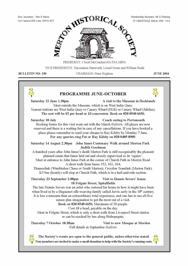
PROGRAMME JUNE-OCTOBER
Saturday 12 June 1.30pm A visit to the Museum in Docklands
Meet outside the Museum, which is on West India Quay.
Nearest stations are West India Quay or Canary Wharf (DLR) or Canary Wharf (Jubilee).
The cost will be £5 per head or £3 concession.
Saturday 10 July Coach outing to Portsmouth
Booking forms for this visit went out with the March Bulletin. All places are now
reserved and there is a waiting list in case of any cancellations. If you have booked a
place please remember to send your cheque to Ray Kilsby by Monday 7 June.
For any queries ring Pat or Ray Kilsby.
Saturday 14 August 2.30pm John Innes Centenary Walk around Merton Park
Judith Goodman
A hundred years after John Innes’s death Merton Park is still recognisably the pleasant
planned estate that Innes laid out and closely supervised as its ‘squire..
Meet at entrance to John Innes Park at the corner of Church Path in Mostyn Road.
A short walk from buses 152, 163, 164;
Thameslink (Wimbledon Chase or South Merton); Croydon Tramlink (Merton Park).
K5 bus (hourly) will stop at Church Path, which is in a hail-and-ride section.
Thursday 23 September 2.00pm Visit to Dennis Severs. house
18 Folgate Street, Spitalfields
The late Dennis Severs was an artist who restored his house to how it might have been
when lived in by a Huguenot silk-weaving family called Jervis early in the 18th century.
It is less a museum than an extraordinary total experience, and one has to use all five
senses plus imagination to get the most out of a visit.
Maximum of 30 people.
Cost £8 a head, payable on the day.
Meet in Folgate Street, which is only a short walk from Liverpool Street station
or can be reached by bus along Bishopsgate.
Thursday 7 October 10.30am Visit to new Mosque at Morden
Full details in September Bulletin
The Society’s events are open to the general public, unless otherwise stated.
Non-members are invited to make a small donation to help with the Society’s running costs.
GEOFF POTTER of Compass Archaeology has kindly provided the following report, which arrived
just
too late to be included in the March Bulletin:
THE GROVE MILL AND FORMER CROWN MILL SITE, LONDON ROAD,
MITCHAM
In January three evaluation trenches were dug in the eastern part of the site, in the area of,
and beyond, the
former Crown Mill. These did not reveal any significant remains, and it appears that the land
was not developed
until the 18th century or early 19th century. Natural gravel was generally overlaid by a
shallow layer of sterile
organic silt, and thence by a reworked soil containing occasional fragments of post-medieval
pottery, clay pipe
and brick/roof tile.
Two of the trenches crossed the line of a north-south water channel that appears on the 1828
Estate Plan and OS
maps up to the 1950s. To the west the channel was bordered by the foundations of Crown Mill,
built c.1870. At
the northern end of the channel was a brick .floor. of similar date, apparently constructed to
prevent erosion
from an adjacent sluice. The northern trench also revealed made deep ground deposits under
Crown Mill,
continuing below water level and apparently closely predating its construction. This is not
recorded by
contemporary maps, which show the area as dry land with buildings.
Recording work has taken place within the standing structure of Grove Mill and in the partly-
surviving waterwheel
housing to the east. The records include an elevation of the earlier (c.1860s) west front of
the Mill, which can
be reconciled with contemporary evidence for the original three-storey structure.
We are currently [late February] carrying out a watching brief during groundworks. Most of the
findings have
come from within Grove Mill, and include a number of earlier brick structures which may date to
the rebuilding
of 1789. These remains include the brick casing for a waterwheel, of approximately 4m diameter
and apparently
located within the contemporary mill (rather than in a separate but adjacent building, as
later).
Two chalk wall footings have been exposed under the northern part of the present Mill,
presumably of earlier
date, although evidence is currently limited to one sherd of ?17th-century pot.
THE SOCIETY’s ANNUAL DINNER
This event, now established in our calendar, took place as usual in the appropriately historic
setting of Morden
Hall, in its present guise as an .Out and Out. restaurant. The date of 27 February was one day
short of the
precise anniversary of the founding of the Society (as Merton & Morden Historical Society) in
1951. More than
40 members and their friends enjoyed a convivial meal and applauded a brief but well-phrased
speech of
welcome by the Chairman.
JG
A MILESTONE FOR THE BULLETIN AND A LOOK BACK
When our Chairman pointed out that this was the Society’s 150th Bulletin it occurred to me that
readers might
like to know something of the contents of issue No.1, which came out in April 1965.
It was in fact called Newsletter No.1 – not till No.15 did it become Quarterly Bulletin and not
till No.43 was the
.Quarterly. dropped. No.1 was produced on a duplicating machine and comprised not far short of
three foolscap
pages. No editor’s name appeared, but I suspect that Miss Jowett, the Hon. Secretary, was the
one who undertook
the task. A message from Chairman Arthur Turner commended the .new venture. to members and
hoped it
would encourage good attendances at monthly meetings and visits, which, he wrote were .not
arranged by your
Committee without considerable thought.. He hoped too that suggestions, contributions and
historical queries
would come in from members.
In that year of the creation of the London Borough of Merton the Society agreed to subscribe £5
towards the
cost of the new civic regalia, and it was also noted that, but for his death in January,
Winston Churchill would
have become a freeman of the new Borough on 1 April.
There were reports on talks by Mr J Dodgson on .The Place-Names of Surrey., Mr D R Pollock on
.The
Railway History of London., Mr R Latham of the PRO on .Public Records and Local History. – and
Mr W J
Rudd on .The Great Steam Fair.. Members could look forward to coach trips to Pinner and to
Canons Ashby, a
walk around Wimbledon village and a talk by Canon Livermore on the History of Morden.
The Hon. Treasurer, Mr S E Cobbett, noted that some members might have .inadvertently
forgotten. to pay
their subscriptions of 3/6d (17.5p).
JG
MERTON HISTORICAL SOCIETY . BULLETIN 150 . JUNE 2004 . PAGE 2
THE HISTORY OF PUB NAMES AND SIGNS
I suspect that most of us pass by pub sign boards without giving them a second glance until
perhaps an unusual
one catches our eye. It was therefore with great interest that a good number of members of our
Society attended
a talk on this subject by David Roe on 13 March. Appropriately enough, it was held at the Burn
Bullock pub in
Mitcham.
He started by explaining that ale houses and taverns have probably been in existence for
something like 1000
years. One which claims to be the oldest in England is the Trip to Jerusalem in Nottingham
which, it is said,
refreshed those who set out for the Crusades.
An ale house, as its name implies, sold only beer and ale, whilst a tavern usually sold beer,
ale, wines, spirits
and food. There were some taverns which provided overnight accommodation as well and became
known as
inns. Obviously inns considerably increased in number with the advent of the stage coach era.
The terms
.public house. and .pub. go back only a century or so.
A chequer board or a bunch of grapes was used as a sign over drinking places in Roman times. In
medieval
times the sign for an ale house or tavern was a stake of wood with a bush on the end of it
projecting from the
building facade. The so-called .ale stake. became a legal requirement in the reign of King
Richard II and over
the years the ale stake became longer and longer. Most shops
had distinctive signs hanging outside to indicate their wares to
those who were illiterate and the heyday of shop signs was the
first half of the 18th century. However, accidents due to falling
signs became quite common and in the 1760s many local bye-
laws were passed requiring projecting signs to be taken down
and affixed to the facade of the premises. Only a few shops now
have trade signs – the barber’s pole and the pawnbroker’s three
balls are remaining examples. Pubs were exempted from these
bye-laws due to their 14th-century legal requirement to have a
sign. The ale stake eventually became a sign post outside the
building.
David Roe did not mention when pubs took on individual names, but The White Hart in Mitcham was
known
by that name in 1609. The name remained until changed (contrary to planning permission) to The
Hooden on
the Green in November 2000. In England, many pub signs lost their pictures in Victorian times,
possibly to
show that it was a high class establishment which was patronised by literate drinkers. The
pictorial signs were
revived in the 1920s. Curiously, although Ireland was part of the United Kingdom for many
centuries, the bars
(as they are called there) are identified only by the name of the proprietor just like any
other shop.
A high proportion of pub names arise from heraldry, eg. The King’s Arms, The Queens Arms, The
Ravensbury
Arms, The Manor Arms. Pub names are frequently derived from heraldic animals and were used to
show
loyalty to the monarchy. For example, The White Hart (an albino deer) which was the symbol of
Richard II, The
Red Lion was the symbol of England, The Greyhound was the Tudor symbol and The White Boar was
the
symbol of Richard III. Other coats of arms may originate from the trade of the people who
predominately used
the pub, such as The Gardeners. Arms and The Bricklayers. Arms.
The names of royalty often appear on pub signs, such as William IV, Queen Victoria and The
George. The
picture shown on this latter sign varies from George I through to George V. Pictures of living
royalty are not
normally permitted although there are a few exceptions. The Queen’s Head is usually shown as
Elizabeth I, but
one pub sign shows Mary Queen of Scots losing her head to the executioner.
The Three Kings is probably of biblical origin and not associated with three UK monarchs. The
Adam and Eve
and The Lamb and Flag certainly have religious origins.
Many signs represent the rural surroundings, eg. The Fox, The Dog and Fox, The Fox and Hounds,
The Bull,
The Dun Cow, The Grove, The Plough and The Wheatsheaf. The Cock could have been the site of a
cock-pit.
The Dog and Duck evokes either retrieving after duck shooting or the old village entertainment
of setting dogs
on the ducks on the village pond. Finally, we were told, the Elephant and Castle name pre-dates
.L.enfant de
Castille. and probably arose from the castle-like carriage (called a howdah) used for seating
passengers on an
elephant’s back.
David Roe’s talk on pub names and signs was extremely interesting and for me at least, made me
look at pub
names and signs in a new light.
Tony Scott
An English inn of the 14th century
from the Louterell Psalter
MERTON HISTORICAL SOCIETY . BULLETIN 150 . JUNE 2004 . PAGE 3
.ROCKETS, RAINS AND ROMAN CANDLES’
This was the title Dr Gerry Moss, chairman of Surrey Industrial History group, gave his talk in
Mitcham
Library Hall on 3 April.
Gunpowder is thought to have originated in China. It was in the 14th century that guns started
to be used in
Europe. The components of gunpowder are saltpetre, charcoal and sulphur. Each of these
components is used in
different quantities depending on what the gunpowder is to be used for.
The first display of fireworks in England took place at Temple Fields, Warwick, in 1572. In
1698 a law was
passed prohibiting the making or sale of fireworks. Despite this, displays of fireworks became
popular, with
effects becoming more elaborate. Pleasure gardens were popular venues for displays. Often these
displays were
set to music.
Surrey has a history of gunpowder making. There were gunpowder manufacturers in Worcester Park.
The
firework manufacturer Brocks had a factory in Sutton. Pains made fireworks to commemorate the
coronation of
Queen Victoria. In 1872 the company moved to Eastfields, Mitcham. Bryant and May acquired the
company in
1960. Five years later the company moved to Salisbury.
The talk concluded with a description of how the different kinds of fireworks are made and how
the lovely
effects, i.e. colours, stars and whistle effects are achieved.
Sue Mansell
The Duke of Richmond’s
magnificent private firework
display on the Thames at
Whitehall in 1749
from a Christmas card showing
a picture in the V&A
(Rectangle comment XPMUser
25/05/2017 00:01:52
blank)
MERTON HERITAGE CENTRE IS TEN YEARS OLD !
In its first decade the Heritage Centre, at The Canons in Mitcham, has put on more than 60
exhibitions, 17
coach tours and numerous events such as lectures, workshops, fairs and demonstrations. We
congratulate Sarah
Gould and her team, most of whom are volunteers, on this great record of service to the
Borough.
Don’t miss the current exhibition Triumph & Tragedy: the Cranmers of Mitcham, which is on till
17 July.
Admission free. Information on 020 8640 9387.
MERTON HISTORICAL SOCIETY . BULLETIN 150 . JUNE 2004 . PAGE 4
VISIT TO GUILDFORD
On Saturday 8 May 16 members of the Society enjoyed a very informative guided walk round the
historic sites
and buildings of Guildford, on a rather dull day which started badly in Wimbledon when it was
learnt that
there was a reduced service to Guildford that day as track work was in progress along the line.
However we all managed to arrive at the meeting-place opposite the famous clock by the Tunsgate
Arch in the
High Street by 11.30 and met our guide, Marjorie Williams. She divided us into two groups and
we set off to
visit the Guildhall across the road first.
The Guildhall is Elizabethan, and it is said that Queen Elizabeth visited it when she visited
friends at nearby
Loseley. The front is dominated by the magnificent bracket clock built in 1683 by John Aylward.
The hall was
the venue for the magistrates. courts, the quarter sessions and the assizes when held in
Guildford.
Mrs Williams showed us the civic plate, which included a mace, the second oldest in the
country, made in the
reign of Henry VII, and a gold chain given by the Onslows in the reign of Charles II.
From there we had a quick look inside Guildford House, now a gallery, built in 1660, and went
upstairs to see
the beautiful decorative plaster ceiling and original window fastenings.
Continuing up the High Street we next entered the peaceful quadrangle of Abbot’s Hospital,
built as an
almshouse by George Abbot, a distinguished scholar who became Archbishop of Canterbury and was
a great
benefactor to the people of Guildford. It was founded in 1619 and completed a few years later,
and resembles
the Whitgift almshouses in Croydon. It is still in use today, together with a new block built
behind the original
building in 1984. We were able to go inside the chapel, which contained two beautiful stained-
glass windows
thought to be Flemish.
We then crossed the High Street and entered Holy Trinity church, the oldest Georgian church in
Surrey and
the home of George Abbot’s tomb.
Going down the hill we were fortunate to be able to find the Medieval Undercroft open to the
public. In the
1200s a merchant built the undercroft as a shop, with his house above. The undercroft has a
wonderful vaulted
stone roof and may have been used as a wine merchant’s, which it certainly was in Victorian
times. Evidence
of the original steps up to the house above remains. It is now looked after by Guildford Museum
and opened
in the season at weekends, manned by volunteers, who come on duty well wrapped up, as no
heating is
allowed in the undercroft. It contains an exhibition about its history, old wine barrels and
reproduction furniture.
Leaving this fascinating building, we walked via back lanes to Guildford Castle, which is being
restored at
present and is not open to the public, but is due to be re-opened at the end of June. The
castle is typically
Norman, and the keep dominates the town on the east side. The keep, built around 1140, replaced
the original
tower built on the mound, or motte. In the 13th century the building contained one of the most
luxurious
palaces in England. It is thought to have been once used as a barracks, and later a prison, but
by the end of the
Middle Ages had fallen into ruins.
The castle is surrounded by beautiful landscaped gardens, which were full of lovely spring
flowers, and is
very close to The Chestnuts, a Victorian house acquired in 1868 by the Reverend Charles
Dodgson, better
known as Lewis Carroll, as a home for his brothers and sisters. He frequently visited The
Chestnuts, and died
there in 1898. In 1998, the centenary of his death, several sculptures of Alice and characters
from Alice in
Wonderland were placed in various sites around the castle grounds and the River Wey.
Finally we made a brief visit to the Guildford
Museum, where our guide quickly showed
us the Lewis Carroll collections, the model of
Guildford friary, now remembered in the
Friary shopping precinct, and the
reconstruction model of a Saxon cemetery.
As it was now 1.30pm we thanked our guides
for a very fascinating and informative
morning’s walk. Members were then free to
get lunch and spend the rest of the day doing
their own thing. We had been given a taster,
and could return to explore the attractions of
Guildford later in the day, and in the future. The 13th-century entrance to Guildford Castle
from an engraving of
Sheila Harris 1829. Castle Arch is now the site of Guildford Museum.
From Surrey: A County History by John Janaway (1994)
(Rectangle comment XPMUser
25/05/2017 00:02:10
blank)
MERTON HISTORICAL SOCIETY . BULLETIN 150 . JUNE 2004 . PAGE 5
CYRIL MAIDMENT has been examining and assessing images of remnants of the Merton Priory
precinct,
and he now offers his thoughts on
ACCESS TO THE PRIORY
Whilst digitising the photographs in the Wimbledon Society Museum, I came across many that
puzzled me.
One in particular I couldn’t place. This is No.3 on the page opposite. The title was .Gate
House entrance in
High Path.. Try as I might, I could find nowhere in High Path where it might have been. Months
later I came
across the drawing from 1925 (from Chamberlain’s Reminiscences of Old Merton), which is No.4,
.Entrance
Gateway to Gate House opposite Priory Gateway., and the problem was solved. You can see they
are one and
the same gateway. Today it would not be High Path but Station Road. I suppose before the houses
were built in
Station Road it was part of High Path. The photograph of the garden is interesting. There is a
railing round the
end of a long narrow lake that covered the length of the garden, and much flint to be seen in
the garden wall,
suggesting that at one time it belonged to the priory.
Picture No.1 shows what Abbey Road looked like until 100 years ago, again a long priory wall.
On the High
Street stood the mansion (No.2) once lived in by Rear Admiral Smith, and thought to occupy the
site of the
priory gate house. Pictures 5 and 6 are of our much-loved Norman arch, firstly as it is today
and secondly as it
was found in what had become part of Liberty’s premises. It is thought that the original
building, of which it
was part, was the prior’s house, or possibly a house for visitors. Picture No.7 is the entrance
gate of the prior’s
house. It was exactly opposite the rear gate of Gate House across the road. Many of us can
remember it. Sadly
it was dismantled, never to be seen again. If you walk along Station Road you can still see
parts of the priory
wall in between car repair shops, which cannot be expected to take great care of the old wall.
In the centre of the page there is a little plan putting this all together, and showing how
close was the west door
of the giant priory church.
Certainly this area of the priory does
seem to be of importance as far as access
is concerned. Dave Saxby, for many
years the leading Museum of London
archaeologist on the site, looks at the
open area still evident at the junction of
Abbey Road and Station Road, and
thinks there may have been a gate house
at this point, particularly taking into
account the avenue of trees to be seen
on the 1741-5 Rocque map, running
through the Gate House gardens, parallel
to Abbey Road.
One needs to bear in mind that once the
main course of the Wandle was south and
east of the priory, setting the parish
boundary. The Roman ford carrying
Stane Street 50 metres south of Merton
bridge, and the site of the large priory
mill, east of Bennett’s mill, confirm this.
Consequently access to the priory
complex would have been easier from
the west. In addition, is it possible that
when the Augustinians arrived there was
still some limited use of Stane Street,
which was inconvenient because it goes
through the middle of the site, and the
priors chose to seal off that approach?
[It is likely that other readers may
have some ideas on this subject and
would like to air them in the Bulletin.
We would be very glad to have further
contributions on this topic.]
Site of
medieval mill
The main course of the River Wandle from Phipps Bridge once flowed
south and east of the Priory. (Today it is west and south of the Priory site.)
Detail from 1894 OS map
MERTON HISTORICAL SOCIETY . BULLETIN 150 . JUNE 2004 . PAGE 6
1 Abbey Road
3 Rear Gate of Gate House from the garden
2 Gate House
4 Rear Gate of Gate House from Station Road
Merton High Street
Gate House Abbey Road
Rear Gate of
Gate House
Gate to
Prior’s House
Prior’s House
and Norman Arch
Detail from John Rocque’s
map of 10 miles around
London 1741-5
5 Norman Arch re-constructed at
Merton Parish Church 6 Norman Arch of Prior’s House 7 Gate of Prior’s House
MERTON HISTORICAL SOCIETY . BULLETIN 150 . JUNE 2004 . PAGE 7
From English Heritage’s London Region Quarterly Review published by GLAAS (Greater London
Archaeology Advisory Service), for July to October 2003
MERTON PRIORY, THE SITE OF THE FIRST ABBEY MILL (MoLAS)
[The text has been slightly shortened.]
The second half of November saw the last phase of archaeological work on the Merton Priory
site: almost two
decades of work here ended with a flourish, with the discovery of the site of the monastic
mill, quite probably
founded with the priory itself in the 12th century.
The site is owned by Countryside Properties plc and Copthorne Homes. The monastic buildings had
completely
disappeared by 1800, and for most of the 20th century the site was covered with industrial
buildings. As a result
the entire area was covered in concrete and asphalt, the archaeology being penetrated here and
there by heavy
concrete foundations. The development plans, for apartment blocks, are predicated on the idea
that the remains
should be left untouched, and this zone used for car parking (an advance on the earlier phases,
when important
parts of the priory remains were covered by Merantun Way and the Savacentre).
Evaluation of the site in 2001-2 had made it clear that the river Wandle had altered its course
dramatically since
medieval times, with an infilled channel running right across the site: the main river channel
now runs to the
west. As the evaluation proceeded, evidence of a large historic mill-pond and masonry
revetments and what
looked like the head-race of a mill-leat appeared, and then one flank of a large brick and
stone building, all well
outside the Scheduled Ancient Monument.
The developers agreed that a further evaluation should be carried out. The work, like previous
phases on the
Merton site, was carried out by Museum of the London Archaeological Service. David Saxby was
the site
supervisor.
The work, recently completed, revealed the complete foundations of a mediaeval watermill with a
revetted
mill-leat and a large associated building. The mill-wheel, about 3m wide and undershot, sat
between massive
masonry abutments. The foundations were generally robbed towards the north, but on the south
side towards
the mill-leat, preservation was very good indeed. The buildings, initially constructed on chalk
rubble and flint
footings, were repeatedly remodeled: initial assessment has identified six putative building
phases. The later
phases, tentatively ascribed to the 16C and 17C, were mostly in brick, with a lot of re-used
clay tile.
If the mill itself was relatively small (c.5m by 8m), the associated building immediately to
its east was a good
deal larger. A particularly interesting feature was what appeared to be a large pool or tank
within this building,
divided into two sections. It seems likely that the structure had an industrial purpose perhaps
associated with
cloth production. Another interesting aspect relates to the great quantities of animal bone,
mostly sheep and
cow, found on the site, which may represent further evidence of industrial uses.
(Rectangle comment XPMUser
25/05/2017 00:03:03
blank)
MERTON HISTORICAL SOCIETY . BULLETIN 150 . JUNE 2004 . PAGE 8
The medieval mill
and head-race
(MoLAS)
LIONEL GREEN has another tale to tell of Merton priory and its place in national history:
EDWARD II AND ISABELLA
Edward II: a lonely childhood
.O, solitude! where are the charms
That sages have seen in thy face?.
Wm Cowper
A critic of Edward has suggested that he was over-endowed with human failings, and some
probably arose from
happenings he endured in early childhood. When he was only two his parents went abroad for
three years.1 His
mother, the cherished Eleanor of Castile, died when he was six, and no doubt he was taken to
see some of the
crosses later erected to commemorate her. As he progressed towards youth, Edward of Caernarfon
had no
living brothers to play with.
In 1298 the son of Sir Arnaud de Gaveston was made a royal ward and became an official
companion of the
king’s son. Both were about 14. In the following year prince Edward was betrothed to the
daughter of the king
of France, when she was only eight. His immediate introduction to Piers Gaveston must have been
more satisfying
to Edward than the distant prospect of marriage to someone who was then a child.
The cause of many of the prince’s failings arose from his intimate friendship with Piers
Gaveston. Convention
would have governed the relationship with a code similar to courtly love, and homosexuality
would have been
strongly censured. His infatuation was to an individual more than to a sexual habit.
Edward II: an unloved king
.And, seeing there was no place to mount up higher
Why should I grieve at my declining fall?.
C Marlowe Edward II
Edward reigned from 8 July 1307 and was always short of money, having taken over the debts of
his father. The
priory of Merton was also pleading poverty, .the result of the care displayed in ministering to
the poor and the
exercise of frequent hospitalities..2 On 11 June 1309 the king granted a licence for the priory
to appropriate
revenues of the church of Cuddington.3 The bishop of Winchester also graciously granted his
permission.4 In
June 1310 the king ordered the prior of Merton and others to send wheat, malt, beans and oats
to York to help
feed his army. On 2 August 1310 he requested 20 marks (£13.33) for the king’s use as a gift for
the war in
Scotland. The prior was admonished for not supplying the victuals which had been requested, ..
and his
excuses . were considered insufficient..5
The most depressive moment of Edward’s reign must have been the death of
Gaveston, brought about by the king’s cousin Thomas earl of Lancaster in 1312,
followed by the total defeat by the Scots at Bannockburn in 1314. The nadir for the
country came in 1315-7 when the crops failed for three consecutive years and
famine was rife, especially in London. In 1317 Merton priory mortgaged all tithes
of corn and fruit in Effingham to the archdeacon of Surrey for six years in return
for a loan of £26.6
The highlight of his reign was probably the defeat of Thomas of Lancaster, who
had never allowed him unfettered sovereignty. The king had been desperate to
remove the earl of Lancaster, and exhorted the nation to muster at Coventry. He
even turned to monastic communities, and on 16 February 1322 asked the prior of
Merton to raise men-at-arms to march against the earl.7 The king’s army began
marching north from Coventry in January 1322 to attack the earl at Pontefract. On
17 March Lancaster surrendered himself at Boroughbridge and was sentenced to a
traitor’s death by hanging. The king commuted the sentence to beheading as an
earl.8
Throughout this period Isabella had played her part as the dutiful queen, acting as
peacemaker between the barons and the king. On 13 November 1312 she gave
birth to a son, the future Edward III. Eventually the king’s fondness for the dissolute
Gaveston, and later for Hugh le Despenser, proved too much for his wife Isabella,
and she began to complain of her husband’s coldness and neglect.
Effigy of Edward II,
Gloucester Cathedral
MERTON HISTORICAL SOCIETY . BULLETIN 150 . JUNE 2004 . PAGE 9
Isabella: she-wolf of France
.Ranging like a she-wolf . drenched by the rain of exile ..
B Brecht The Life of Edward II of England
In 1325 Isabella went on an official visit to
France as mediator between the king of
England and her brother, Charles king of
France, over the land of Aquitaine9 (Guienne
and Ponthieu). She arrived in Paris on 1 April
1325 and concluded a settlement by 14 May.
The treaty was drawn up on 30 May, whereby
the lands were to be held by Edward with
homage due to the king of France.10
Edward made plans to do homage and was at
Dover on 24 August but feigned illness, not willing
to be mortified as a lesser king. He created his son
duke of Aquitaine and count of Ponthieu and
Montreuil, and sent him to France. At the Bois de
Vincennes on 21 September 1325 prince Edward
acted as the king’s substitute to perform homage
to the French king. The 13-year-old heir apparent
was now in the power of the queen and her family.
Isabella spent the winter in Paris and formed a
liaison with Roger Mortimer, who had escaped
from the Tower in 1323 to live in France. The
king of France, Isabella’s brother, did not approve
of her conduct, and in June 1326 asked them to
leave France. They made their way to William II,
count of Hainault, Holland and Zeeland. Here
Isabella arranged for her son prince Edward to
marry Philippa, one of the daughters of the count.11
The count of Hainault advanced a portion of Philippa’s dowry to the queen, which enabled her to
raise an army,
led by the count’s brother, John of Hainault. Isabella returned to England, landing at the
estuary of the river
Orwell, Suffolk, on 23 September 1326. With her were Mortimer, John of Hainault, many
disgruntled exiles
and a force of 2757 soldiers.12 London received her, and she advanced to Bristol on 26 October.
The king was
captured on 16 November and placed in Kenilworth castle until his fate could be decided by a
parliament
summoned for the purpose. Isabella was at Woodstock from 3 December until the 22nd, and spent
Christmas
1326 at Wallingford.
Parliament had been called for 7 January, summoned in the king’s name, but he refused to
attend. Isabella set
out for Westminster and the journey included visits to Reading, Windsor, Chertsey and Merton.13
The queen visits Merton
.Hear the other side..
St Augustine of Hippo
The superiors of the monasteries of Reading, Chertsey and Merton were parliamentary barons, and
Isabella
would have sought their support to force the king to abdicate. She arrived at Westminster on 4
January, which
suggests that the visit to Merton priory was on the 3rd. She would have been received by the
prior, William de
Brokesborn (1307-35), who had been prior for longer than Isabella had been queen. She may have
wished to
use him as a sounding board for her scheme to rid England of Edward II. The queen’s visit, with
many attendant
persons, must have been a strain on the resources of the priory and its officials.
How the inhabitants of Merton must have chattered as news passed around that the queen had been
in their
midst! They would not have guessed that within a month they would have a new king.
Edward was deposed, and on 29 January 1327 the royal son was proclaimed king as Edward III. He
was 14
years old, and his father was finally monstrously murdered in Berkeley castle on 21 September
1327.
(Rectangle comment XPMUser
25/05/2017 00:03:23
blank)
Left: Queen Isabella with John of Hainault
returning from France and The Netherlands
(Biblioteche Nationale)
MERTON HISTORICAL SOCIETY . BULLETIN 150 . JUNE 2004 . PAGE 10
Isabella the queen mother
.Tomorrow do thy worst
For I have lived today..
J Dryden
The queen virtually ruled England with Mortimer from 1327 until 1330, when Mortimer was tried
before
parliament and executed as a traitor. Edward III obliged his mother to retire to Castle Rising,
Norfolk.
On 24 May 1337 Philip of Valois, now Philip VI of France, confiscated Aquitaine from the
English crown. He
had assumed the throne of France as nephew of Philip IV. This caused Edward III to revive his
claim to the
French crown through his mother Isabella, daughter of Philip IV and sister to the last three
kings of the Capetian
line (begun in 987), which became extinct in the male line in 1328.14 Thus began the Hundred
Years. War.
In June 1340 Edward destroyed the French navy at anchor in Sluys (Sluis, Netherlands). In July
1346 he
returned to Normandy and took Caen. This was followed on 26 August by a battle at Crécy-en-
Ponthieu which
involved Edward’s son the Black Prince. Finally the English were able to take Calais in 1347.
(For Edward’s
celebrations involving Merton on 6 January 1347 see Bulletin No.141 [March 2002] p.8.)
Throughout all these engagements queen Isabella was still living at Castle Rising, no doubt
enjoying vicarious
satisfaction over her son’s successes. The king visited her .twice or thrice a year.15 until
she died on 22 August
1358. She was buried at Greyfriars monastery in London.
1 C Bingham Life and Times of Edward II 1973 p.22
2 Merton cartulary f146; Victoria County History of Surrey II p.97
3 Patent Roll 2 Edward II pt.2 m4; V C H Surrey II p.97; A Heales Records of Merton Prory 1898
p.201
4 Manning and Bray I p.250; Heales op.cit. p.202
5 Heales op.cit. p.203; Close Roll 4 Edward II m4; V C H Surrey II p.97
6 Merton cartulary f184; V C H Surrey II p.97; Heales op.cit. p.218
7 Heales op.cit. p.224
8 Bingham op.cit. p.145
9 Julius Caesar named southern Gaul Aquitaine, from the numerous rivers and fine ports. The
poetical
inhabitants of the district adopted the name for their dukedom. Guienne possessed the ports
which
provided the ships for the Gascon wine trade.
10 T Rymer Foedera p.601; J Hunter .Journal of the mission of Isabella to the court of France.
in
Archaeologia 36 (1855) p.247
11 Hunter op.cit. p.256
12 A Strickland Queens of England 1866 Vol. I p.512
13 Hunter op.cit p.257
14 The title .king of France. was retained by the kings of England until George III.
15 J Froissart Chronicles Ch XXIII
A queen’s head at Beverley Minster, believed to be Isabella
(Pitkin Pictorials)
(Rectangle comment XPMUser
25/05/2017 00:03:43
blank)
IN BRIEF
©
An exhibition about the Wandle is on at Wandsworth Museum until 4 July. The Museum is at The
Courthouse, 11 Garratt Lane and is open, free, on Tuesday-Friday 10-5 and Saturday 2-5. An
accompanying
series of talks includes one by David Saxby on 3 June on the Merton Priory excavations. Tickets
£2.50.
Booking and further details on 020 8871 7074.
©
Watch out for events throughout the weekend of 12-13 June marking the Wandle Valley Festival.
The
chapter house will be open, with archaeological finds on display; the new bridge will be
inaugurated; there
will be guided walks and family events. Information from David Saxby and from John Hawks
©
Lambeth Local History Forum is again offering a programme of heritage walks in south London
this
summer. Telephone Lambeth Archives on 020 7926 6076 for a leaflet.
©
!!!!!Streatham Society talks coming up include ‘streatham’s Story. by John Brown on 7 June and
‘streatham’s
Fine Architecture. by Brian Bloice on 5 July. Both at Woodlawns, 26 Leigham Court Road SW16 at
8 pm.
©
A facsimile of part of Stanford’s interesting Library Map of London and its Suburbs (1862) is
on sale at
Wandsworth Museum for £4. The scale is 6 inches to the mile, and it covers much of our area,
reaching as
far south as Cannon Hill Lane, Phipps Bridge and Mitcham’s Eagle House.
MERTON HISTORICAL SOCIETY . BULLETIN 150 . JUNE 2004 . PAGE 11
The following is a slightly shortened extract from an essay by ERIC MONTAGUE, written as part
of his
course requirement for his MA in Local History:
MITCHAM’s CHOLERA OUTBREAK IN 1866, AND ITS AFTERMATH
Since the late 17th century the village of Mitcham, barely nine miles from Westminster, and 12
from the City, had
been highly regarded for its .fine air.,1 and had attracted many merchants and legal men
seeking a healthy place
of residence for themselves and their families away from the City.2
By 1866, though Mitcham was still managed by a vestry, several local government functions, such
as policing and
the administration of the Poor Law, had become the responsibility of ad hoc bodies. The remit
of the Croydon
Local Board of Health, formed in 1849, which had secured many improvements in the town itself,
did not extend
to Mitcham,3 though under the Public Health Act of 1872, with neighbouring parishes like Merton
and Morden,
Mitcham would soon come within the Croydon Rural Sanitary Authority. For the purposes of
registration of
births, deaths and marriages Mitcham at this time was in the extra-metropolitan Surrey district
of Croydon. This
study is concerned with the effect on Mitcham, if any, of the fourth and, as it proved, the
final serious outbreak of
cholera in this country.4
With a population of 9381 in 1861, Mitcham experienced only six deaths from .Asiatic Cholera.
in 1866, a death
rate of 0.64 per 1000,5 the same as in the adjoining district of Wandsworth, within the
metropolitan area.6
Remarkably, in the Croydon registration district as a whole the cholera death rate per 1000 in
1866 was half that
of the sub-district of Mitcham. For Croydon town centre, where one might expect it to have been
higher, the rate
was 0.24 per 1000. The full significance of these figures needs further research, for the
Croydon registration
district embraced a swathe of extra-metropolitan (and largely rural) Surrey, extending from
Merton to Penge and
Norwood. Nevertheless, the low mortality rate for Croydon itself is impressive and, assuming no
.adjustment. of
the figures to exclude temporary residents, could well be attributed to the improvements in
sanitation in the town
centre achieved by the local Board of Health in the 1850s and early .60s, and, above all, to
the provision of an
excellent water supply.7
Examination of the details recorded of the handful of villagers who succumbed to cholera in
Mitcham in 1866
tends to confirm that here, as in London itself, it was the elderly, women and children who
were the most vulnerable.
The number involved is admittedly small and therefore statistically insignificant, but it does
seem that mortality in
the parish due to cholera was confined exclusively to members of the labouring class.5
The first to die, in August 1866, was the 75-year-old wife of a leather-dresser. The address,
given as .Mitcham
Common., makes it very likely he was an employee of Peter Pharaoh, whose tannery was on the
banks of the
Wandle at Mill Green, Beddington Corner.8 Several small cottages are indicated on the 1867 OS
map next to the
works, and it is highly likely that in the absence of a well the tenants would have drawn water
from the river for
domestic purposes, if not for actual drinking.
Two weeks later, the second Mitcham victim died. She was the wife of a floorcloth printer, aged
33, and within a
month two of her children had also died. The floorcloth factory at which her husband probably
worked can be
located at Phipps Bridge, a mile and a half downstream from Mill Green. A third Mitcham child,
nine months old,
died in October. The father was a .carman. (or carter), who lived on the Causeway, off
Mitcham’s Cricket Green,
and although one cannot be sure, it is possible the family were tenants of one of several very
dilapidated cottages
to be seen in early photographs.9 Two further cholera deaths occurred in Mitcham in October
1866, one an 84year-
old .labourer., and the other the 60-year-old wife of a labourer. Where they lived is not
stated.
Given names (which should be in the burial records) and using the 1861 census returns, it would
not be difficult to
ascertain precisely where all these people lived and to identify their dwellings on the 25. OS
maps of 1867.
Contemporary accounts confirm that shallow wells were relied on extensively at this time,10 and
the Wandle and
several ditches are described as receiving domestic waste as well as land drainage.11 Both
wells and ditches are
shown on the large-scale OS maps. Further research would be interesting, but the demographic
pattern of mortality
due to cholera in Mitcham is clear, and the implication is strong that contaminated water
supplies were the cause
of the infection.
Historians have noted the initial lack of widespread public concern when cholera returned to
Britain in 1865,12
and as far as can be judged from local records the reaction in Mitcham to the outbreak of the
disease in the summer
and early autumn of 1866 was minimal. Minutes of the Mitcham vestry meetings, formal as usual
at this period,
contain no reference whatever to the matter,13 and in his annual report on parish affairs for
the year 1866/7 Daniel
Wilson, the vicar, apparently did not consider that the few cases recorded called for any
comment.14 The impression
given is that a slight increase in deaths due to gastro-intestinal infections in late summer
was quite normal. This
may be an illusion and further research could produce more evidence. For instance, the minutes
of the Croydon
MERTON HISTORICAL SOCIETY . BULLETIN 150 . JUNE 2004 . PAGE 12
Board of Guardians might contain some medical references to Mitcham at this time, and it is
possible that the
Croydon or county press may have carried news items, but their coverage of outlying districts
tended to be superficial,
and a search (if copies survive for the period) could well be unproductive.15
The published statistics certainly indicate that in the neighbouring parts of Surrey the
incidence of cholera in 1866
was low, with one death, that of a seven-year-old child of a carpenter, being recorded in
Wimbledon, for instance,5
whilst in Sutton no cases at all were reported.16
Water closets were in use in some of the larger houses in Mitcham early in the 19th century,17
and 18th-century
drains of brick and tile have been uncovered in several archaeological excavations.18 Until the
mid-19th century
for the majority earth or pail closets had to suffice, the contents being dug into the garden
or yard, if there was no
night soil collection. Braithwaite in 1853 noted domestic privies overhanging the Wandle near
Mitcham bridge,19
and old residents, recalling their childhood in the 1860s, mention the open .Western Ditch.
alongside Merton
Lane (Western Road), taking sewage from cottages between Fair Green and Fieldgate Lane.20 The
ditch was
probably abolished in the late 1870s by the new Croydon Rural Sanitary Authority which, between
1878 to 1880,
laid 55 miles of trunk main serving Mitcham, Merton, Beddington and Wallington. The outfall of
the new sewerage
works was the Wandle Valley Sewage Disposal Works at Colliers Wood, land for which (mainly in
the parish of
Mitcham) was acquired after a public enquiry.21
These works, complete with such innovations as screens, ‘straining tanks. and intermittent
filter beds, were opened
in 1877.22 The civil engineer was Baldwin Latham who, soon after his appointment to the Croydon
Local Board
of Health in 1849, had been responsible for the design and construction of the Beddington
sewage .farm. to deal
with Croydon’s waste.23 The Colliers Wood works were extended in 1882 to deal with the
increasing volume of
sewage needing treatment, water closets having by this time come into general use, and a
sludge-processing plant
was added.22 Such improvements to the main drainage had to be paid for, and in 1889 the vicar
of Mitcham, the
Revd Daniel Wilson, reviewing changes that had taken place in the parish since his institution
in 1859, commented
that .The Rates have also increased from 3s. 6d. in the pound, which was their normal amount in
1872, and are
now 5s., supplemented by a Sanitary Rate of 2s. or upwards..24
Artesian wells delivering water of high bacteriological purity served many of the larger houses
and several factories
in Mitcham by the middle of the 19th century25 but, as we have seen, the great majority of
villagers obtained their
water from shallow wells.10 A public pump, newly installed in the centre of the Fair Green in
1865, where it drew
water from a well sunk into the underlying gravel, was replaced in 1898 by the .Jubilee Clock
Tower., which
incorporated a drinking fountain supplied with mains water.26 Presumably by this time piped
water was readily
available to the shops and domestic premises around the Green, and the pump was no longer
needed. The Lambeth
Water Company had laid their first main through Merton and the adjoining Mitcham hamlet of
Colliers Wood in
1850.27 Precisely when the company extended its supply network to the centre of Mitcham has not
been ascertained,
but it most unlikely that the whole of the village was .on the mains. before 1900.
Refuse disposal remained in private hands in Mitcham until the 1920s.28 Collection had for many
years been in the
hands of contractors like the Clarksons, who owned a worked-out gravel pit on the banks of the
Wandle at Phipps
Bridge, where they tipped house refuse and, no doubt, the contents of the few remaining ash-
privies. Pollution of
the subsoil was evidently not considered a problem, nor was potential contamination of the
river by the leachate a
matter for concern.
Finally in 1895 Mitcham had the benefit of a new 64-bed fever hospital, the Wandle Valley
Isolation Hospital,
built by the Croydon Rural District council at a cost of £35,000.29 By coincidence, it stood at
Beddington Corner,
close by the cottages where the first victim of the last cholera outbreak had lived, and died,
in 1866.
[It is planned to publish the complete text of Eric Montague’s study of cholera in Mitcham,
which sets
the outbreak against the regional picture, as one of our Studies in Merton History series. JG]
1 I Walton The Life of Dr John Donne (1640)
2 E Bartley Mitcham in Days Gone By (1909) p.5
3 Information from the Archivist, Croydon Local Studies Centre, in interview February 2003
4 Previous outbreaks occurred in 1831-2, 1848-9 and 1853-4.
5 .Report of the Epidemic in England of 1866. Parliamentary Papers 1867-68 xxxvii p.206
6 ibid. p.5
7 J Gent Croydon: the story of a hundred years (1970) p.11
8 Merton Local Studies Centre. Copy of Mitcham Tithe Survey: Register and Map 1846/7 and Post
Office Directory 1851
9 T Francis Old Mitcham (1993) plate 101
10 J Drewett .Memories of Mitcham. in Old Mitcham Part II ((1926) (ed.) H Bidder pp.2-3
11 F Braithwaite .On the Rise and Fall of the River Wandle: its Springs, Tributaries and
Pollution. Proceedings of the Institution of Civil Engineers
XX (1861) p.201
MERTON HISTORICAL SOCIETY . BULLETIN 150 . JUNE 2004 . PAGE 13
12 For example N Longmate King Cholera Hamish Hamilton, London (1966) p.212
13 Surrey History Centre. Mitcham vestry minutes (not paginated)
14 Merton Local Studies Centre. D Wilson .Letters to the Parishioners of Mitcham 1866/7.. In
bound volume of letters (1889) shelved at L2 (361) WIL
15 Neither Merton Local Studies Centre nor Sutton Archives and Local History search room have
copies of the local press as early as 1866.
16 Information supplied by the Archivist, London Borough of Sutton, in interview in February
2003
17 Surrey History Centre, Particulars of the Sale by Auction of the Estate of Henry Hoare in
1828 2361/2/2. Mitcham Grove, the late Henry Hoare’s
residence had water closets installed.
18 Merton Heritage Centre, The Canons, Mitcham. Site books: Excavations by MHS members at Hall
Place (1970) and Ravensbury Manor House
(1973)
19 Braithwaite op. cit. p.200
20 Merton Local Studies Centre. Transcript of evidence of Henry Tanner in Ecclesiastical
Commissioners v Bridger et ors (1890)
21 W Santo Crimp Sewage Disposal Works 2nd ed. (1894) pp.191-7. Crimp worked under Baldwin
Latham as resident engineer in charge of construction
works at the Wandle Valley sewage disposal works.
22 Plans and details seen and copied at the Wandle Valley Sewage Disposal Works office when
visited in 1948. Present whereabouts unknown
23 Gent op. cit. p.9 states that The Builder (1866) reported that the River Commissioners had
visited the Beddington sewage farm and had been much
impressed.
24 Merton Local Studies Centre. D Wilson op. cit.
25 Merton Local Studies Centre. Ms and typescript notes by .F.P.R.. LP 994 L.2 (628.1) LUC
quoting J Lucas in Journal of the Society of Arts XXV
(1877) and Barrow and Wells Record of London Wells (1913)
26 Merton Local studies Centre. Tom Francis’s lantern slide lecture notes
27 R Milward and C Maidment The Lull Before the Storm Wimbledon Society Museum (2002) p.56
28 Information from K Gutteridge, Chief Sanitary Inspector, Borough of Mitcham, in interview in
1948
29 Kelly’s Directory (1925)
ROSEMARY TURNER has been tracking down
THE MORRIS & Co TAPESTRIES AT WESTMINSTER ABBEY
In 1910 Morris & Co was commissioned to make three small tapestry panels for Westminster Abbey.
They
were designed by Professor E W Tristram, an authority on medieval painting, and the weavers
were John
Martin, Gordon Berry, John Glassbrook and George Fitzhenry.1 My book on William Morris textiles
describes
the design as .neither modern nor historically based..2 Two of the designs, representing St
Edward the Confessor
[below right] and Henry III [below left] were based on 14th-century painted sedilia panels at
the side of the
presbytery in the Abbey. The third, St John as a pilgrim [below centre], was taken from the
manuscript Life of
St Edward preserved in the University Library, Cambridge.
(Rectangle comment XPMUser
25/05/2017 00:05:26
blank)
MERTON HISTORICAL SOCIETY . BULLETIN 150 . JUNE 2004 . PAGE 14
According to Jocelyn Perkins, former Sacrist of the Abbey, the three panels were the gift of Mr
and Mrs A
Murray Smith and Mr Henry Yates Thompson, and were presented shortly before the coronation of
King
George V and employed at the ceremony to decorate the lantern. This was at the crossing where
the coronation
chair was placed and the lantern altar now stands. The coronation took place on 22 June 1911.
Subsequently they were suspended at the back of the sedilia, with the idea that they took the
place of the
obliterated panels.
In 1938 the paintings were restored, and the tapestries were moved to the north aisle of Henry
VII’s chapel.
A book published in 1986 quotes their position as being .at the eastern end of the north aisle
of Henry VII’s
chapel, adjacent to the monument to Edward V and Richard Duke of York [the .Princes in the
Tower.]..3
The tapestries have recently been moved to Samaria, a room adjacent to the Jerusalem Chamber,
and are no
longer on view to the public. The colours are still very good.
In the book on Morris textiles there are a few discrepancies. It quotes one of the tapestries
as depicting Henry
II rather than Henry III. It also says the panel depicting St John was not woven until 1914.
This would have
made it too late for it to have been used at the coronation of 1911.
(Rectangle comment XPMUser
25/05/2017 00:06:02
blank)
Notes
1 H C Marillier History of the
Merton Abbey Tapestry Works
Constable & Co, London 1927
pp.23,35,36 gives Henry II,
rather than Henry III. According
to him, Martin and Glassbrook
wove St Edward; Martin, Berry
and Glassbrook wove Henry II
and Martin and Fitzhenry were
responsible for St John as a
Pilgrim. Henry Currie Marillier
was managing director of
Morris & Co from 1905 until
the company’s liquidation in
1940, and was an authority on
tapestries. There was another
tapestry in the same series
designed by Professor Tristram,
which was of St Michael and St
George, and was derived from
screen paintings at Ranworth
church, Norfolk. This is not at
the Abbey.
2 L Parry William Morris
Textiles Weidenfeld and
Nicolson , London 1983 p.120.
Linda Parry, an authority on
Arts and Crafts textiles, curated
the centenary William Morris
exhibition at the V&A in 1996
and is president of the William
Morris Society
3 Westminster Abbey Bell &
Hyman, London 1986
The sedilia at Westminster Abbey with its two restored paintings. There have been various
interpretations of these paintings over the
years. The left-hand figure used to be identified as the 7th-century Sebert (Sigeberht), who
may, according to legend, have founded
the first monastery on the site. Reproduced by courtesy of the Dean & Chapter of Westminster
MERTON HISTORICAL SOCIETY . BULLETIN 150 . JUNE 2004 . PAGE 15
LOCAL HISTORY WORKSHOP
Friday 19 March. Seven present. Peter Hopkins in the chair.
©
!!!!!Bill Rudd welcomed, on the whole, the appearance of articles on Merton history in the
local free Guardian
newspaper. It was apparent that the writer consulted our publications (and those of the
Wimbledon Society),
as shown, for instance, by a reference to Morden Hall as dating from about 1750. He was not
happy however
with a description of Liberty’s Colour House as a .former barn.!
©
Ancient access to Merton priory was the subject that had been occupying Cyril Maidment, and he
had
brought along several images of gateways into the precincts [see page 6]. There was some
discussion about
the eastern parish boundary of Merton, earlier courses of the Wandle, and Bennett’s Ditch. The
.treasure
map. of Merton Abbey [see Bulletin No.147], otherwise .Doctor Shockwell’s map., had come from a
friend
of the man operating the crane when Scott McCracken was excavating in the 1980s. Nothing more
is known
of its provenance. Cyril, who is inclined to accept its authenticity, suggested that its
peculiar orientation,
with east at the top, might refer to the direction of access to the site,.
©
!!!!!Rosemary Turner had been tracking down the present whereabouts of tapestries made by
Morris & Co at
Merton Abbey for Westminster Abbey early last century. They had been moved at various times and
unfortunately are not now accessible to the public. Her account of their history is on pages
14-15.
©
As reported in the last Bulletin Judith Goodman hoped to identify, for a correspondent, the
settings of three
views of buses in Morden from the 1950s. She had now located the view reproduced last time as
being the
west side of St Helier Avenue, with the house glimpsed to the left being one of Nos 88, 96 or
108. The east
side of the same road and the west side of Morden Hall Road figured in the other two
photographs.
She had been to Southend Museum to see the temporary exhibition of finds from the (princely?)
Saxon
burial chamber recently excavated at Prittlewell. Everything is now at the Museum of London,
where they
expect, with today’s techniques, to learn more than was possible from the Sutton Hoo remains. A
most
exciting discovery.
She also reported that she had been reading Margaret Gelling and Ann Cole The Landscape of
Place-Names
Shaun Tyas, Stamford 2000. The authors point out that there were once about 30 places called
meretun, of
which most have become, in modern form, Marten, Martin or Marton. There are only four English
Mertons
. a reminder to be wary of identifying our Merton with any certainty as the site of an infamous
murder or a
notable battle in Saxon times.
©
!!!!!Peter Hopkins has been attempting to identify
dwellings mentioned in the Merton Land Tax
records and also in a survey of the Merton
Abbey estate dating from 1802 and shown on a
plan of 1805. Recently he had been preparing
for publication the text of Beating the Bounds
of Mitcham in 1833(edited by Eric Montague),
and was therefore particularly interested in the
section where Mitcham adjoined Merton. He
asked for help in identifying locations shown
in old photographs, so that he could begin to
match them to the buildings mentioned in these
texts.
©
For decades Lionel Green has been researching every aspect of Merton priory, and he brought to
the Workshop
a draft .Contents. list for his projected history . the proposed title is A Priory Laid Bare.
There followed
some discussion about what should prove to be a definitive work
Judith Goodman
Dates of next workshops: Friday 25 June and Friday 13 August at 7.30pm at Wandle Industrial
Museum.
All are welcome.
(Rectangle comment XPMUser
25/05/2017 00:06:22
blank)
A section of Priory wall
Letters and contributions for the Bulletin should be sent to the Hon. Editor. The views
expressed in this
Bulletin are those of the contributors concerned and not necessarily those of the Society or
its Officers.
Printed by Peter Hopkins
MERTON HISTORICAL SOCIETY . BULLETIN 150 . JUNE 2004 . PAGE 16