 MERTON HISTORICAL SOCIETY
 Bulletin 174
Download Bulletin 174
June 2010 Bulletin 174
Littler’s Cottages J A Goodman
V-1s on Mitcham. Part 2: The Details D Haunton
and much more
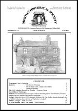
Littler’s Cottages, Phipps Bridge Road, by S Rowles 1901 (see page 10)
CONTENTS
Programme: June to September 2
Reports: ‘The History of Tooting’ 2
‘The St Helier Estate: a home in the country’ 3
‘Literary Wimbledon’ 5
The 1910 Valuation Records for Morden – Rosemary Turner 6
Local History Workshops:
5 March: lost landscapes and townscapes; small ads from the past; the 1910 Valuation; incomers
between the wars; wartime Civil Defence in Mitcham 8
16 April: Lines Bros toys in 1955; memories of Merton Park Film Studios; theories about early days
of St Mary’s, Merton; photos of work on Wimbledon’s windmill 9
Littler’s Cottages – Judith Goodman 10
V-1s on Mitcham Part 2: The Details – David Haunton 11
PROGRAMME JUNE–SEPTEMBER
Thursday 17 June 11am Guided visit to some Wren churches
Tony Tucker who gave us an excellent talk in January on Wren and his City churches, will lead
this visit to some of the City’s most interesting churches. £6 per head.
This visit is fully booked.
Saturday 19 July 2pm Guided visit to Lord’s Cricket Ground
£12 (£7 concessions) per head.
Wednesday 11 August 2 for 2.30pm Guided tour of Brompton Cemetery
£5 per head.
Thursday 16 September 11am Guided visit to Foundling Museum
£6 per head.
‘THE HISTORY OF TOOTING’
About 60 members and visitors came to this talk on 13 February given by Rex Osborn, chair of Tooting Local
History Group, at a venue new to the Society – the hall of Christchurch, in Colliers Wood. Rex is a ward
councillor in Tooting, and a tour guide, with a background in international history. The talk focused on four
aspects of Tooting’s history: the significance of the location in the Roman and pre-Norman era; the old Saxon
church; the manorial history and Salvador House; and the sad story of Surrey House, the ‘pauper’s academy’.
The main road (A24) through Tooting follows the line of the Roman Stane Street, which took this course as it
had to pass through two hills midway between what is now Tooting Broadway and Tooting Bec. There are
several theories as to the origin of the name ‘Tooting’, but results of a joint research project by the Universities
of London and Nottingham point to the Old English tote (a look-out), and ingas (people of). The district on the
top of the eastern hill, Totterdown, takes its name from tote and dun (a hill). During the wars between the
English and the Danes in the early 10th century Edward the Elder had roads built at right angles to Stane Street,
to intercept the Danish armies, who used these old Roman roads. One of these new roads was on the route of
what is now Garratt Lane and Mitcham Road, at Tooting Broadway. A road could not cross Stane Street
further north, where it went through a pass, nor further south, where the land was marshy, near the Rivers
Graveney and Wandle respectively. A village – Tooting – grew up at the road crossing.
There was a 1000-year-old Saxon church in Tooting that was replaced in 1834 by the present, much larger, St
Nicholas church. The old church had a round tower, the last one in Surrey. Rex Osborn noted that round towers
were cheaper to build than square ones in Saxon times, and they were not unusual on churches, particularly in
East Anglia. He did not accept the theory that the tower could have been built by the Romans for military
purposes long before a church was established alongside. There is still uncertainty about the exact site of the
old church. In the 1820s a church school was erected close to the church, on the site of an old moat. The
building started to fall down in the 1840s, so the rubble from the demolished old church was stuffed into the
foundations; it is now a Shiite mosque.
The first lords of the manor in Tooting were in the Norman era, from the de Gravenell family (whence the
Graveney district and river take their name). Their manor house is believed to have been close to the church.
By the 18th century the manorial lands were south-east of Tooting Broadway, when they were acquired by a
merchant prince, Joseph Salvador, who built Salvador House in 1744. One of his sons, Francis, was a hero of
the American Revolution, and the politics of the time caused Joseph to sell his home in 1783. The house then
became a school for young gentlemen. The estate was sold between 1827 and 1844, and the building (then
known as Eldon House) was demolished c.1900. Rex Osborn and the Tooting History Group had investigated
fragments of old walls still standing alongside, or incorporated into, industrial premises and backyards, and
studied traces of foundations in car-parks, to determine the exact location of Salvador House, which was just
MERTON HISTORICAL SOCIETY – BULLETIN 174 – JUNE 2010 – PAGE 2
behind where the Granada is today. The Granada replaced a row of 19behind where the Granada is today. The Granada replaced a row of 19-century cottages built on the estate.
Investigations also suggested that the alley-way from Mitcham Road to the Tramshed pub was the location of
the grand entrance to the manorial estate.
Another large house in Tooting was Surrey
Hall, on the west side of Tooting High
Street, just north of the present junction
with Garratt Lane. This was the location
of a 19th-century tragedy and scandal,
publicised by Charles Dickens. Surrey Hall
was acquired in 1825 by the family of
Bartholomew Peter Drouet, who set up
the Infant Pauper Asylum, an
‘Establishment for Pauper Children of the
Metropolitan Parishes’ (nicknamed the
‘pauper’s academy’). At first 600 children
from ages four to 14 were crammed in.
Meals were eaten standing up; there were
no toilets – all used the backyard; and there
were open sewers along the boundaries.
By 1848 numbers had grown to 1700, and a shirt factory had been added to the rudimentary teaching and
accommodation facilities. At the end of December 1848 there was one case of cholera, and two to three weeks
later 250 children had died in an epidemic, and the premises had to be evacuated. A proper medical investigation
revealed that before the epidemic children had been covered with sores, and were malnourished, and standards
of hygiene were appalling. The site was shut down and cleared by 1850. Drouet went on trial but was acquitted.
Charles Dickens, who had published Oliver Twist ten years earlier, denounced Drouet in The Examiner as a
‘baby farmer’, and his asylum as ‘a disgrace to a Christian community’. Because of the publicity and hounding
by the press Drouet abandoned plans to open another infant pauper asylum in premises he had bought in
Streatham.
This was an interesting and entertaining talk. Rex Osborn was a good speaker, not using notes, and was
supported by a digital presentation to a high standard operated by his daughter.
David Roe
‘THE ST HELIER ESTATE: A HOME IN THE COUNTRY’
St Theresa’s church hall was packed on Saturday 13 March for this presentation by Margaret Thomas,
librarian at the Borough of Sutton’s new The Circle Library in Middleton Road, which was due to open the
following Friday. Margaret had been instrumental in securing a £40,000 lottery grant to fund a Memory Bank
Project to record oral histories from residents past and present, and much of what she shared with us was
based on these recordings, combined with photographs and other items in the archives.
She started by reminding us that the estate really was built ‘in the country’. The library itself stands on what
was Batts Farm in Carshalton. (The Batt/Batts family also held properties in Morden, Merton and Mitcham
from the late 17th to the early 19th centuries. In 1828 Batts Farm was one of the many properties owned
by Henry Hoare of Mitcham Grove.) By the 1860s it was held by the Pimm family, who continued to farm
there until the early 20th century. They specialised in poultry farming, but later diversified into other areas
of employment to supplement their incomes as farming declined.
Hoare had also owned the adjoining Hill House Farm in Carshalton, named on the earliest Ordnance Survey
2-inch maps as ‘Pig Farm’. The farmhouse has long gone, but the adjoining Victorian house called Hill
House, built in the 1840s or 1850s, still stands in Bishopsford Road. According to the 1911 census, 11
workers, described as ‘threshing machine minders’, were living in the barn. All were middle-aged, but only
one was married. One had been born in Carshalton, six in Croydon, one in Sanderstead, and the others
outside Surrey.
Until destroyed by fire a few years ago, Bishopsford House, built in the 1860s, still stood in Poulter Park.
Sales particulars of 1909 describe it as having four handsome reception rooms, two staircases leading to
12 bedrooms and (the height of luxury!) two bathrooms. It stood in 35 acres of gardens, woodland and a
small farmery.
Surrey Hall, Tooting – Drouet’s ‘Pauper’s Academy’
MERTON HISTORICAL SOCIETY – BULLETIN 174 – JUNE 2010 – PAGE 3
Across the parish boundary in Morden was The Lodge, another property owned by the Hoare family, who in
Across the parish boundary in Morden was The Lodge, another property owned by the Hoare family, who in
.
By the early years of the 20th century these farms and estates were struggling to remain profitable, and it was
probably with some relief that the owners found a ready buyer in the London County Council.
After the First World War there was a growing demand for better housing to relieve the appalling overcrowding
in London by building ‘Homes for Heroes’. The St Helier estate – named after Lady St Helier, a London
alderman who died as it was being built – was one of three large estates built on the outskirts of London, to
provide good homes for the poorest Londoners, the others being Becontree and Downham.
Building took place from 1929 to 1934. The contractors were C J Wills, who had their own football team in the
Sunday Seniors League. They installed a site railway to move building materials around, and after it was
removed, some gardens were extended over its former route.
The houses were well-planned for the period, and seemed luxurious to the new residents, many of whom were
used to sharing facilities. Although some houses, especially on the Morden side, had bathrooms from the
beginning, many started with a bath in the kitchen covered with a board that doubled as a kitchen table; separate
bathrooms were not added until the 1970s. Cold water was on tap, but hot water was provided by a wood- or
coal-fired copper, though geysers were fitted later. For many, cooking was done in a range in the living room,
though kitchen cookers were later installed. There was only one electric socket per house, and electric fires and
irons could be hired from the Council at a penny a week.
The new residents were conscious of ‘moving up a notch’ socially, and happily accepted various restrictions
enforced to ‘keep things nice’. Thus there were railings around the greens to stop children playing on them.
Hedges were kept at a regulation height, though this was because they were all cut by the Council.
At first there were few local amenities. There were no local shops at first, though bread and milk were delivered
– by horse and cart. Many residents grew their own vegetables in their small gardens. The hospital was not built
until 1938. This was pre-National Health, and each family had to pay 6d a week to be on a doctor’s books.
Community spirit developed slowly, the new occupants being somewhat self-conscious at first. But churches
and other organisations soon formed clubs and societies and organised outings. The Gaumont cinema was built,
and other forms of entertainment developed. Cycling was especially popular.
Then came the War. Fortunately mortality from bombing was not great, due to the spaced-out nature of the
estate, most bombs falling in gardens and open spaces. School log books record constant disruption from air-
raid warnings, pupils spending long periods in the school shelters, even taking exams in them! The hospital was
hit, in spite of its coat of whitewash.
After the War there was a proliferation of clubs for football, cricket and other activities. Coach outings remained
popular, as summer holidays by the sea were still a novelty for many. In 1977 many roads organised street
parties to celebrate the Queen’s Jubilee, the many greens being ideal for this purpose.
Margaret concluded by saying that the library will be putting on a number of exhibitions over the coming
months, focusing on various aspects of the history of the estate. She is also planning an historical section on the
library’s website.
Merton Historical Society is about to publish the memoirs of a boy who grew up on the Morden part of the
estate in the 1930s and 1940s. Memories of a Morden Lad: 1932–1957 by Ronald Read will be the thirtieth
of our Local History Notes, and should be ready by the summer. Mr Read recounts his childhood and wartime
memories of growing up on the estate, and then takes us to post-war Europe following his call-up to the army
in 1945. His returned to civilian life in Morden in 1948 was
interrupted by 18 months spent in sanatoria in Waddon,
Southbourne and Cheam, after he was diagnosed with TB
in 1952. Mr Read expresses himself bluntly, and some
readers might be offended by his language, but his account
is a valuable, and fascinating, record of his life and
experiences at home in Morden and further away. At 72
pages, this will be our most substantial Note, and will sell at
£5 (£4 to members) plus 85p postage. Available at lectures.
Peter Hopkins
ground floor plan of Mr Read’s house (on the right),
reproduced by courtesy of Merton Library & Heritage Service
MERTON HISTORICAL SOCIETY – BULLETIN 174 – JUNE 2010 – PAGE 4
‘LITERARY WIMBLEDON’
The audience at St Mary’s church hall, Merton Park, on 10 April were treated to an entertaining afternoon by
four members of the Wimbledon Society – Michael Norman-Smith, Monica Ellison, Janet Koss and Sheila
Dunman. Technical back-up (sound and vision) was efficiently provided by Asif Malik.
A virtual walk, for which we were given a helpful map, was the framework for this account of an assortment
of literary (in the broadest sense) figures associated with Wimbledon. The numbers are legion, and there was
not time to include, for instance, Emile Zola, who enjoyed Wimbledon’s shops in 1898, or Nigel Williams, whose
They Came From SW19 and The Wimbledon Poisoner have proved popular more recently.
The earliest literary figure we met was Robert Knox (1641-1720), who knew Wimbledon in his childhood and
returned there in 1703 (he owned land near the Wandle). In between he had spent 20 years as a prisoner in
Ceylon (Sri Lanka). His Historical Relation of the Island of Ceylon … was a bestseller in 1681, and he also
wrote an autobiography.
Dr Arthur Malan took over as headmaster at the school at Wimbledon’s Eagle House in 1874. An all-round
talented man and gifted teacher, he found time to write stories and serials for The Boys’ Own Paper.
Another occupant of Eagle House (from 1887 to 1924), but as owner and restorer, was architect Sir Thomas
Graham Jackson (1835-1924), who designed many buildings at Oxford, helped rescue Winchester cathedral
from collapse, and travelled extensively in the Mediterranean. He published his very readable Recollections,
as well as his rather tame (M R James he wasn’t!) Six Ghost Stories, one of which is set in Eagle House.
William Thomas Stead (1849-1912) lived at Cambridge House, on the site of today’s Welford Place. He
edited the Pall Mall Gazette from 1883 to 1888. Best known for his article ‘Maiden Tribute of Modern
Babylon’ (1885), which led to Parliament’s raising the age of consent to 16, he was later derided for his
support of spiritualism, and he died on the Titanic.
Ethel Mannin (1900-1984), born in Clapham, left school at 15 and became
a stenographer, but soon established herself at the centre of the world of
‘modern’ writing. Her sympathies were left-wing and feminist, and she
published about 100 books, fiction and non-fiction. Her autobiographical
Confessions and Impressions came out in 1930. She lived for more than
40 years at Oak Cottage in Burleigh Road, before moving to Devon.
Poet, essayist and editor James Henry Leigh Hunt (1784-1859), when a
schoolboy, spent a summer at Spring House in Merton and visited Wimbledon.
As an adult he occasionally patronised the Rose & Crown, as did later the
poet Algernon Charles Swinburne (1837-1909), who spent the last 30
years of his life in retirement at the foot of Putney Hill.
The Hermitage in Common West Side was the home towards the end of
her life of novelist Margaret Oliphant (1828-1897). Widowed early, she
wrote prolifically in her struggles to support her children and other family
members. Of her nearly 100 novels the best-known today are the Chronicles
of Carlingford series.
Sir Thomas Henry Hall Caine (1853-1931) lived for a while in a house at Crooked Billet. He wrote popular
novels, such as The Manxman, moved in celebrity circles, and took on the role of secretary and companion to
D G Rossetti in the latter’s decline.
In Dunstall Road nearby, at least at weekends in the 1930s and 1840s, was Marie Adelaide Belloc Lowndes
(1868-1947), a sister of Hilaire Belloc. She published a number of novels, often based on real incidents, with
The Lodger (1912) being inspired by Jack The Ripper.
Pretty Gothic Lodge in Woodhayes Road was the home for a while of Lady Anne Barnard (née Lindsay)
(1750-1825), who wrote the ballad Auld Robin Gray. However she is best known for her diaries and letters
written in South Africa where her husband served as colonial secretary.
Captain Frederick Marryat (1792-1848) leased Gothic Lodge from 1820 to 1827. It was close to his parents
at Wimbledon House and was a pleasant place for his large family while he was at sea. We know him today
for Masterman Ready and The Children of The New Forest.
Axel Munthe (1857-1949), author of the international best-seller The Story of San Michele (1929), was at
Southside House, with his second wife, whose family owned the house. He was a Swedish psychiatrist who
became a naturalised Briton.
Ethel Mannin in 1930
MERTON HISTORICAL SOCIETY – BULLETIN 174 – JUNE 2010 – PAGE 5
The Firs, now gone, off Copse Hill, was the home of Thomas Hughes (1822-1896), who wrote Tom Brown’s
Schooldays here (1857). Hughes was a barrister, Liberal MP, Christian Socialist, and supporter of Working
Men’s Education and the Co-operative movement. At The Firs he and his friend John Ludlow, with their
families, tried the experiment of communal living, but the household broke up soon after 11-year-old Maurice
Hughes, for whom the bestseller was written, died.
The birthplace of Robert Graves (1895-1985), novelist and poet, at 1, Lauriston Road is marked by an English
Heritage plaque. After unhappy spells at Rokeby and King’s College School he went away to Charterhouse
(also not a success). His first poetry was published while he served with the Welch Fusiliers in the First World
War, and his autobiographical Goodbye To All That, which caused a sensation, came out in 1929. He is best
known now for some of his poetry and for the Claudius books.
Popular novelist Georgette Heyer (1902-1974) was born in Woodside, the daughter of George Heyer, a
French master at King’s. She attended The Study in Wimbledon before finishing her education in France and in
London. A precocious talent, her first book, The Black Moth, was published when she was 17, and she went
on to write nearly 60 novels, mostly historical romances, but including some contemporary detective stories.
She took Jane Austen for her model and her historical research was meticulous.
The presenters of this collection of literary figures had studied their subjects well, and put over their material in
a lively way. Their audience were both amused and instructed, and I, for one, intend to track down some of
Ethel Mannin’s works…
Judith Goodman
ROSEMARY TURNER is exploring
THE 1910 VALUATION RECORDS FOR MORDEN
The Valuation Office originated in 1909, as a branch of the Estate Duty Office. In 1910 it undertook a general
valuation of land in Great Britain. Its purpose was to access the value of property to assist with the collection
of land value duties.
Area around St Lawrence Church, Morden, from 1910 valuation map
MERTON HISTORICAL SOCIETY – BULLETIN 174 – JUNE 2010 – PAGE 6
At first sight the records would seem to be too modern for local historians, but Morden at the time was still
mostly agricultural, and its buildings often of a great age. The Valuation includes very detailed information about
the fabric of the buildings, and the sizes and functions of their rooms. Its closeness in date to the 1911 census
enables us to obtain an insight into how many people were living in the buildings at that time.
The Valuation was divided into regions. London is IR121, and includes Morden. This reference is to the Ordnance
Survey maps, which have plot numbers marked on them. They are mostly 1886-1912 25-inch OS maps, except
for more remote areas. The maps and field books are at The National Archives, Kew. Unfortunately all but one
of the maps referring to Morden IR121/1/110, equivalent to XIII.7, have gone missing.
The field books also have an IR prefix, and their full reference is found in a set of books which lists places
alphabetically by civil parish, within each registration district. The field books contain entries which correspond with
the numbers on the maps. For Morden there are 500 entries. The amount of detail in each valuation varies, and
some entries are linked to plans within other valuations. They all include a description of the plot and its situation,
acreage where appropriate, occupier and owner, whether it is freehold or rented, and the term of the tenancy.
There then follow details of the residential and working buildings, and also land usage. There are sometimes extra
notes, where relevant, and finally a breakdown of the value of the property. Some entries have a detailed plan.
The valuations could be disputed, and notes about the outcome are written in red on the pages.
The numbers are not sequential, and do not seem to relate to landownership or usage of the property. I have
included a section of the OS map covering the land around St Lawrence church. This shows the range of
numbers within an area. Nos 110 and 111 are 1 and 2 Church Cottages and are described together at 110:
Semi-detached cottages: 110 occupied by
Mrs W Stockbridge. On the 1st floor 2 beds
and on the ground floor, sitting room, kitchen,
scullery, WC and front and back gardens. It
was built of yeo [sic] stocks, with tiled roof,
and a back addition built of timber, roughcast
and pantiled. No.111 was unoccupied.
Both properties were owned by G Hatfeild.
The 1911 census lists Church Cottages, London
Road; head of household was Rachel
Stockbridge, a widow aged 63 born at
Woodcote. Also in the house were James
Mansfield, her son-in-law, who was a
bricklayer on the railway; his wife Lily; Mildred
Stockbridge, another daughter; and Harold
Stockbridge her grandson. In the 1901 census
her husband was named as William
Stockbridge, builder.
No.158 is the parish hall and schoolhouse:
School House, Central Road, described as cottage and garden, buildings used for parochial purposes;
occupant Alex McLean; owner school trustees per the Rector George Preston Kelsall Winlaw. Occupier:
tenancy weekly 7/6.
Description cottage: built of stocks and tiled roof. 1st floor: 3 beds, one of which is small. Ground floor: 2
sitting rooms, kitchen, outside coals, wc, small garden.
Parish Hall: built of brick, part old building & part cement-faced & tile roof, comprising large hall, side
hall divided by rolling shutters & classroom; 2 cloakrooms, lavatory and stoke hole.
Caretaker’s apartment above comprising 2 attics, living room, scullery, wc, yard and plot of vacant
building land. There is an added note: ‘rifle range erected Jan 1914’.
Total value of property £1410.
I could not find this entry in the 1911 census, but in 1901 Alex McLean is living at Hill House Lodge.
It always amazes me when looking at the census entries that people with large families possibly living in one
room often find space for a lodger. It conjures up scenes from medieval times when people slept on the floor of
the hall or kitchen. In the case of some houses in the census one room served as kitchen, hall and bedroom.
I found these records extremely interesting, and well worth a second look.
Nos. 1 & 2 Church Cottages, London Road, Morden – May 1962 Reproduced by courtesy of W J Rudd
MERTON HISTORICAL SOCIETY – BULLETIN 174 – JUNE 2010 – PAGE 7
LOCAL HISTORY WORKSHOPS
Friday 5 March Seven present – David Haunton in the chair
.
Madeline Healey showed us photographs of bygone days of the Phipps Bridge area and Garth Road. They
came from her family album, and showed landscapes long since gone.
.
Judith Goodman had copies of old newspaper cuttings relating to Merton. They had been sent to her by
David Saxby. Messrs Skinner & Dyke were advertising Merton Place for sale in December 1800. (Emma
Hamilton purchased it on behalf of Nelson in 1801.) There were two adverts for salvaged building material
from Merton Place, which confirmed that it had been pulled down by 1817. The last time the house had been
offered for sale seemed to have been in 1815. Another cutting, from 1767, announced the expiry of the leases
of a number of houses and works at Merton Abbey. There was also a poem from 1811 about Merton Abbey.
.
Rosemary Turner recounted the trials and tribulations of her attempts to research the 1910 Valuation Records
for Morden.
She has been invited to attend the opening of Middleton Library. They will have a small exhibition relating the
agriculture of the St Helier Estate. A larger exhibition is to come.
A building covered in ivy in one of Madeline’s photos reminded Rosemary of a house on the St Helier Estate
when she was growing up. It was empty and covered with ivy, with holes in the brickwork and woodwork.
When some scouts knocked at their door in Bob-a-Job Week her father said he had a bit of gardening for
them. They took one look and could not get away quick enough.
.
Peter Hopkins’s ten-year project translating Morden medieval documents is nearing completion, although he
says there is still more information to find. Barbara Harvey, the Westminster Abbey historian, is preparing
transcripts of States of the Manor accounts for the British Academy. She is going to let us have copies of the
Morden sections.
He has permission from the Abbey, the British Library, and other archives, to publish images of the documents
on our website alongside the translations, but he is still waiting for permission from TNA. Simon Neil is using
the UV light at TNA to reveal writing too faint to read on the document mentioned in the last workshop report.
Peter had produced a detailed booklet to accompany the CD-ROM of his translations. He passed copies to
members for comment.
Irene Bain has sent Peter her memoir of working at Tower Creameries of Mitcham.
The second instalment of Simon’s translation of the priory’s foundation document starts by saying that St
Mary’s church was knocked down by its founder, Gilbert, soon after the priory moved to the Wandle site. A
rumour that the north door of the present church has been dendro-dated to 1130 has not been substantiated.
.
Bill Rudd began by suggesting that the Romans known to have been in Morden were probably workers on
the Roman road (Stane Street).
He had photographs from an exhibition he had once put together for Morden Park Library. They were of
Morden buildings mostly long gone.
.
Keith Penny had been continuing his research into ‘where people came from’. From the St Olave’s baptism
register he had recorded the fathers’ occupations. There were a large number of clerks. He had also looked
in the voters’ register for unusual forenames and surnames, to check against the GRO birth indexes, to see
where they were born. The vast majority came from the LCC, i.e. Southwark, Wandsworth and Lambeth.
The age profile was mostly young marrieds. There were only 20 marriages at St Olave’s in 1931/2.
Keith has a book which belonged to his father, called London Transport in Wartime, which includes an eye
witness account of the Balham Underground station bombing that Dave Haunton had written about [Bulletin
173].
.
Dave Haunton has been continuing his research into World War II at TNA He had found references to the
difficulties encountered when recruiting Mitcham people into the Civil Defence Units. There was a detailed
report from 1939 which found the CDU very unsatisfactory, and a later one with high praise. Both articles
were extremely non-politically correct, showing how much things had changed over the years. Dave was
asked to write an article about his findings.
In a folder marked Supplementary Blitz Papers Dave found only one air raid incident report. It related to the
bombing of the Tower Creameries, which was destroyed. The air raid lasted from 10pm to 5am, and 3000
people were evacuated from their homes.
Rosemary said the husband of one of her church members was injured in the raid.
Rosemary Turner
MERTON HISTORICAL SOCIETY – BULLETIN 174 – JUNE 2010 – PAGE 8
Friday 16 April 2010 Four present – Rosemary Turner in the chair
.
Dave Haunton had brought along his catalogue
from the Schoolboy’s Own Exhibition held at the
Horticultural Halls, Westminster, for a fortnight from
31 December 1955. Lines Bros of Merton, makers
of Tri-Ang toys, displayed the largest exhibit – a
pond on which scale-model ocean liners and other
vessels were operated by remote control.
He then showed us a mysterious unlabelled
photograph, from his family collection, of St James’s
Street looking north towards Piccadilly. Apparently
Edwardian in date, it showed sober crowds dispersing
perhaps after a procession or cortege, and we made
some guesses as to the occasion. Any ideas?
.
Radio 4’s Film Programme broadcast on Good Friday
had attracted Judith Goodman’s attention, and she
had brought along a recording. It had looked at some
of the smaller film studios of the past, and the first
ten minutes were devoted to Merton Park Film
Studios. Michael Winner was amusing about the
parsimonious and surly producer Jack Greenwood
who ruled the place. Other speakers, including a
woman who worked as an editor there 50 years ago,
also recalled the cramped conditions. The workshops
and stages have long gone, but Long Lodge (269
Kingston Road), which housed the office, is still there,
and is now occupied by an insurance firm. One not
bad feature film was made there – The Criminal
(1960), starring Stanley Baker (as The Criminal) and
Jill Bennett (as The Blonde) – in which Greenwood made sure his name was right next to that of the rather
better-known Joseph Losey on the credits. But most of the work was in commercial or training films. Apart,
that is, from the popular Scotland Yard and Edgar Lustgarten ‘second features’. The police in these series
were only ever seen to use the same two Wolseleys (one of Greenwood’s little economies); their number plates
were VON and UML, and aficionados watched out for these familiar vehicles every single time.
.
There was some discussion about the Willows School site, where Barratts are building and want to install a
‘time capsule’. Peter Hopkins pointed out that only the roadside frontage of the school site was part of the
former Ducketts Farm, where Joseph Bazalgette had his house, later known as The Willows.
With reference to the early history of Merton church, Peter reported
Lionel Green’s suggestion that the building knocked down by Gilbert
may have been only a wooden one. Gilbert’s motive in destroying it
might have been to make the estate, a royal gift, less desirable to the
king. The church must have been soon rebuilt (in stone).
.
Rosemary Turner had brought along some photographs of work
being done on the Wimbledon windmill in 1959 and 1960, by Charles
Hugh Hill and his son Ronald Charles Hill, who were C H Hill Builders,
Decorators and Plumbers of 26 West Place, Wimbledon. It has to be
said, there was little evidence in the pictures of health and safety
concerns 50 years ago! It was agreed that the collection, donated by
the family, should be passed to the Wimbledon Society Museum, or
the Windmill Museum, so that they could be displayed.
She reported that the Committee had offered to pay for photocopies
of the Morden 1910 Valuation records [see pages 6-7].
Judith Goodman
Next Workshops: Fridays 4 June and 23 July at 2.30 at Wandle Industrial Museum. All are welcome.
MERTON HISTORICAL SOCIETY – BULLETIN 174 – JUNE 2010 – PAGE 9
LITTLER’S COTTAGES
Recently we were interested to receive emails
from Deborrah Cuttriss Sherman, who lives in
Canada. She tells us that her grandmother,
Gwendolyn Gladys West, grew up in Littler’s
Cottages in Phipps Bridge Road, Merton Abbey.
Gwendolyn, we are told, was a nurse at the
London Police Institute (not traced), but in 1901
emigrated to Hamilton, Ontario, where she
married and settled. Deborrah has a pen-andink
drawing of two of the row of cottages [see
page 1], of which the one with the open door is
presumed to be Gwendolyn’s home. The
drawing is signed and dated ‘S Rowles
6.11.1901’ and may well have been a farewell
gift to Gwendolyn. Stan Rowles was her cousin,
and something of an artist. Deborrah also has
a number of Edwardian postcards of the Phipps
Bridge area that have come down to her from
her grandmother.
This row of weatherboard cottages was owned
and rented out by Edmund Littler, silk printer
at the site that was taken over by Liberty’s in
1904. In the foreground is a small footbridge
over the ditch that ran in front of the cottages
(clearly visible apparently in the original picture,
which is slightly too large to scan completely).
The circular feature is possibly a hedge. The
River Wandle
Littler’s Cottages
extracts from 25-inch to 1-mile OS maps
of 1898 (above) and 1933 (left)
sign, up on end, that reads ‘Batey’s’ suggests
that the cottage may have housed a small
shop. Batey’s was a popular brand of
lemonade.
Unfortunately no one by the name of West
appears here in the 1901 census. Nor have I
found the name in the directories of the time.
The cottages, perhaps early 19th-century in
date and unlikely to have had running water,
gas, electricity, or modern drainage (or damp
courses!), survived a long time. They are still
shown on the 25-inch OS map for 1931, but
have gone by the time of the 1933 revision.
Merton Heritage and Local Studies Centre
has a postcard view of the cottages, which
was used on page 40 of Eric Montague’s
Colliers Wood or Merton Singlegate, and
on page 22 of Beating the Bounds, both
published by this Society. The stretch of
Phipps Bridge Road on which they stood is
now Liberty Avenue.
Judith Goodman
MERTON HISTORICAL SOCIETY – BULLETIN 174 – JUNE 2010 – PAGE 10
DAVID HAUNTON concludes his survey
V-1s ON MITCHAM PART 2: THE DETAILS
DAVID HAUNTON concludes his survey
V-1s ON MITCHAM PART 2: THE DETAILS
Sources
The basic information is taken from files in The National Archives (TNA) (HO 198/79 – HO 198/94) which
contain the original forms completed by the reporting RAF technical officers, usually accompanied by a small
sketch map. Occasionally only the sketch map survives, but these indicators have been cross-checked in the
summaries held in other TNA files (HO 198/161 – HO 198/172).1 The Borough of Mitcham Incident Map,
compiled after the war and now held at Merton Heritage & Local Studies Centre, plots all the high explosive
(HE) bombs and V-1s (‘Fly Bombs’) which fell on the area. It wrongly classifies [10] as an HE bomb, but
correctly plots [7] as HE, not as V-1. It also includes a further three ‘V-1’ plots which are not supported by any
evidence at TNA, and are thus probably mis-classified HE bombs.2
The numbers of deaths have been compiled from the Commonwealth War Graves Commission’s List of Civilian
War Dead for Surrey, where they are recorded by name, address and date and place of death and/or fatal
injury.
In the accompanying list, K = number of people killed, DH = Direct Hit, ‘Front’ or ‘Rear’ = Front or rear of the
premises, N,E,S,W = Compass directions, and ‘Nearest Feature’ is a more or less permanent feature of the
landscape from which a measurement was taken – usually a road junction. Damage to dwellings was recorded
in categories: A = completely demolished, B = not repairable, may need attention to make safe, C = repairable,
but possibly not inhabitable at present.
The Effects
The V-1 inflicted damage and destruction by the power of its explosive blast, but did not by itself cause fires. In
very general terms, Mitcham buildings were completely destroyed if within 70 feet of the point of impact. They
were not repairable up to 100-150 feet away, heavily damaged up to 300-400 feet away and lightly damaged as
much as 900 or even 1800 feet from the explosion. There is much variation within these figures. Almost all the
houses destroyed or damaged were two-storey terraced dwellings. The phrase ‘general blast damage over a
wide area’ (covering the effects on glass, plaster and roofs) is very common, and in many of the later reports
is omitted as understood. Only in two cases are there any comments on the houses: [1] hit ‘old cottage terrace
houses’, while the 24 terrace houses reduced to rubble by [27] were of ‘very poor construction’.
By contrast, any damage to factories is usually noted. Thus we have [4] Wandle Valley Sewerage Works in
Bygrove Road ‘blast damage to brick outbuildings’; [11] RACS milk supply depot in Sandy Lane ‘light steel
structure buildings mostly affected’; [16] T Palmer & Co, constructional engineers, Church Road, ‘main shed
150 x 80 feet demolished, extensive damage to
works buildings of steel frames with corrugated
iron sides and asbestos roofs’; [31] Southern
Cylinder Services3 in Fortescue Road ‘on war
production, out of commission’; [32] Whitely
Products works at Ravensbury Mill ‘severe
blast damage … factory out of action for the
time being’ (Whitely made a wide range of
The
draughtsman
has mis-spelt
both Belgrave
Road and
Vickers-
Armstrongs
Crown copyright
The National
Archives ref.
HO192/509
MERTON HISTORICAL SOCIETY – BULLETIN 174 – JUNE 2010 – PAGE 11
………………………………………………………………………………….
………………………………………………………………………………….
•
V-1s (45)
•
Mapped, but no report (3)
Sites superimposed on a 1930s map issued with The Official Guide to Mitcham by the Homeland Association Ltd, London WC2
Crown Copyright Reserved
MERTON HISTORICAL SOCIETY – BULLETIN 174 – JUNE 2010 – PAGE 12
V-1 Flying Bombs reported in Mitcham 1944-45
V-1 Flying Bombs reported in Mitcham 1944-45
Date Time Street or Area Nearest Feature K A B
1 18 Jun 44 01:17 30 Homewood Road DH Belgrave Road 18 20 30
2 ” ” 04:35 King’s College School Rear Lavender Avenue 0 —
3 19 June 07:35 Mitcham Common Between Watneys and Croydon Roads 0 —
4 22 June 06:20 Wandle Valley Sewerage Works N sect’n Byegrove Road 0 —
” ” 07:55 26/28 Rowan Road Road Sunnymede Avenue 7 11 10
6 ” ” 09:10 308 London Road DH Elmwood Road 3 5 5
7 23 June 02:03 (Mitcham Common) (** NOT a V-1 **) —
8 ” ” 08:07 32 Greenwood Road DH 6 5 4
9 ” ” 17:05 142 Sherwood Park Road Front Hadley Road 7 14 10
24 June ?? Mitcham Common Commonside East, S of Sherwood School 0 —
11 25 June 01:55 Sandy Lane Pavem’t Fernlea Road, E of Mitcham Stadium 0 -1
12 27 June 18:36 34/36 Oxtoby Way DH Hassocks Road 1 4 2
13 29 June 18:25 Sewage Farm Beddington Lane 0 —
14 30 June 04:15 Mitcham Common Near Croydon Road and Beddington Lane 0 —
” ” 06:56 Wilson Cottage Hospital Front Cranmer Road and Caesar’s Walk 0 —
16 ” ” 19:55 T.Palmer & Co Church Road DH Hazlemere Avenue 0 —
17 1 July 09:27 Mitcham Common Between Croydon and Windmill Roads 0 —
18 3 July 02:22 School playground Vicarage Gardens and Church Road 0 -2
19 ” ” 08:02 Rustic Avenue Rear Streatham Road 2 2 6
” ” 15:50 New Close HT cable pylon 6 —
21 ” ” 19:40 Mitcham Common Cramer, Willow, Carshalton Roads jnctn 0 —
22 4 July 15:32 423/5 Commonside East DH Castleton Road 1 2 2
23 7 July 13:05 Mitcham Common Between Carshalton Road and
Mitcham Junction Station Approach 0 —
24 ” ” 15:40 Peckham & Sutton railway line SE of jnctn of Park Avenue and Hill Road 0 —
” ” 17:31 Mitcham Common Near [14] 0 —
26 8 July 05:14 Between Vectis and Links Roads Streatham Road 5 9 6
27 11 July 10:11 80 Fleming Mead Rear Taylor Road 3 13 11
28 ” ” 12:59 Queens Road Belgrave Road and Bath Road 0 -9
29 ” ” 14:46 Pollards Hill Golf Course 100 yds from Galpin Road garden fences 0 —
12 July 16:26 c.15/17 Glebe Avenue DH Lewis Road 1 6 10
31 14 July 09:49 Christchurch Close E of Christchurch Road 0 1 7
32 ” ” 15:43 SE of Morden Road Jnctn of Wandle Road and Boxley Road 0 —
33 19 July 00:26 Hadfield Paints, Western Road Mount Road 0 —
34 20 July 10:03 Aberdeen Road Church Road 0 3 4
21 July 07:47 HAA battery, Mitcham Common Mitcham Golf Clubhouse 0 —
36 23 July 00:24 60 Lavender Avenue Rear Biggin Avenue 0 -4
37 27 July 21:26 Pollards Hill Golf Course South of Club House 0 —
38 29 July 00:33 Mitcham Common Near [17] 0 —
39 ” ” 14:20 Mitcham Common Madeira Road and Commonside West 0 —
3 Aug 00:59 Eastfield Road Rear Garden adjoining football stadium 0 2 8
41 ” ” 05:00 Ravensbury Cottages Rear Ravensbury Grove 1 3 3
42 ” ” 08:14 Mitcham Common Railway bridge at Willow Lane 0 —
43 5 Aug 16:33 8 Beverley Road DH Sherwood Park Road 1 4 1
44 9 Aug 06:46 Tennis Ground Hawkes Road Victoria Road 0 —
19 Sept 04:20 Avenue Road DH Northborough Road 1 14 10
46 14 Jan 45 01:56 Railway Embankment S of Caesar’s Walk Hatton Gardens 0 —
MERTON HISTORICAL SOCIETY – BULLETIN 174 – JUNE 2010 – PAGE 13
sports and keep-fit goods; their main wartime products were elastic – cords for parachutes, and ropes for the
sturdy arrester wires and crash barriers used on aircraft carriers); [33] Hadfield Paints in Western Road ‘blast
and fire damage to bridge and steel-framed buildings with laboratories, transport shed, paint storage warehouse
and Lissen (sic) type steel huts’. The local papers add that the intense blaze threatened nearby council houses,
but the NFS (National Fire Service) prevented the fire from spreading, and had it under control within an hour.
4 There was another investigation (TNA
file HO 192/586) when [34] fell near the Bryant
Cartons factory in Church Road, opposite Aberdeen
Road, which made ‘cardboard packing cartons for
MoS and MAP’ (ie. the Ministry of Supply and the
Ministry of Aircraft Production). With about 200
employees, ‘there were no casualties to staff, who
were in shelters, having received an “Immediate
Danger” warning from the roof spotter’ (who must
then have moved pretty smartly to reach a shelter in
time). The main damage was to the roof, where all
the asbestos and much glazing had gone. There was
some slight structural damage, but ‘the majority will
not require replacement until after the war’, and the Bryant Cartons factory showing roof damagemachines were not damaged. Crown copyright The National Archives ref. HO192/586
Damage or worse to (public) surface shelters and (private) Anderson shelters was always noted. Thus we
have the stark litany of [8] ‘surface shelter collapsed’, [9] ‘surface shelter demolished’, [20] ‘Anderson shelter
demolished'(six people were killed), [22] ‘Anderson and surface shelters damaged’ and [26] ‘surface shelter
demolished, [all five] occupants killed’, lightened by [19] ‘superficial damage to Anderson shelter’ and [31]
‘surface shelter roof fractured but otherwise intact’. It should be noted that by 1944 Mitcham Borough Council
had provided more than 100 public shelters ‘for the use of passers-by’ capable of accommodating 7000 persons
(TNA file HO 207/772). It is a tribute to the Council’s careful provision that so few people died in public
shelters or on the street.
Notes on some individual V-1s
[1] The number of damaged houses given is the total for categories B and C. Almost all the casualties occurred
in five adjacent houses in Homewood Road – nos.24(1), 26(2), 28(7), 30(3) and 32(2).
[2] landed on the sports ground at the rear of the school, causing ‘blast damage only’.
[5] hit a street tree and thus left no crater. Constable J G Dunn, Metropolitan Police, was fatally injured on duty,
while directing people to shelters.
[6] Mr Herbert Smee, Air Raid Warden, died while on duty.
[7] is listed here because it was originally reported as a V-1. After technical inspection, the crater on Mitcham
Common by Seven Islands Pond was re-classified as caused by an HE bomb, and the TNA record was marked
‘deleted’ from the list of V-1s.
[10] The report is missing, but this V-1 is included in the summary file at TNA. I have estimated its position
from the TNA sketch map. The Borough Map erroneously shows it as an HE bomb.
[11] also damaged 4 houses (category C), and ‘wrecked’ the east side of Mitcham Stadium (see [40]).
[12] also damaged 14 blocks, each of four maisonettes, (category C) in Hassocks Road.
[15] landed in the hospital grounds east of the main building, causing blast damage mainly to the roof and
windows. Local papers reported that two people were killed, nine seriously injured, and five had minor injuries.
They added that the ‘boiler, kitchen and ward blocks were damaged’, but ‘blast walls prevented greater damage’.
[18] caused category B damage to the end of one wing of the school building, and lesser damage to a warden’s
post nearby.
[21] The report is missing, but the point of impact is plotted on both the TNA sketch map and the Borough Map.
MERTON HISTORICAL SOCIETY – BULLETIN 174 – JUNE 2010 – PAGE 14
[24][24]
[25] on Mitcham Common fell ‘north of small lake on map’. This was One Island Pond.
[27] Unusually the report records the numbers of the demolished houses, as 74-84 and ’31-43′. Alas, the
second range is wrong. Fleming Mead runs in an oval, with the even numbers on the inside and the odd ones on
the outside. The missile fell in the rear garden of no.80. Inspection of the re-built houses shows that ’31-43′
should actually be 28-40.
[28] Unfortunate Queens Road, hit by this V-1, is described as ‘open ground due to previous bombing’, though
a corner shop was heavily damaged. Three serious injuries are noted, together with ‘killed: nil’.
[29] is recorded with relief as ‘fell in centre of small stream: casualties nil’.
[30] The house numbers are my estimate, as the report mentions only the street name, and the distance from
Lewis Road.
[31] caused nine people to be taken to hospital, according to a local paper.
[32] ‘detonated on trees’, so there was no crater.
[35] hit the wooden barrack huts of the anti-aircraft battery. These may have been vacant, as the battery, in
common with many anti-aircraft units, may have moved to the south coast shortly beforehand.
[36] fell on allotments, according to a local paper, and put an iron foundry out of action.
[40] damaged the west side of Mitcham Stadium (see [11]), as well as the houses.
[42] blocked both lines of the Croydon & Wimbledon railway with debris, cut all communications and damaged
Mitcham Junction Station. Both lines were re-opened at 08:55, using Time Interval Working until 10:38, when
the phones were restored (so signalmen could arrange schedules and priorities with one another) and full
signalling was restored at 16:20.
[45] did so much damage to Avenue Road that special documentation was required: photographs were taken by
an American ‘Pictorial Unit’ (TNA file HO 192/636). The local paper reported that at least three people were
taken to hospital, and nine treated for minor injuries at a first-aid post, but at least half the houses were empty,
as many residents had been evacuated. However, some evacuees had returned, following Mr Duncan Sandys’5
ill-judged announcement on 7 September that ‘apart from a last few shots, the Battle for London is over’. He
was confident in this announcement because, by that date, the Allied armies in Europe had captured almost all
the fixed V-1 launching sites operated by the German Army. Subsequently, however, the German Air Force
aimed many V-1s at London, launched from Heinkel He 111 bombers flying over the North Sea. They were
operated initially by III Gruppe ‘Wing’ of Kampfgeschwader ‘Bomber Group’ KG3, which was later expanded
and re-numbered KG53. This V-1 had been launched from a III/KG3 aircraft on the third such raid.
Avenue Road 19 September 1944 Crown copyright The National Archives ref. HO192/636
[46] cut both tracks of the Croydon & Wimbledon railway line and the adjacent telephone wires. Trains operated
to either side of the obstruction and were linked by buses. Telecoms were restored at 13:36, and normal
working resumed at 16:20. Local papers added that three people were taken to hospital, that repaired roofs
were blown off again, and that windows were damaged over a wide area. The Wilson Cottage Hospital suffered
(slightly) again. KG53 had air-launched this V-1, on the last such raid.
MERTON HISTORICAL SOCIETY – BULLETIN 174 – JUNE 2010 – PAGE 15
The Toll
The Toll
Test drop of a V-1 from a Heinkel 111 (from Air-launched Doodlebugs)
of injuries inflicted by [45] and [46].
By early September 13,713 houses had been damaged (or destroyed) and 11,355 had received first-aid repairs
to make them minimally habitable (eg. tarpaulins over the roof until tiles could be replaced). 21 builders were
under contract to the Corporation, the Ministry of Works had supplied a labour force of 410 men, and the Royal
Marines had sent 120 men to help. Presumably [45] and [46] accounted for a further 500 damaged houses.
Finally, we note that, of the 45 Mitcham V-1s, no fewer than 16 (about one-third) fell on open ground – ten on
Mitcham Common, two on Pollards Hill Golf Course, two on sewage farms and two on sports grounds –
implying that about two-thirds of the Borough was essentially built-up at the time.
1
As always, London Main Line War Damage by B W L Brooksbank (Capital Transport, 2007) has been invaluable for incidents affecting
the railways. I have also used The Doodlebugs by Norman Longmate (Hutchinson, 1981) and Air-Launched Doodlebugs by Peter J C
Smith (Pen and Sword, 2006). It has been possible to glean some additional details from the various local papers (at least three of which
covered all or parts of Mitcham) despite the efforts of wartime censors.
2
One is plotted on the same spot in Avenue Road as [45], one on the Bank Sports Ground north of Stanford Road, and the third not far
from [13] on open ground (? sewage works) on the Borough boundary, midway between Beddington Lane and the railway line to
Peckham and Sutton.
3
Does anyone know what sort of cylinders ? Hydraulic, car engine, compressed air, other ? There is no connection with the modern firm
of the same name in Fareham, Hampshire, who supply and test scuba-diving kit.
4
Postwar, the whole area between Phipps Bridge Road and Church Road, south of Haslemere Avenue, has been comprehensively redeveloped.
Though some street names are preserved – Batsworth Road, Belgrave Walk and Road, Benedict Road, Queens Road – the
streets themselves are now in different places or run in different directions from previously.
5
As Parliamentary Secretary to the Ministry of Supply, he was Chairman of the Flying Bomb Counter Measures Committee.
‘HOW THE VOTE WAS WON’
1 May to 4 September
Museum of Richmond
Old Town Hall, Whittaker Avenue
Richmond TW9 1TP
free entry
How female actors, writers and artists played a part in the early 1900s Women’s Suffrage Campaign,
nationally and locally. www.suffragette.org.uk www.aurorametro.com
[Local suffragette Rose Lamartine Yates of Merton Park is featured in the exhibition.]
‘FROM INDUSTRY TO LEISURE’
is that title of the new exhibition at the Wandle Industrial Museum, opening in June.
Tel: 020 8648 0127
Letters and contributions for the Bulletin should be sent to the Hon. Editor.
The views expressed in this Bulletin are those of the contributors concerned and not
necessarily those of the Society or its Officers.
website: www.mertonhistoricalsociety.org.uk email: mhs@mertonhistoricalsociety.org.uk
Printed by Peter Hopkins
MERTON HISTORICAL SOCIETY – BULLETIN 174 – JUNE 2010 – PAGE 16