 MERTON HISTORICAL SOCIETY
 Bulletin 146
Download Bulletin 146
June 2003 – Bulletin 146
Missing Piece of the Puzzle (Abbey Lodge) – P J Hopkins
Samuel John Tracy – J A Goodman
‘This Sickly Gaol’ (Southwark) – J A Goodman
54-56 Church Road, Mitcham Excavations – R A M Scott
Beating the Bounds of Morden 1882 – W J Rudd
Merton Priory: What does it mean? – L E Green
The Evidence of Place-names: Discussion – various
and much more
PRESIDENT: J Scott McCracken BA FSA MIFA PRESIDENT: J Scott McCracken BA FSA MIFA
VICE PRESIDENTS: Viscountess Hanworth, Lionel Green and William Rudd
BULLETIN NO. 146CHAIRMAN: Peter Hopkins JUNE 2003
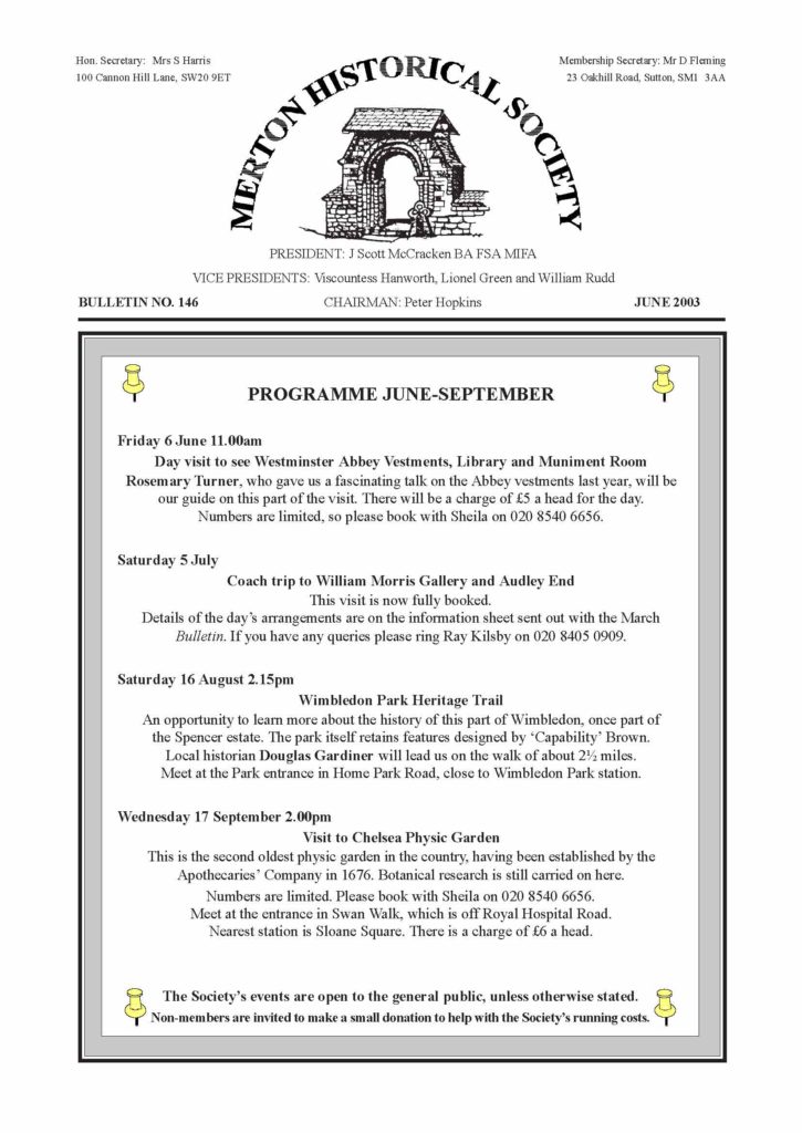
PROGRAMME JUNE-SEPTEMBER
Friday 6 June 11.00am
Day visit to see Westminster Abbey Vestments, Library and Muniment Room
Rosemary Turner, who gave us a fascinating talk on the Abbey vestments last year, will be
our guide on this part of the visit. There will be a charge of £5 a head for the day.
Numbers are limited.
Saturday 5 July
Coach trip to William Morris Gallery and Audley End
This visit is now fully booked.
Details of the day’s arrangements are on the information sheet sent out with the March
Bulletin. If you have any queries please ring Ray Kilsby.
Saturday 16 August 2.15pm
Wimbledon Park Heritage Trail
An opportunity to learn more about the history of this part of Wimbledon, once part of
the Spencer estate. The park itself retains features designed by .Capability. Brown.
Local historian Douglas Gardiner will lead us on the walk of about 2½ miles.
Meet at the Park entrance in Home Park Road, close to Wimbledon Park station.
Wednesday 17 September 2.00pm
Visit to Chelsea Physic Garden
This is the second oldest physic garden in the country, having been established by the
Apothecaries. Company in 1676. Botanical research is still carried on here.
Numbers are limited.
Meet at the entrance in Swan Walk, which is off Royal Hospital Road.
Nearest station is Sloane Square. There is a charge of £6 a head.
The Society’s events are open to the general public, unless otherwise stated.
Non-members are invited to make a small donation to help with the Society’s running costs.
REIGATE STONE, UNDERGROUND QUARRIES AND STANDING BUILDINGS
Reigate stone was quarried and used for building purposes before the Norman Conquest, and
continued
so to be throughout the Middle Ages, until as late as the 18th century. On 15 February members
and
friends were privileged to hear, with a good few laughs, from the expert on the subject, when
Paul
Sowan enlightened a receptive audience. It was in 1963 that he became Secretary of the Croydon
Natural
History and Scientific Society and embarked on a career of studying stone quarries .
particularly of
Reigate stone. His first task was to prevent a local authority from permanently blocking the
entrance to
Godstone quarry. (Was it really God’s stone?)
The term .Reigate stone. refers to a stone found in the Upper Greensand of the North Downs, but
the
name varies according to the ancient parish in which it was quarried, i.e. Reigate, Gatton,
Merstham,
Godstone and Chaldon. It is not a true sandstone, although its composition includes about 60%
silica
(quartz), along with glauconite (one of the mica family), calcite and fossil debris. Reigate
stone was a
prestige stone used for important castles, cathedrals and palaces. Wren used large quantities
for the
lower part of St Paul’s. The large blocks were cut with picks, chisels and wedges. Saws were
not then
available.
How was the stone conveyed to London? Most quarries have access to the sea or rivers, but the
Downs
prevent easy access, although, once the stone reached the Thames, rafting to Hampton Court,
Westminster,
the Tower, Rochester and the Essex churches would have been easy. Paul suggested that some
roads
may have been specially constructed, such as Ditches Lane from Chaldon to Coulsdon.
As well as the building stone the quarries produced hearthstone, i.e. stone used to construct
hearths, but
it could also mean pieces of stone used for cleaning hearths. The best hearthstone came from
Godstone,
and continued to be extracted until the late 1950s.
Paul conveyed all this information with humour to a rapt assembly. We learned the difference
between
mine and quarry. Quarries produce building stone . ashlar, freestone etc . whereas mines bring
forth
minerals . metal ores, coal, salt etc. Reigate stone came from underground quarries, and not
mines. But
underground quarries were regulated by mining regulations, although these were not legally
operative
until 1872.
Great Britain has (or had) mines in every county except the Western Isles, and Paul is the
expert for
Surrey. Various government departments continually approach him for information. He was
involved
with the Transport Ministry when the M23 motorway cut through countless cavities. But the
ministries
are oblivious of each other’s requests, so that Paul has to tell the government what it already
knows.
When the Inland Revenue began asking questions about mines in Surrey Paul found it difficult
not to
safeguard his favourite beauty spots with his .mine. of information!
Over the past 40 years Paul has visited quarries and mines in different parts of the country
and abroad.
Members enjoyed hearing of his sometimes hilarious experiences.
Lionel Green
SURREY ARCHAEOLOGICAL SOCIETY . VILLAGE STUDIES GROUP
On Saturday 1 March 25 members of Surrey Archaeological Society met at The Canons, Mitcham,
under the chairmanship of Dennis Turner to review recent work by their respective societies on
the
origin of selected Surrey villages.
Proceedings commenced with a presentation by our chairman Peter Hopkins on the boundaries of
Morden,
which he illustrated with a fascinating succession of overlying maps containing hints of land
holdings
preceding the creation of the ecclesiastical parish. Concentrating on the area around St
Lawrence’s
church and on Central Road, both of which engendered lively discussion, Peter was obliged by
shortage
of time to leave until a future meeting similar examinations of Lower Morden and finally, but
certainly
not least, the centre(?) of late Saxon Merton.
Equally intriguing studies of the structure and early development of the villages of Thorpe and
Cobham
by Jill Williams and David Taylor respectively, followed by discussion, occupied the afternoon.
Proceedings concluded with the promise of further sessions to be arranged, and a vote of thanks
to
Merton’s Heritage Officer Sarah Gould for kindly arranging for The Canons to be used again, and
for
providing refreshments.
Eric Montague
MERTON HISTORICAL SOCIETY . BULLETIN 147 . SEPTEMBER 2003 . PAGE 2
WORCESTER PARK, CUDDINGTON AND NONSUCH
It was a full house at the Snuff Mill Environmental Centre on 15 March, when we welcomed David
Rymill as our
speaker. It is encouraging to have had such numbers at our meetings over recent months, but it
is embarrassing to
turn away members, and we do apologise. The Committee is looking for larger accommodation for
next year, but
this year’s venues are already fixed. So come early to ensure a seat once we resume our indoor
meetings in October!
David Rymill, an archivist at Hampshire Record Office, is a native of Worcester Park, and in
2000 published
Worcester Park & Cuddington: a walk through the centuries. In his talk David took us on a
virtual walk around
Worcester Park and through the centuries, with the aid of the dual projection of slides.
Worcester Park took its name from Edward Somerset, the 4th Earl of Worcester, who held the
office of Keeper of
the Great Park of Nonsuch under James I. Nonsuch Palace had been built by Henry VIII as a
hunting lodge and the
Great and Little Parks, which Henry created in 1539 around the palace, formed part of a new
hunting forest based
on Hampton Court. Unfortunately the medieval village of Cuddington occupied the site which
Henry had chosen
for his new palace, but that posed no problem to the Tudor monarch. The lord of the manor of
Cuddington, Richard
Codington, seems to have been happy enough to surrender his ancestral home in exchange for the
manor and lands
of the recently dissolved priory of Ixworth in Suffolk. Ixworth was adjacent to Great
Livermere, which belonged to
Richard’s stepson, and as Richard was childless, the two estates were consolidated on his death
in 1567.
Having obtained the manor of Cuddington, Henry arranged for the manor
house and its barns to be demolished, together with four other farms and
the parish church. Cuddington church had been in the possession of Merton
Priory, and they had appointed its rectors, one of whom, Walter de Merton,
became Chancellor to Henry III, Bishop of Rochester, and founder of
Merton College, Oxford.
A more substantial link with Merton Priory was the use of over 3500 tons
of its demolished stonework, carted from Merton to be used in the
foundations of the new palace! Other stone came from Reigate, tiles from
Kingston and Streatham, timber from Bookham and Newdigate, scaffolding
from Dorking. Kilns were built at Nonsuch for making bricks and lime.
Four neighbouring farmers were compensated for damage done to crops
by the brickworks, so perhaps the villagers of Cuddington had similarly
received compensation for losing their homes to make way for the palace.
The palace itself was spectacular . there was indeed .None such..
By 1682, however, the building was old-fashioned and probably the worse for wear, and in that
year Barbara
Villiers, Duchess of Cleveland and one of Charles II’s mistresses, obtained permission to
demolish the palace and
sell its materials. The district once more reverted to arable farming, with five farms in the
area. One of these was
Sparrow Farm, a name which brings to mind the vast medieval common of Sparrowfield, which
served the
communities of Cheam, Cuddington, Ewell, Malden and Morden. Frequent disputes took place
concerning the all-
important rights of common, and in the mid-16th century the two earliest maps or .plotts. of
the area were drawn up
to settle one such dispute. A colour photograph of the later and more detailed of these is
included in David’s book.
Another local farm was Worcester Park Farm, where Millais and Holman Hunt stayed in 1851 while
painting
Ophelia in the Stream and A Huguenot on St Bartholomew’s Eve (Millais) and The Hireling
Shepherd and The Light
of the World (Hunt), using various locations in the vicinity.
It was the coming of the railway in 1859 that led to the development of Worcester Park, and
this was accelerated
with the electrification of the line in 1925 and the opening of Stoneleigh station in 1932.
Worcester Park station was
at the junction of the three ancient parishes of Cheam, Cuddington and Malden, and the name
Worcester Park now
refers to roads and houses in all three parishes, even though they are in three different
boroughs, and two administrative
counties. Cuddington waited 350 years for its parish church to be replaced, but in 1867 an iron
church was erected,
and in 1895 the present church was opened, at the opposite end of the parish to its medieval
predecessor.
Two other links with Merton should be mentioned. Blakesley School was originally set up in 1913
in Blakesley
House, next door to the Nelson Hospital, but moved to Worcester Court in 1939. It closed in
1959, and is now the
site of Worcester Gardens. Kingsley High School also moved from Merton, having been founded in
1927 in a house
near Raynes Park station. A branch was set up in 1934 in Malden which moved to a tall Victorian
house in The
Avenue in 1936. In 1942 the two schools amalgamated at the new site.
Of necessity, the above represents just a few highlights from a very detailed and interesting
afternoon. Perhaps we
can follow it up with a real walk one day? Peter Hopkins
from John Speed’s 1610 map of Surrey
MERTON HISTORICAL SOCIETY . BULLETIN 147 . SEPTEMBER 2003 . PAGE 3
A DEMONSTRATION OF ANGLO-SAXON ARMS AND ARMOUR
This was the subject of our April meeting on Saturday the 12th at The Canons, Mitcham. David
McDermott, a
former teacher and now a re-enactor, provided the presentation described by his own publicity
as an .interactive
exposition. of the life and times of the people who lived in these islands 1000 years ago, as
seen through the eyes
of an Anglo-Saxon thegn (lord). David has contributed to many television programmes, including
Simon Schama’s
A History of Britain, Channel 4’s school programme Conquering the Normans, and – in a lighter
mood -Big
Breakfast. He has also given demonstrations to many museums including the Museum of London.
The audience was therefore privileged to see David in the flesh, as were the travellers on
Tramlink who witnessed
him carrying his stock of costumes in his large rucksack as well as an assortment of weapons of
the period. When
he crossed the road one motorist wound down his window and shouted, .The Romans are coming!.
During a fascinating two hours we were introduced to all the arms, armour and
clothing an Anglo-Saxon warrior would have worn (or carried), including the
helmet, which was heavy and strong, but lined inside with something soft like a tea
cosy; the shield, which was 36-40 inches across; the spear, which was about six
feet long; and the sword, made of steel, which could cut off a head with one blow.
During the interval people were invited to handle all the objects and to ask questions
of the speaker. Many articles of clothing were examined and passed round, such as
the goatskin shoes with integral sole, hand-stitched, with toggles; the trousers
made of wool, close-fitting for warmth, with a gusset and a drawstring waist; and
the chainmail, which contained 2500 rings handmade by David himself.
Many of our members acted as willing volunteers
in allowing themselves to be dressed in the clothes
or to carry the weapons, including Tim Fripp,
Desmond Bazley and Ellen Eames. A special
mention must be made of Pat Brown, who
volunteered to be dressed in the gambeson, or
under-tunic, with the chainmail on top. Many thanks
to all these volunteers, and many thanks to David
McDermott for providing us all with such an
exciting afternoon. Finally, the last and possibly best
part of the event was watching him pack away all
his articles in his copious rucksack and set off for
the Tramlink stop!
Sheila Harris
THE SMR NEEDS YOUR HELP!
The English Heritage Sites and Monuments Record is a searchable database which includes listed
buildings,
archaeological sites and other local historical information. It is now an essential tool for
anyone interested in
researching a particular area, and for planners who need to be aware of a site’s historical
significance when
faced with development proposals.
Merton Historical Society, with its long background of involvement with archaeological
investigation locally,
has a good collection of artefacts and other material. If this were to be recorded in the
format required by the
SMR its value would be greatly increased. We need volunteers for this interesting and rewarding
task . no
experience needed, and training is available. It is not a huge commitment, and you would learn
more about your
local area, have .hands on. contact with artefacts and meet others interested in local
archaeology and history.
Please contact Peter Hopkins.
We welcome the following new members, and hope they enjoy their membership:
Miss E M Bell London SW17 Mrs P M Cole Birchington, Kent
Mr M Hanson Wimbledon Mr J Ward Morden
Miss J A Wick Merton Park
And we are pleased that Ms S Vogel of Mitcham has rejoined the Society
MERTON HISTORICAL SOCIETY . BULLETIN 147 . SEPTEMBER 2003 . PAGE 4
LOCAL HISTORY WORKSHOPS
Friday 7 March . 6 present. Don Fleming in the chair.
©
Don Fleming informed us that it had been reported in volume 53 (2) of History Today (February
2003) that
rare illustrations of HMS Victory had recently come to light in Glasgow. John Constable painted
the three
representations of Nelson’s flagship in 1803, two years before Trafalgar, and they have
remained in the
possession of Constable’s descendants to the present day.
©
Sheila Harris had been contacted by Mrs Kathleen Watts of Preston near Dorset. She grew up in
London Road,
Mitcham, in the 1920s and 1930s, and she has generously offered the Society a copy of her
childhood memories.
©
Peter Hopkins discussed ideas for the Society’s proposed website. Peter would like to include a
wide range of
historical information on the area, as well as details on the Society. One advantage of the
Internet is that information
can be arranged at various levels, so that serious researchers can delve more deeply than
casual enquirers.
©
Eric Montague is at present researching the effects in the Mitcham area of the 1860s cholera
epidemic. A
document in the British Library mentions an outbreak in cottages behind the floorcloth factory,
which was
at Phipps Bridge. Cholera was waterborne, and a well is shown here on early OS maps. Another
outbreak
was in The Causeway, near the .Dipping Place. opposite the present Queens Head. In Merton an
outbreak is
mentioned at .the Bush., presumably the Rush, in the area of the present Nelson Hospital.
©
Bill Rudd presented a set of programmes featuring the Mitcham County Grammar School for Boys,
performing several of the Gilbert and Sullivan comic operas between 1948 and 1954. They were
kindly
donated by Society member Alan Shelley, to whom we offer our grateful thanks.
©
Judith Goodman had followed up the two ‘sporting heroes. mentioned by Peter Hopkins at the last
Workshop.
‘southey House. was really No 2 Southey Villas, Pelham Road, Wimbledon. The curate of Merton,
Rev J C
Crawford, also lived over the parish boundary, at 63 Merton Hall Road.
Judith then told us more about the artist G A Storey, also mentioned at the previous Workshop.
An article
will appear in the next Bulletin. Judith was congratulated on gaining her recent Diploma in Art
History.
Peter Hopkins
Friday 9 May . 5 present, Peter Hopkins in the chair.
©
Bill Rudd, in nostalgic mood again, had brought along some comics from the .60s and .70s, and
members
chuckled over Whizzer & Chips, Beano, Hornet, Dandy and something called The Sure-Shot Shooter,
which
was new to your reporter. More seriously, he had been watching, and enjoying, the new TV series
Castle.
Bill had also been looking at the changing faces of two modest little Morden buildings. No.118
Central
Road was built c.1875 as a small bakery, with No.120, one end of a short row, serving as the
baker’s house.
After many years No.118 became a hairdresser’s, and then a car accessory shop. The building was
altered
and enlarged, filling the space between it and its neighbour, and now the whole site of No.118
is a car repair
business, though No.120 is still a house. Nos 138 and 140 London Road were built c.1900 as Nos
1 and 2
Monmouth Villas, and are now, after extension into the gap between them and the next pair,
occupied as
South Seas Wave Whale Ltd, Bathroom Fittings.
©
Ellen Eames, new chair of her local Residents Association, is exploring the possibility of
getting Conservation
Area status for her patch, which includes the roads Hamilton to Victory, as well as Quicks,
Latimer, Ridley
and part of Haydons, and was part of Lord Nelson’s estate. It was suggested that a dossier on
Rose Cottage
(101 Hamilton Road) [Bulletin 131, September 1999] might be useful.
©
Don Fleming had been reading about William Morris’s Red House and its acquisition by the
National Trust,
in the April issue of History Today. He reported that there would be an exhibition of art
inspired by the
Wandle, in the Sun Lounge at Croydon’s Fairfield Halls from 23 to 28 June.
©
Peter Hopkins, with the help of two of our members, had made a serendipitous discovery that
clarified the
history of a small part of Hotham’s land in Wimbledon [see page 6]. He had also brought along a
photocopy
of what MoLAS like to call .the treasure map.. David Saxby and his colleagues at the Museum of
London
believe it to be genuine, though nobody is quite certain who it came from. It seems to be a
tracing of a map
of .Merton Abbey. dating from before 1727, not to scale, but with some dimensions marked on it.
It shows
a number of buildings, ruined walls and piles of stone, and there are some names of owners or
occupiers .
some familiar, others not. Peter intends to provide a (reduced) copy and an article for the
next Bulletin.
Judith Goodman
Dates of next Workshops: Friday 27 June and Friday 8 August at 7.30pm at Wandle Industrial
Museum.
MERTON HISTORICAL SOCIETY . BULLETIN 147 . SEPTEMBER 2003 . PAGE 5
PETER HOPKINS reports on the discovery of
A MISSING PIECE OF THE PUZZLE
When I was researching for my booklet on Lord Nelson’s Merton Place estate in 1998 I found a
number of
documents in various local archives. The Lambeth Archives Department at the Minet Library has
documents
relating to the estate as it was assembled by Richard Hotham. The Wimbledon Society Museum has
deeds from
the time of Nelson and Lady Hamilton. There were Sales Particulars in the Merton Local Studies
Collection
and at the Guildford Muniment Room. And there were maps and plans in each of these places, and
at the Surrey
Record Office, then at Kingston.
But there was one part of Sir Richard Hotham’s estate for which I could find no documentation.
As well as the
house and lands ultimately bought by Nelson, Deed 3764 in the Lambeth Archives mentions:
barns, coach houses, stables, dovehouses, outhouses, sheds, gardens … lately erected, built
and made by Sir Richard
Hotham in the field or close over against Merton Abbey wall where an ancient messuage or
tenement formerly stood
and all those two several closes or pieces or parcels of meadow or pasture land formerly one
close and heretofore known
by the name of the field or close over against Merton Abbey wall but which have lately been
divided by the said Sir
Richard Hotham and which are now called or known by the name of the two home closes and
containing by estimation
9 acres more or less … and all those several closes pieces or parcels of meadow or pasture
ground now known by the
respective names of the Upper and Lower Mill fields containing together 16 acres more or less
It had been part of Henry Pratt’s original Moat Farm, bought by Hotham in 1764 . the house and
grounds in
Merton plus 78 acres in Wimbledon. Hotham extended the estate by purchasing another 52 acres in
Wimbledon.
When he sold the estate in 1792, to the calico printers Greaves, Hodgson, Newton & Leach, the
25 acres
mentioned above, excluding an acre or so for the buildings and gardens, had been reorganised
as:
Home Mead containing 4 acres 1 rood 21 perches
Middle Mead containing 3 acres 3 roods 7 perches
Rick Yard containing 2 roods 17 perches adjoining next piece described,
parcel called Sheephouse Field containing 5 acres 3 roods 38 perches
also Mill Field containing 9 acres 26 perches
Greaves invested a considerable sum in the company and was granted possession of the house and
52 acres
land, all part of Pratt’s estate, while the company retained the rest of Pratt’s estate and the
lands later added by
Hotham, totalling another 78 acres. On Greaves. death his executors sold their part to Nelson
in the autumn of
1801, but what happened to the remaining 78 acres? The land that Hotham had added to the estate
ended up in
the possession of James Perry of Wandle Villa, later known as Wandlebank House. But I finally
had to admit .it
is not certain what became of the remainder of Pratt’s former estate., though I did suggest
that .three fields
shown on the Wimbledon Tithe Apportionment, plots 273, 274 and 276, could possibly be the
property formerly
owned by Henry Pratt..
At our March lecture this year, discussion arose about the British Land Company, and after the
meeting Mr and
Mrs Bellew told me that they had several deeds relating to a property in All Saints Road
Wimbledon bought
from the company in 1865, and they kindly offered to lend them to me to take to our next
Workshop. Imagine
my surprise and pleasure when I discovered that one of the documents covered the very property
that I had been
attempting to trace!
Outlines of Hotham’s and Nelson’s
Merton Place estates traced on a
modern street map produced by Merton
Design Unit, Merton Council
reproduced with permission
..
…….
………
….
…
……..
…
…….
..
…..
..
Nelson’s
estate
Hotham’s
estate
….
..
…..
..
0 500m 1 Km
MERTON HISTORICAL SOCIETY . BULLETIN 147 . SEPTEMBER 2003 . PAGE 6
The Abbey Lodge estate
All Saints Road, formerly Hubert Road, was part of a 20-acre plot of land suitable for
development, formerly
part of Abbey Lodge, Wimbledon, bought by the British Land Company Ltd from the executors of
John Pryce.
On 23 September 1800 John’s uncle, Edward Pryce, had bought at auction from Greaves, Hodgson,
Newton,
Leach & Co:
. All those the farm yards and buildings situate at the south east corner of the road leading
from Merton to Wandsworth …
consisting of two brick built seven stall stables a five bay barn a cow house piggery a brick
built poultry house and dove
cot poultry yard tool house husbandry stable for eight horses and a granary and brick built
tenement
. And all that garden adjoining to or near the said farm yards and buildings containing by
estimation 1a 2r 14p more or less
. And all that piece or parcel of land called Home Mead containing by estimation 4a 1r 21p more
or less
. And also all that piece or parcel of Land called Middle Mead containing by estimation 3a 3r
7p more or less
. And also all that piece or parcel of ground called the Rick Yard adjoining the piece next
hereinafter particularly described
containing by admeasurement 2 roods 17 perches
. And also all that field called Sheephouse Field and the sheep house and large cart lodge
thereupon containing by estimation
5a 3r 38p more or less
. And also that piece or parcel of ground called Millfield containing by estimation 9a 0r 25p
little more or less
All which said farm yards buildings pieces or parcels of land and other hereditaments are
comprised in the first lot of said
printed particulars
Mathematicians among you will have noticed slight variations in the totals of the acreages
given in the different
lists. It is interesting to note that the area of the small Rick Yard had been obtained .by
admeasurement.
whereas the other acreages were .by estimation … more or less.. In the earliest deed, in the
Lambeth Archives,
the figures had been rounded to whole acres, whereas later estimates were in acres, roods and
perches (1 acre
= 4 roods; 1 rood = 40 perches).
The document followed the history of Pryce’s new property, from its purchase, on 30 June/1 July
1747, by Sir
Daniel Lambert Knight and Daniel Lambert Merchant from Thomas Hammond, and its sale on 15/16
June
1748 to Henry Pratt Esquire. Pratt’s son, Henry, sold it to Sir Richard Hotham, who sold it to
Charles Greaves,
William Hodgson, James Newton and John Leach on 22/23 June 1792.
It would appear that Edward Pryce was already leasing an adjoining property from Richard Mansel
Philipps
and Caroline his wife, née Caroline Bond Hopkins, which he then bought from them in 1803:
. All those two messuages or tenements with the outhouses and buildings some time then since
erected and made by
Thomas Berryman with the appurtenances thereto belonging
. And also those two fields closes or parcels of arable land one of them known by the name of
the East Close and containing
by estimation 5a 0r 20p (more or less)
. and the other called the West Close containing by estimation 4a 2r 20p (more or less)
Which said messuages or tenements lands and hereditaments were situate lying and being in
Wimbledon in the County of
Surrey and were formerly in the occupation of said Thomas Berryman afterwards of William Thoyts
and then of said
Edward Pryce his heirs and assigns
Thoyts had been granted a sixty-one-year lease in July 1769.
In the Wimbledon Tithe Apportionment of 1850, Pryce’s estate totalled 31.5 acres. It was in the
occupation of
Eleanor Ridge, formerly resident at Morden Park. The estate was variously known as Merton Abbey
Lodge or
just Abbey Lodge. The farm yards buildings and garden, on the corner of .Haydons Lane., had
come into the
possession of John Leach Bennett, whose father, Thomas Bennett, had leased the stable and other
buildings to
Nelson in 1801. In 1863 or 1864 John Leach Bennett bought further land from John Pryce’s
executors, and
another 9a 3r 0p, including Abbey Lodge itself, were sold to Samuel John Tracy.
A summary of the transactions
PROPERTY OWNER 1 OWNER 2 OWNER 3 ACREAGE SOLD TO IN ESTATE
Berryman’s Hopkins Bond Hopkins Philipps 9¾ acres PRYCE 1803 Merton Abbey Lodge
Moat Farm Pratt Hotham Greaves, Hodgson & Co 25½ acres PRYCE 1801 Merton Abbey Lodge
Moat Farm Pratt Hotham Greaves 52 acres NELSON 1801 Merton Place
extra lands various Hotham Greaves, Hodgson & Co 52 acres PERRY Wandlebank
Merton Grange Axe 114 acres NELSON 1802 Merton Place
MERTON HISTORICAL SOCIETY . BULLETIN 147 . SEPTEMBER 2003 . PAGE 7
The abstract includes this plan showing the situation in 1864, before the sale of land to the
British Land Company.
The document also includes a plan of the boundary between Pryce’s land and Perry’s land,
originally marked by a
public footpath. A new footpath having extinguished the old one, the boundary was redefined in
December 1808.
Merton Abbey Farm
The mention of Thomas Berryman may also help solve another mystery. In the British Library is
an extra-illustrated
edition of Manning & Bray’s History and Antiquities of Surrey (BL Crach 1.Tab.1.b.1. ). One of
the illustrations
in Volume 3 is a drawing by .Berryman. labelled .A sketch of Merton Abbey Farm before it was
pulled down for
Lord Nelson’s mansion. It was the birthplace of my father, Mr John Berryman, Free School
master, Chertsey. Oct
1798 in going the annual rounds of visiting my relations.. The following is a copy drawn by the
late John Wallace.
Steve Turner’s transcript of the Merton
Parish Registers, to be published on
microfiche by East Surrey Family History
Society, includes a John son of Thomas and
Jane Berryman, baptised on 28 October
1736. It seems likely that this may have
been the artist’s father, but where was
.Merton Abbey Farm.?
Although Emma Hamilton extended Merton Place, the house certainly wasn’t pulled down for
Nelson! Neighbouring
Merton Grange was added to Nelson’s estate in 1802, but we have no evidence of any Berryman
tenure. According
to the Merton Land Tax assessment books it was being farmed by Robert Linton from 1784. The
1799 Land Tax
Redemption certificate for Greaves & Co’s 78 acres shows that part of their land was, or had
been, in the occupation
of .Berriman., but the .ancient messuage and tenement. within that property had been replaced
between 1764 and
1792 by the .barns, coach houses, stables, dovehouses, outhouses, sheds, gardens … lately
erected, built and made
by Sir Richard Hotham.. These buildings were leased to Nelson in 1801 by Thomas Bennett for use
as stables, but
could not have been the birthplace of our artist’s father, if he was the John son of Thomas
baptised in 1736.
MERTON HISTORICAL SOCIETY . BULLETIN 147 . SEPTEMBER 2003 . PAGE 8
One candidate remains. Thomas Berryman had built .two messuages or tenements with the outhouses
and buildings.
on the neighbouring property that he leased from the Bond Hopkins family. Was it in fact Edward
Pryce who
demolished Berryman’s structure, not Nelson? The property was leased to William Thoyts from
1761, so the
Berrymans were no longer in occupation in 1798. But the artist does not say that his relations
were still in residence
in October 1798, only that he drew it while visiting relatives at that date. Other members of
the family were still in
the area. The name Berryman appears in records throughout the 18th and early 19th centuries in
Merton, Morden,
Mitcham and Wimbledon. Richard Berryman, who served as assessor for the Merton Land Tax from
1780 to
1790, was tenant of Baker’s Farm, on the corner of Cannon Hill Lane and Kingston Road, until
1787. He was
buried at Merton on 31 October 1790. Edward and Susan Berryman’s children were baptised at
Merton between
1788 and 1796. Rebecca Berryman was buried there in April 1798, aged 72. Richard and Ann
Berryman were
living at Abbey Row, Merton Abbey, between 1815 and 1821. And no doubt there were also aunts
and cousins
with other surnames.
We cannot be certain, but the new evidence from Mr and Mrs Bellew’s document is a strong
indication that
Thomas Berryman’s .Merton Abbey Farm. was demolished to make way for Edward Pryce’s .Merton
Abbey
Lodge. some time after 1803.
Mr and Mrs Bellew intend to deposit their documents at Surrey History Centre at Woking. I am
extremely grateful
that they let me examine them first. No 11 Hubert Road, later All Saints Road, was Lot 146, so
there would have
been at least 146 copies of the Abstract of Title printed in 1865, yet this is the only copy
that I have come across.
Do any other members have similar important documents in their possession? If so, can I
encourage you to follow
Mr and Mrs Bellew’s excellent example and offer them to Surrey History Centre for safekeeping?
I will happily
deliver them to Woking for you, as long as you don’t mind me reading them first!
JUDITH GOODMAN adds further information on SAMUEL JOHN TRACY
Samuel John Trac(e)y . the spelling varies . appears in local directories from 1860, when he
was at Merton
Cottage, whose modern address is Church Path, Merton Park. However, according to John Wallace,
it was not
until the following year that he was leasing this property from Henry John Wyatt.1
Interestingly, the 1861 census
tells us that Tracy’s youngest child Henrietta, aged eight, had been born in Merton, so the
family had been resident
somewhere else in the parish since at least 1853. Tracy was 47 in 1861, and had been born in
Hampshire at either
Alverstoke (1861 census) or Aldershot (1871 census). Presumably he knew where his birthplace
was but one or
other of the enumerators failed to read his own notes! Fanny, his wife, aged 42, had been born
at Arcot in India,
scene of Robert Clive’s stand against the French in 1751. As well as Henrietta the Tracys had
three other daughters,
all born in London, and they employed a governess to care for them.
Tracy was qualified in both medicine and dentistry and is believed to have been Queen
Victoria’s dentist. He was
also interested in property development, and was apparently in some kind of partnership with
the lord of the manor
of Merton, John Hilbert Tate, when the latter proposed in 1858 to sell 5.3ha (13 acres) of
demesne land, called
Churchfield, between Church Lane and the Rush, for housing. This scheme came to nothing, and
Tracy conveyed
his interest to the British Land Company in 1862.2 However, in 1864 he was again involved in a
plan to develop
Churchfield, with three roads and perhaps 100 houses.3 Again the plan came to nothing, and the
land was finally
purchased by John Innes.
In 1865 the Tracys moved to Abbey Lodge on the
Wimbledon side of Merton High Street. Their housewarming
party began with afternoon croquet and
continued till 4 o’clock the next morning. As guests
included many surgeons from St Bartholomew’s
(where Tracy also worked) it may well have been a
noisy occasion!4 By the time of the 1871 census Tracy
was describing himself as .dentist and landowner.,
but whether he continued an interest in development
is not known. He is not listed at Abbey Lodge, or
anywhere else local, after this date.
1 J Wallace Ancient Copyholds in the Manor of Merton unpublished
typescript n.d. p22
2 J Wallace Dorset Hall in Merton privately printed 1991 p18
3 J Wallace Long Lodge at Merton Rush privately printed 1993 p20;
E M Jowett Raynes Park: a social history Merton Historical Society,
London, 1987 p100
4 Jowett op.cit. p105
Detail from 25 inch to
the mile OS map 1871
MERTON HISTORICAL SOCIETY . BULLETIN 147 . SEPTEMBER 2003 . PAGE 9
.THIS SICKLY GAOL’
I thought it would be interesting to know the conditions in which convicted felons from our
part of the historic
county of Surrey would have served their time 200 years ago. The text is taken from the
Everyman edition of
The State of the Prisons by John Howard (c.1726-1790). It was written in 1784. JG
SURREY
COUNTY GAOL IN SOUTHWARK
The new gaol, besides the gaoler’s house, and the tap-room, has . for master’s-side debtors, a
parlour, and
four other sizable rooms: and for common-side debtors, three good rooms. Mr. Hall prevents
their being
crowded with the wives and children of the debtors. For these prisoners, there is a court; into
which felons
are not admitted; except a few, whom the gaoler has reasons for indulging with that
distinction.
The ward for men felons has six rooms on three floors; in these they sleep. There is a court
belonging to it.
The ward for women felons has two lower rooms, two above; and a court. The felons. court should
be paved
with flat stones, not only for the convenience of washing, but for safety, as pebbles are
dangerous. In the
men’s court there should be a pump and a convenient bath, for at several of my visits the
Thames water
was off.
In the two upper rooms of the women’s ward, are put malefactors of either sex condemned to die,
and
sometimes pirates. I have here noted eighteen rooms: yet they are not sufficient for the number
of prisoners.
Mr. Hall is sometimes obliged to put men felons into some rooms of the women’s ward. In so
close a prison
situated in a populous neighbourhood, I did not wonder frequently to find several felons sick
on the floors.
No bedding nor straw. The Act for preserving the health of prisoners and the clauses against
spirituous
liquors are hung up.
A chapel and two close rooms for the sick, lately built on the vacant ground where formerly was
the house
of correction; after the riots in 1780, were used for a bridewell till that in St. George’s
Fields was rebuilt. At
my last visit the chapel was fitted up, and the two small rooms for an infirmary: these are on
the ground-
floor, only one window in each. Many were sick on the dirty floors; one of the turnkeys had
lately died of a
fever: of the fifty-five felons, etc., in October 1783, sixteen were fines, and I have the
names and the
sentences of twenty-five convicts, who are left languishing in this sickly gaol.1
Transports have not the king’s allowance of 2s. 6d. a week. For these a merchant formerly
contracted with
the county to take them at the gaol: the gaoler sent them to the ship, attended by his
servants; and received
from the merchant 10s. 6d. for each prisoner so conducted.
Lent assize is at Kingston: summer assize at Guildford and Croydon2 alternately.
There is hung up in the gaol a printed
list of sixteen legacies and donations.
The dates of the first six are 1555,
1571, 1576, 1584, 1597, 1598. Three
are in the next century, viz. 1609,
1638, 1656. The other seven are not
dated: and one of them noted on the
list, has not been received since 1726.
There are also other articles which
seem to need inspection. Two of the
charities are for debtors expressly: the
others are not so distinguished: but
debtors have them all. In the title of
the paper it is said, .The gaol was
formerly called the White Lion Prison..
The common seal of the prison is a
lion rampant. One of the legacies to
this prison was bequeathed by Eleanor
Gwynn, from which are sent to this
prison once in eight weeks, sixty-five
penny loaves. Common-side debtors
have this as well as the preceding gifts.
Here I would just mention, that all the
rags left by the felons after every assize,
ought to be immediately burned, or
rather buried; as they only serve to
harbour vermin, dirt, and infection.
1 The occasion of my visit at this time, to this and two or three other prisons, was, that I
had seen on board the hulks a few days before,
several sickly objects, who told me they had lately come from this and other gaols; which, by
the looks of those convicts, I was
persuaded must be in a bad state. I was sorry to find them confirm my suspicions, that our
gaols are verging to their old state. Without
much additional and unremitting care, the benefits produced of late years by attention to this
object, will prove merely temporary.
2 During the assize at Croydon the prisoners are confined in two stables at the .Three Tuns..
Surrey County Gaol as shown on Richard Horwood’s map of London 1799-1819.
Note the spelling of .gaol.! The site is now occupied by Newington Gardens.
MERTON HISTORICAL SOCIETY . BULLETIN 147 . SEPTEMBER 2003 . PAGE 10
TONY SCOTT contributes a report on
EXCAVATION AT 54/56 CHURCH ROAD, MITCHAM
At 54/56 Church Road, Mitcham, was a pair of semi-detached weatherboarded cottages, each with a
brick front
and sharing a brick dividing wall. They were last occupied c.1975, were significantly altered
by renovation
begun without planning permission c.1980, and then left semi-derelict until half demolished,
again without
planning permission, in 2000. Permission to demolish and redevelop the site was granted on 19
December
2002, and the ruins of the buildings were examined by Robin Densum of Compass Archaeology soon
afterwards.
Following complete demolition, two trial trenches were excavated in January 2003, and the
results of both
investigations are contained in a substantial volume recently received by the Society.
The houses were dated to the period 1800-1819, using evidence that no pottery finds later than
c.1800 were
found underneath the houses, that the construction backfill around the foundations contained
pottery pieces
from c.1720-1780 and that the houses are shown on a map of 1819.
They were of an interesting and somewhat unusual construction, being a transition between
earlier timber-
framed and completely weatherboarded structures and the later totally brick construction with
which we are all
familiar.
It is thought that the reason that the front wall was built in brick was to present a solid,
affluent front to the
street, with the brick dividing wall providing support for the weight of the four fireplaces
(two downstairs and
two upstairs) in each house. At the time of construction a brick wall would have cost more than
a weatherboarded
timber studding wall. The first occupants could well have been village tradesmen. They were
unlikely to have
been farm labourers.
Post-demolition trenches produced very little. There was no evidence of an earlier building on
the site, and the
only finds substantially earlier than the houses were a Roman potsherd, a fragment of Roman
tile and two
sherds dated c.1140-1220. These are not thought to be significant.
The strips of land that can be seen on the Tithe Map of 1847, and even on a modern map, running
northwards
from Church Road to Love Lane are thought to represent medieval planned tofts and house plots
which were
laid out along the north side of Church Road from the church towards Lower Green as an overall
plan, perhaps
in the 12th or 13th century. If this was the case, the absence of any previous buildings on our
site, and the fact that
the layout of the presumed medieval plots appears to be less regular to the east of this site
(i.e. further away
from the church) may possibly indicate that the development of the medieval village along
Church Road was
halted by the Black Death of 1348/9. This, together with the ensuing economic depression over
the following
century or so, cut England’s population in half and would have halted any expansion of the
village.
The street frontage of Nos. 54 & 56 Church Road, Mitcham, c.1960
MERTON HISTORICAL SOCIETY . BULLETIN 147 . SEPTEMBER 2003 . PAGE 11
BEATING THE BOUNDS OF MORDEN
BILL RUDD has contributed this extract from the vestry minutes of Morden:
1882
August 18th. The following report was received from Mr. R. M. Chart
relative to the Beating the Bounds of the Parish, Ascension Day, May 18th 1882.
.At 10 O’clock a.m. on this day the following parishioners met at the .Crown.
Inn for the purpose of perambulating the boundaries of the Parish.
Viz;
The Revd. William Winlaw Rector
Messrs. Hugh Knight
Henry Hallam
J. Kimpton
(Clerk & Sexton)
(Schoolmaster)
(Assistant Overseer)
F. K. Barclay Esqre. North Esqre.
Earnest Knight & Worsfold
William Willoughby Winlaw
George P. Kelsall Winlaw
Frederick Moss
)
) sons of the Rector(The Laurels)
Charles Harvey )
John Kimpton )
William Jackson )
Henry Turner )
Willm. Stockbridge )
Stephen Hales )
John Worsfold )
Francis Burrough )
Scholars of the National School
Mr. R. M. Chart, Surveyor attended at the request of the Rev. Rector with a copy
of the Tithe and Ordnance Maps, and it was resolved that on the former should
be marked such points as it might be deemed advisable to erect new boundary
stones or posts: The Surveyor stated that notice in writing had been given to
each adjoining parish of this perambulation of the boundaries.
The Revd. W. Winlaw having read quotations from the Acts of Parliament
authorising the proceedings: the perambulation of the Boundaries was commenced
at Iron Boundary post near the Crown Inn; where Merton Parish was represented
by Mr. Downing, . Assistant Overseer who accompanied the party to the intersection
of Boundary with that of Mitcham in Mr. Hatfield’s grounds, where Mr. Chart
represented the Parish of Mitcham. Beyond this no parish sent a representative,
and the course was interrupted following the line shown on the Tithe Map aforesaid:
which line was found to accord with the Boundary posts recently erected by
Mitcham Parish and Carshalton Parish, except that at a point where the Boundary
crosses the Site of an ancient hedge dividing the field numbered 282 and 285 on
the Tithe Map. Carshalton was found to have erected a Boundary post some 25
feet East of their proper line of boundary, which was protested against, and it
was resolved that the same be reported to the Morden Vestry, with the view of its
removal to its proper and ancient position.
The course from this point was uninterrupted: the perambulation terminating
at the starting point aforesaid which was reached at 5.30 p.m. when the distance
travelled was reported to be about 8½ Miles..
The Surveyor subsequently reported that the number of New Posts determined
as being required to maintain the boundaries of the Parish was 32, and that he had
marked the position of the same in Red Ink upon the Copy of the Tithe Map aforesaid,
and recommended the erection of Cast Iron Boundary posts as being the most
durable..
Signed
Robert M. Chart,
Surveyor, Mitcham.
MERTON HISTORICAL SOCIETY . BULLETIN 147 . SEPTEMBER 2003 . PAGE 12
[When Bill originally transcribed this entry in 1981 he identified the point at which the
boundary crossed the
ancient hedge, and where Carshalton had encroached upon Morden’s territory, to be that of a
large oak tree in
the playing-field of Chaucer Middle School. There was a cast-iron post on either side of the
tree, marking the
Morden and Carshalton sides of the boundary. This tree was later removed for a housing
development. The iron
posts were reset, at Bill’s request, near the front fence of Canterbury Centre, opposite Dore
Gardens. He hopes
they are still there!]
IN BRIEF
©
The next entry for Kingston University’s MA in Local History course takes place in September.
The full
course involves two years of part-time study plus a dissertation, though there are shorter
certificate and
diploma options. Details on 020 8547 8361/7378 or www.kingston.ac.uk
©
!!!!!Merton Heritage Centre at The Canons has new opening hours: Tuesdays and Wednesdays 10am-
4pm;
Fridays and Saturdays 10am-4.30pm. Events include: 3-14 June a small-scale repeat exhibition
upstairs at
The Canons: Prevention or Cure: Hospitals & Health in Merton; and 17 June . 19 July in the main
exhibition
space: Unearthing the Past: Merton Archaeology (a MoLAS exhibition). Tel: 020 8640 9387;
www.Merton.gov.uk/libraries; e-mail: Sarah.Gould@Merton.gov.uk
©
GLIAS (Greater London Industrial Archaeology Society) is running a series of walks of
industrial
archaeology interest throughout the summer. e-mail: secretary@glias.org.uk, or consult their
newsletter at
Merton Local Studies Centre.
©
And Lambeth Local History Forum have again organised a programme ofHeritage Walks in South
London
from May to October. They last about two hours and most are free. For information and leaflet
contact
Lambeth Archives Department, Minet Library, 52 Knatchbull Road, SE5 9QY, tel: 020 7926 6076, or
compiler
Brian Bloice, at weekends, on 020 8764 8314.
©
And Brian Bloice will be speaking about Streatham’s Architectural Heritage for the Streatham
Society at
Woodlawns, 16 Leigham Court Road SW16 at 8pm on Monday 7 July. All welcome.
©
English Heritage has a new online image resource for England’s history . www.english-
heritage.org.uk/
viewfinder makes 20,000 photographs from their vast collection available to the public.
©
As part of Wimbledon Society’s centenary celebrations some of their fine collection of
watercolours,
including local views, will be on display at Eagle House, High Street, Wimbledon, from Monday 9
June to
Friday 20 June every day from 10am to 4pm. Not to be missed.
©
The Society now exchanges journals with East Surrey Family History Society, so if you wish to
see their
journal and/or publications list speak to Tony Scott, who has the latest number, as well as
publications from
numerous other societies and organisations. Back numbers go into our store at The Canons, but
can be
accessed by members by applying to Bill Rudd.
©
The ESFHS Journal is one of many periodicals which can be consulted at the Local Studies Centre
at
Morden Library. Look out for British Association for Local History publications, Local History
News and
The Local Historian, and Surrey Archaeological Society’s Surrey History.
©
It has been suggested that Merton Historical Society should include the text of past issues of
our Bulletin on
our forthcoming web site. If any contributors object to this, please contact the Editor or the
Chairman.
MERTON HISTORICAL SOCIETY . BULLETIN 147 . SEPTEMBER 2003 . PAGE 13
RECENT EXCAVATIONS IN THE LONDON BOROUGH OF MERTON
The Quarterly Review for the last quarter of 2002 from GLAAS (Greater London Archaeology
Advisory Service)
highlights, with coloured pictures, two Merton excavations . the MoLAS work at the Bennett’s
Mill site, and
Time Team’s visit to Merton Abbey Mills. In the complete borough-by-borough list there are
reports on four
sites in our borough. Little of importance was found at the Sandy Lane football stadium, at the
Rutlish School
site, or at 80 Plough Lane.
The report of the Bennett’s Mill site was as follows: (pp46-7)
MERTON REPRESENTED ON THE LONDON ARCHAEOLOGICAL FORUM
For many years the Society has maintained links, either as a corporate member or through
individual members,
with Surrey Archaeological Society and various archaeological groups and organisations in the
Greater London
area.
Awareness of the broader issues affecting archaeology in the capital and co-ordination of
effort are both vital,
as is maintaining contact with others whose interests we share. With all this in mind, at its
meeting on 25 April,
the Committee was pleased to accept Ellen Eames’s offer to attend meetings of the newly formed
London
Archaeological Forum, as the Society’s representative.
Eric Montague
MERTON HISTORICAL SOCIETY . BULLETIN 147 . SEPTEMBER 2003 . PAGE 14
ANNUAL DINNER
It may have taken us 50 years to take the plunge, but, now we have begun, the annual dinner
seems set to be
a fixture in the Society’s calendar. On 28 February, for the third time, a convivial group of
members and their
guests met at Morden Hall, where they enjoyed the food, drink and conversation. And if not all
the talk was
about serious historical matters the setting at least was appropriate to the occasion, Peter
Hopkins made a
model (ie brief) chairman’s speech, and a pleasant evening was had by all.
JG
PETER HOPKINS reports on
THE ANNUAL SERVICE AT MERTON PRIORY
For the past six years a short inter-denominational service has been held at the Chapter House
of Merton
Priory on the Sunday nearest to 3 May, the day on which the canons of Merton entered into their
new
buildings on the banks of the Wandle in 1117. Although numbers were low this year, the
acoustics of the
Chapter House assisted our singing as we praised God for the work and witness of Merton Priory
over the
centuries. Can I encourage others to join us in this service of celebration next year. Our
thanks are due to
those who led the service, and those who organised it, especially Sheila Fairbank of the
Friends of Merton
Priory.
Our Vice President, LIONEL GREEN, opened the service with the following thoughts:
MERTON PRIORY – WHAT DOES IT MEAN?
What does Merton priory mean to us in the 21st century? The name may conjure up different
thoughts to
different people.
………
To the legal historian it must be the important council of 1236, the forerunner of our
parliamentary legal
system providing the first entry in the Statute Book.
To an architect it would be the creation and size of the buildings covering 60 acres and the
styles of every
period.
To the water engineer, how the river was channelled to drive mills, to make fish ponds, to
flush toilets and to
control flooding.
To the hotel manager, how the traveller enjoyed the hospitality of the monastery. From the
humble pilgrim
to the proud baron and his entourage. Think of the guest house – what an entrance it had!
To the academic it might be the founding of the collegiate system at Oxford and Cambridge.
It could be the thousands of youths who completed their schooling here and went on to flourish
in other
fields. Not forgetting a few who became saints.
Some may consider the effect of Merton’s daughter houses founded by canons from here.
Cirencester became
the richest Augustinian house in the land. Holyrood influenced relations between Scotland and
England.
To musicians it might be the development of church music and singing.
It could be the close connection of each reigning sovereign with Merton and its effect on the
community.
To the economist it might be the intricate workings of the priory. Looking at the duties of
just one officer, the
granger; it was required of him to ensure corn supplies, their milling and the issue of flour
to the kitchen and
bakehouse.
To the farmer and countryman who knows about forward planning . wool sold before the lambs were
born,
trees planted for generations unborn, huge barns built to garner the grain not yet sown.
To the medics, the well being of all members of the community through adequate fresh water and
drainage.
To the topographer it could be the varied land holdings in many counties. The regular repair of
roads and
building bridges.
These are some of my thoughts and I hope they stimulate fresh thoughts on Merton Priory. Let us
now
remember all that has been achieved here.
MERTON HISTORICAL SOCIETY . BULLETIN 147 . SEPTEMBER 2003 . PAGE 15
In a final (perhaps!) exchange of views JOHN PILE and ERIC MONTAGUE illustrate how difficult
are
the finer points of terminology:
John Pile
There is really only one point in Eric’s The Evidence of Place-Names (part 2) in the December
Bulletin that I
really ought to take issue with, and that concerns the land in Mitcham granted at some date
before 1170 by .the
whole parish. to the priory at Southwark. Unfortunately I have not had the opportunity to read
John Blair’s
transcription, mentioned by Eric, of British Library MS Add.6040 No.16, but I do not subscribe
to the view that
some land in Mitcham, presumably common or .waste., could lie .outside the jurisdiction of any
manor.. To
call this land .folkland. is unhelpful as it has long been recognized, for example by F W
Maitland, Domesday
book and Beyond (1907) pp244-258, and more recently by Christopher Jessel, The Law of the Manor
(1998)
pp21-22, that folkland is an Anglo-Saxon term for land which might be granted by a king to a
subject for his
use, but to which the king retained the right to receive all the customary dues relating to it.
This contrasted with
bookland, which a king granted to the Church or to an individual, but retained only the dues
known as the
trinoda necessitas: service in the royal army, repair of bridges, and a contribution to the
upkeep of town defences.
What folkland most emphatically was not, was, as Jessel puts it, .land of the folk, rather like
African tribal
land.. This is a nice idea, but one completely at odds with the evidence.
Since reading Eric’s article I have come across the following passage by Charles Francis
Trower, an author
evidently well grounded in manorial law, in an article on Findon in Sussex Archaeological
Collections vol.26
(1875), .I believe [it] to be the case (though I have not been able to find any lawyer or law
book distinctly
pledged to the position) that every acre in a parish was, in its early history, parcel of some
manor … This is an
interesting admission, but it is my belief that the nineteenth-century lawyer who, after
examining all the available
evidence, finally declared that Mitcham Common never formed part of the possessions of any of
the manors,
did so because the old manorial bounds on the waste had, by that time, become irretrievably
lost.
And Eric Montague
Having read John Pile’s comments, I think it is important to stress that we have to be very
wary of espousing too
readily the theories expounded by late 19th- and early 20th-century antiquarians (and even
legal .authorities.)
when writing of the origin and history of manors. Writers like Hone in The Manor and Manorial
Records
(1906) however emphasised the complexity and diversity of manorial structures, whilst Bennett
in Life on the
English Manor (1948) reminded his readers that manorialisation was not universal. It is
certainly a mistake to
believe, as Trower evidently did, that the whole of medieval England was neatly parcelled out
in manors.
Folk-land, a term which Shaw-Lefevre (later Viscount Eversley) used when speaking of Mitcham
Common in
Parliamentary debates, is a useful concept, and despite various attempts in the 18th and early
19th centuries to
determine by agreement the extent of each manor’s jurisdiction over the parish waste, this
proved impossible.
Far from agreeing with John’s submission that the manorial boundaries had been .lost., I hold
to the view that
across much of the Common they had never been established. Certainly, as late as the 18th
century Mitcham
vestry was sanctioning enclosure of small parcels of common waste without recourse to the lords
of any of the
manors.
a comment from Peter Hopkins
I am not sure that I have the effrontery to intervene in a discussion between such experts as
Eric and John, but
sometimes the observer can see more of the battle than the participants! The frequency of
disputes over the
centuries between tenants of manors sharing rights of common over an area of .waste. is evident
in the history
of Sparrowfield, which was intercommoned by tenants of manors in Morden, Cheam, Malden,
Cuddington and
Ewell. No doubt there would have been similar disputes between tenants of the various manors
claiming rights
over Mitcham Common. It is only natural that the canons of Southwark Priory would have sought
to safeguard
their title to the parcel of land enclosed from the Common by ensuring that all who claimed
rights of common
in the land registered their approval of the enclosure. Normally an enclosure would be approved
at the manorial
court by the .homage.. the tenants of the individual manor. Where several manors shared rights
of common, it
is surely not surprising that .the whole parish. was involved in the .grant..
Letters and contributions for the Bulletin should be sent to the Hon. Editor. The views
expressed in this
Bulletin are those of the contributors concerned and not necessarily those of the Society or
its Officers.
Printed by Peter Hopkins
MERTON HISTORICAL SOCIETY . BULLETIN 147 . SEPTEMBER 2003 . PAGE 16